|
|
Mountain/Rock |
|---|---|
|
|
20.32592°N / 103.28581°W |
|
|
Hiking, Mountaineering |
|
|
8058 ft / 2456 m |
|
|
Overview
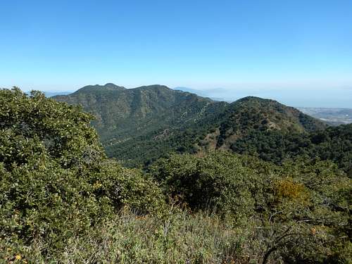
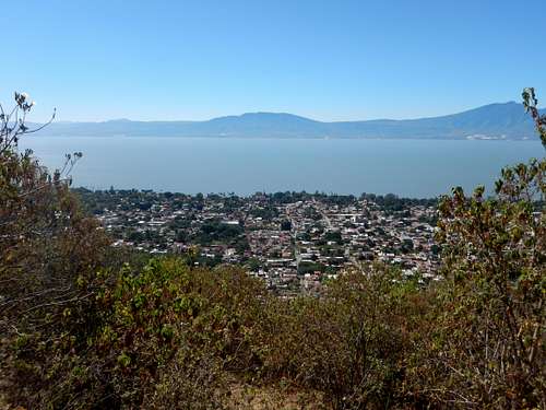
La Chupina is the highest point in the Sierra El Tecuan (also known as the Sierra de San Juan Cosala). It rises directly above Ajijic and Lago de Chapala, which itself is south of Guadalajara. Ajijic itself is known as the art gallery center of Mexico and the town sees a lot of tourists and retirees from the United States. Lago Chapala is also very scenic, at least when it isn't hazy. There are a lot of birds on the shore of the lake as well, perhaps more than I have ever seen, with the exception of on Trinidad. There is plenty of bird life in the mountains as well, including raptors and big vultures. There are many flowers in certain seasons as well.
The views from the mountains and of the lake are spectacular and there are many good trails in the mountains. There are also a lot of religious statues and shrines in the mountains and during the wet season there are waterfalls as well. If you are in the Guadalajara region, this is a very recommended hiking area and at least a few days can be spent on the trail.
The mountains are made of old volcanic rocks, but now days bear no resemblance to volcanoes. It is possible that the mountains are old eroded volcanoes, but they could have been uplifted from previous basalt layers as well.
Getting There
The main trailheads are in Ajijic. Buses from Guadalajara leave the Antigua Central Camionera Bus Station every hour. The ride takes about an hour. If you are flying into the Guadalajara International Airport (also known as the Aeropuerto Internacional Miguel Hidalgo), you don't need to go into the city of Guadalajara in order to reach Ajijic. It's about the same price to ride a taxi from the airport to Chapala as it is from the airport to Guadalajara.
Buses also connect Ajijic with Chapala every 20 minutes. The ride takes about 15 minutes.
Area Map:
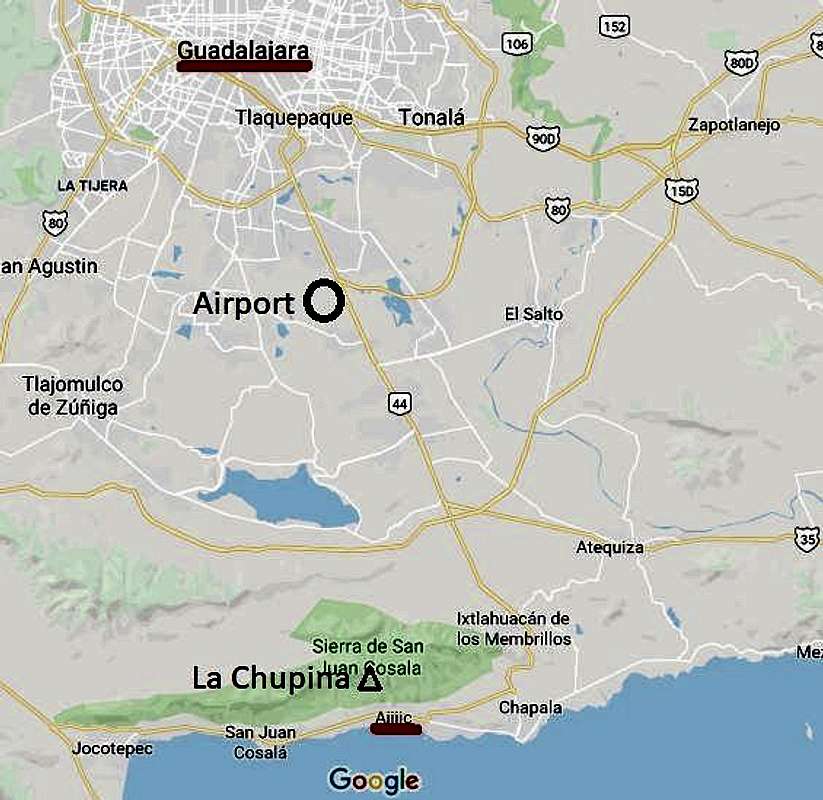
All trailheads should be within walking distance of Ajijic.
Once you are situated in Ajijic, La Galeana Trailhead is probably the easiest to find. From the main west to east highway in Ajijic, head for the Oxxo store. The name of the street you want to follow to the trailhead is Calle Galeana. Walk this road to the trailhead. There are several other possible trailheads and most are fairly easy to find. You can find them by heading up the streets and towards the mountains. See also the map in the Routes Overview section.
Routes Overview
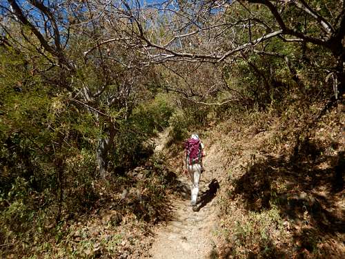
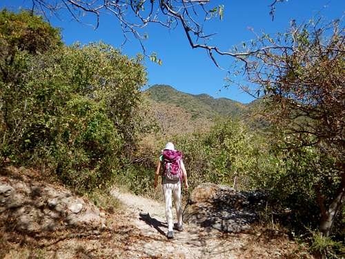
There are several trails heading up into the mountains. Many of them are steep and hot once the sun comes out, but most are easy to follow. It is recommended that you get a very early start in order to beat the heat. Bring plenty of water as well; we were out by the time we finished the hike! Here is an overview map, but there are more trails than shown on the map:
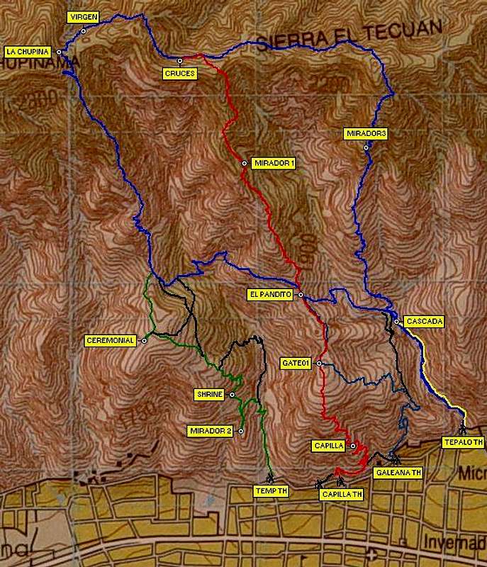
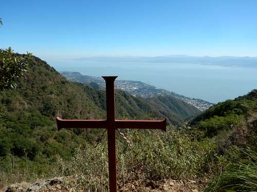
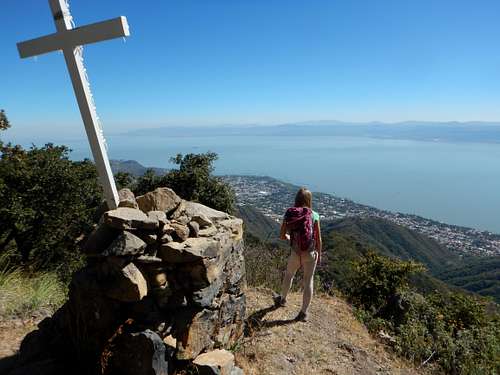
There are several possibilities, but we took the "red" Chapilla Trail up the steep ridge. The views of the lake were nice and we saw several vultures, but as mentioned the hike was very hot. We made it to the ridge top where there were views of Guadalajara and then headed west along the ridge to the crosses at a viewpoint. We then climbed over a high peak before reaching a religious shrine at a saddle near La Chupina. A more rugged trail heads west from here and to the highest summit of the mountain.
After heading to the summit, we returned up and over the mountain and and came down the Chapilla Trail.We then took a side trail that dropped into the canyon with the waterfalls, but they were dry. After the waterfalls, we followed the trail back to the Tapalo Trailhead.
This is just one suggested route and there are other possibilities. There are also trails up into the mountains from the north and the Guadalajara side of the mountain. I am not familiar with them and you would sacrifice much of the views of the lake. Hiking from Ajijic is recommended.
Red Tape
There is no red tape, so please take care of the area.
When to Climb
November through mid May is the dry season, and are very dry, but hiking can be done year round. The wet season can be a good time to hike since it will be greener and the waterfalls will be flowing, but you don't want to do the hike during a heavy rainstorm since the trails are steep.
Camping
You probably could camp in the mountains, but there is no water. Staying in Ajijic is a better choice and there are plenty of hotels, B&Bs.
Mountain Conditions
Below are the weather averages for Ajijic. It will be a bit cooler on the summit ridge. Since the trails face south and are exposed to full sun, temperatures feel much hotter than the temperatures indicate.
| Month | High (° F ) | High (° C) | Low (° F ) | Low (° C) | in. Rain | mm Rain | Rain Days |
| Jan | 72 | 22 | 52 | 11 | 0.55 | 14 | 2 |
| Feb | 75 | 24 | 54 | 12 | 0.28 | 7 | 1 |
| Mar | 80 | 27 | 56 | 13 | 0.24 | 6 | 1 |
| Apr | 84 | 29 | 59 | 15 | 0.28 | 7 | 1 |
| May | 86 | 30 | 62 | 17 | 0.98 | 25 | 3 |
| Jun | 83 | 28 | 63 | 17 | 6.14 | 156 | 14 |
| Jul | 79 | 26 | 61 | 16 | 7.87 | 200 | 19 |
| Aug | 79 | 26 | 61 | 16 | 6.34 | 161 | 17 |
| Sep | 78 | 26 | 61 | 16 | 5.55 | 141 | 14 |
| Oct | 77 | 25 | 59 | 15 | 2.01 | 51 | 5 |
| Nov | 76 | 24 | 56 | 13 | 0.55 | 14 | 1 |
| Dec | 73 | 23 | 54 | 12 | 0.43 | 11 | 1 |

