Elevation Gain: ~6400'
6/24/2011
Steve Knapp and I met in Morrison on Friday evening and we started the long drive to the Lake City area to climb a bunch of peaks. Since Steve is working on climbing all the peaks in Park County, he really wanted to take advantage of the later sunset and get a couple of peaks en route to Lake City. So after a quick stop at Subway in Fairplay where we ran into
Kirk Mallory, we drove up Salt Creek Road to a minor highpoint on the road and hiked to the summit of 10180 from there; nothing to spectacular about this one. Next, we followed the Salt Creek Road back towards US-285 and stopped at an intersection with an old road. This one was a little more interesting since we needed headlamps on the descent. We continued the drive and camped along the Cinnamon Pass Road.
 9943
9943
 10180 & 9943 Map
6/25/2011
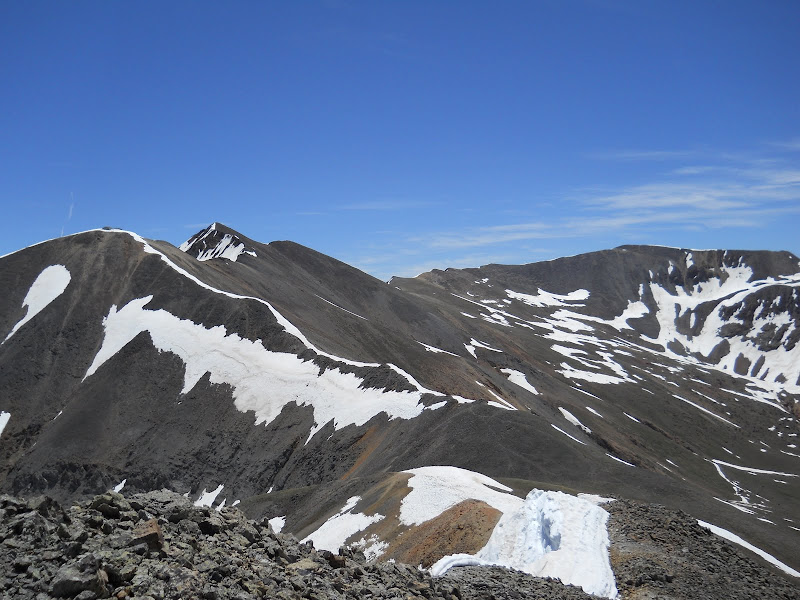
After waking up, we continued the drive to the Cooper Creek Trailhead, then followed the trail to the crossing of Cooper Creek. We decided against crossing the creek here since the water level was so high. We continued a short distance up the valley and found a good snowbridge to cross, then rejoined the trail which we followed up to the basin below "Cooper Creek Peak" and "Every Mountain". We gained the saddle between the two peaks, dropped our packs and followed the ridge to the summit of "Cooper Creek Peak" which provided good views of the centennial peaks: Redcloud, 13832 and 13811. We returned to our packs and followed the ridge to "Every Mountain". We took a break on the 13131 where Steve replaced my dead camera batteries and took a few photos, then continued onto "Gudy Peak" where we found a brief section of some precariously stacked, nearly vertical talus. The trip over to "C.T. Peak was simple. Continuing over to 13540, we encountered very steep and loose talus near the 12896 spot elevation and decided to descend south, traverse west, then climb up to the summit. We continued onto 13427 where we ran into
Erik Packard and his friend Warren. They were on their way to 13540. We had to drop ~200' to avoid a corniced snowfield en route to 13427. From 13427, we glissaded at least 1000' down to the road, then walked the road back to the TH. We ate dinner and prepared for bed when Erik and Warren joined our campsite.
 Redcloud Peak from "Cooper Creek Peak"
 13832 from "Cooper Creek Peak"
 13811 & 13832, from left to right
 "Every Mountain"

Wetterhorn, Matterhorn & Uncompahgre Peaks, from left to right. Photo: Steve Knapp

Uncompahgre Peak. Photo: Steve Knapp
"Cooper Creek Peak", from left to right. Photo: Steve Knapp

"Gudy Peak" above Cooper Lake. Photo: Steve Knapp

Steve topping out on 13540

Redcloud & Sunshine Peaks, from left to right

Wetterhorn, Matterhorn & Uncompahgre Peaks, from left to right

Map6/26/2011
The next morning, we drove up to Cinnamon Pass, then hiked up the south Ridge of Wood Mountain to its summit, which provided some good views. We descended the west ridge, then descended north into the small basin west of 13688. There was some firm snow in this basin. We traversed to the base of a gully north of the 13688-Wood Mountain saddle. We are not sure if we chose the correct gully, but it went at 3rd class. From the ridge we continued to the summit. Steve ran ahead and descended the gully to prevent any rock fall issues. We ascended back to the Wood Mountain-13708 saddle and followed the ridge to the summit of 13708. We were contemplating adding Seigal, but it appeared that it would be easier from Engineer Pass, so we continued to "Animas Forks Mountain". From here we descended southeast and were able to glissade most of the descent to the road. After a failed attempt at catching a ride from a couple of rangers on an ATV back up to Cinnamon Pass, we walked a bit up the road, then began contouring towards Cinnamon Mountain. We both chose a different snowfield to climb up to Cinnamon Mountain's east ridge, dropped our packs, then continued to the summit of Cinnamon Mountain. We returned to our packs, refueled, hiked to the Cinnamon Mountain-13535 saddle, then up to the summit of 13535. We descended back to Cinnamon Pass and started the long drive home. We were initially planning on climbing Tenderfoot Mountain in Gunnison, but found a some accessible peaks along CO-149 instead.
 13688. Photo: Steve Knapp

“Animas Forks Mountain" & 13708, from left to right. Photo: Steve Knapp

13535 & Cinnamon Mountain, from left to right. Photo: Steve Knapp

“Animas Forks Mountain". Photo: Steve Knapp

Wildhorse Peak

Wetterhorn, Matterhorn & Uncompahgre Peaks, from left to right

Wetterhorn Peak

13688 Route

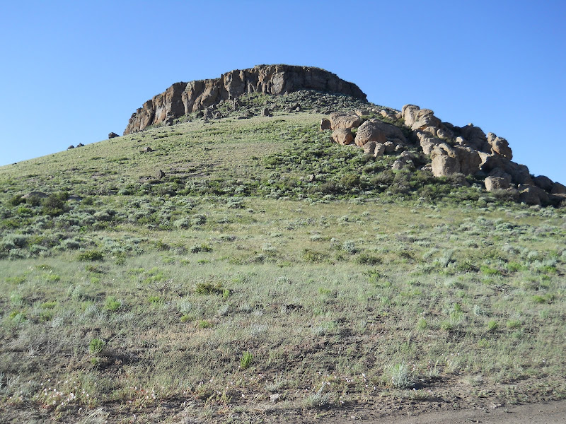
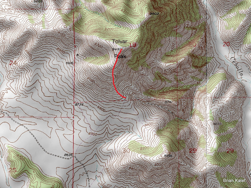
Tolvar Peak

9150
8890

8750

8870


Comments
No comments posted yet.
