The end of summer snuck up on me quickly, so the first significant snowfall of the season forced me to make some changes to my original hiking plans. David and I were finally able to settle on a day for a summit hike in the Tetons, but a larger-than expected early season snow storm prompted us to look farther south. Hayden Peak in the Uintas seemed the obvious choice for a fun day hike scramble that we had not yet done, but with mountain-forecast.com predicting unmelted snow there as well and us not wanting to scramble over icy terrain, we decided that Mount Watson would have to suffice as the back-up to our back-up plan if Hayden still looked iced over on the morning of our hike.
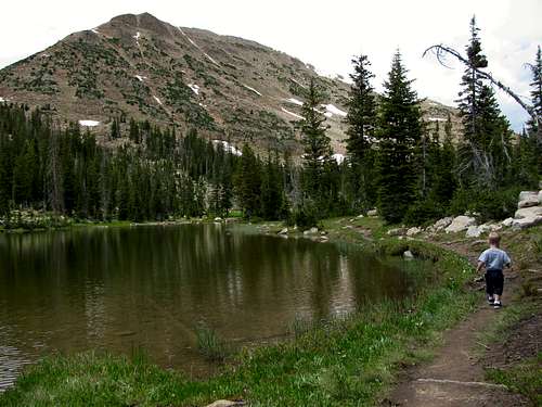
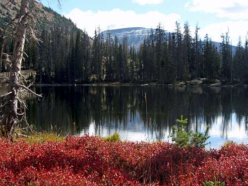
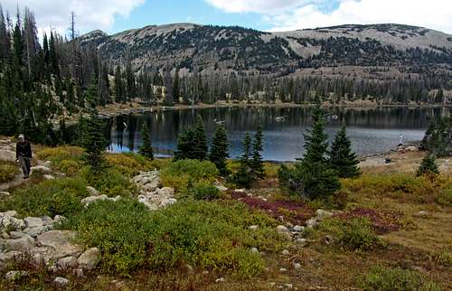
![Mount Watson over Watson Lake]() My son walking around Watson Lake (back when he was a toddler)
My son walking around Watson Lake (back when he was a toddler)Lake-O-Rama Loop Hike
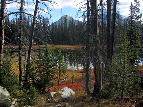
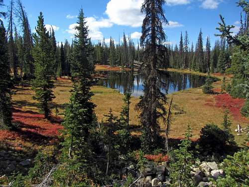
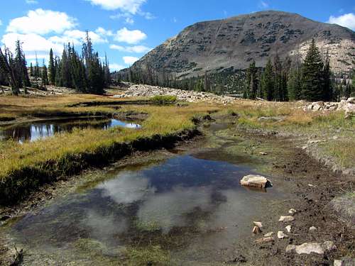
![Lily Lake]() This hike would have plenty of lakes like Lily Lake ...
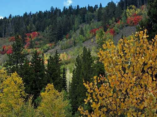
This hike would have plenty of lakes like Lily Lake ...![Hope Lake]() ... and Hope Lake, along with some nice fall foliage
... and Hope Lake, along with some nice fall foliage
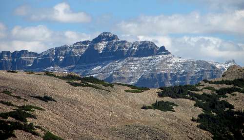
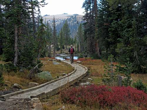
![Mount Watson from trailhead]() Mount Watson from trailhead
Mount Watson from trailhead
Shortly after driving through the small town of Kamas , we started encountering all sorts of wildlife on our way into the Uinta Mountains. There were a couple of places where we had to slow down and/or stop to make way for cattle, and we also saw several deer and even a moose shortly after entering the designated wilderness area. Perhaps the sudden cold temperatures in the days leading up to this had led to the sudden animal activity, but whatever had caused it we thought it was fun to see (sorry, no pictures).
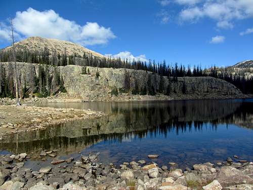
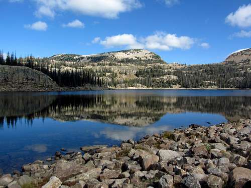
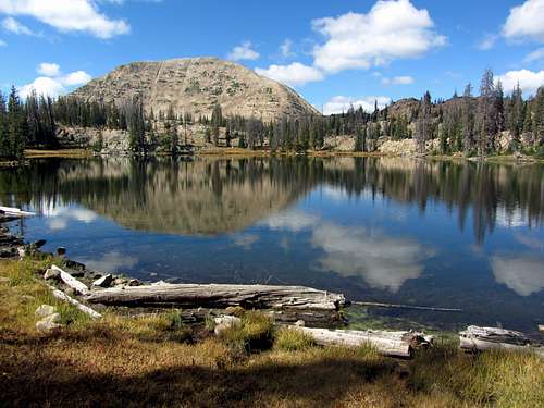
![Mount Watson & Wall Lake]() Wall Lake reflection of Mount Watson ...
Wall Lake reflection of Mount Watson ...![Notch Pass over Wall Lake]() ... and the Notch
... and the Notch
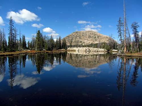
![Mount Watson Wall Lake reflection]() Mount Watson Wall Lake reflection
Mount Watson Wall Lake reflection
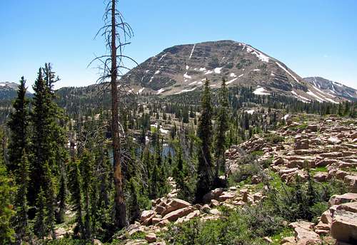
During the drive up towards Bald Mountain Pass, which is the highest paved road in the entire state of Utah topping out at around 10,715 feet, I made a note of snow conditions. Fortunately, 11,527-foot Mount Watson looked entirely snow-free, while 11,947-foot Bald Mountain only appeared to have a very slight dusting. Stopping at the pass overlook, we did our best to assess the conditions on 12,479-foot Hayden Peak. Looking at the mountain’s shaded southwest side in the early morning hours, it was difficult to determine the extent of the previous days’ snowfall, so to play it safe we decided to make the short drive back to the Crystal Lake Trailhead to do Mount Watson instead. We could always come back to do Hayden another time.
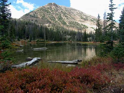
![Un-named Uinta Lake]() Un-named Uinta Lake
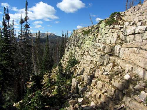
Un-named Uinta Lake![Wall above Hope Lake]() This wall above Hope Lake ...
This wall above Hope Lake ...![Hope Lake wall]() ... looked like it would be fun to climb
... looked like it would be fun to climbThis visit to the Cache-Uinta National Forest I was able to catch a ranger in the parking lot, who told me that I could just stick my National Parks Pass on the dashboard of my car (with the expiration month info face-up), to help me avoid having to pay the wilderness fee. This info would’ve been useful during our previous hike of Mount Timpanogos, but it was no big deal. Luckily, David had actually been to the area to hike/camp near Ibantik Lake the most recently (it had been a couple years since I’d been to the Uintas with my family), so he was able to show me the trailhead that I had somehow missed during my previous visit to the same lake (we started off on the Divide Lakes Trail and then made a short/easy bushwhack around Lily Lake to get onto the trail leading to Wall Lake, because some rather large trucks/SUVs blocking our view of that smaller trailhead had caused us to start out on the more obvious one leading west toward Crystal Lake instead).
![First Twin Lake]() Now heading west, we ran into South Twin Lake ...
Now heading west, we ran into South Twin Lake ...![Second Twin Lake]() ... and North Twin Lake
... and North Twin Lake
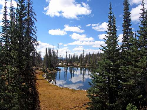
![North Twin Lake]() Every few hundred yards ...
Every few hundred yards ...![North Twin Lake reflections]() ... it seemed we'd encounter another lake
... it seemed we'd encounter another lakeFor anyone unfamiliar with the Uintas, the number of lakes mentioned in that short little recap should give a good indication as to what one of the main draws is for those who spend time here. I love this area not only for the many lakes you can find here (the Mirror Lake Highway is a suitable name for the main road, from where you can easily see many of them, and many come simply to camp do some fishing at one of the many lakes that are re-stocked with fish each year), but also for the unique wilderness feel. While the Wasatch Range boasts more prominent peaks with generally steeper routes, the Uinta Range, while only being slightly farther away from Salt Lake City, offers a more secluded experience at generally higher elevations (all of the trailheads in the area start out above at least 10,000 feet in elevation).
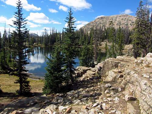
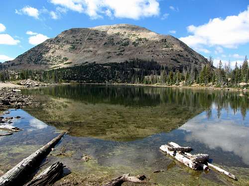
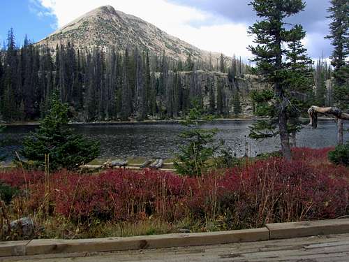
![Watson over Clyde Lake]() A well-marked trail led us from Clyde Lake ...
A well-marked trail led us from Clyde Lake ...![Approaching Mount Watson]() ... closer towards Mount Watson
... closer towards Mount Watson
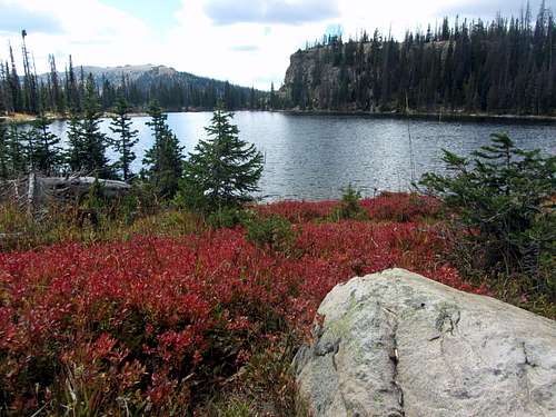
![North Twin Lake fall colors]() More red bushes ...
More red bushes ...![Little ponds]() ... and little ponds
... and little ponds
We covered the first mile of trail quickly, arriving at Wall Lake in short order. This first lake would end up being the largest and deepest that we would encounter on our hike, and offered a nice view of Mount Watson to the west and Notch Pass to the north. Continuing along the trail, we saw a few horses and their riders off in the trees nearby, but besides a few other horse riders later on, we would not encounter anyone else during the entire hike.
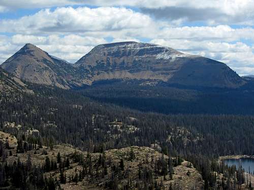
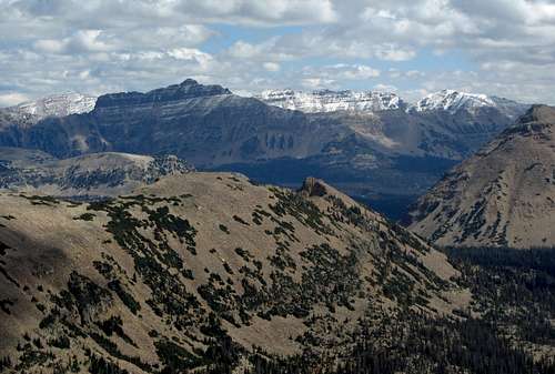
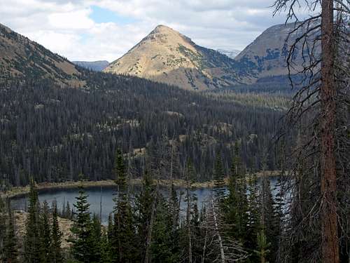
![A-1 Peak]() Back to the west were nice views of A-1 Peak in the distance ...
Back to the west were nice views of A-1 Peak in the distance ...![Reids Peak & Bald Mountain]() ... as well as Reids Peak (left) and Bald Mountain (right)
... as well as Reids Peak (left) and Bald Mountain (right)
![Hayden Peak]() Dusting of snow on Hayden Peak
Dusting of snow on Hayden Peak
Above Hope Lake we passed by a rock wall that almost looked man-made, which I’m sure many people have climbed for fun over the years. We soon arrived at the Notch Pass trail junction, where we took a left to veer back towards Mount Watson to the west. Staying to the right would’ve lead us up to Notch Pass, from which point we could’ve continued down the other side towards Ibantik Lake, arguably the most scenic one in the area. Since we’d already been there before on individual hikes with our own families and our main goal was Mount Watson, we took the trail to the left.
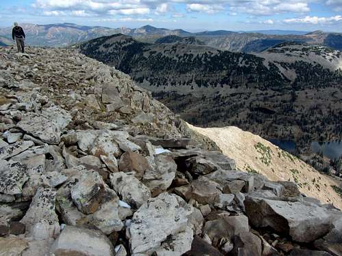
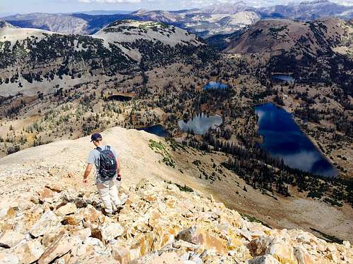
![Northeast Ridge ramps]() After zig-zagging our way up a series of easy ledges at the bottom of Watson's Northeast Ridge ...
After zig-zagging our way up a series of easy ledges at the bottom of Watson's Northeast Ridge ...![Lake views from northeast ridge]() ... our view opened up to see several lakes below us (Triple Divide, Booker, John, Twin, Clyde, & Wall Lakes)
... our view opened up to see several lakes below us (Triple Divide, Booker, John, Twin, Clyde, & Wall Lakes)
![Spot the horses]() Spot the horses
Spot the horses
The trail then brought us to Twin Lakes, the second of which offered some nice red fall foliage along the north shore. As we skirted the edge of the lake, the perfectly still water gave nice reflections of the clouds above us. I was pleasantly surprised by how well-maintained this section of the trail was, as I had heard that there really wasn’t much of a trail at this point (maybe it was improved recently). After figuring that we’d need to bushwhack and/or find our own way from Twin Lakes to Clyde Lake, this meant that the only place where we’d really need to do any route-finding at all would be on Mount Watson’s northeast ridge.
![View north]() Nice views to the north ...
Nice views to the north ...![A-1 Peak behind the Notch]() ... towards the Notch
... towards the Notch
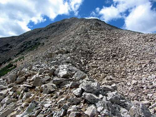
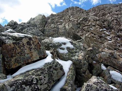
![Remainder of northeast ridge]() Halfway up the northeast ridge, we encountered more boulder-hopping ...
Halfway up the northeast ridge, we encountered more boulder-hopping ...![Little snow]() ... with the occasional patch of snow to bypass
... with the occasional patch of snow to bypass
We walked past a couple more un-named ponds before arriving at Clyde Lake, the second biggest lake we would encounter that day. From here the northeast ridge started to look a bit steeper than its class 2 rating would’ve implied, but we continued on, soaking in the nice lake views.
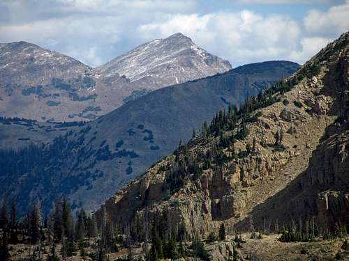
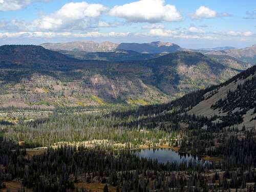
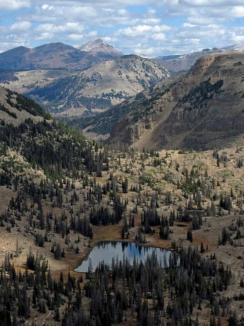
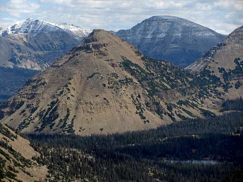
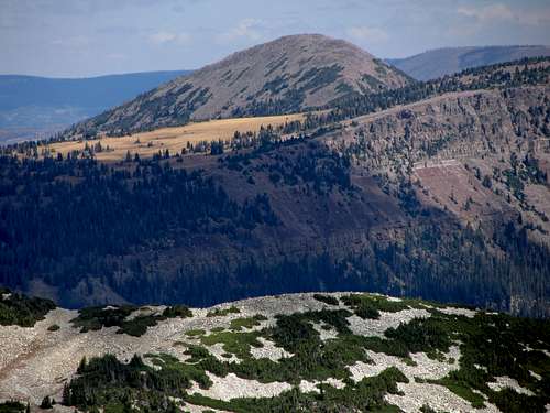
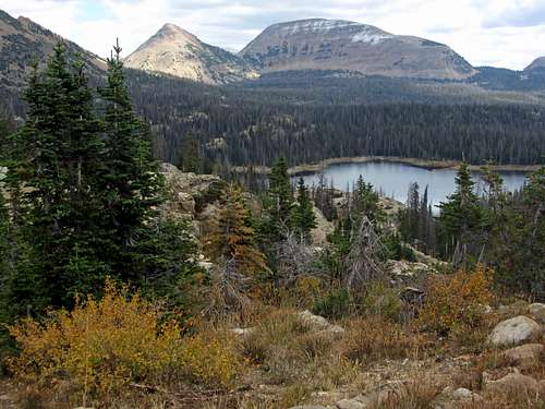
![Hayden & friends]() In the distance we spotted nearby Hayden Peak and friends ...
In the distance we spotted nearby Hayden Peak and friends ...![Reids & friends]() ... which looked tempting for future hikes
... which looked tempting for future hikes
Upon reaching the point where the trail contoured around Clyde Lake to the south, we continued straight off of the trail to the base of the ridge. Arriving at the ridge in person, it didn’t look as imposing as it had from a distance, so we simply started straight up. We soon came to some steeper ledges, which prompted us to start switch-backing our way up. The trail leading us to this point (which would continue looping back to the trailhead) had been mostly flat, so suddenly gaining a thousand feet in the remaining half mile to the summit served as a rude awakening for our legs. Our pace slowed a bit here, but the route-finding was easy and didn’t really require us to use our hands at all unless we chose to do so.
![Watson Northeast Ridge]() Looking back down on the steep northeast ridge ...
Looking back down on the steep northeast ridge ...![Mount Watson steep east slopes]() ... and eastern slopes of Mount Watson
... and eastern slopes of Mount Watson
![Meadow in the distance]() Interesting plateau meadow to the north
Interesting plateau meadow to the north
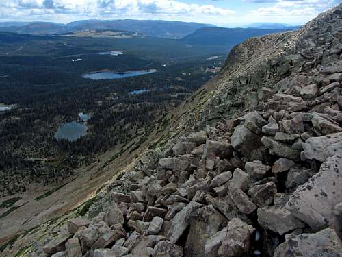
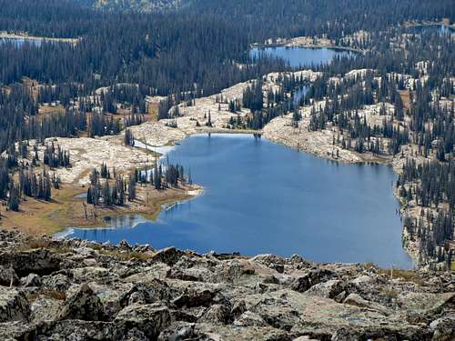
For the first part of uphill hiking we traversed below (to the left, or south of) the ridge crest as that appeared the easiest way to go, but halfway up we got onto the crest of the ridge. The remainder of the route to the top would require some boulder-hopping, with the occasional loose boulder and small patch of snow requiring a bit of attention. The route was relatively easy, giving us great views of even more lakes off in the distance, including John Lake and the Three Divide Lakes which we had narrowly missed on our way here.
![Mount Watson summit view]() Awesome lake views to the east ...
Awesome lake views to the east ...![Northeast Ridge descent]() ... from the northeast ridge of Mount Watson
... from the northeast ridge of Mount Watson
![Mount Watson summit pic]() On the summit of Mount Watson ...
On the summit of Mount Watson ...![Lake to the west]() ... with more lakes visible to the west
... with more lakes visible to the west
More peaks became visible to the east as we gained elevation, and from here we could now clearly make out that there was more snow on Hayden Peak than we had originally thought there was. Since that route is a solid class 3 (with a few short class 4 moves thrown in), I was glad that we’d decided to save that one for another time.
![Clyde Lake]() After a quick descent we were back down on the trail ...
After a quick descent we were back down on the trail ...![Clyde Lake surroundings]() ... next to Clyde Lake
... next to Clyde Lake
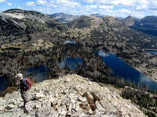
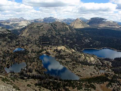
After surveying our surroundings from the summit of Mount Watson, I was able to spot 30 lakes, some of which we’d passed on our way to the top. While I usually prefer quality over quantity when it comes to mountain views and hikes, it was still pretty amazing to be able to see that many lakes in such a relatively short hike.
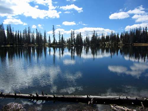
![Reids & Bald over Wall Lake]() Reids Peak & Bald Mountain over Wall Lake
Reids Peak & Bald Mountain over Wall Lake![Watson Lake behind trees]() Looking south trough some trees ...
Looking south trough some trees ...![Watson lake shoreline]() ... at Watson Lake
... at Watson Lake
On the way back to the car I noticed a couple of trail improvements since my last visit four years before. The section of trail just north of Watson Lake was a bit difficult to follow in the past, but a clearer trail now bypassed the steep hillside on the north shore in favor of the more gradual approach to the east. Also, a new boardwalk just south of Cliff Lake now led to a more direct connection with the Crystal Lake Trail (before, you had to cross a steep section of trail near the western shore of the westernmost Lily Lake).
![Cliff Lake fall colors]() The shoreline of Cliff Lake had probably the brightest red colors we'd seen ...
The shoreline of Cliff Lake had probably the brightest red colors we'd seen ...![Watson over Cliff Lake]() ... on our entire Mount Watson hike
... on our entire Mount Watson hike
![Petit Lake]() Mount Watson above Petit Lake ...
Mount Watson above Petit Lake ...![Mount Watson over Cliff Lake]() ... and Cliff Lake
... and Cliff Lake
While at first this little hike was just a back-up plan to doing Hayden Peak, it ended up being a very fun and scenic hike in its own right. For those only interested in trail hiking, I’d say the trail portion of the loop we did (going counter-clockwise, which I feel gives better views of Mount Watson to the west) is one of the best you can do as a day hike from the Salt Lake area, and the only one I know of where you can walk right next to a dozen lakes in just over 5 miles with only 600 feet of elevation gain. The terrain is easy enough to explore that you’d also find no problem getting your own secluded camping spot next to one of the many un-named lakes or ponds in the area, unless it was an especially busy summer holiday or weekend.
![Mirror Lake Byway fall colors]() We saw more nice fall colors along the Provo River ...
We saw more nice fall colors along the Provo River ...![More Mirror Lake Byway colors]() ... as we drove back down the Mirror Lake Scenic Byway
... as we drove back down the Mirror Lake Scenic Byway
Mount Watson Stats
DISTANCE:
6.5 miles roundtrip
CRYSTAL LAKE TRAILHEAD:
10,049 feet
MOUNT WATSON ELEVATION:
11,527 feet
ELEVATION GAIN:
1,700 feet
DIFFICULTY (NORTHEAST RIDGE):
Class 2+
TIME:
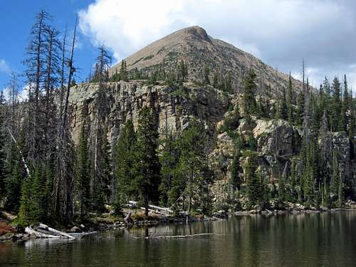
4.5 hours ![Mt. Watson from Notch Pass]() Looking towards Mount Watson from the Notch (northeast ridge is on the right)
Looking towards Mount Watson from the Notch (northeast ridge is on the right)


Comments
Post a Comment