
|
|
Mountain/Rock |
|---|---|
|
|
46.79429°N / 12.09745°E |
|
|
Bolzano Alto-Adige |
|
|
Hiking, Scrambling, Skiing |
|
|
Spring, Summer, Fall, Winter |
|
|
7037 ft / 2145 m |
|
|
Overview
Lutterkopf - Monte Luta 2145 m
Not to be confused with the mountain of the same name located in the Valle Aurina, Monte Luta is a summit located North-East of the village of Tesido at the entrance to the Val di Casies. As all the mountains located in the region South Tyrol/Bolzano Alto Adige, near the boundaries between Italy and Austria, this mountain has two names: Lutterkopf is the original Tyrolean toponym, while the italian name is Monte Luta. It is the lower - the other mountain is the Durakopf/Monte Salomone - situated along a ridge which flanks the Taistner Alm on Alpe Tesido from the orographic right side. The mountain is located on the watershed between the Val di Casies and the Valle Anterselva, both lateral valley of the Val Pusteria.
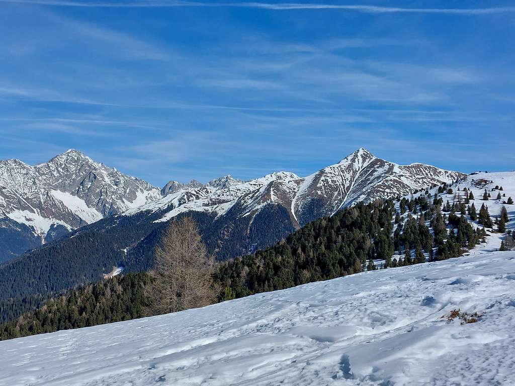
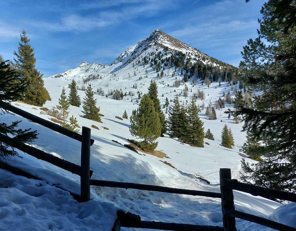
The climb to Monte Luta is not difficult and is usually carried out together with the traverse to Durakopf-Monte Salomone 2275 m, to which it is connected by a ridge. However, it is a beautiful and popular destination even on its own, also due to the vast panorama offered from the summit.
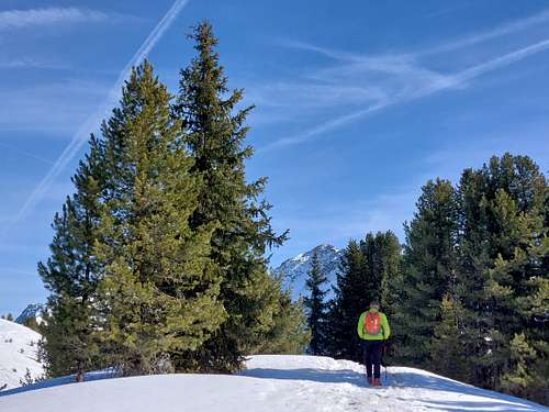
Monte Luta is an essentially grassy peak that can be traveled on in all seasons, becoming much more interesting during the winter months, when it offers an excellent opportunity for an ascent on skis or snowshoes, or with crampons, depending on the snow conditions.
Getting There
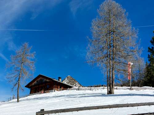
The starting point to climb Monte Luta is the parking lot located immediately after the Muderlhof mountain farm (1584 m, restaurant), reachable via a panoramic road from Monguelfo and Tesido in Val di Casies.
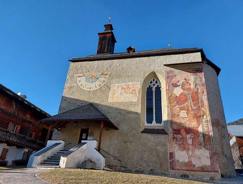
Coming along the A22 highway exit Bressanone, then continue along the SS49 state road up to Monguelfo (about 60 km). Exit Monguelfo West and reach Tesido 1203 m. From the tourist Office of Tesido pass the church and continue to the mountain farm Mudlerhof and the wide parking lot just above.
Normal Route
Lutterkopf - Monte Luta Normal route
Summit quote: 2145 m
Difficulty: EI (in winter), otherwise E
Difference in level: 560 m from the Mudlerhof parking lot
Starting point: Mudlerhof parking lot
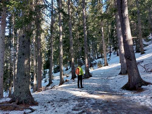
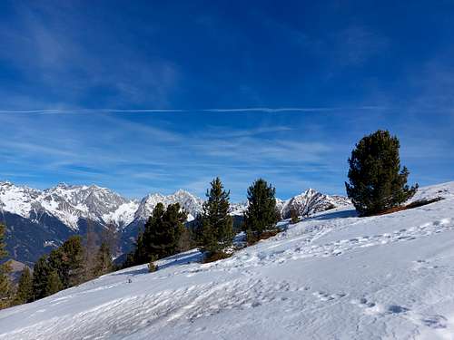
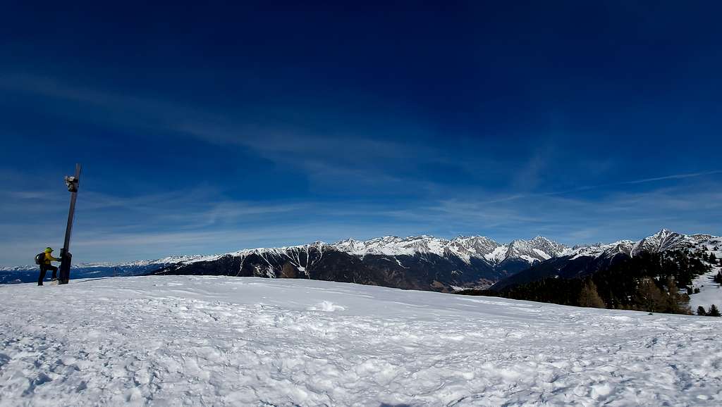
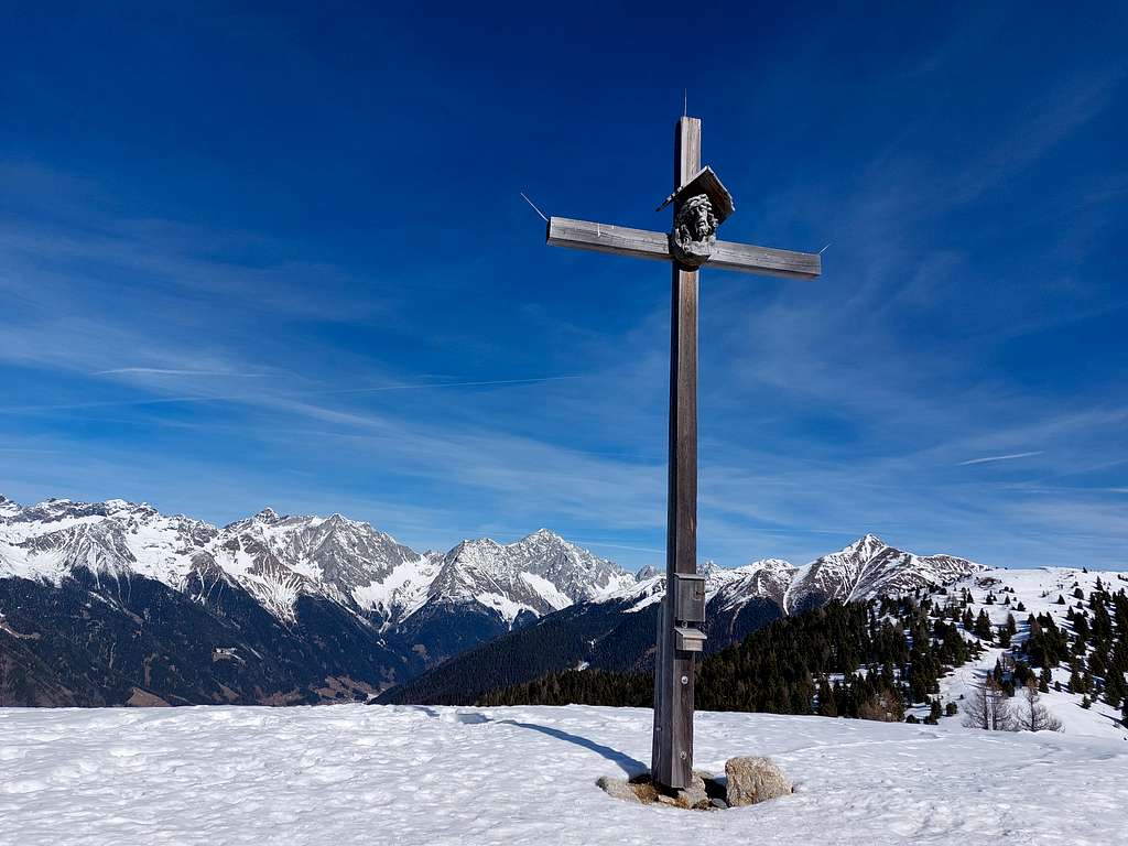
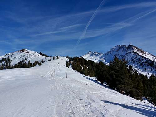
From the Mudler car park take the path n. 31 on the left. After the first bend, at a signpost you must ignore the forest roadand turn left onto a steep path leading directly to a forest road. Cross and climb up, paying attention to the white/red trail signs and following the sign n. 31. This route rises, always with a moderate slope, inside a beautiful coniferous forest. With a small series of hairpin bends it then exits onto more open terrain and reaches the top of Lutterkopf-Monte Luta 2145 m (cross with summit book).
From the summit follow again the path 31 which continues along the opposite side (North West) and descends a few meters towards a grassy basin, where the path 31A coming from the Brunnerwiesenalm joins our itinerary.
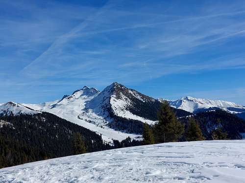
The route continues uphill for a few tens of meters and then begins a nice traverse halfway up the hill in the woods on the side of the Taistner alm with moderate ups and downs, until you reach a saddle (signposted), from which you can clearly see the summit and the cross of Durakopf.
From here it is possible to continue straight towards this other peak, or alternatively turn right to continue the descent.
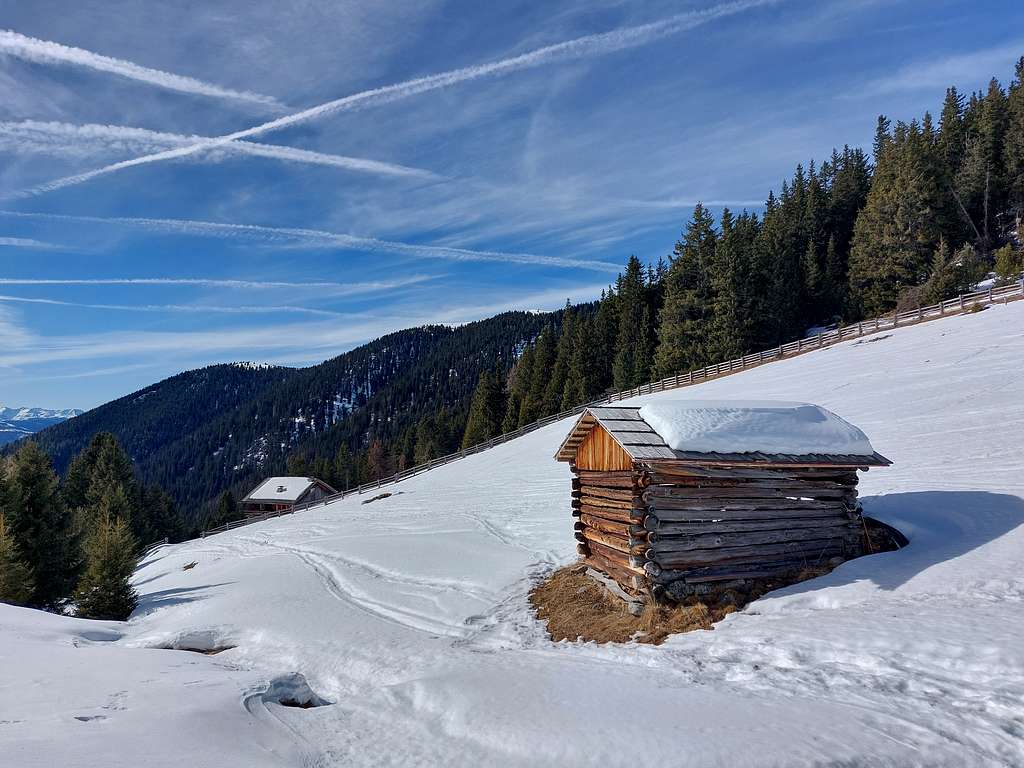
In this case you quickly descend to the Alpe di Tesido, where it's situated the alm named Nuova Malga di Tèsido/Neue Taistner Sennhütte 1992 m. (refreshment service only. From the alm you then descend the long mule track 38A, which takes you back downhill to the Mudlerhof car park.
Red Tape
No fees no permits required
When to Climb
All year round
Accomodation
Monguelfo and Tesido offer different possibilities.
Bibliography
Kompass 1:25.000 Val Pusteria, sheet 2