Mathias Zehring - Dec 14, 2024 3:02 pm - Hasn't voted
well done!very enjoyable to read. Thank you!
MikeLJ - Dec 15, 2024 8:24 am - Hasn't voted
Re: well done!Hi Mathias, thanks very much for your comment. Glad you enjoyed the TR.
Regards,
Mike
|
|
Trip Report |
|---|---|
|
|
47.16510°N / 11.86095°E |
|
|
Sep 4, 2024 |
|
|
Hiking, Mountaineering |
|
|
Summer, Winter |
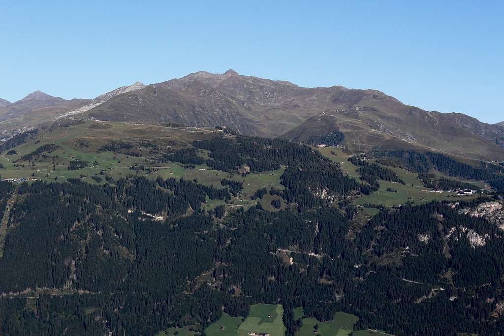
A rather ordinary view looking northwest towards the barns of the Wanglalm (in the clouds) taken on quite a humid day, 6th September 2024.
Virtually the same view taken on 13th September. The tracks and paths have been completely buried in the snow.
A late booking found us in the town of Mayrhofen in Austria in early September.
We had both visited the town in the past separately but it had been so long ago that everything was a bit of a vague memory. As we walked around the town, I suddenly would remember I had been there before!
Typically, the weather in Austria had been pretty good all Summer long but when we arrived on a Wednesday afternoon in temperatures of 30 degrees centigrade, the forecast now showed that the following Sunday would be the last good day! We would have to fit a lot into the first few days.
We could not have predicted how influential and different the changes in the weather would be.
In order to gain some sort of acclimatization, on the first day we caught the cable car up to the top of the Ahornbahn on the lower slopes of the Ahornspitze. Leaving the top station, we started uphill and soon noticed two things. Firstly, a sign on one of the many buildings telling us we were at 2000m. Secondly, we both realised how out of breath we were. Living at sea level all the time, even 2000m needs some acclimatization.
It was a warm but cloudy day with quite a strong breeze as we headed up towards the Finkenkogel – at 2227m, a point on the west - southwest ridge running up towards the Ahornspitze summit.
It only took 45 minutes up the well-trodden paths to reach the summit cross and after pausing here, we continued up the ridge to the next significant top above that to have a rest and admire the views.
The next day, the weather was very cloudy and looked like it would rain despite the positive forecast. This time, we rode the cable car up the north side of the valley to the Penkenbahn and set out walking along the path and service roads, to the Penkenjochhaus. Again, at around 2000m, we didn’t feel that acclimatized.
“I think we could go up to the Wanglspitze.” I said to Marie.
At 2420m, I thought it would be good for us to go a bit higher.
We started to see lots of tiny frogs and some larger Salamanders on the path. It was difficult not to step on them, there were so many.
(Sometime later, a friend of mine in England reminded me that seeing the Salamanders is a sign of approaching bad weather. I didn’t remember that at the time!)
It was easy going and well sign posted and we weren’t really in that much of a hurry. We reached the Wanglalm having seen very few people for a summer’s day and continued upwards on a smaller and steeper path. We had to put a bit of effort into the ascent and reached the summit cross, a little breathless. However, it was only 10.20 am, I had thought it would have taken us longer to get this far.
We sat on a nearby bench to have a bite to eat, there wasn’t much of a view to admire as the clouds swirled around and occasionally broke up to show us the sights below.
“It’s a bit early to go back.” Marie said.
“Yes,” I agreed. “We could go up a bit higher, it will help us to acclimatize.”
I checked the map and worked out where we were. Next to where we sat, was the top station of a dormant cable car, closed for the summer. This was not on my map.
I ought to say at this point, that I had bought the map on my previous visit …in 1994! Not surprisingly, it was a bit out of date but I wasn’t worried, the whole area is well signposted.
“There is a point on the map marked as 2538m, shall we follow the path up to there?” I suggested.
We set off along the ski service road and followed it down and then upwards again.
“None of these cable car stations are marked on my map at all”, I remarked as we passed the third one.
“It must be bleak up here in winter.” Marie said staring across the hillsides of grass and rock. It was cloudy but we occasionally had a view up the Ziller valley towards Hintertux and the mountains above the ski runs, it looked brighter there.
We were still a little breathless but going much better after our break and something to eat. We carried on upwards and Marie got a little ahead of me when I stopped to take photos. Looking around, I couldn’t really match up my memory of the map with what I was seeing but I didn’t stop to get it out and have a proper look.
“There’s a signpost up there.” Marie said as she waited for me to catch up. I assumed that must be Pt 2538m.
We reached the signpost, it wasn’t a top, it was a junction in the path. To the right was Pangert and to the left Rastkogel. I checked the map and realised what had happened. In the years since 1994, the path has been re-routed and no longer goes over Pt 2538m, we were at the Hoarbergjoch at 2590m.
We realised we were close to the Rastkogel summit – something I had wanted to climb but hadn’t thought we would do it that day. It was 12.20 pm so we decided we would give it until 1.00 pm to see if we could make it.
Suddenly, we had a reason to go a bit faster so we put some effort into it. Luckily, the cloud was breaking around us and we could see further than earlier.
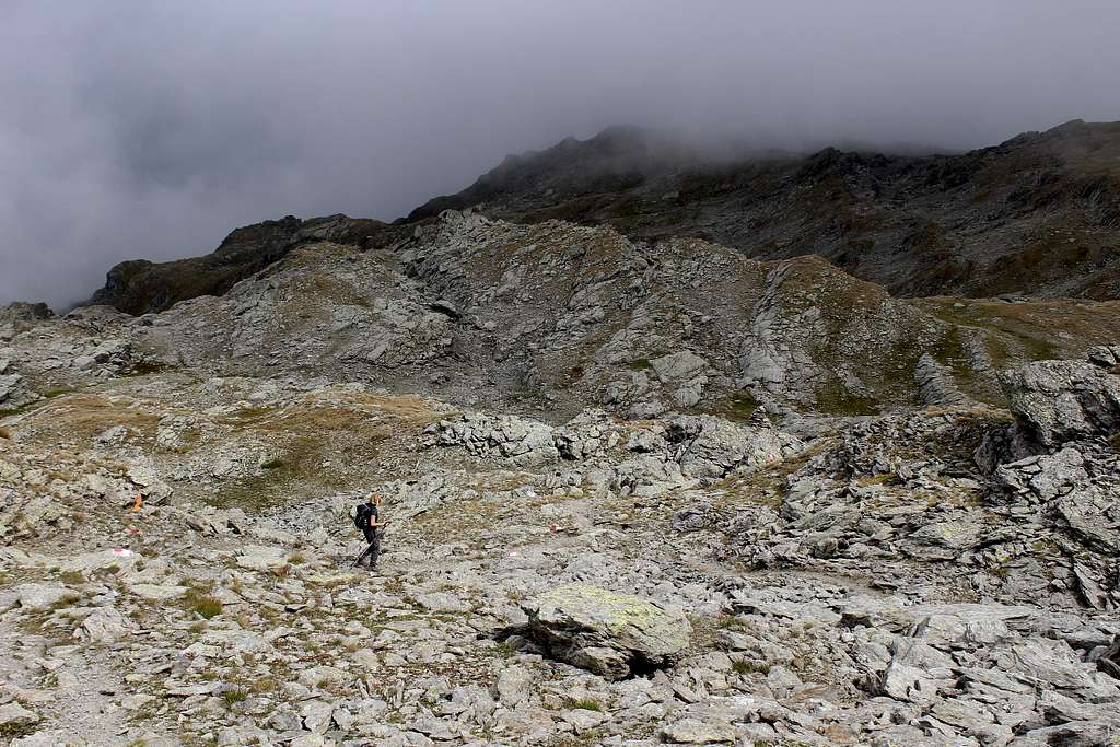
The path was quite rough in places and passed over loose rock but it was well marked with red and whites painted flashes, in fact some of the paint was still wet – Marie put her hand on it by accident!
Ahead, we could see the summit but it wasn’t as close as we had thought. The path went up, then dropped and we had to climb up again. It was vague in places and the last part was a bit of a scramble but we reached the summit at 2762m at 12.55 pm.
The clouds had rolled in again, isolating us on the summit but it felt great to be there when we hadn’t expected to do it.
We had a quick bite to eat and set off down from the summit at 1.15 pm, we knew the last cable car was at 4.30 pm so we had something to aim for.
At first, our descent back to the Hoarbergjoch seemed slow, neither of us wanted to slip on the loose, gravelly path. Once we were on firmer ground we made better time, reaching the Wanglspitz again at 2.45 pm.
We rested, then continued to the Penkenbahn, arriving at 4.15 pm. A very enjoyable day and a nice and unexpected summit, on our second day.
We awoke to perfect blue skies and lovely sunshine and by 9.00 am we had left the top station of the Ahornbahn cable car and set off towards the Edelhutte. According to the signposts, the summit ascent would take around 4 hours but we were unfamiliar with the terrain and wondered exactly how long we would need.
There were plenty of people wandering around the high alp, many were here just for the views but a number were heading along the path with us, towards the Edelhutte. At that time of the day, much of the path was in deep shadow, making the going quite cool and easy, the sunshine was warming the hillsides up all the time.
We reached the Edelhutte in about an hour and stopped just above it for a drink and something to eat. Marie felt I was going too fast and needed a breather and a bar to eat, I was surprised I was feeling quite good, it’s usually the other way around!
The path continued upwards through the grassy alp onto more rockier ground. The views northwards across and down the Ziller valley had been getting better all the time, the towns and villages resembled groups of distant dollhouse – like buildings in the morning sunshine. Above us, the Popbergschneide - the west-southwest ridge of the mountain was drawing closer.
We crossed the scree field below the twin summits about 200 meters above us, to reach the ridge line. Looking south, towards the high mountains that form the Italian border, we could see a sea of clouds were tumbling over the ridge, to melt away in the heat of the Austrian day. The summit of the Grosser Loffler was swamped.
Turning back to our ridge, it looked like it was a scramble from there to the top.
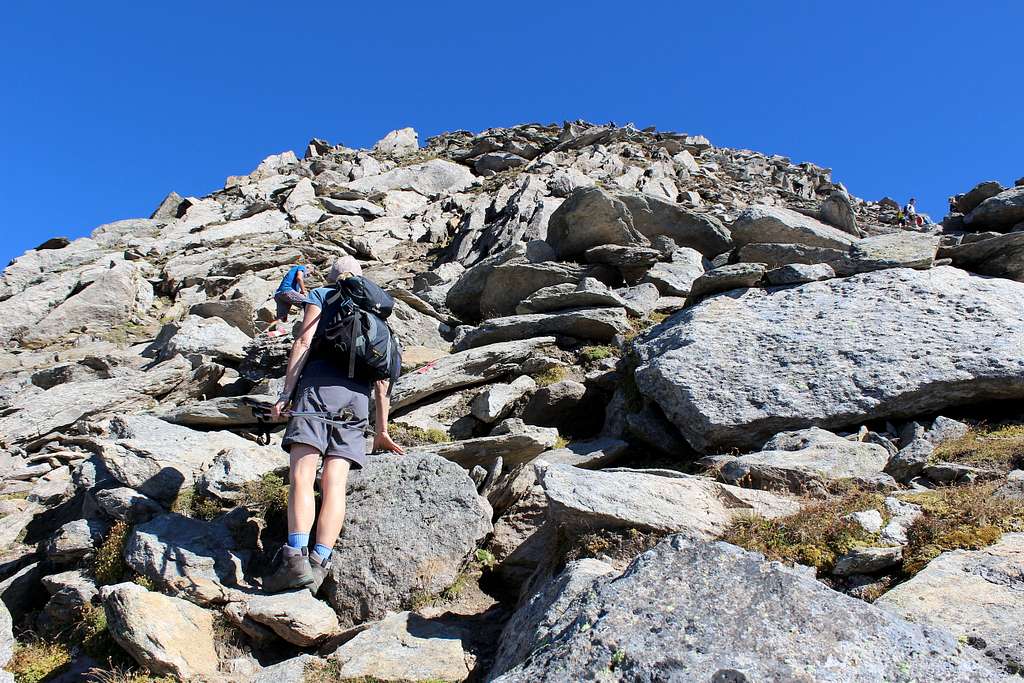
We gradually made height, Marie was going much quicker now, she followed a man with his dog who had been in our cable car. The dog seemed to find the best route up the rocks and we all followed. There were plenty of loose boulders on the way up but it wasn’t bad going as long as everyone was careful.
We reached the first (south) summit just before 12.00 noon. According to the map, this was the main summit, the highest point but everyone was traversing over to the second summit (north) with the wooden cross on top. We followed, descending the rock with a fixed cable to help us and soon we scrambled up to the cross to signify the end of the ascent.
The views in every direction were spectacular.
Nearby, we had great views of the Brandenberger Kolm, Torhelm and the Gerlosssteinwand, further afield to the north, we could see the Karwendel mountains above the Inn valley. I pointed out the Wilder Kaiser mountains where Marie and I had visited several times.
I heard two Germans speaking, the only word I understood was “Zugspitze”! I followed their pointing towards a sandy coloured blur on the horizon – I guessed that was it as it looked like the mountain we had seen from Seefeld.
We could see countless other mountains I didn’t know the names of but I identified the Olperer above the Hintertux ski resort and westwards, I photographed what I later identified as the Grossvenediger. It all looked wonderful in the sunshine.
After a while, we traversed back to the first summit and found somewhere to sit and have lunch in the sunshine, it was a beautiful place to stop.
I noticed some others had scrambled up the rocks to a precarious perch on top of the summit so I had to try it too!
“Come on, we need to be starting down.” Marie called to me.
I climbed down and we set off just before 1.00 pm, plenty of time to get back.
The scramble down was easy but required concentration with all of the loose rock. I don’t know what happened but part way down, my back started to ache. Perhaps I stretched awkwardly or twisted the wrong way – I have had back troubles before - but I started to notice the pain. It wasn’t much at first but was more annoying as we descended.
I had a thought earlier that I might descend the Popbergschneide ridge but now I just wanted to get down as easily as possible.
We re-traced our steps to the Edelhutte, I got slower as we went down and my back hurt more. We stopped for a drink there and to rest my back for a while. When we set off, it wasn’t too bad but the pain soon retuned. There was nothing for it but to just keep going, Marie went ahead and I descended at my own pace in the afternoon sunshine.
We reached the Ahornbahn at 4.00 pm. It had been a beautiful day to do such a good route and the fabulous views just enhanced that feeling. I had to put up with back pain for the rest of the trip but maybe even that was worth it!
The next day was sunny again and although I had a bad back, we felt we had to go out as we expected it to be the last good day for a while.
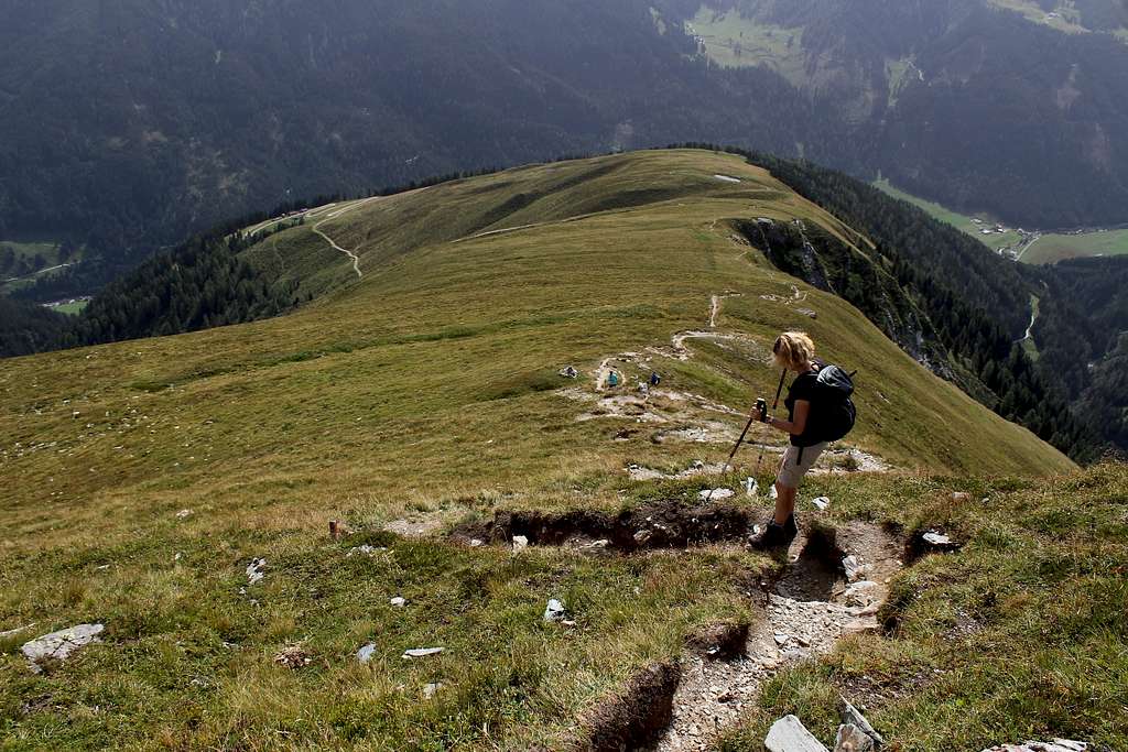
We got the bus to Lanersbach and the Eggalm cable car. From there it was an easy walk for an hour along gravelled tracks and a footpath to the summit of the Grublspitze (2395m). As it was Sunday, it was a popular route and we had originally planned to continue with the majority of walkers up to the Ramsjoch but I worried that my back would suffer even more, so we descended the grassy ridge to the southeast, then back to the Eggalm. As we did this, the views became hazier and clouds filled the skies. By the time we had caught the bus back to the hotel, it was raining.
For the next few days, it rained on and off and was much cooler than before. We wandered around the town and tried the odd walk endeavouring not to get too wet.
I was re-reading Frank Smythe’s book “Over Tyrolese Hills”, an account of a mountaineering traverse from Bludenz, eastwards to Zell am See. This was undertaken in 1935 by Smythe and a companion, Campbell Secord. The mountaineering side of this was interesting as Smythe was a real purist and hated any sort of “artificial aids” in the mountaineering environment. He was horrified to find that the north ridge of the Olperer had been “defiled” by metal handholds driven into the rock thus spoiling what would have been an interesting climb! They had the whole range more or less to themselves except for a few other parties, so I shudder to think what he would have thought of the Ski playground on the Hintertux glacier nowadays. They passed through many small villages and towns that are now major tourist centres, including Mayrhofen. It’s surprising how things have changed.
The other interesting aspect is his description of Europe and particularly Austria and her neighbours in 1935, given our advantage of hindsight. Smythe was confident that the Sud Tyrol – which had been acceded to Italy after WW1 – would soon be returned to be part of Austria! He lived in Austria for many years and loved the Austrians although, he was not quite so complimentary to the Germans and Italians! He had no idea of course, that war was imminent.
On the following Wednesday we were surprised to find the weather was sunny. We could see new snow on some of the higher mountains, so we got the bus down the valley to Hainzenberg and caught the Gerlossteinbahn upwards.
It was a bright sunny morning for us to take the steep path towards the Arbiskogel, few of the other walkers followed us, which was a bit of a surprise as it was a good path with a few easy scrambles.
We made height quite quickly and had great views down the Ziller valley again. We reached the summit of the Gerlossteinwand (2166m) before lunch and was surprised again to see that most of the walkers were coming up the way we had planned to descend! They all descended the steeper rough way!
Great views of Torhelm and the Brandberger Kolm and across towards the Kreuzjoch. We stayed for a while then set off with a view to climb the nearby Hochfeld but eventually decided against this as my back was complaining again!
We descended to the cable car for 2.30 pm, only to find there was no bus for over an hour. We decided to walk down to Zell am Ziller to get the train back to Mayrhofen. By the time we arrived there, it was cloudy and the rain returned soon afterwards.
The following day, the rain was falling harder now in the town and it was a lot colder, so much so that we could see snow lying on the slopes just above us when the clouds cleared. Another day of reading and resting.
Next day, the webcams on the Penkenbahn showed the snow was lying quite deeply on the higher ground but the clouds covered all the hills around.
We caught the Penkenbahn up and headed off towards the Penkenjochhaus. There were a few people around but they were staying near the main tracks. Although the snow was falling, it was a lot better than walking in the rain so we decided to extend our trip towards the Wanglalm.
We descended what we knew to be a service road – the previous week we had to avoid a 4x4 and several bicycles – now the gravelled road was under quite deep snow and we had to take care not to wander off into a snow filled ditch! No one else had been this way and no one followed us, visibility was often quite poor and the snow was knee deep a lot of the time. However, it was enjoyable to be out doing something.
We reached the Wangalm at 11.40 am and stayed for around 10 minutes to take a few pictures before deciding to head back. It was difficult to believe it was the same route we had taken so recently in dry weather. We were amazed to find as we descended, that our footprints were already disappearing as they filled up with new snow!
We were nearly back to the Penkenjochhaus before we met another walker, an Englishman who had lived in the area for 30 years, this, he told us, was his favourite time of the year!
We continued to the Penkenbahn and descended to the valley as the afternoon waned and the snow became heavier. We had enjoyed a really good walk in the snow, no views but great exercise. We didn’t realise it at the time but this weather would bring devastating floods to many parts of central Europe over the coming days.
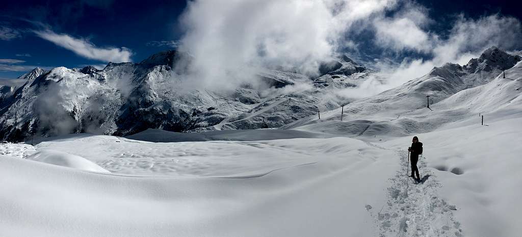
After another day of continuous rain in the valley, the forecast promised an improvement with the possibility of some sunshine. We caught the bus up the valley towards the Hintertux ski area. We were surprised how few other people were on our bus as it had at last stopped raining. As the bus continued, the clouds started to break up and for the first time, we saw the extent of the snowfall. The hills were covered with a thick blanket of snow – more than we had often seen in Austria at Christmas!
By the time we had taken the cable car up to the Sommerbergalm, the skies were blue and sunny. We had originally wondered if we could take the service road up to the Tuxerjoch Haus and follow the footpath around the Weitental and down towards Bichalm. Now that we saw it, there was no way that we could have taken that route through the deep snow and the accompanying avalanche risk.
We tramped around in the snow, admiring the views and taking photos. High above us, the wind was blowing snow off the peaks and the clouds were passing through quickly. We saw a man descending the Tuxerjoch Haus service road on snowshoes and decided to walk up as far as we could go. A 4x4 with snow chains had obviously been this way already, making it easier for us. We followed this for about 15 mins until we found the vehicle abandoned/parked!
After that, the route through the snow had been made by a group wearing a mixture of snowshoe or skis. They had created a trail for us through the deep snow. We followed the broken trail in the sunny weather. The views were stupendous, both above us and looking down the valley. The snow looked perfect although, it was obviously deep and we started to wonder just how much farther we could go on.
After about an hour, two things happened. Firstly, our earlier trail blazers had split up. The snowshoe tracks headed uphill steeply on the snow, whilst the ski tracks contoured around on what we imagined was the road. Secondly, we noticed the Tuxerjoch Haus was now only a few hundred meters above us.
I started to follow the snowshoe tracks but sunk knee deep into the snow at every step. On top of this, I was starting to worry about the snow. It was deep and warming up in the sunshine. I remembered reading many years ago that the angle at which snow can avalanche is at a much gentler angle than most people realise and I am far from an expert on the subject.
“I think I’m going to head down, I’ll wait for you in the restaurant.” Marie decided.
I carried on following the ski tracks but I was still sinking every few steps. This went on for 15 mins or so, I made a little more progress – I reckoned I was somewhere around the 2200 meter level – when I too decided to turn back.
(I planted my walking pole in the snow and measured the depth later, it was 62 cm deep)
Marie had already vanished from view so I tried to speed up on the downhill route and I caught her up later. We descended to the restaurant for a lovely Goulash soup. We had only been heading up to the hut as a target and for the views but better to be safe.
By the time we had finished lunch, the sunny part of the day was ending and more and more clouds appeared as we descended a hillside track towards the Bichalm, we watched avalanches falling off the rocky slopes above as we walked and finally, we reached the bus stop at the village of Madseit.
We had a lovely sunny, winter’s day, all the more unusual as it was in mid September! The snow remained for the next day and as we left the following day, the weather improved and the snowline climbed the hillsides. However, I think for the higher summits, winter had already arrived.
very enjoyable to read. Thank you!
Hi Mathias, thanks very much for your comment. Glad you enjoyed the TR.
Regards,
Mike










Comments
Post a Comment