Page Type Page Type: Trip Report
Date Date Climbed/Hiked: May 29, 2010
Activities Activities: Hiking
Seasons Season: Spring

Planning and Arrival


“What do you want to do on Memorial Day weekend?” I innocently asked a couple of weeks before the Holiday. That kind of question usually leads to a series of suggestions, but fortunately all of them generally involve some kind of outdoor activities. I was of course quietly hoping that a trip into the Eastern Sierra would come up at one point without making me look like I have planned that from the very beginning. “What about the Eastern Sierra?” Finally... I replied that that might be a good idea, smiling and jumping inside. To be honest, I am quite sure that my partner completely sees through the whole “scheme” and secretly has a great time playing that game with me. In any case, however we come up with our trips we both enjoy it to the fullest.

We decided to rent a cabin at the Rock Creek Lakes Resort, something we have done a few times in the past. Actually, we spent a few days there in October of last year and had a great time hiking and fishing. We like the Rock Creek Lake Resort very much as the cabins are secluded, beautifully located in the forest at an elevation of about 9,800 feet. There are ample of things to be done there depending on the season, but this time we wanted to go mostly hiking. I was aware that there was still much snow in the higher elevations which may limit our options. In fact, the road up to the resort was just opened a couple of weeks ago. And the night temperatures were supposed to be in the teens that weekend. Regardless, we both were looking forward to the trip and to spending time away from the city. We took half day off on Friday. We have learned from past weekend trips that the traffic out of Los Angeles north on the 405 or 5 starts to get real bad at around 3-4pm. Leaving the city at around noon will get us quickly over the mountains into the Mojave Desert and further up north. Going from sea level to a little bit less than 10,000 feet in a day is quite a difference and many people could develop some sort of altitude sickness. We both had no problem the previous few trips but we generally try to drink a lot the day before and during the drive. Being well hydrated helps us a lot to minimize the effects of altitude. It turned out that leaving Los Angeles at around noon was a great idea and we made very good time. We stopped briefly – as usual – in Mojave and Bishop and arrived at the resort at around 6pm.

Mount Morgan Bear Creek Spire

There was still a lot of snow at that elevation but luckily the roads were all completely free. We checked in and after getting everything into out cabin we wanted to walk a little to the lake. It was cold and we needed real warm winter clothes as we walked the short distance from the cabin to the lake. It was a beautiful evening with the last sun rays touching the peaks in the Little Lakes Valley. Mount Morgan was bathed in warm, orange light, while the still partially frozen lake was already welcoming the night. It was a gorgeous scenery and we spent about half an hour looking at the surrounding peaks before we noticed how cold it was. We quickly made our way back to the cabin, prepared a nice dinner, and fell asleep shortly after.


Hot Creek and Mammoth Rock Trail


The next day we got up early and had a good hearty breakfast. The sun was shining through the trees and the blue sky was promising a great day. The night before we talked about what to do and we both decided that we wanted to take it slow the first day at this altitude. I wanted to check out Little Lakes Valley but the road was blocked and still snow-covered at the Pack Station. We both did not like the idea of walking on snow all the time, so we drove down Rock Creek Canyon towards the Hot Creek Geothermal Area. I have visited that place many times. It offers amazing views at the Convict Canyon area and hiking along the creek provides the relaxation we both wanted that day.

Hot Pools Hot Creek

We parked the car at the gate on Hot Creek Road and hiked along the dirt road for about one mile to the parking lot. We walked down to the Geothermal Area and were greeted by the smell of sulfur and bubbling pools. For some years now it is forbidden to jump into the water as a sudden rise of boiling hot water could cause serious injuries. There were many warning signs which also said that the increased geothermal activity in the area should not be taken as a sign of a general (and potentially alarming) increased activity in the Long Valley Caldera. Despite the warning signs I have seen many time people sitting in the pools there in the past, but not this time. I thought that I have not seen so much bubbling water in the years before, but I might be wrong. We hiked along the creek where we saw many people fly-fishing. We rested many times along the creek and enjoyed the warming sun looking at the snow-covered mountains to the southwest. At one point and away from the hot pools I checked the water and was surprised how warm or even hot it was. We eventually scrambled over some rocks and up the slope to the dirt road above the canyon and returned to the car.

Since we wanted to hike more the next day we decided to check out some trailheads and access roads. I was interested in Agnew Meadows but the road was still closed at the main lodge at Mammoth Mountain. In fact the ski season seemed to be still in full swing. There were so many people on the mountain and slopes. The area around Lake Mary was also something we wanted to check but the road past Twin Lakes was also still closed and snow covered. After a while we realized that we could not get close to all the trailheads leading to higher elevations. We either needed to add a few miles to the hike to get there or “settle” on a hike at lower elevation. I checked the maps again and found some trails south of Mammoth Lakes in the Sherwin Range. I remembered reading in Secor’s book that the trail up to Sherwin/Valentine Lake is highly recommended. Since the Sherwin Lakes are at around 8,700 feet elevation, snow should not be a major obstacle. We checked out the trailhead off Sherwin Creek Road and finally decided to hike that tomorrow. Since it still was early afternoon we wanted to walk a little more. Driving back on the Sherwin Creek Road we saw the trailhead of the “Mammoth Rock Trail”. After quickly checking the map, the trail seemed to lead along the meadows south of Mammoth Lakes towards Mammoth Rock and eventually intersects with the Old Mammoth Road near Twin Lakes. We went for a quick stroll and enjoyed the views from the meadows towards the Sherwin Range, Laurel and Bloody Mountain, and Mammoth Mountain. The trail ascends very gently through some forests. After one mile and at an elevation of about 8,000 feet we were walking over snow. It was fun though as the slope was gentle. After about 1.5 miles the snow became quite deep and soft, so we turned back.

Mammoth Rock Trail Sherwin Range


We drove back to our cabin, changed quickly, and headed again back down Rock Creek Canyon to enjoy a fine dinner at the Convict Lake Restaurant. Although quite pricey, I personally like the restaurant and the food there very much. I used to stay a few times at the Convict Lake Resort in the past, but it seems to me that it changed in recent times. The last two times I had dinner at the restaurant there was barbeque outside with live music and horseshoe competition. It might appeal to many people, but definitely not to us. If we decide to spend time away from the city in the mountains we both want solitude and quietness. Certainly not the “party” that now seems to go on sometimes at Convict Lake Resort. Anyhow, after a very good dinner, we returned to our cabin and had a good night.


Sherwin Lakes


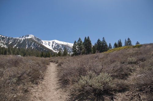
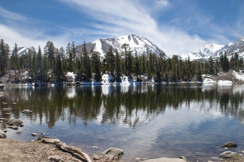
The next day we got up early again and after a good breakfast we drove to the Sherwin Lakes trailhead. As soon as we pulled into the parking lot and got ready to hike a parade of cars arrived unloading dozens of kids. Apparently there was some sort of parents with kids outing. Worrying about our plan to enjoy the outdoors quietly and peacefully we headed out as quickly as we could. However, all those thoughts vanished rapidly as soon as we entered the forested slopes and crossed Sherwin Creek on the wooden bridge. We were immediately immersed in the beauty of the area. The trail first leads gently uphill through the forest and eventually climbs rather steeply up the forested slope (parts of an ancient glacial moraine) in many switchbacks. Gorgeous views opened up to the north towards the town of Mammoth Lakes and the Long Valley Caldera. The snow patches became more and more frequent and sometimes required careful traversing of some steep slopes. Eventually, the trail flattened and led through an open forest towards the Sherwin Lakes. Once we reached the highest and largest lake we were immediately taken in by its beauty; crystal clear water reflecting the dark-green trees dotting the lakeshore and the heavily snow-packed peaks of the Sherwin Range. Gorgeous views at Bloody Mountain and the pointed “Duck Lake Peak” in the distance. There were many people sitting at the lake among the boulders enjoying the scenery. Some dogs were splashing in the ice-cold water.

Sherwin Lakes Trail Sherwin Lakes

We were sitting there for quite some time before we decided to hike even further towards Valentine Lake. Being at an elevation of about 10,000 feet, we were certain that we won’t be able to go all the way. After the Sherwin Lakes the trail now was almost completely covered in snow and sometimes hard to find. Only the occasional dirty boot paths crossing the glistening white snow re-assured us of the right track. There were also almost no other people from that point on, so we really felt and enjoyed the solitude. We almost made it to the John Muir Wilderness boundary (about one mile from the Sherwin Lakes) before we turned back. We again spent more than 30 minutes sitting at Sherwin Lake before the increasingly cold wind reminded us to hike down. Delving in our memories of an amazing hike we drove back to our cabin and prepared a delicious dinner.


It's hard to leave


The next day, the certainty of having to drive back to Los Angeles, leaving this beautiful place weighed heavily in our minds all morning. It took a long time to carry all our stuff to the car, to check out, and to say good-bye. Clinging to the beauty of the canyon and the surrounding mountains we stopped many times on our drive down Rock Creek Canyon to sit quietly along the creek, soaking in the warmth of the sun, the sound of rushing water, the chirps of the birds.

Rock Creek Aspens in Spring


Back down at Tom’s Place and Highway 395 we did not turn south towards Los Angeles but right towards Mammoth Lakes. We took Crowley Lake Drive, a much more scenic and relaxed drive, and had some coffee at Looney Bean Coffee in Mammoth Lakes. After spending some time outside the café, reality soon sat in and we were on our way home. We stopped as usual in Bishop to replenish our supply of breads and cookies at Erick Schat’s Bakery. Although this place is extremely busy at all times, the goodies are delicious and well worth a visit anytime you drive by. After having a sandwich outside we kept driving, stopping on our way at Big Pine, Independence, and Lone Pine to take many pictures of the towering mountain peaks.

Eyeing the Horseshoe Meadow road climbing up the mountains, some thoughts started to crystallize in my head...

...see you very soon...


Comments

Post a Comment
Viewing: 1-2 of 2
SierraCJ

SierraCJ - Jul 1, 2010 2:19 pm - Voted 10/10

Nice report!

I know what you mean by "hard to leave". I go up there as often as I can and every time I hate leaving. We're very lucky to have such a wonderful place to go that is so close to home. CJ

SoCalHiker

SoCalHiker - Jul 1, 2010 2:35 pm - Hasn't voted

Re: Nice report!

Thanks for your kind words. I try to go there as often as I can, too. We are lucky indeed. Cheers, Guido

Viewing: 1-2 of 2


Parents 

Parents

Parents refers to a larger category under which an object falls. For example, theAconcagua mountain page has the 'Aconcagua Group' and the 'Seven Summits' asparents and is a parent itself to many routes, photos, and Trip Reports.

Rock Creek CanyonTrip Reports