-
 24941 Hits
-
 84.27% Score
-
 18 Votes
|
|
Mountain/Rock |
|---|---|
|
|
45.54960°N / 6.82660°E |
|
|
12398 ft / 3779 m |
|
|
Overview
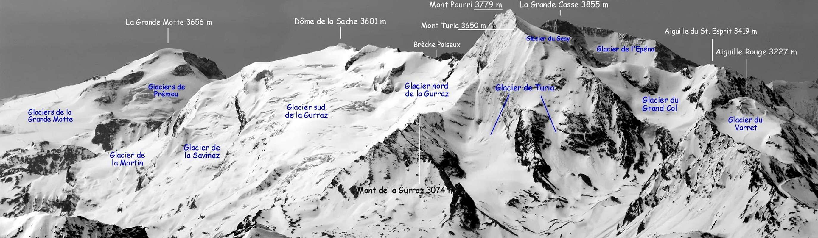
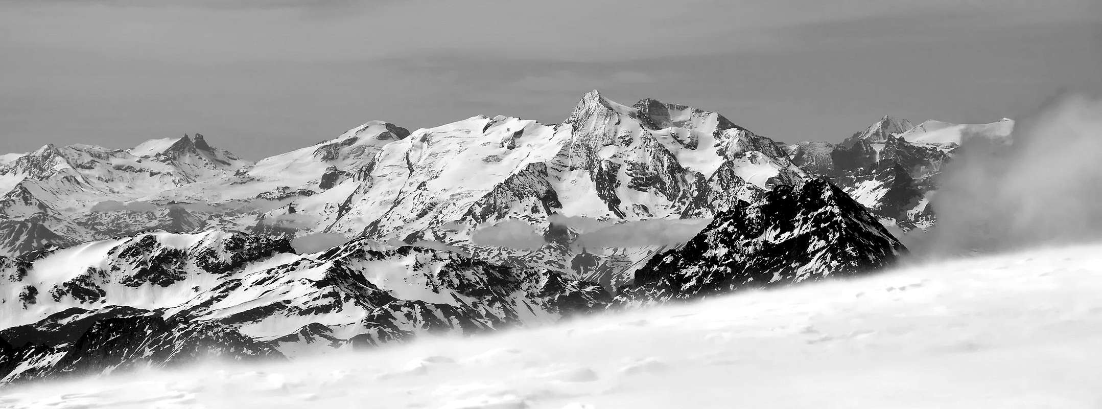
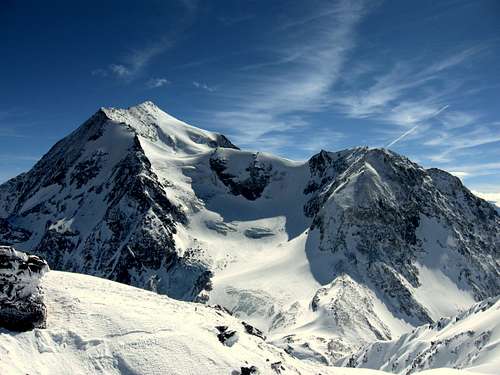
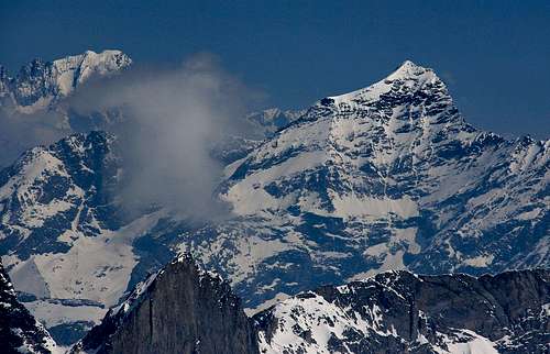
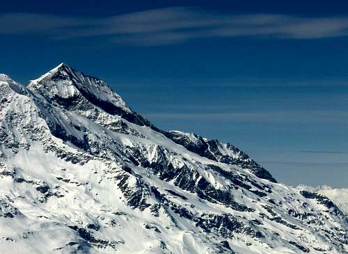
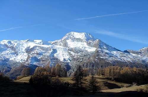
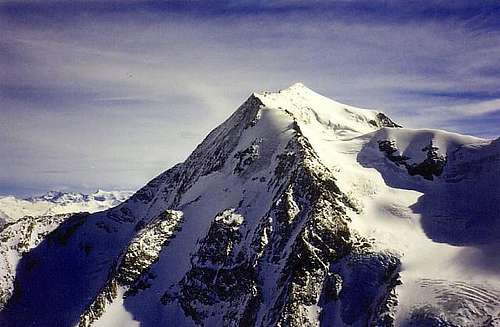
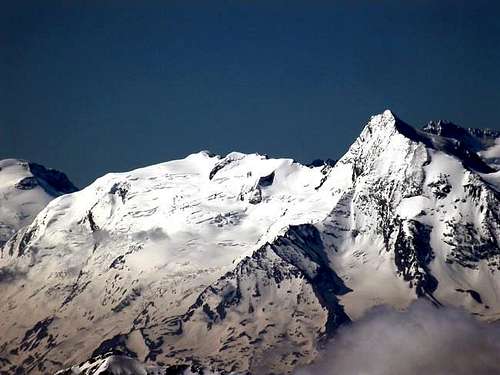
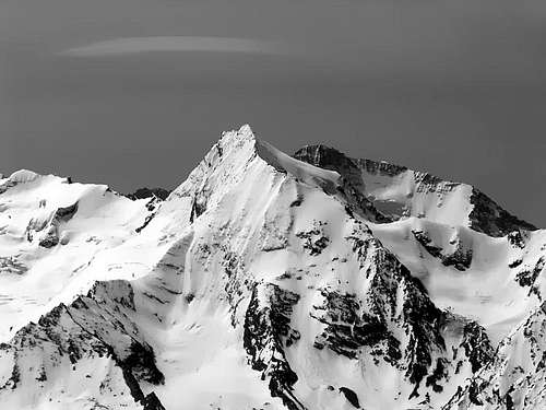
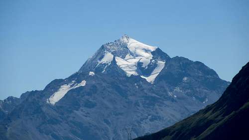
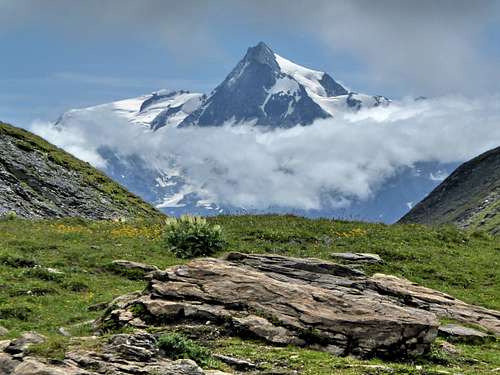
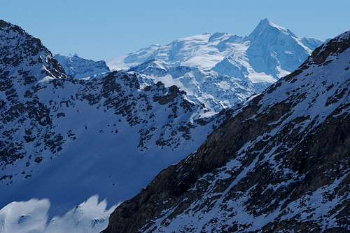
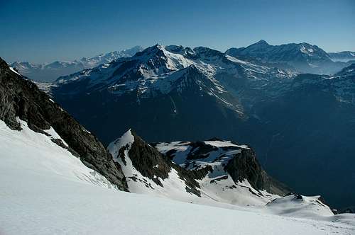
The Mont Pourri is the second highest peak of the Massif de la Vanoise after the Grande Casse. It's the most northern situated summit of this massive face on the Col du Petit Saint Bernard. This huge mount dominates Bourg Saint Maurice, located at 12 km distance from nearly 3.000 meters. The NE face is breathtakingly high located over the haute Tarentaire: the village of La Gurraz, 4 km as the crow flies from the summit is 2.500 meters lower and threatened by the 2 hanging glaciers of La Gurraz north and south which drop down to near 2.000 meters height (they are the lowest permanent icefields in La Vanoise). Mont Pourri means rotted mountain.
Traduzione in Italiano come da testo Huberschwiller
Il Mont Pourri è la seconda cima più alta del Massif de la Vanoise dopo la Grande Casse. È la cima più a nord di questa enorme parete sul Col du Petit Saint Bernard. Questo enorme monte domina Bourg Saint Maurice, situato a 12 km di distanza da quasi 3.000 metri. La parete NE è incredibilmente alta e si trova sopra l'Haute Tarentaire: il villaggio di La Gurraz, a 4 km in linea d'aria dalla cima, è 2.500 metri più in basso ed è minacciato dai 2 ghiacciai sospesi di La Gurraz a nord e a sud che scendono fino a quasi 2.000 metri di altezza (sono i ghiacciai permanenti più bassi della Vanoise). Mont Pourri significa montagna marcia.
 |
 |
 |
 |
 |
Climbing History
- The first ascent: Michel Croz, solo, the (03/10/1861).
- Second ascent: W. Mathews and Rev T. G. Bonney in august 1862 with Michel and Jean Croz.
- Third ascent: Horace Walker with Melchior Anderegg and J. Jaun (26/06/1868).
- Fourth ascent: Joseph Paccard from Peisey (1873).
- First crossing Dôme de la Sache - Mont Pourri: J. Blanc-le-Greffier and V. Mangard (13/08/1880).
- S-E face: A. Messimy with J. Blanc-le-Greffier (26/08/1894).
- E Ridge: M. H. Mettrier wjth Jean-Marie and Auguste Blanc (30/07/1904).
- South face with skis: 1.000m Pierre Tardivel le (26 mars 1989).
- Direct south face with skis: 850m Pierre Tardivel le (12 avril 1995).
Getting There
Start point is Peisey-Nancroix near Bourg Saint-Maurice.
Nearest airports: Geneva Cointrin (150 km), Chambery (100 km), Lyon (180 km).
By the road, A 43 to Albertville. Take then the route de Tarentaise to Moutiers (27 km from Albertville), Aime. Bellentre (22 km after Moutiers). At the right the D 87 leads to Peisey-Nancroix (it belongs to the famous ski-resort of Les Arcs). Continue after Peisey along the D87, cross Le Moulin, Nancroix, to Les Lanches (park near the bridge 1.524 meters).
Some advices: saturdays in february and march arrive to Albertville before 8h'00 or after 16h'00. Traffic infos on France Bleu Pays de Savoie (103.9).
Red Tape
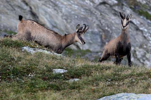
There is no permit required to climb this mountain, but the massif is located in the Park National de la Vanoise.
Rules:
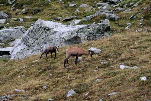
- No picking, no collecting the animals, plants, rocks and fossils all belong to the environment.
- No loud noise, no disturbance, for the tranquility of all.
- No dogs, not even on a lead, so as not to disturb wild and domestic animals alike.
- Leave no rubbish, no trace of your passage.
- No camping, no bivouacking. Bivouacking is allowed near certain refuges, under the control of the warden.
- No fires. To reduce the risk of wild-fires and to avoid damaging the soil.
- No paragliders or other means of air-transport. Overflying at less than 1.000 meters is also forbidden for the tranquility of the animals.
- No mountain biking. For the safety of walkers and to avoid erosion of the paths. However, certain trails in the Park have been designated for biking.
Histoy of the Park
King Victor Emmanuel II created the Gran Paradiso royal reserve in 1856; it was enlarged in 1922 and made into a national park. In France, the creation of a national reserve in the Vanoise mountains was being considered from 1943, under pressure from the Club Alpin Français, the Touring Club de France and hunting associations. There were numerous hesitations concerning the surface area to be protected as well as whether the focus should be placed on humans or animals. Finally, the project was planned with two zones, one central, the other peripheral. The ibex was at last permanently protected by the Vanoise National Park, created on 6 July 1963 - the first French national park. It has a common border with the Italian Gran Paradiso National Park. Twinned since 1972, together they cover 1.250 km2 and constitute the largest protected site in Western Europe.
Non è richiesto alcun permesso per scalare questa montagna, ma il massiccio si trova nel Parco Nazionale della Vanoise.
Regole:
- Vietato raccogliere, non collezionare animali, piante, rocce e fossili appartengono tutti all'ambiente.
- Vietato fare rumore, non disturbare, per la tranquillità di tutti.
- Vietato portare cani, nemmeno al guinzaglio, per non disturbare gli animali selvatici e domestici.
- Non lasciare rifiuti, nessuna traccia del tuo passaggio.
- Vietato campeggiare, non bivaccare. Il bivacco è consentito vicino ad alcuni rifugi, sotto il controllo del guardiano.
- Vietato accendere fuochi. Per ridurre il rischio di incendi boschivi ed evitare di danneggiare il suolo.
- Vietato usare parapendio o altri mezzi di trasporto aereo. È vietato anche sorvolare a meno di 1.000 metri per la tranquillità degli animali.
- Vietato andare in mountain bike. Per la sicurezza degli escursionisti e per evitare l'erosione dei sentieri. Tuttavia, alcuni sentieri nel Parco sono stati designati per andare in bicicletta.
Storia del Parco
Re Vittorio Emanuele II creò la riserva reale del Gran Paradiso nel 1856; fu ampliata nel 1922 e trasformata in parco nazionale. In Francia, la creazione di una riserva nazionale nelle montagne della Vanoise fu presa in considerazione dal 1943, sotto la pressione del Club Alpin Français, del Touring Club de France e delle associazioni venatorie. Ci furono numerose esitazioni riguardo alla superficie da proteggere e se l'attenzione dovesse essere rivolta agli esseri umani o agli animali. Alla fine, il progetto fu pianificato con due zone, una centrale, l'altra periferica. Lo stambecco fu infine protetto in modo permanente dal Parco nazionale della Vanoise, creato il 6 luglio 1963, il primo parco nazionale francese. Ha un confine comune con il Parco nazionale italiano del Gran Paradiso. Gemellati dal 1972, insieme coprono 1.250 km2 e costituiscono il più grande sito protetto dell'Europa occidentale.
 |
 |
 |
 |
 |
When To Climb
This mountain can be climbed all year round. Also quite a popular extreme skiing mountain in the spring time.
Questa montagna può essere scalata tutto l'anno. È anche una montagna molto popolare per lo sci estremo in primavera.
Normal Route
The normal route of ascent is by the crevassed and fairly steep Glacier du Geay from the Refuge du Mont Pourri.
Orientation: NW
Total level: 1.425 meters
Maximal level: 40°
Difficulty: PD
- Day 1: Climb to the Refuge du Mont Pourri (850 meters level, 2h'00). From les Lanches, cross the bridge and take the path to the hamlet Beaupraz. Climb tight to near 2.000 meters, crossing the Combe du Trovet (gully) and reach the Chalets des Loyes. Take left, climb to the Plan des Ecuries to the refuge (2.370 meters).
- Day 2: Take the path near the waterstream to the annex of the refuge (2.460 meters). Climb along the moraine (steep and painful) to the rightbank of the glacier (at 2.880 meters). Go the glacier up in the middle, avoiding the seracs. Climb the last NW slope to the shoulder and follow the ridge to the summit.
Descent: The same way.
Equipment: crampons, ice axe, harness.
 |
 |
 |
 |
|
La via normale di salita è attraverso il crepacciato e piuttosto ripido Glacier du Geay dal Refuge du Mont Pourri.
Orientamento: NW
Livello totale: 1.425 metri
Livello massimo: 40°
Difficoltà: PD
- Giorno 1: Salita al Refuge du Mont Pourri (livello 850 metri, 2h'00). Da Les Lanches, attraversare il ponte e prendere il sentiero per la frazione Beaupraz. Salire stretti fino a quasi 2.000 metri, attraversando la Combe du Trovet (canalone) e raggiungere gli Chalets des Loyes. Prendere a sinistra, salire al Plan des Ecuries fino al rifugio (2.370 metri).
- Giorno 2: Prendere il sentiero vicino al ruscello fino all'annesso del rifugio (2.460 metri). Salire lungo la morena (ripida e faticosa) fino alla riva destra del ghiacciaio (a 2.880 metri). Salire sul ghiacciaio al centro, evitando i seracchi. Salire l'ultimo pendio NW fino alla spalla e seguire la cresta fino alla cima.
Discesa: Per la stessa via.
Attrezzatura: ramponi, piccozza, imbracatura.
 |
 |
 |
 |
|
 |
 |
Huts
Refuge du Mont Pourri (2374m) Tél. 04 79 07 90 43
- Depuis Albertville, Moutiers (N90), puis par Landry (D87) et Peisey-Nancroix.
- Ou depuis Albertville, Moutiers (N90), puis Bourg-St-Maurice (D113) et Les Arcs 1800 ou Les Arcs 2000.
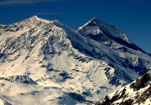
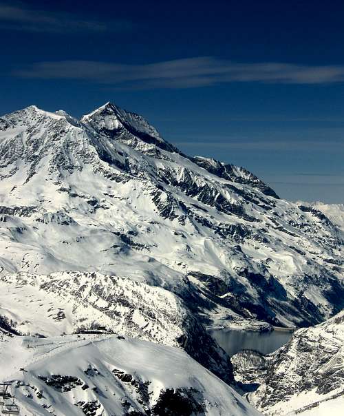
Other summits of the Mont Pourri Massive
- Mont Turia (3.650m): noth ridge of the Mont Pourri.
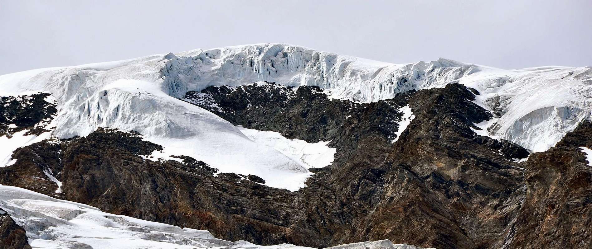
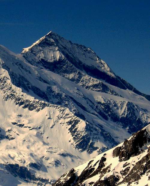
- Dôme de la Sache (3.601m): second highest peak in the south of the Mont Pourri. A gigantic icecap covers the summit.
- Grande Parei (3.365m).
- Dôme des Platières (3.473m).
- Aiguille du Saint Esprit (3.419m): elegant needle on the left of the Glacier du Geay and dominating the normal route.
- Aiguille Rouge (3.227m): can be reached by cablecar from Arcs 2000.
- Rochers Rouges (3.002m).
- Pointe du Chardonnay (2.870m): gully skiing eldorado in the skiresort of Tignes.
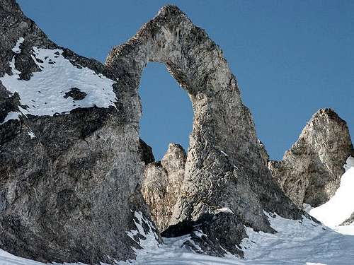
- Aiguille Percée (2.778m): crumbly limestone massif, eroded by the high winds that bluster through the Palet and Sachette passes chiselling weird and wonderful geological structures – needles, turrets and other sculptures forged by Mother Nature.
Books and Maps
BOOKS:
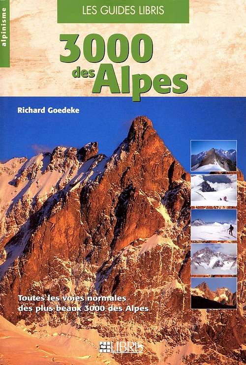
- "3000 des Alpes" di Richard Goedeke Toutes les voies normales des plus beaux 3000 des Alpes. Les Guides LIBRIS.
- "Alpi Marittime Monviso-Alpi Cozie-Delfinato-Vanoise-I grandi spazi delle Alpi, Alessandro Gogna, Marco Milani, Federico Raiser, Priuli & Verucca, Edizioni Melogarano (in Italian).
 |
 |
MAPS:
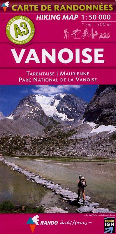
- Carte de Randonnées Hiking Map VANOISE Tarentaise Maurienne Parc National de la Vanoise 1:50.000. Rando éditions.
- IGN Grenoble mont-blanc parc national de la vanoise (n°53), Serie Verte 1:100.000.
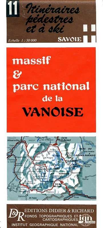
- IGN France - Itinéraires pédestres a ski massif & parc national de la VANOISE, Carte (n°11), 1:50.000. D&R Editions Didier & Richard.
 |
 |
 |