-
 4149 Hits
-
 82.48% Score
-
 15 Votes
|
|
Mountain/Rock |
|---|---|
|
|
44.71897°N / 7.06589°E |
|
|
Mountaineering, Trad Climbing, Scrambling |
|
|
Summer |
|
|
10404 ft / 3171 m |
|
|
Overview
Monte Granero 3171 m
Monte Granero 3171 m is a complex and imposing rocky peak exceeding in height the threshold of 3000 meters and belonging to the Alpi Cozie Centrali. The summit consists of two peaks, separated by a narrow notch, the Cima Sud (slightly higher) and the Cima Nord. The mountain is located at the head of the Po and Pellice valleys, in the province of Cuneo, Piedmonte, not far from the border with France. It has a pyramidal shape with a fine rocky wall facing SE and enjoys a beautiful view over the main peak of Monte Viso. Monte Granero is a beautiful and interesting mountain, even if not very popular, and also rather complex, with four main crests (SW, East, NE, NW) and four sides.
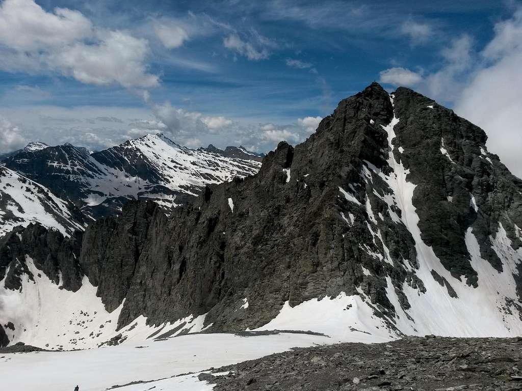
The are two easy routes to summit Monte Granero. The easiest one is the Normal route taking place on the West side, used by the first climbers for the descent. The difficulty of the itinerary is mountaineering and is rated as F. Another slightly more demanding route used to reach the summit is the SE ridge (Cresta Sud Est), the ascent route of the first summiters.
History
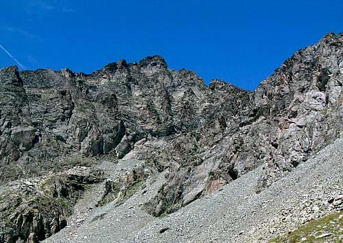
The first known ascent was carried out by E. Bianco, A. and C. Fiorio, F. Pagagnone and C. Ratti on 23 August 1879, without guides, who climbed the summit via the SE ridge and descended from the easier West side.
Getting There
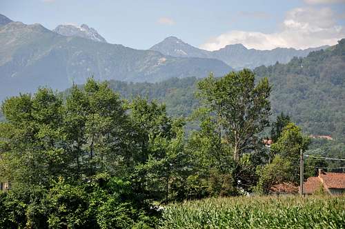
The starting point for the ascents is Pian del Re, where it begins the Po river, which can be reached from the town of Saluzzo by following the Valle Po. After passing the villages of Revello, Sanfront and Paesana, the road finally reachs Crissolo where, in the middle of the village, it takes the direction of Pian Melzè and finally Pian del Re car park (paying parking for € 10, summer 2020).
Normal route West side (Val Pellice)
Normal route Val Pellice
Summit altitude: 3171 m
Difficulty: Alpine F
Vertical gain: 1950 m from Villanova Pellice, 800 m from Rifugio Granero
Exposure: West
Starting point: Villanova Pellice 1223 m
Very long route, it is the easiest one to the summit. It is possible to take it more lightly by staying overnight at the Rifugio Granero.
From Villanova Pellice (it is forbidden to continue by car to the Conca del Prà), follow the path between the houses, rising above the stream and cutting the dirt road in several points, reaching the Conca del Prà. Cross the basin and take the path to the right to the Refuge Granero, reach the Partia d'Aval pastures, then the Partia d'Amount. From here follow the path to the left, crossing the stream, and reaching Pian Sineive with the stele dedicated to a US plane that crashed during a research mission. From Pian Sineive the path climbs sharply on a grassy ridge at the end of which you reach the hut at 2377 m. Immediately behind the refuge there is the Lago Lungo from which it originates the Pellice stream.
Continue behind the hut first on the path, then on stony ground in the direction of the Passo Seillerino, without reaching it, as you have to bend to the left, following numerous tracks and cairns. Doing a semicircle you reach the base of the gully that descends from the top.
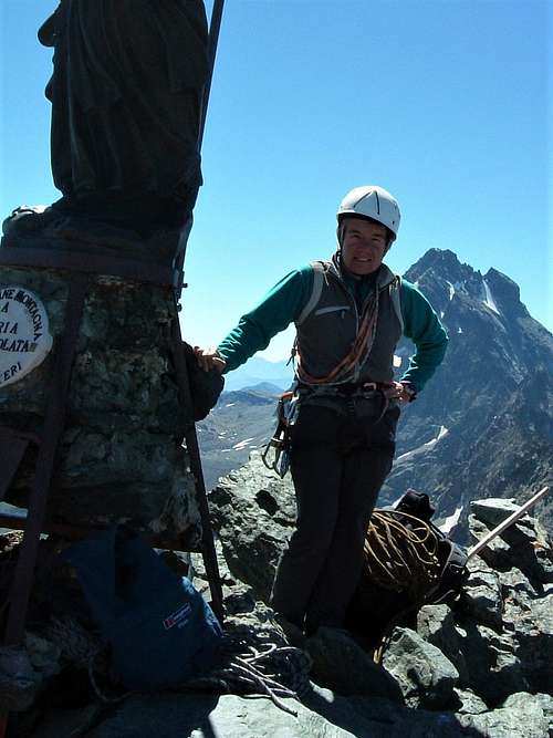
You go up it either to the center (be careful not to unload stones on those who follow, helmet recommended) or to the right, where the rocks are more solid. Without great difficulty climb up some easy steps of I-I+ up to the castle of final rocks that can be overcome without problems, reaching the small summit with the statue of the Madonna.
Variant: the summit can be reached also from Pian del Re.
From Pian del Re follow the wide path V16 which heads West on the right side of the plateau (orographic left) towards Pian Mait and Colle delle Traversette (signpost). After a few steps we ignore on the right a path (pole) to Colle della Gianna. A few more minutes we ignore on the left (pole) the path to Lago Superiore and Rifugio Giacoletti. The itinerary reachs the Vallone delle Traversette, where it leaves yet another path to the left to Coulour del Porco and Rifugio Giacoletti. Keeping to the right the path starts rising to reach Pian Armoine with a few bends. The path continues to climb with other bends up to Pian Mait. After crossing the basin you reach the Casermette, an old military shelter. With a few hairpin bends the path gets the entrance to the Buco di Viso and cross it. The narrow tunnel leads to the French side (Guil), where you go down for a hundred meters and then climb a scree gully to get the Val Pellice side. With a long traverse, without losing too much altitude, you get to the base of the gully rising to the summit. Climb the gully on debris reaching with easy climbing the small statue of the Madonna which stands on the summit.
SE ridge
South-East ridge (Normal route Valle Po)
Summit altitude: 3171 m
Difficulty: Alpine PD-
Vertical gain: 1150 m
Exposure: SE
Starting point: Pian del Re
The SE ridge takes place along airy ledges and steep rocks and therefore requires a minimum of mountaineering experience and the use of a rope to ensure the less experienced.
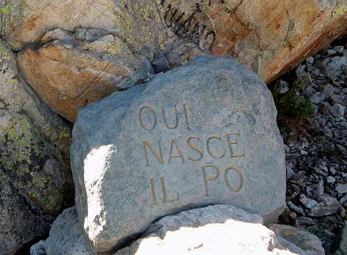
From Pian del Re 2020 m take the path in the West direction which traverses along the hillside. After about 700 meters the path reachs the Vallone delle Traversette, where keeping to the right it starts rising to reach Pian Armoine with a few bends. The path continues to climb with other bends up to Pian Mait. Continuing on you reach the Casermette, above which a track on the landslide leads to the entrance to the Buco di Viso. Ignore the path to the left to Buco di Viso and Colle delle Traversette and take the right branch to Passo Luisás. Going up a small path among the debris you reach the high pass at 3019 m, located between Monte Granero and Monte Meidassa. From the pass start to climb the wall overlooking the Po Valley, immediately to the left of Monte Granero East ridge. Climb slanting left along ledges and small gullies (cairns), up to a small saddle at the top of the SW ridge, where you meet the normal route coming from the Seillierino Pass.
Going up to the right along stepped rocks and ledges, you will soon reach the small statue of the Madonna which stands on the summit.
Climbing routes: Via Michelin-Masoero
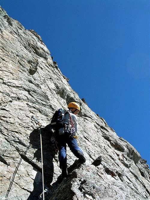
Via Michelin-Masoero report
Difficulty: 5b max
Length: 300 m, 9 pitches
Exposition: SE
First ascent: F. Michelin - S. Masoero
Starting point: Pian del Re
Approach
The climbing route develops on the sunny SE face and can be reached along the path that leads from Pian del Re to Colle delle Traversette up to the deviation near a ruined military barrack, where you turn right to Colle del Luisas. A hundred meters before reaching the col, leave the path of the Colle Luisas (blue arrow on a stone) and climb up a stony ground for about twenty meters to the start of the climb (blue arrow on the whitish wall, about 2-2,30 hours from Pian del Re). Another possibility is to approach in 1 hour and 40' from the Rifugio Giacoletti following the "Sentiero del Postino" to Colle delle Traversette, reaching the ruined military barrack.
Route report
L1 - Climb the first tower on the right spur not to its top, but exiting to the right a few meters below (blue stop). Walls, slabs, overhang. Short step 5b/c, 25 m
L2 - Slabs with cracks. 4b, 25 m.
L3 - Reddish and overhanging spur. 5a/b, 25 m.
L4 - Left traverse on rocks with grass. Easy, 30 m
L5 - Head to the left of the chimney, then up a nice wall. 5a, 25 m
L6 - Slabs and short protrusions. 4b 20 m.
L7 - Go down to the breach, then climb the beautiful slab. 5a, 20m
L8 - Traverse to the right, easy. About 30 m.
L9 - Straight up the steep wall, beautiful. 5b, 5c steps, 30 m.
L10 - Continue on more knocked down slabs and on a cracked wall. 5a, 5b, 25 m
L11 - Slabs then a cracked wall a little to the right up to the notch of the West ridge. The normal route of Val Pellice passes a few meters away. 4b, 30 m
L12 - Short dark rock wall, then easy steps up to the statue of the Madonna on the summit. 5b, 20 m
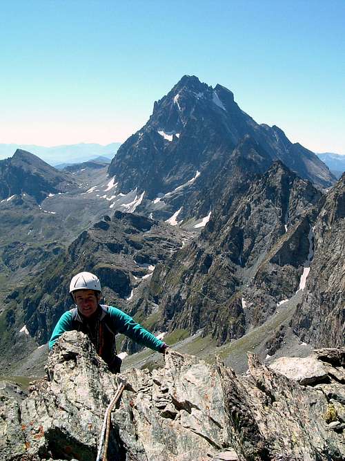
Descent
The descent takes place along the Route SE (Valle Po) and is very well marked with yellow stripes. On some passages there are bolts. Traits exposed.
The first part of the descent is in common with the Normal from Val Pellice and runs along the West ridge on this side until some yellow arrows send to the left (South) to cross the West ridge to look out over the Val Po side. With short sections of climbing and ledges, the descent continues on the Val Po side, cutting it all diagonally to the left (East) toward the Col Luisas. In case of bad weather or adverse conditions it may be advisable to descend from the normal route of Val Pellice and then climb back to Colle Luisas.
From Colle Luisas you go down to the barracks and then, along the Traversette path, to Pian del Re.
Il Buco di Viso
Near Monte Granero it's located the Buco di Viso, or Buco delle Traversette, a tunnel carved into the rock about 75 meters long, between Italy and France, connecting the municipal areas of Crissolo and Ristolas. It is located in Piedmont, in the territory of the province of Cuneo, on the slopes of Mount Granero, at an altitude of 2,882 m slightly lower than the Col of Traversette at the altitude 2,950 m. The interior has no lighting and has an average height of 2.5 meters by about 2 meters wide, dimensions just enough to allow a loaded mule to pass through two lateral ones. The transit is free and can be easily carried out only in the summer months since the winter closure is carried out for protective purposes to prevent snow from accumulating in the tunnel obstructing the passage and causing damage to the structure.
A torch is required to walk the tunnel and a protective helmet is recommended. Inside, the temperature is significantly lower than outside.
Red Tape
No fees no permits required
When to Climb
The best season goes from June to September
Accomodation
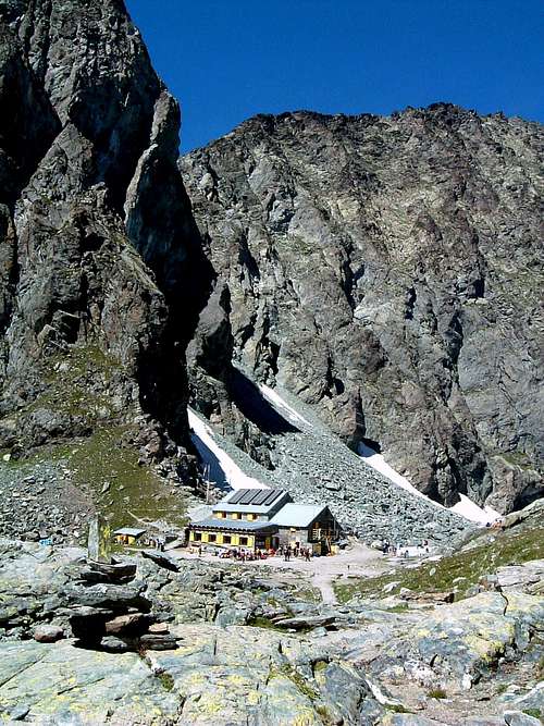
- Rifugio Granero 2377 m - CAI - Phone 0121 91760 (hut) - 0121 930222 (home)
E-
- Rifugio Giacoletti 2741 m - CAI (Italian Alpine Club- Barge), guardian Andrea Sorbino, open from 15-6 to 15-9
The Po and Pellice valleys offer numerous dining and accommodation options.
Meteo
Guidebooks and maps
“Pays du Viso – Escalade en Queyras entre France et Italie” - Sylvain Pusnel and Guillaume Vallot
"Alpi Cozie Centrali" - Eugenio Ferreri - Collana Guide dei Monti d'Italia CAI-TCI
Maps
"Monviso-Valle Varaita-Valle Po-Valle Pellice" -IGC sheet 106 1:25000

