
|
|
Route |
|---|---|
|
|
45.67270°N / 10.59160°E |
|
|
Hiking, Mountaineering, Scrambling |
|
|
Spring, Summer, Fall, Winter |
|
|
Most of a day |
|
|
EE |
|
|
Overview
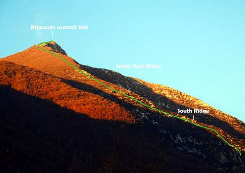
Monte Pizzocolo South Ridge
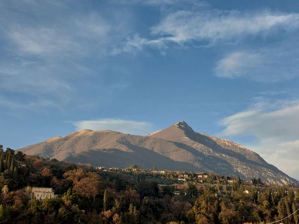
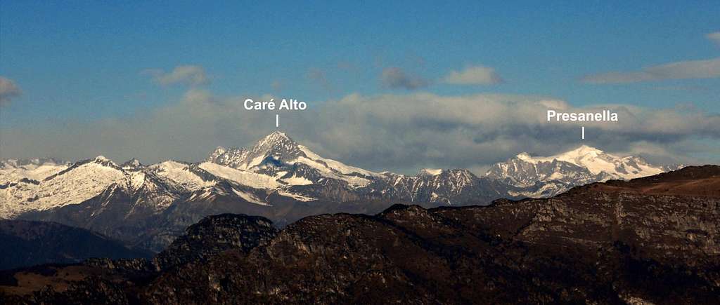
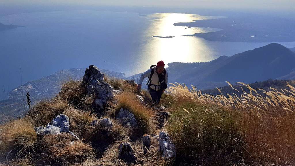
The imposing Monte Pizzocolo 1581 m belongs to the mountain area named Prealpi Bresciane and Gardesane, Subgroup Pizzocolo, the Southernmost one among the Garda ranges. It's situated in a beautiful location overhelming the South-Western shore of Lago di Garda, while to the West it's facing the Adamello and Presanella groups. For this reason, besides to its prominence exceeding 600 meters, the summit of Pizzocolo offers a panorama of incredible magnitude! A true open balcony! Pizzocolo is rocky and steep on its South East side (Lago di Garda side), on the contrary covered by woods, on its West side. Rocky, isolated and showing an unmistakable profile, Pizzocolo is a highly sought peak by the good hikers.
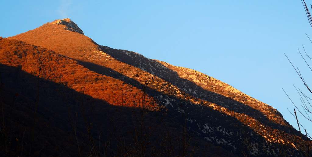
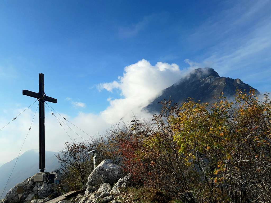
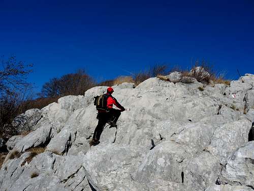
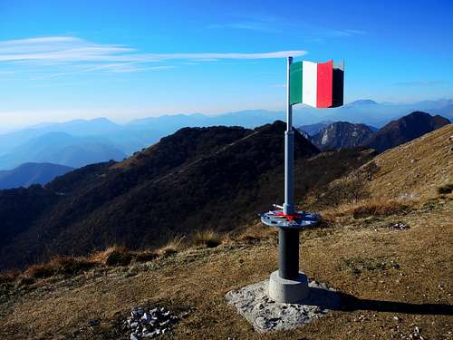
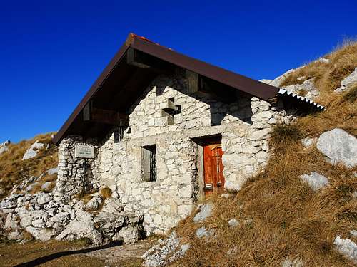
The route described below is a beautiful round trail which provides an interesting and panoramic ascent scrambling up the South ridge along the path n. 27, route that climbs steeply up a rocky and wooden ridge. There are a few very easy rocky moves, a couple of which equipped with an iron cable. A bit before the summit there is an anemometer, on the summit we find a cross and just below the culminating point, on the West side, we also can find a nice church and the bivouac "Due Aceri" (meaning "Two Maples"), erected on the ruins of a WWI manufact.
Getting There
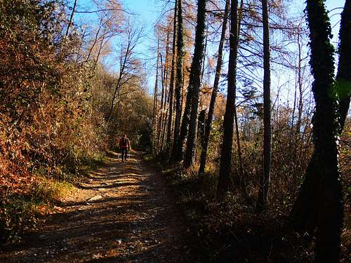
The reference resort is the little town of Toscolano-Maderno, located on the South-Western shore of Garda Lake. Toscolano is easily accessible both from Brescia and Verona. Once you reach Toscolano, just after the bridge over the Toscolano stream, leave the main road called Gardesana Occidentale and turn to left (signposts Maclino and Sanico) taking the road rising to Sanico. Beyond Maclino and Sanico, continue on a steep winding road (signposts S. Urbano), getting the place named Ortello di Sotto m. 705 (2.5 km from Sanico, 6.8 km from Toscolano), where there are some small parking lots near the junction with the path n 27 starting to the right of the road.
Route Description
Monte Pizzocolo South Ridge from Ortello di Sotto
Summit quote: 1581 m
Difficulty: EE
Difference in level: 880 m from Ortello di Sotto
Exposition: South Time required: 4,30 hours round trip
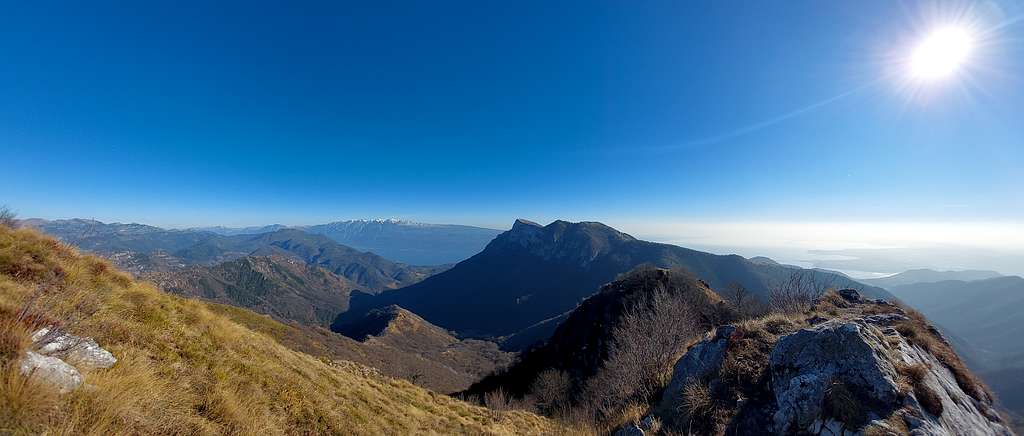
Moderately difficult scramble that leads to the summit of Monte Pizzocolo, where it opens a breathtaking 360° view over Southern Garda lake, major mountain ranges of Lombardia and Trentino, as Brenta Dolomites, Adamello, Presanella, Monte Baldo, Monte Altissimo di Nago.
Route description
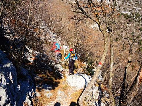
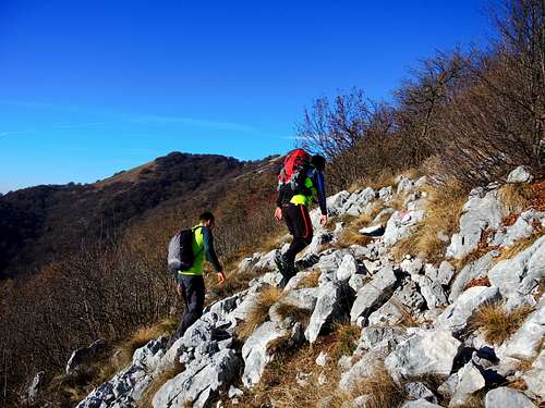
Park the car an take the dirt road on the right (CAI 279). At the first junction at 742 m, where to the right it forks another dirt road, we continue straight on CAI n. 27. At the second junction at 777 m, keep the right hand always along CAI n. 27. We pass two buildings and after about 1.5 km from the start the road ends and we continue on a narrow path. Soon we reach a small bridge over Prera Valley, we cross the bridge and we can see to our left a white rocky slab equipped for rock climbing. We skirt the slab and continue on the narrow path, crossing the slope mainly on level. At one point we find a junction signposted (signs Cresta Sud), from where we enjoy a nice view over the rocky Monte Castello di Gaino and its south ridge. Here we leave the main trail that continues to traverse the slope and turn to left onto the path starting to climb steeply within the sparse wood. Climb the ridge alternating stretches in the wood to easy rocky passages. The route, always pretty steep, it's well worn and indicated by trail markers and cairns. After a long stretch a bit closed within the sparse forest, the route exits on a grassy shoulder from where it appears the summit ridge of the mountain. From this point forward you can enjoy a superb view of the lake. Immediately after the terrain becomes rocky again and we continue the steep climb, passing near a characteristic anemometer with mirrors. We are very close to the summit, in fact, after a few minutes, we get the summit flag and cross.
Just below the summit there is a nice and small church dedicated to the fallen of all wars and mountains and a bit further down the bivouac "Due Aceri" (meaning "Two Maples"), originally an artifact of the Great War 1915-18. On the summit of Pizzocolo there were the back of the Italian lines during WWI.
Descent - From the top reach the curch and down to the bivouac "Due Aceri", where it starts the trail n. 5 (in the direction of Rifugio Pirlo allo Spino), which falls westward just below the flat crest of the West Pizzocolo, getting soon a junction near a tiny pound, named the "Sguàs dele Pìle". Take the left path n. 11, Via di Valle, which drops steeply inside the woods and leads to Malga Valle. The trail continues steeply downstream of the pasture and joins a forest road. Turn to left and take this road, always steep, descending for a long time inside the woods as far as the junction with the road S. Urbano - Sanico, route n. 6. We sharply turn to left on this road and follow it for about 10 min. to get the parking lot.
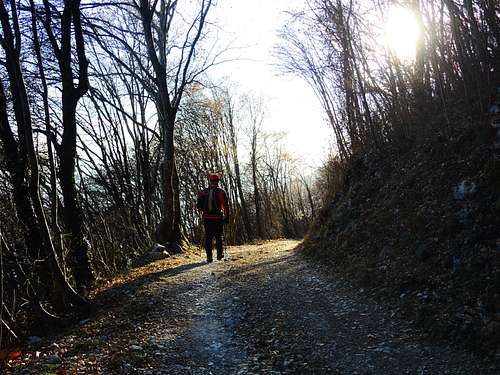
Start of South ridge approach |
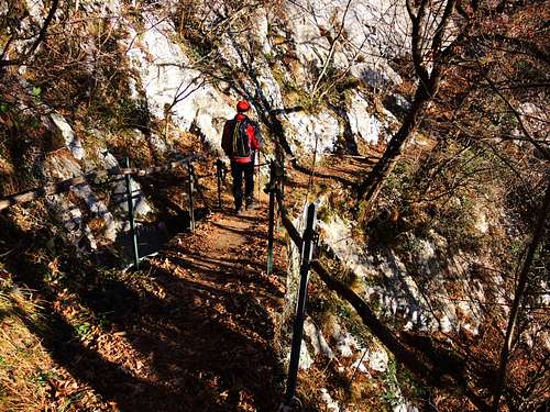
The bridge along the approach |
S ridge start junction |
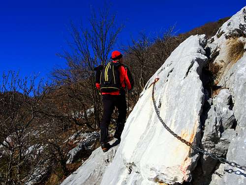
Short fixed rope |
Upper slopes |
Slab up along S ridge |
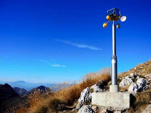
Pizzocolo anemometer before the top |
Summit flag |
Small chapel below the summit |
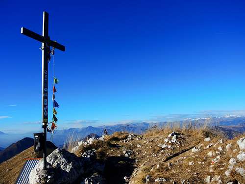
Summit cross |
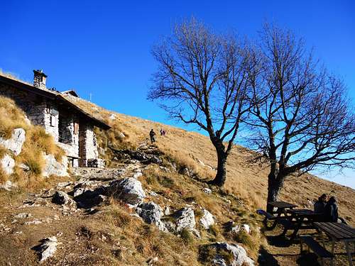
Bivacco "Due Aceri" |
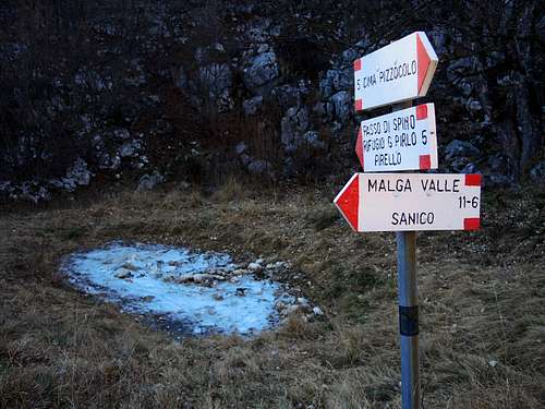
Junction near "Sguàs dele Pìle" |
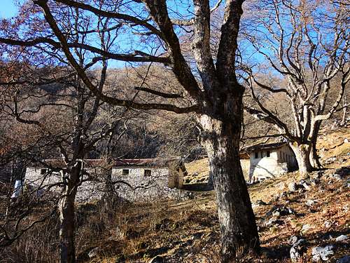
Malga Valle along the descent |
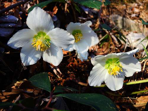
"Christmas Rose" along the descent |
Descent track on West side |
Essential Gear
The route requires the right middle mountain equipment, especially hiking boots and warm clothes. In winter condition axe and crampons are needed.
Red Tape
No fees no permits required. The peak is located inside "Parco Alto Garda Bresciano".
When to climb
All year round
Accomodation
Several possibilities of accomodation in Toscolano Maderno and surroundings
Bibliography
"Prealpi Bresciane" - Fausto Camerini, Collana Guide dei Monti d'Italia C.A.I.-T.C.I.
Meteo forecast
Meteo Arpa Lombardia
Meteo Alto Garda e Ledro