
|
|
Mountain/Rock |
|---|---|
|
|
39.85131°N / 16.36407°E |
|
|
Cerchiara di Calabria |
|
|
Hiking, Trad Climbing, Scrambling |
|
|
Spring, Summer, Fall, Winter |
|
|
4721 ft / 1439 m |
|
|
Monte Sellaro & the Cessuta Regional Park
The eastern part of the Pollino massif is formed by a number of mountains which differ significantly from those of the main chain both by their elevation and their overall appearance. Indeed, the rugged cliffs, profound gorges, vertical rock walls and the maquis shrubland girding the base of massive limestone escarpments contribute to the unique aspects of this Mediterranean and yet mountainous landscape.
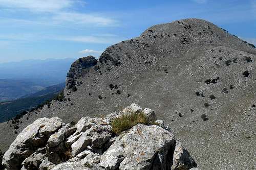
As the most south-eastern extension of this sub-range rises Monte Sellaro (1,439 m). With its eastern foresummit, Monte Panno Bianco (1,330 m), the conspicuous shape of this mountain is dominating the coast of the Ionian Sea, the Gulf of Sibari and the edge of the lowlands of the Coscile valley which is imbedded by the Pellegrino Massif (west), the Sila mountain range (south) and the highest summits of the Pollino massif (north-east). The mountain can be seen from a long distance, and its name, "Sellaro", is said to derrive from the very shape of the mountain which, indeed, resembles a saddle (ital.: sella).
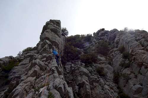
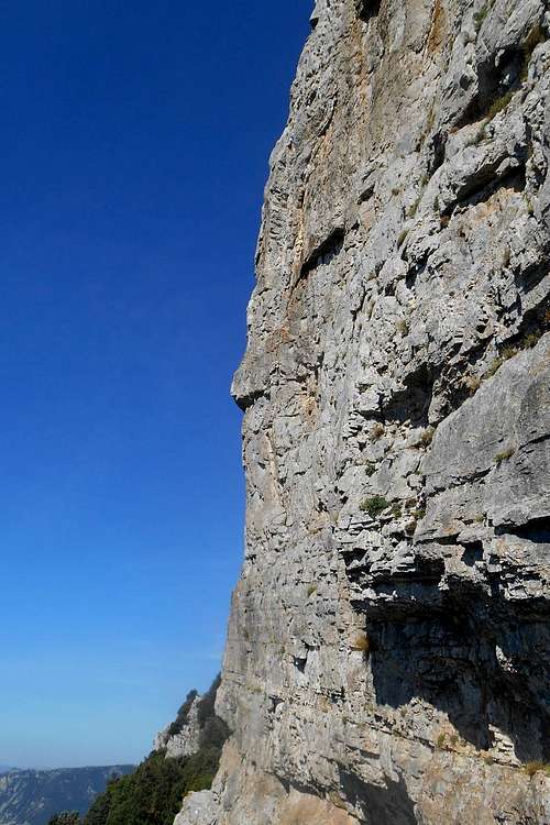
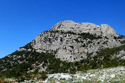 Monte Sellaro (south face) | 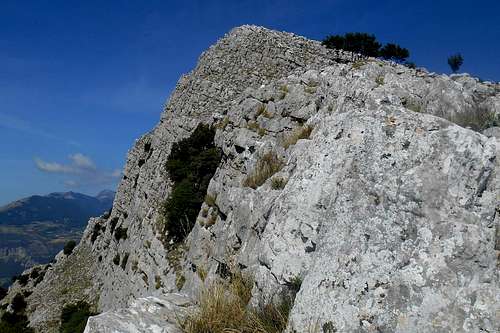 Monte Sellaro (the summit ridge) | 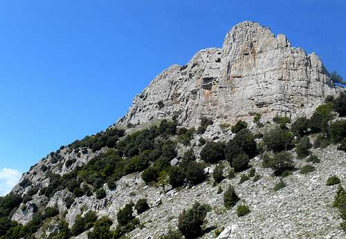 Monte Sellaro (the wall) |
The whole area is part of the Pollino National Park, the most extensive national park in Italy, and in turn forms a regional park, known as "Parco della Cessuta". This regional park includes over 300 hectares of oak forests. The karstic topography of the this area includes also numerous caves, grottos, dolines and other karstic phenomenons. One of the most impressive manifestations of karstification is the well-known"Abisso del Bifurto", a 683 m deep and partially vertical sinkhole which is very popular among speleologists. Other interesting caves are Grotta Serra del Gufo, Grotta Panno Bianco and Grotta Balze di Cristo. Some of these places are only accessible with adequate gear and/or an official guide.
Trailheads can be found near the town centre of Cerchiara di Calabria, in the vicinity of the beautiful 10th-century monastry Santa Maria delle Armi, attached to the vertical rocks of Monte Panno Bianco, and along the asphalt road that connects the village with the monastry. There are numerous hiking trails, but the signposting sometimes leaves plenty of room for interpretation.
Climbing Monte Sellaro is not hard. Indeed, on the signposted trails anyone with a normal physical fitness can reach the summit. Orientation should not be a major concern either. The view from the top of the mountain instead is spectacular. To the west almost all the major peaks of the Pollino massif are visible at once: further away the summit of the central part - Timpa del Principe, Monte Manfriana, Serra Dolcedorme, Monte Pollino, Serra delle Ciavole, Serra di Crispo, closer the craggy cliffs of Timpa di Porace, Timpa di Cassano, Timpa di San Lorenzo and Timpa della Falconara. To the south-west the view goes over the lowlands of the Coscile valley to the far-off silhouettes of the mountains of the Orsomarso range. To the south and east lie the azure and turquoise waters of the Gulf of Sibari and the Ionian Sea.
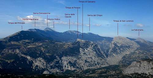
Summit view from Monte Sellaro (Pollino massif)
Rock climbers will find quite a number of interesting routes as well, especially on the south and south-west walls of Monte Sellaro and the south-west face of Monte Panno Bianco. The rock quality of the limestone is fair, maybe even better than that of other crags of the area. (For a short overview see the link section at the end of this SP.)
Routes
Monte Sellaro
In order to reach the summit of both Monte Sellaro and its twin peak Monte Panno Bianco you can take the hiking trail which starts in the vicinity of Cerchiara di Calabria (about 1 1/2 hours) or the one that rises right behind the monastry Santa Maria delle Armi (about 1 hour). Both trails eventually lead to a col that divides the two summits.
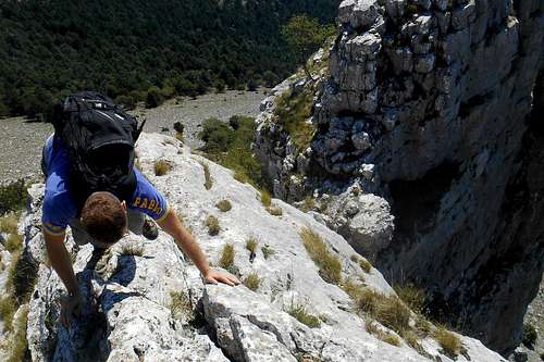
More demanding routes can be found, for example, on the SSW ridge (approx. II UIAA), or from the base via "Sperone del naufragio" (mainly III, max. V+ UIAA), and the SE ridge (II-/II UIAA) of Monte Sellaro. While the latter offers some nice and easy scrambling opportunities, some more technical parts of the former are pretty much exposed and at some point most people would certainly want to employ a rope and at least some basic protection gear.
Another somewhat harder scrambling route (III+ UIAA) uses the central gully, a deep incision in the SW face of the mountain. Its upper exit is close to the actual summit. In order to reach the gully entrace, head straight for the base of the southern tower and follow the broad ledge that skirts the escarpment (for approx. 300 m) until you come upon a broad opening which marks the entrance of the steep gully. The upper part is mostly grass-covered and therefore extremely slippery when wet. You will face some moderately difficult climbing on compact limestone rock before entering the actual gully and the exposure is not irrelevant.
Note: There is no signposting for either of these routes and the approach is on pathless and often lose terrain.
 Scrambling on the south-east ridge | 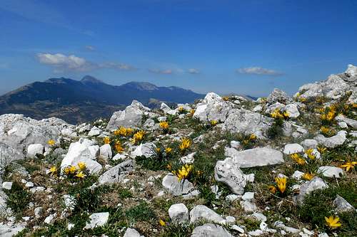 Summit plateau & view | 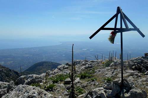 Monte Sellaro - the summit |
Monte Panno Bianco
 Monte Sellaro (from Monte Panno Bianco) | 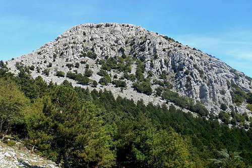 Monte Panno Bianco (south face) | 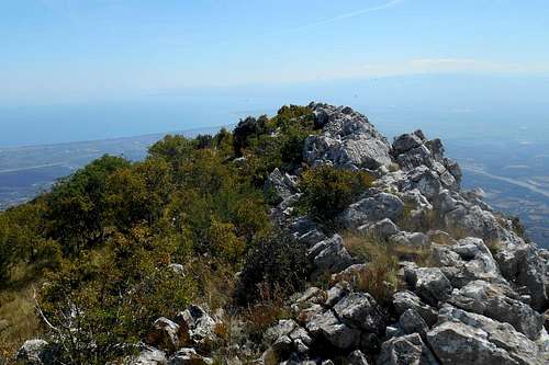 Ionian Sea (from Monte Panno Bianco) |
Also the south-west face holds rock climbing routes, for instance: Piccolo Principe (around II, IV+/VI, A1 UIAA) first climbed in 2007.
 Piccolo Principe - Monte Panno Bianco - 1st pitch (UIAA VI, A1) | 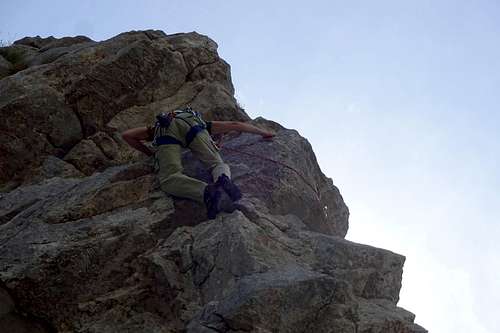 Piccolo Principe - Monte Panno Bianco - 1st pitch (UIAA VI, A1) |
 Monte Sellaro - southern tower Monte Sellaro - southern tower | 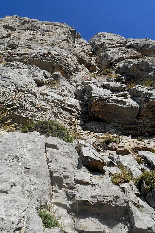 Monte Sellaro - rock face Monte Sellaro - rock face | 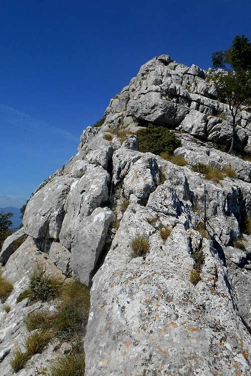 Monte Sellaro - the south-east ridge Monte Sellaro - the south-east ridge |
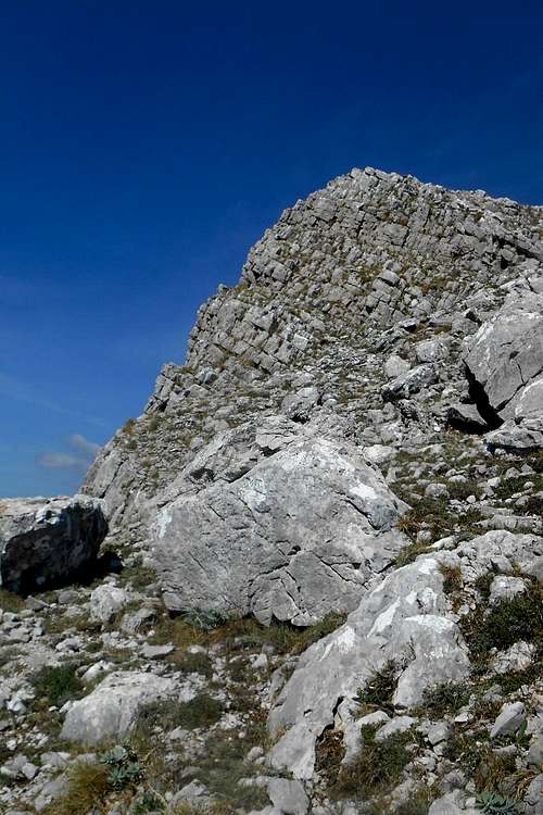 Monte Sellaro - the summit Monte Sellaro - the summit | 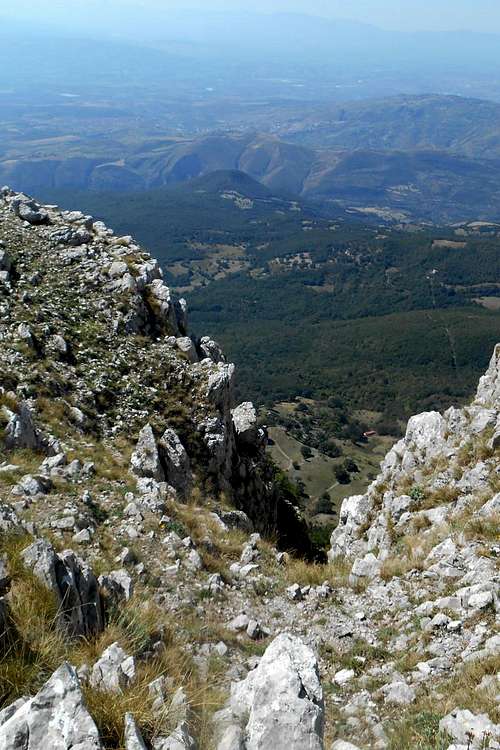 Monte Sellaro - the central gully Monte Sellaro - the central gully | 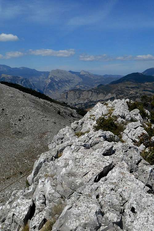 Monte Panno Bianco (summit ridge) Monte Panno Bianco (summit ridge) |
Getting There
Nearest airports are Bari, Brindis (Adriatic coast) and Naples (Tyrrhenian coast). Public transport is available along the Ionian coast (railway), bus service is not the best option.- From Naples airport it is about 3 1/2 hour (380 km). Take the highway A3 Napoli-Reggio Calabria. Exit the highway at Frascineto, take the provincial road SP263 and follow indications for Francavilla Marittima and, shortly after, for Cerchiara di Calabria. From the later simply keep on the main road and turn left, simply following indications for the ancient monastry "Santa Maria delle Armi". You may leave the car on any of the parking bays along the road or at the large parking area you will encounter short before reaching the monastry.
- From Bari airport it is about 2 1/2 (200 km). Take any road with indications for Taranto and, shortly before reaching Taranto the state road SS106 in direction Reggio di Calabria. Exit at Villapiano Scalo, taking the state road SS92. Keep following indications for Cerchiara di Calabria.
- Also from Brindisi Airport, take the main road for Taranto and then the interstate SS106.
Red Tape
The regional park "Parco della Cessuta", and hence Monte Sellaro is an integral part of the 'Pollino National Park'. With a total area of 1,960 square kilometers it is the most extensive national park in Italy. The park was officially founded in 1993. The same rules and regulations apply as for any other national park in Italy.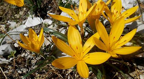
Sternbergia lutea
Free camping is generally not encouraged (in other terms: it is not allowed). However, it might be tolerated from dusk until dawn and as emergency bivouac. No open fire etc. will be tolerated, though. There are no fees or permits required for hiking or climbing in this area. No parking fees to pay either.
When To Climb
Due to its moderate elevation and its vicinity to the Mediterranean Sea, Monte Sellaro has a mild climate throughout the year. During the summer months day temperature are considerably high. However, approach routes are short and trails mostly shaded by the forest canopy (oak trees, yoke-elms, pines etc.). Snow can be found only on quite rare occasions, between January and March, and usually does not last for more than a few days.
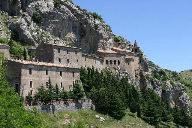
Santa Maria delle Armi
Best time for hiking, climbing or exploring the grottos and caves is probably spring. But also summer and autumn are good seasons as you may end a day of climbing with a refreshing bath in the Ionian sea, or the torrents of the also nearby Raganello gorge. Indeed, hiking and climbing in this part of the Pollino massif will fit perfectly into your beach vacation.
Accommodation, mountain huts etc.
There is no official bivouac opportunity on any side of this mountain. Mountain huts are the Rifugi Calvario (room for 10 guests) and the former barracks of the State Forestry Corps (room for 27 guests). Both locations might not be accessible without contacting the maintainers. The next town center, the quite scenic Cerchiara di Calabria, can be reached by foot on easy trails in somewhat less than two hours from the summit. There you can find accommodation at one of the local B&Bs. You may also find nice rooms at one of the numerous B&Bs of the nearby town center of Civita.Of course, you may choose between the numerous proposals of hotels and a wide variety of rooms and flats for rent, camping grounds etc. at almost any of the coastal towns.
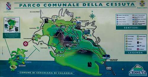
Hiking map Parco della Cessuta
Other useful guidebooks and hiking maps include:
- A piedi sul Pollino, author: Emanuele Pissara, Edizioni Prometeo, 2001. - Guidebook containing more than 100 itineraries (with detailed descriptions, photographs and useful information).
- Carta Turistica - Parco Nazionale del Pollino, Edizioni Il Coscile, map scale 1:55.000
- Sud Verticale, author: Guido Gravame, Idea Montagna, 2015. - Finally, a new guide book (in Italian language) with alpine routes, climbing routes etc. of the Pollino range and the Lucanian Apennines.
External Links
A short list of climbing routes for both the main peak Monte Sellaro and its sister summit, Monte Panno Bianco, can be found here: www.rocciaeresina.it (The detailed route descriptions are available in Italian only. )