
-
 4416 Hits
-
 79.04% Score
-
 10 Votes
|
|
Route |
|---|---|
|
|
42.82483°N / 13.27477°E |
|
|
Download GPX » View Route on Map |
|
|
Hiking, Skiing |
|
|
Spring, Summer, Fall, Winter |
|
|
Half a day |
|
|
Easy hike up (T2 on the Swiss Hiking Scale) |
|
|
Introduction
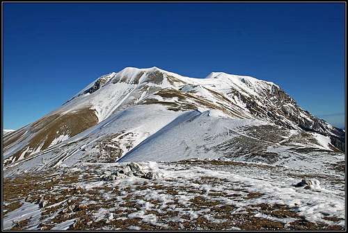
The normal route on the highest summit of Monti Sibillini is nice and very popular. It's very easy and the only challenge is a bit less than 1000 m of altitude gain, in combination with quite a distance to make. The tour can be done any time of a year, so also as a ski tour, which in good conditions should be a pure joy.
By the long S ridge you gain the main crest, where great view on the high summits around Lago di Pilato opens. On the web page (and written materials) of Monti Sibilini National Parc, this route is described as a part of Route E15, which goes from Forca di Presta on Monte Vettore and down to Santa Maria in Pantano.
General Information


Difficulty (grading is on the Swiss Hiking Scale): T2. It's all the time easy hike up, much of the route is T1, all the time well beaten, not too steep, broad trail. Well marked (No. 101), no exposed passages.
Altitude to overcome: cca 950 m (from 1534 m to 2476 m).
Time for ascent: 3 h.
Best season: Summer and autumn months, normally from June till November (or first snow). For skiing: when the road to Forca di Presta is cleaned and when snow is settled.
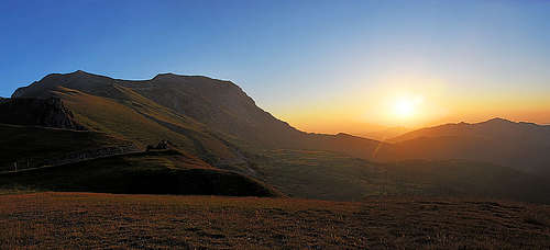
Best hour: Due to southern orientation, start early in the morning. If cold, also afternoon is fine.
Gear: Good shoes and poles.
Maps: Online Open Street Map is ok.
Huts: Rifugio Tito Zillioli, 2240 m, is on the main ridge - not maintained, only an emergency shelter. Near Forca di Presta, there's Rifugio degli Alpini, 1560 m, reachable by car.
Water: Just by the trail there's no water. A small water source is below Forca della Ciaule.
Starting point: Forca di Presta (road pass), 1534 m. Reachable by a good asphalted road from Castelluccio or from Ascoli Piceno (via Acquasanta Terme and Arquata del Tronto). See also the page of Piano Grande and Castelluccio!
Route Description
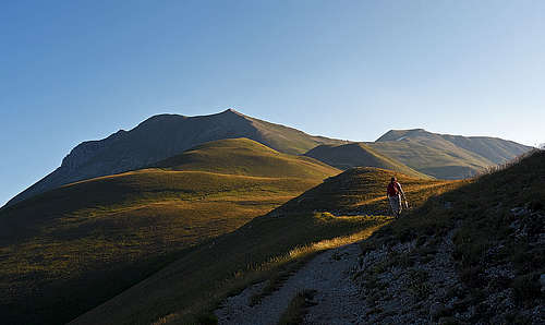
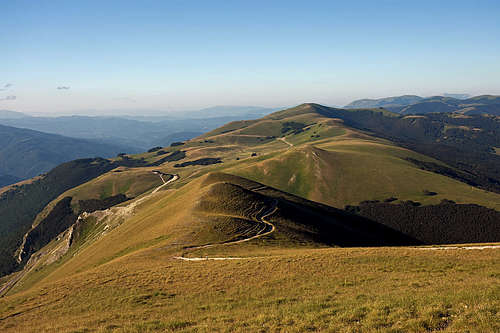
From Forca di Presta you start ascending towards the N. The trail keeps a bit left, so in the morning it can still be shady and soon also nice views open on Piano Grande and Castelluccio. By Costa di Particelle we soon reach Point 1930 m, which we detour by the right side. Then the path switches the slopes of the S ridge again, so we detour the grassy bump of Monte Vettoretto, 2052 m, by its W slopes.
|
|
The slopes above the saddle behind it are called Pratopulito. The trail crosses them towards the right and always up - aiming towards the Tito Zillioli hut, which we see all the time in front of us. We reach it in another 30 min, just behind the hut there's Forca della Ciaule, 2240 m.
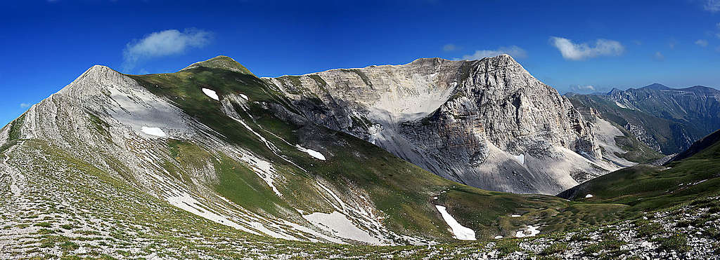

The summit of Monte Vettore is towards the right, so from the hut we follow the gentle main crest towards the NE and only when reaching the summit dome, the trail slowly turns towards the N. In a few long switchbacks it gains the summit plateau and continues by it to the small cross on the summit.
OpenTopo Map