|
|
Mountain/Rock |
|---|---|
|
|
17.52749°S / 149.80315°W |
|
|
2723 ft / 830 m |
|
|
Overview
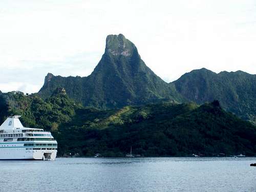
Mouaputa is a spectacular peak on the island of Moorea. The mountain is famous for having a hole right through the summit. The hole was formed when the demi-god Pai tossed his magic spear from Tahiti to prevent Rotui (mountain) from being carried off to the island of Raiatea by the god of thieves known as Hiro.
Despite the low altitude of the peaks, the mountains of Moorea are among the most rugged in the world and every bit as rugged as the Himalayas. Unlike the Himalayas however, most peaks on this and the surrounding islands are considered impossible to climb and many still await first ascents. Although Mouaputa is only 830 meters/2723 feet high, it should not be under estimated. It is a serious climb.
At first impression, I had the idea while looking at the peak that good things can come in small packages, because the mountain looked so spectacular. The mountain is one of the lowest elevation summits that I have ever climbed. My thoughts were naïve. After actually climbing the peak (but just missing the summit), I came to the more accurate conclusion that small things can also come in terrifying packages. Maybe I’m a pansy, but climbing Mouaputa scared the piss (I don’t swear) out of me. It is more a mountain that some summits I have climbed that were five or more times higher. Holding on to a rope while descending wet rock covered with slick mud with the consistency of glazed snot, while dangling over a 370 meter/1200 foot void in the rain does not inspire confidence. If you're not up to Mouaputa, Rotui is a better alternative and still challenging.
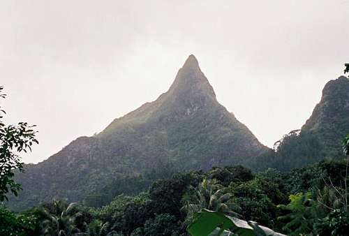
On the plus side, the peak is spectacular and beautiful. Mouaputa means shark tooth in the Polynesian language and the mountain does indeed look like a shark tooth when viewed from the north (see the signature photo).
While Moorea and Tahiti are very popular with tourist, expect to have the mountains all to yourself. I never did meet anyone on any of the routes. It seems almost everyone hangs out at the lagoon, beaches, and resorts instead of climbing mountains, which is a good thing if you enjoy solitude.
Getting There
Getting to Moorea is easy. First, you must fly to Papeete (actually the suburb of Faaa), the capital of French Polynesia which is located on the island of Tahiti. From the wharf at Papeete, several ferries depart for the island of Moorea between the hours of 6 am and 5:30 pm. The boat ride cost $9-10 each way in November 2005, and takes 30 minutes to an hour depending on what boat you book with (ferries that take vehicles are slower).
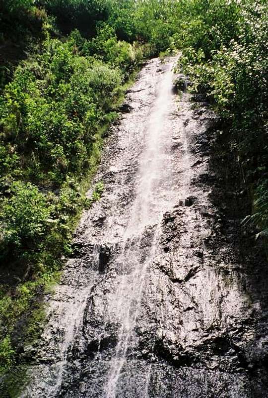
Once on Moorea and at Vaiare, you will notice two busses waiting for passengers. Bus schedules always correspond with the ferry schedules on Moorea. You want the bus heading south. Get on the bus ($3) and follow it to the village of Afareaitu. Get off at Afareaitu. To locate the route to the trailhead, walk to the northern section of town and to the Vaioro River. Hopefully the weather will be clear enough to locate the correct river valley, as there is one to the south as well. The one you want is the valley that you can see that ascends towards the peak. The hole in the mountain can be seen. Follow the road along the west side of the river and towards the Afareaitu Waterfall.
Routes Overview
Apparently the only route that has been climbed is the Vaioro Valley Route and it is no walk up. The route is extremely dangerous, especially on the descent, if it has been raining. The route follows the Vaioro River up to the Afareaitu Waterfall and climbs up the steep slope to the west. The route then follows a valley and a (hopefully) dry creek bed through some nice forest to the crux section. The last section is scary and dangerous when wet and there are eight fixed rope sections. See the route page for more details.
Of note, the route has been much improved in recent years and is a lot easier now than when I made my climb.
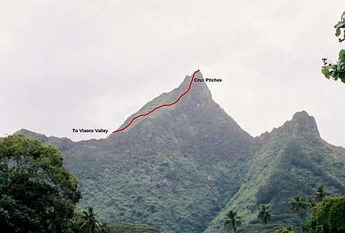 Vaioro Valley Route up Mouaputa as viewed from Vaiare. The route is more difficult that it appears in the photo, and is quite the challenge.
Red Tape
No permits are required.
When To Climb
July through September are the driest months and the best months for climbing. May and October are the second best months for climbing. April can go either way, but mid-November through March are very wet. This peak is extremely dangerous during and after rain and should be avoided. I feel lucky to have made it down alive during a rainstorm.
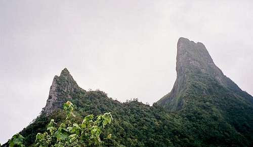 Mouaputa (right) as seen from the pass between Mouaputa and Fairurani mountains as seen in November.
Camping
There are no campgrounds in the area. If you enquire locally, you may be able to camp along the road and trail to the waterfall. See the route page for details.
All of the well-known hotel chain places to stay on Moorea are very expensive, especially if you do not book at home on a packaged tour.
In addition to camping, and for those travelers who wish for budget accommodations, and who wish to move about the islands more independently, below is the most comprehensive link to those types of accommodations:
GUEST HOUSES AND PENSIONS ON MOOREA
Mountain Conditions
Below is the weather forecast for Papeete, which is just across the channel and in Tahiti. This is the closest weather link you will find to Mouaputa. The mountains are quite a bit wetter and a little cooler than Papeete.
CLICK HERE FOR PAPEETE WEATHER FORECAST
Below is the average climate chart for Papeete. Temperature values never stray much from average, but precipitation values do.
| MONTH | HIGH | LOW | PRECIP |
| JAN | 86 | 74 | 12.4” |
| FEB | 86 | 74 | 9.2" |
| MAR | 87 | 74 | 7.9" |
| APR | 87 | 73 | 5.7" |
| MAY | 85 | 72 | 3.6" |
| JUN | 84 | 70 | 2.4" |
| JUL | 82 | 69 | 2.4” |
| AUG | 82 | 68 | 1.9” |
| SEP | 83 | 69 | 1.8” |
| OCT | 84 | 71 | 3.6" |
| NOV | 85 | 72 | 6.4" |
| DEC | 85 | 73 | 12.5" |


