
|
|
Mountain/Rock |
|---|---|
|
|
38.27710°N / 119.4764°W |
|
|
Mono |
|
|
Hiking, Scrambling, Skiing |
|
|
Spring, Summer, Fall |
|
|
10525 ft / 3208 m |
|
|
Overview
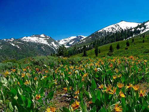
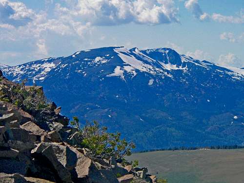
South from Stockade Flat below Mt. Emma. Hanging Valley Ridge and Walker Mtn. back center
When driving down the east side of the Sierra on Highway 108 from Sonora Pass a curious smooth rounded subrange with black and white tones catches the eye above Leavitt Meadows off to the right. Mount Emma is the only named peak in the group (although not the high point) on the east side above the Walker River. Emma Lake below the northwest slope offers a nice hiking/fishing destination. The peak's northeast slope is a fairly stable class 2 scramble that can be done in a few hours from Stockade Flat.
Mount Emma can easily be combined with its neighbors, including the Peak 10,727 (the high point of the group) and Pt. 10,659.
Appreciation is owed to Windsor Riley (aka Noondueler) who created this page, and who passed away in 2016.
Getting There
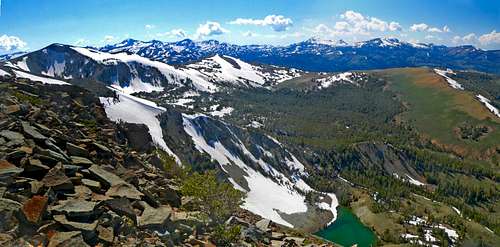
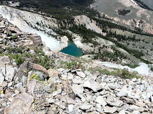
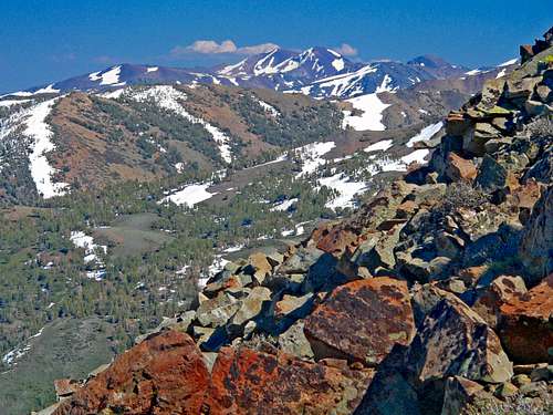
Northwest from Mt. Emma with Emma Lake below
From the north: At the junction of Highway 108 and Highway 395 continue south for about three quarters of a mile and take a sharp right onto forest road 066 (Little Walker Road).
From the south: From Bridgeport go north on Highway 395 for about 16.5 miles and turn left onto forest road 066 (Little Walker Road).
Continue south on this dirt road, passable to all vehicles for about 3 ½ miles to Obsidian Campground at about 7,700’. You can hike from here and cut up to the road, or continue up the 4WD road about 3.3 miles to the actual trailhead at Stockade Flat 8,590’.
Although the road to Stockade Flat is 3.3 miles from Obsidian Campground, it is only about a 1 3/4 miles walk. Therefore, 3.5 miles is added round trip to the hike if starting from Obsidian Campground.
The route really starts from Emma Lake at a little over 9,300', which is about a mile from Stockade Flat. Once at Emma Lake, you can head to the back side of the lake and walk up the steep scree slopes to the saddle below Mount Emma. From Emma Lake it is less than 1 1/2 miles and 1,200' to the summit. Therefore, even from Obsidian Campground, it is 4 1/4 miles one way to Mount Emma; although the elevation gain is nearly 900' greater.
Red Tape
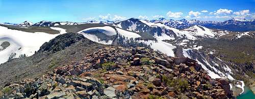
Mt. Emma west
This day hike is in the Toiyabe National Forest and no permits are required.
Camping
White Mountain from Mt. Emma northeast slope
Dunderberg Peak from Mt. Emma northeast slope
There is the Obsidian Campground at Obsidian Flat.
There is also the Sonora Bridge Campground two miles west of Hwy. 395 on Hwy. 108 on the south side of the Hwy.
Etymology
Emma, Mount (10,525); Emma Lake Fales Hot Springs 15'
Probably named for Emma Mack whose parents lived at Hardy Station at the junction of US 395 and State Route 108. This was the presumption of Sen. Maurice Mack of Nevada, her brother. (Maule. See also Anna Lake.)(TNF)-- Place Names of the Sierra Nevada by Peter Browning, Wilderness Press