
-
 1822 Hits
-
 79.78% Score
-
 11 Votes
|
|
Mountain/Rock |
|---|---|
|
|
43.86420°N / 109.30438°W |
|
|
Hiking, Scrambling |
|
|
Summer |
|
|
11312 ft / 3448 m |
|
|
Overview
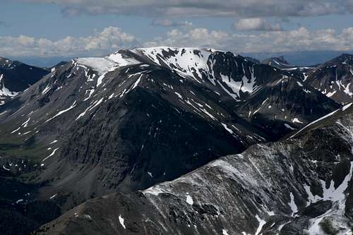
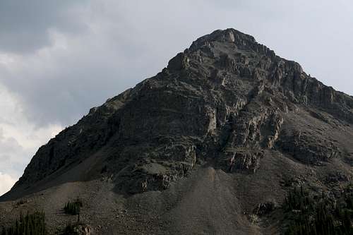
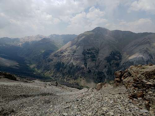
Viewed from the ruins of Kirwin below, Mount Sniffel looks about as classic as a mountain can get. Tall, steep, and rugged, it towers above the surrounding valleys. No mountaineer could fail to feel inspired to climb it.
If you hike a bit up one of those valleys, though, you'll soon discover that Sniffel is merely a bump at the northern end of a long ridgeline. It is the lowest of several peaks along that ridgeline, the highest being an unnamed summit with an altitude of 11,962'. In fact, Sniffel does not even have the prominence to be a ranked peak.
Still, its appearance from the abandoned mining community below commands attention, and that makes it worth climbing. Plus, it has a really cool summit register up top that on its own almost makes the outing worth it.

|

|

|
Getting There
High clearance is necessary, and 4wd is a plus. It is advisable to get out and check stream crossings before plowing through them.
Remember that odometers can vary slightly. In two different vehicles, I have gotten two different measures here, but both were within a mile of each other.
From Meeteetse, 32 miles south of Cody, turn west onto the signed road for Wyoming 290. In 6.4 miles, turn left onto Wood River Road. At 11.6 miles, the pavement ends. The national forest boundary is at 21.7 miles. Pass Wood River Campground at 22.4 miles and Brown Mountain Campground at 24.8 miles. The road now gets a little rougher, but it is not real 4WD stuff.
At 26.8 miles is the first of three stream crossings, at Jojo Creek. This one is short and usually shallow. The second river crossing (Wood River) is at 27 miles. This one is wider and deeper. The third crossing (Wood River), which is actually two crossings in quick succession, is at 29.3 miles. These are broad but shallow.
Continue on to the trailhead and old townsite of Kirwin, at 34 miles. There is one more stream crossing, of a stream draining Brown Basin, just before the trailhead, but it is a tributary stream and may even be dry.
It takes me about 75 minutes to make the drive to Kirwin. Conditions can change. In 2010, there were water crossings that were not there during my visits in 2001 and 2007. In one spot, the stream and the road were the same for about a quarter-mile. Be prepared for a driving adventure. It's a long drive in. It would be wise to check with the local ranger district about any access restrictions before heading in. Call 307-868-2379 (Meeteetse Ranger District).
Route
If you're looking at a map, the most obvious way to approach Sniffel will be by walking through Kirwin and picking up an old closed road that switchbacks up the slopes of Bald Mountain and following it until you can break off near some ruins and drop to the Cascade Creek Trail. This works, but it's annoying.
There is a more direct way. Hike south toward the confluence of Cascade Creek and Wood River. After going through an extensive area of dead timber, you can find an old trail alongside Cascade Creek. Most maps don't show it, but it's there. This approach is more direct.
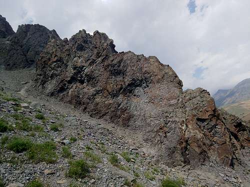
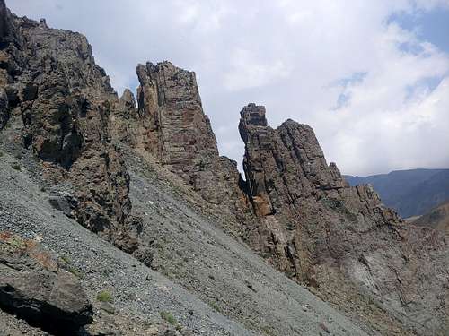
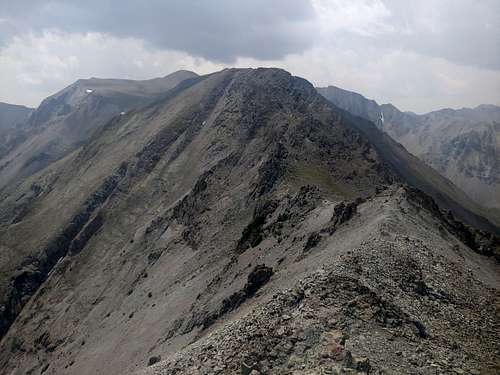
Eventually, you'll be on Cascade Creek Trail, and you'll want to leave it and start heading west for the saddle between Sniffel and Point 11,492. Some of it is nice alpine meadow walking, and a lot of it is shitty talus. Avoid the temptation of the ridges that seem to promise fun climbing and a direct route to the summit ridge. While there is fun 4th and low 5th Class climbing there, the ridges all cliff out, forcing a retreat.
|
|
From the saddle, hike north to the summit. Take time to read the story by the person who left it there; it's great, and this is coming from someone who isn't a big fan of summit registers.
Overall elevation gain from Kirwin is about 2100' over approximately 3 miles. Expect a lot of Class 1 and 2 hiking and some Class 3 scrambling.
|
|
Red Tape
Nothing official, but this is prime grizzly country, so know how to prepare and behave.
When to Climb
Late spring through early fall
Camping
You can camp in the Forest Service campgrounds mentioned in the driving instructions; they're first-come, first-served, and I don't know what the current fees are. There's also plenty of dispersed camping on the way in. Given that this is grizzly country, I recommend sleeping in your car at the trailhead as the best option.