
-
 8750 Hits
-
 71.06% Score
-
 1 Votes
|
|
Mountain/Rock |
|---|---|
|
|
53.12382°N / 168.69482°W |
|
|
Mountaineering, Skiing |
|
|
Spring, Summer, Fall, Winter |
|
|
7051 ft / 2149 m |
|
|
Overview
Mt Vsevidof is the highest peak on the island of Umnak, an island in the Aleutian archipelago being one of the westmost enhabited locations in the US.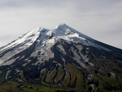
Vsevidof North Face
The mountain is 2149m high (7050ft) and is glaciated. It resembles the PNW volcanoes as it is aswell a stratovolcano, although in comparison to these volcanoes it is not dormant with the last erruption happening on March 11th 1957 after an erthquake that occured three days earlier; the erruption ended the next day.
The large volcanic cone has a base of 10km across with a slope of 15 degrees from the first 300m of elevation, the slope reaches its max near the summit where it is around 30 degrees, the crater on witch the summit is on, is heavily glaciated with glaciers extending all the way down the mountain from the North and East face.
The peak has been summted in 1880, but there has been no ski descent.
Getting There
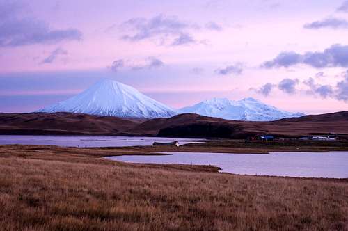
Both Umnak Volcanoes
The largest problem with approaching the mountain are the multiple creeks between Nikoski and Vsevidof, most of them are small and crossable (preferably in late spring) although by far the largest problem is Black Creek, a large creek/river that directly comes from the West glacier. The creek is pretty large at points so it is prefferable you cross it towards the western side, near the glacier.
Route
There is no established standard route although the glacier and soil composition variables result into a shadow route that can be followed. The best way to climb the peak is through the SE ridge. This is by far the least glaciated area on the mountain but it has a significant steepnes and overall alttitude gain throughout the route.Heading directly NW from the SE ridge you will reach the crater rim, from there you must travel east towards the true summit.
From geo maps and sat pictures you can see that the summit block wild be a mild mixed route.
Maps
You can see all these maps in full resoloution if you open it in a new tab.
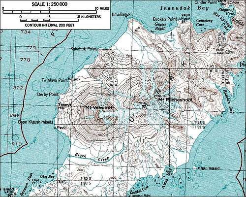
Vsevidof Topo Map 1
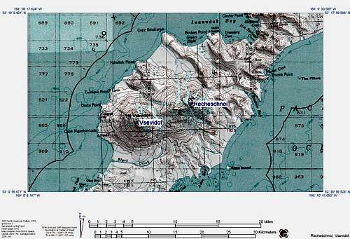
Vsevidof Topo Map 2