Overview
Javelina Summit is one of the most accessible summits in the White Tank Mountains. It sits just west of the burgeoning community of Verrado, with new homes being built as of the end of 2018.
The primary trailhead is the Verrado Lost Creek Trail to the northeast. However, there is also access from the west via the Skyline Regional Park. There is also access from the south via recently built neighborhoods off Sienna Hills Parkway, although the trail system isn’t as clearly defined as the other two trailheads.
With a prominence of 672’, Javelina Summit enjoys wonderful views of the surrounding mountains, despite its small stature. A trail leads all the way to the summit, making this a viable year-round destination. There is also a lower north summit with a little over 200' of prominence. There is not trail to the top of the lower summit. However, it would easy to hike up there if you had the time and weather is cool enough for off-trail hiking.
The shortest trail route is just under 2 3/4 miles one way, with the trail coming up the west side. It is possible to bushwhack up to Javelina Summit from the east side, but there aren’t any easy ways to do so.
Ideally, Javelina Summit is best hiked between November and March. However, it would make a fine morning destination in April, May, September, or October. Just be mindful of rattlesnakes, which should leave you be, as long as you stay on the trail.
![Glorious views while heading up the summit trail]() Views from the summit trail
Views from the summit trailGetting There
Javelina Summit is located just west of Verrado. The easiest starting point in the Lost Creek Trailhead. This is located off Verrado Parkway by taking W. Lost Creek Drive to the end, past the golf courses.
Skyline Regional Park is located off the I-10 about three miles west of the Verrado Parkway exit. Drive north on Watson Road to the trailhead.
Route
From the Lost Creek trailhead, follow the road for about 300 yards, and then head south for 100 yards to access the main trail heading west. A little over a mile from the trailhead, there is a junction. Take the trail heading south. Continue for half a mile until you see a smaller trail straight ahead; while the larger trail makes a right turn. Take the smaller trail straight ahead, which winds up and down for a quarter mile and connects with the summit trail. Once on the summit trail, it is easy to follow all the way to the summit. Total distance one way is about 2.7 miles, gaining 960 feet.
![Walking up the Javelina Summit trail in the White Tank Mountains]() Walking up the summit trail
Walking up the summit trail![View of the summit block]() View of the summit block
View of the summit block![Switchbacks up near the summit]() Switchbacks near the summit
Switchbacks near the summit
From the Skyline Parkway, take the Quartz Mine Trail heading south. The trail loops around the south side of a mountain, and then heads back north and connects with the Tortuga Trail. Take this trail until you see the summit trail. Total distance one way is about 2.9 miles, gaining about 1,050’. Bring a trail map to help guide you.
Red Tape
Skyline Regional Park is open sunrise to sunset; although gates close at 10pm. The Lost Creek Trail is generally open without specific restrictions.
External Links
Verrado Trails
Skyline Regional Park
Area trail map

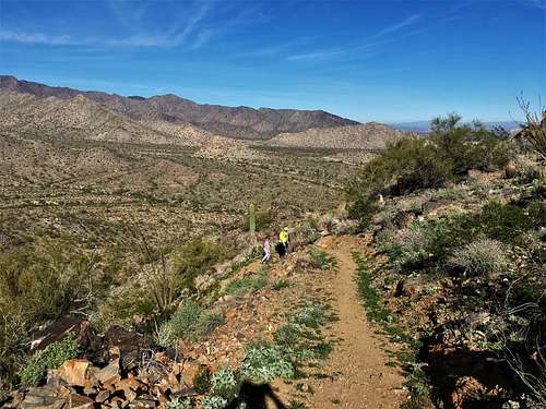 Views from the summit trail
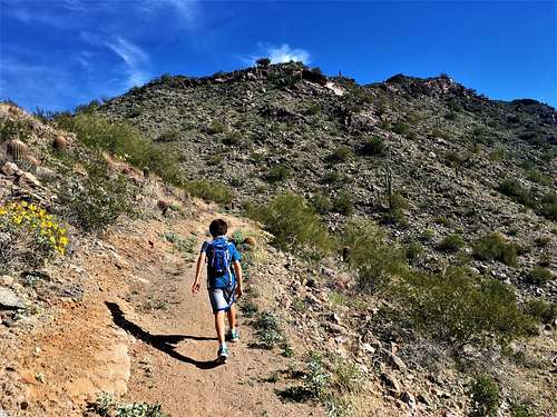 Walking up the summit trail
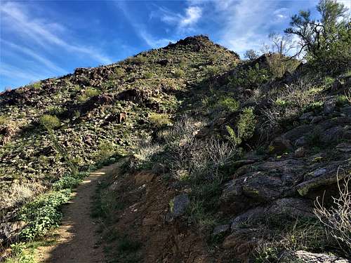 View of the summit block
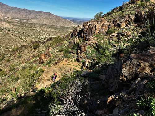 Switchbacks near the summit