
-
 43628 Hits
-
 84.82% Score
-
 19 Votes
|
|
Mountain/Rock |
|---|---|
|
|
38.02400°N / 119.304°W |
|
|
12446 ft / 3794 m |
|
|
Overview
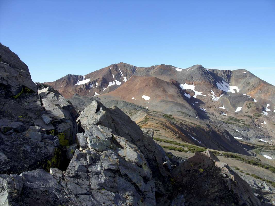
Excelsior Mountain. Photo: hgrapid
Excelsior Mountain is the next highest peak on the Sierra Nevada crest north of Mount Conness, on the northeastern border of Yosemite National Park. Excelsior's summit offers excellent views of North Peak, and Mount Conness and is a popular ski mountaineering destination.
Excelsior mountain is made up of mostly rust-colored metamorphic rock similar to nearby Mount Dana. Its summit is class 2 from several directions. However, Excelsior's northeast face drops steeply into a glacial cirque and was the site of a fatality in August of 2005. The southeast side of Excelsior is cut off by impressive cliffs that drop into Lundy Canyon.
Excelsior Mountain features moderate backcountry skiing terrain on its summit ridge and northeast ridge as well as expert chutes. In spring when the access road is plowed Excelsior is only ~4.5 miles (hgrapid) one way from Virginia Lakes Trailhead, ideal for moderate level ski touring. Excelsior is also often skied from the south via Saddlebag Lake.
 |  |  |  |  |
Getting There
Virginia Lakes Trailhead:The easiest approach. Take US-395 to Conway summit north of Mono Lake, then turn west at a sign for "Virginia Lakes". Proceed 6 miles (hgrapid) to the end. This is the most popular trailhead for ski touring because it accesses the northeast flank of Excelsior, as well as the high trailhead elevation (9840 feet). From here the distance to the summit is ~4.5 miles (hgrapid).
Saddlebag Lake Trailhead:
Another popular approach. Take highway 120 (Tioga Road) about 1 mile east of Yosemite National Park's east entrace, then turn north at a sign for "Saddlebag Lake". Proceed 2 miles to the end. This trailhead is at 10060 feet elevation. From here to the summit is about 7 miles.
Green Lakes Trailhead:
Located further north than the other trailheads, Green Lakes Trailhead can be used as an alternative to Virginia Lakes for accessing the north and northeast sides of the mountain. However, it has a much lower elevation and approach distances are much longer.
Lundy Lake Trailhead:
The closest trailhead to Excelsior Mountain can be accessed from Highway 395 a few miles south of Conway Summit. Lundy Lake is at 7800 feet elevation, and upper Lundy Canyon is surrounded by major cliffs and waterfalls. Thus only expert climbers will be able to use this trailhead.
Tuolumne Meadows:
Accesses the west side of Excelsior Mountain, which is cut off by the Sierra Crest from the east side; very long approach.
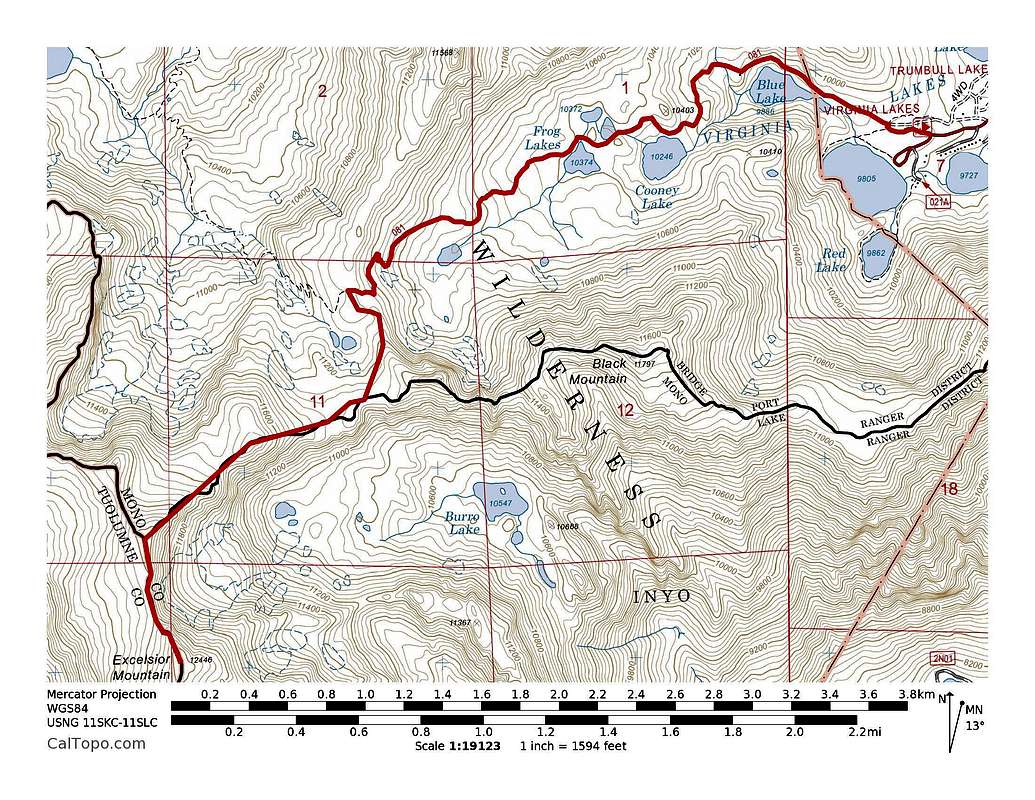
Excelsior Mountain's Northeast Ridge Route. ~9 miles with 3000' of elevation gain. Click to enlarge.
Red Tape
Excelsior Mountain is located in Hoover Wilderness (east side) and Yosemite Wilderness (west side). No red tape for day trips, however motorized transportation is not allowed. For overnight trips a wilderness permit is required. See Camping section.When To Climb
All year. In winter you will have to overcome snowbound access roads, which is an additional 6 miles (hgrapid) one way in the case of Virginia Lakes Trailhead. Saddlebag Lake will add maybe 8-10 miles one way.Camping
Backcountry camping:Requires a wilderness permit:
1. If you're using Tuolumne Meadows Trailhead, get it from Tuolumne Meadows Ranger Station of Yosemite National Park;
2. If you're using Virginia Lakes or Green Lakes Trailheads, get it from Bridgeport Ranger Station of Toiyabe National Forest on Hwy 395 1 mile south of Bridgeport;
3. If you're using the Saddlebag Lake or Lundy Lake Trailheads, get it from Inyo National Forest's Mono Lake Visitor Center in Lee Vining.
Bear cannisters are recommended to protect your food from black bears.
Campgrounds:
There are numerous fee campgrounds along Highway 120 east of Yosemite National Park, and at Virginia Lakes, Saddlebag Lake, Tuolumne Meadows and Green Lakes Trailheads.
Commercial lodging:
Cabins can be rented at Tuolumne Meadows. There is a small resort at Saddlebag Lake, one at Virginia Lakes, one at Lundy Lake and a full-service resort at Tioga Pass on Highway 120 1 mile east of Yosemite National Park. Other lodging can be found at nearby towns, i.e. Lee Vining and Bridgeport.