
|
|
Mountain/Rock |
|---|---|
|
|
39.35110°N / 120.367°W |
|
|
Nevada |
|
|
Hiking |
|
|
Spring, Summer, Fall, Winter |
|
|
8219 ft / 2505 m |
|
|
Overview
  |
Situated very near Donner Summit on Hwy 80, Andesite Peak sees it's fair share of visitors year round. The peak can be climbed by itself as a very easy outing from Castle Pass, or combined for a nice trifecta with nearby Castle and Basin Peaks. The most direct approach to the summit (from Castle Pass) is mostly on a very well maintained trail. The final 100 feet of climbing are off trail and involve some easy class 2 scrambling, but this can be easily negotiated by the most novice of hikers.
The Castle Peak area is a very popular destination in the Tahoe National Forest. On a summer weekend, expect to share the area with numerous other hikers as well as mountain bikers. Part of the trail leading to the summit is on the Hole in the Ground Mountain Bike Trail. Sharing the trail really doesn't present any problems. Just keep you ears open for the fast approaching bikes. Due to it's proximity to the interstate, the locale is also quite popular in the winter.
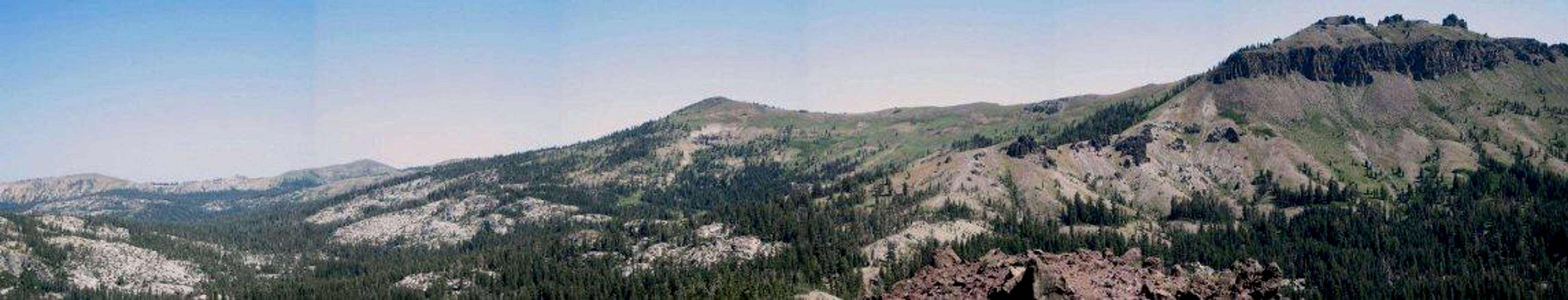
Given the peak's close proximity to it's larger neighbor Castle Peak, it's no surprise that Andesite shares many of the same geological features. The Castle Peak area is a small portion of the uplifted western slope of the Sierra. The intense pressure generated by this uplift forced magma into gaps in the rock caused by local faulting. Overtime, these andesitic flows continued their push toward the surface, creating what would become Castle and Andesite Peak. Indeed, both peaks are remnants of an ancient volcano.
Getting There
 Summit area of Andesite Peak.
Winter Access
Basically, the road won't be plowed much past the freeway. You can park anywhere along the side of the road. Continue along the road (you should easily be able to follow it even covered in snow) for approximately 1 mile. Then ascend Castle Pass, hang a left and head up to the peak.
Summer Access
In the summer, you will have two choices depending on what kind of vehicle you are in. The dirt road leading from the highway to Castle Pass may be difficult to drive without a high clearance vehicle. That having been said, parking at the end of the pavement only adds about a mile total to the hike and passes through some pleasant meadows.
 Meadows on the road to Castle Pass.
Red Tape
Permits are not required for day hikes or overnights stays in any season. More information can be found at the Tahoe National Forest website.Permits are required for any campfires, bbq's or stoves.
Camping
There are numerous Forest Service campsites in the area, most of which charge about $14.00. There are several "hike in" sites managed by the Forest Service for which there is no charge. Please visit the Tahoe National Forest Camping website for more information. There is also a privately owned campground at Cisco Grove. This facility has running water, toilets, convenience store, RV hook ups and more. Visit Cisco Grove Campground for more information.The Sierra Club also has a few accomodations in the area. The very popular backcounty Peter Grubb Hut is located just a short hop down the north side of Castle Pass.
For more refined accomodations, the Sierra Club also offers the Clair Tappaan Lodge near Donner Summit. The prices are very reasonable and you get three meals per day included!
Mountain Conditions
Current conditions can be found on the Tahoe National Forest- Conditions webpage. The snow melt report is particularly helpful if you plan of heading out in the early spring.
For current conditions and information call or stop by the:
Tahoe National Forest
49685 Hampshire Rocks Road (old Hwy 40)
(at the Big Bend or Rainbow Road exits off of I-80)
PO Box 830
Soda Springs CA 95631
530.426.3609 (voice only)
Beware that avalanches can be a distinct possibility after winter storms. Check the Sierra Avalanche Center for more information.
Etymolgy
A dark-colored volcanic rock composed essentially of plagioclase feldspar and one or more mafic minerals, as hornblende or biotite."andesite." Dictionary.com Unabridged (v 1.0.1). Based on the Random House Unabridged Dictionary, © Random House, Inc. 2006. 27 Aug. 2006.