
|
|
Mountain/Rock |
|---|---|
|
|
39.27985°N / 119.8945°W |
|
|
Washoe |
|
|
Hiking, Scrambling |
|
|
Summer, Fall |
|
|
9081 ft / 2768 m |
|
|
Overview
Point 9089 is located on the east side of Lake Tahoe in Western Nevada. Point 9089 is accessed from the Tahoe Rim Trail (TRT) heading south from Tahoe Meadows. After passing below Point 9089, the trail dips back down to the 8,500’ range before climbing back up to Snow Valley Peak further south. Point 9089 is not named, and is technically a “Point” because it only rises about 220 feet above the ridge it shares with Peak 9225 to the north. Most people pass by it without realizing it is there. However, they are missing out. The actual elevation comes from the Tahoe Rim Trail maps (see External links). The 9,089' isn't clearly labeled on other topographic maps. The summit is pretty unique. There are actually three summits that seem to be nearly the same height, but the east summit is the highest. It is also very small, enough for about one person to sit on. The lower east summit is less than 50 yards away and only a few feet lower. The west summit is 23 feet lower at 9,065’, but has a view of most of Lake Tahoe. Not surprisingly, the east summit has better views looking east towards Nevada. All of these summits require some class 3 moves to reach them, but only for 10-15 feet or so.
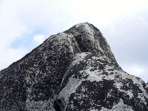 True summit of Point 9081
There is a lot of snow on this section of the trail between December and May. By late May, early June, the trail usually loses most of its snow. This section of the TRT is used frequently by bicyclists and joggers. The bikers usually don’t come until the snow is completely gone; usually in early July. The best time to hike is probably during the fall (October, November) when temperatures are lower, there is little snow, and there are less bikers on the trail. This hike only gains 600 feet, with 1/3rd of that in the last quarter mile or so. Thus, one appeal of this hike is that the TRT can be jogged with excellent views along the way, and Point 9089 summitted during the trip. Thus, this makes an excellent workout hike when training for more serious hikes in the higher Sierras.
Getting There
From Reno take 395 to the Mount Rose Highway (431). Take 431 as it winds up the mountains. The Mount Rose Highway runs for about 20 miles between Reno and Incline Village. At the top of the road is the Mount Rose Summit at 8911’. The Tahoe Meadows starts less than a mile past it. Follow 431 until the end of the meadow where you can access the Tahoe Rim Trail. The elevation here is about 8555’.
Route
From the parking area, head into the meadow where there are a few trails. Follow the one that hugs the edge of the meadow. Pretty soon there are signs pointing to the Tahoe Rim Trail. Head into the forest, where the trail slowly ascends. After about 1 mile, the trail heads east around the south side of the west ridge to Peak 9225. From here, Point 9089 is visible to the south. A little less than two miles further up the trail, you reach the top of a hill, and the trail descends. Point 9089 rises up straight ahead to the south. From here, you can get off the trail and head towards the mountain, or continue a little further up the trail and head up the mountain. From the most obvious off-shoots from the trail, it is between 210’ and 220’ up to the summit in about ¼ mile.
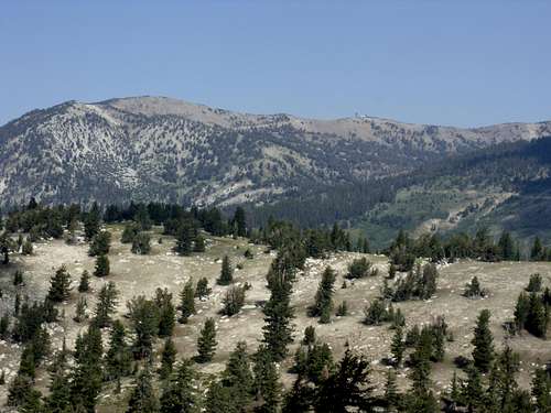 View of Relay Peak 10,335' from the summit
The round trip hiking distance is about 6.5 miles, with a one-way elevation gain of about 600 feet.
Red Tape
There are no permits needed to hike on the Tahoe Rim Trail or any fee to park at the Tahoe Meadows. When the pass gets heavy snows, roads may be closed. Roads may also be closed during the summer due to fire danger. During the summer, bikers are frequent on the Tahoe Rim Trail, especially near Tahoe Meadows. They are restricted to only odd days, so try and hike on even days. However, if hiking when they are on the trail, be careful, and watch for them.