
|
|
Mountain/Rock |
|---|---|
|
|
34.19207°N / 117.83867°W |
|
|
Los Angeles |
|
|
Hiking |
|
|
Spring, Summer, Fall, Winter |
|
|
3322 ft / 1013 m |
|
|
Overview
Glendora Mountain is a small peak just east of San Gabriel Canyon's reservoirs. It lies just east of Glendora Mountain Road (North-south, Glendora Ridge Road runs east-west). The road itself is sometimes closed in the north from Glendora Ridge Road near East Fork (Iron Mountain area), to just outside of Dalton Canyon in the south.During road closures, Glendora Mountain Road makes a very popular biking route.
The main attraction of this area is Glendora Mountain Road, which is an excellent tarmac driving road that balances various dynamics and turns with several high-speed sections. If you're in the area and fancy ticking off a peak, perhaps Glendora Mountain will suffice.
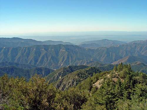
View south from the Heaton Flat trail towards the Glendora Ridge and the Glendora Ridge Road. September 20, 2008
Getting There
From 210 Freeway:Head towards Glendora.
Exit Lone Hill Avenue, and head north.
Left on Foothill
Right on Loraine
Right on Sierra Madre
Left on Glendora Mountain Road
The gate is sometimes closed approx. 1.25 miles from the intersection with Sierra Madre. The road was re-opened in early summer 2007 after being repaired, but it may close after heavy rains, fires, or in winter.
Ascending the peak is easiest done by gaining the firebreak that leads directly along the ridgeline, north-south. If heading from the north, jump off the road and take the firebreak to the summit. From the south, heading north, the firebreak leads off the right side of the road near the intersection with Garcia Road, which heads west towards the canyon bottom.
Desert gaitors are a good piece of equipment in these areas, as the firebreaks often still have a healthy amount of mustard and other fast-growing low vegetation along them. Also, keep your eyes open for snakes, as they are relatively common on these lower-altitude peaks.
-=FOR THE BICYCLE FOLK=-
For a popular bike round-trip route, exit Azusa Avenue and head north. Azusa becomes San Gabriel Canyon Road. Parking is on the left side, opposite of the small Ranger Station.
Pass through the mountains, past the reservoirs, and make a right turn over the bridge towards East Fork. Continue until you reach the fork in the road, where you have the option of turning right and going up Glendora Mountain/Ridge Road, or heading straight to East Fork. Make a right, and follow this route up to the saddle where the road splits. You can take the route past Glendora Mountain by heading west (right side), and following the paved road past the locked gate. It's all downhill from there.
The road eventually drops down into the city. The best return route is to ride down to Sierra Madre Avenue, and take that west (left turn) back to Azusa/San Gabriel Canyon Road, and back up to the parking lot.
If biking, beware of people driving in the area, as this is a very popular driving road. Some of us who drive this road for fun typically go at night, so as not to disturb you guys. :-)
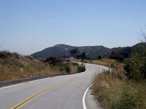
Glendora Mountain as seen from the eastern approach along closed Glendora Mountain Road. True summit is on the far left of the ridge.