
|
|
Mountain/Rock |
|---|---|
|
|
39.50191°N / 110.31654°W |
|
|
Carbon |
|
|
Hiking, Mountaineering, Trad Climbing, Toprope, Bouldering, Scrambling |
|
|
Spring, Summer, Fall |
|
|
9852 ft / 3003 m |
|
|
Overview
Patmos Head is a rugged summit in the Book Cliffs (sometimes the upper elevations of the Book Cliffs are sometimes labeled as the Roan or Brown Cliffs, but everyone locally just knows them as the Book Cliffs). It is also one of the highest summits of the Book Cliffs, though there is some confusion as to which is the high point of the ridge and as to whether or not Patmos Head is even a ranked summit.
According to the 1:250,000 scale map, Patmos Head is 9851 feet elevation and the highest point on the ridge. According to the 7.5 minute map, Patmos Head is 9841 feet and lower than point 9842 and Patmos Mountain at 9845 feet. The latest map, the 1:100,000 scale metric map indicates a closed contour and the mountain has an elevation of 3000+ meters/9843+ feet). The Utah Mountaineering Guide, 1st and 2nd editions uses the elevation 3003 meters/9854 feet and indicates that it’s two meters higher than Patmos Mountain. So, to sum it all up, Patmos Head may or may not the highest point on the ridge and which point is the ranked peak is subject to debate. One thing for sure is that Patmos Head is the most interesting high summit in the area as Mount Bartles, Patmos Mountain and Bruin Point all have old jeep trails (the road to Bruin Point is still well used) high on their slopes.
Patmos Head is a seldom climbed peak and usage has been decreasing even more in recent years. This is probably because the only source of information on the peak was a brief mention in the Utah Mountaineering Guide editions 1 & 2 which last went out of print in 1986. I was the first to sign the register in 13 years.
Like most summits in the area, Patmos Head is a rugged mountain and quite challenging to climb. There are no trails anywhere close to the summit area. Despite its ruggedness, Patmos Head was used as a heliograph/triangulation site in the 1880’s. Remains of the old survey station can still be seen.
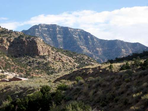 Patmos Head from the old Geneva Coal Mine.
Getting There
From Highway 6 East of Prince and Wellington, turn east (about 9.1 miles) on Highway 123. Drive east on Highway 123 about 8.7 miles to the junction of Highway 124 in East Carbon City. From East Carbon City, drive south of Highway 124 until it turns east and reaches the Geneva Coal Mine. The road is paved to this point, but is gravel beyond here. Drive east up horse Canyon past the water tanks and to a small pull off/campsite/corral on the left. Park here.
You can get slightly closer to the mountain if you continue along the road a short distance up Horse Canyon until an old road takes off to the left.
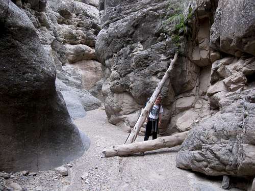
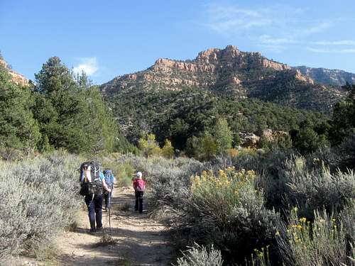 Photo taken near the trailhead (above Geneva Mine).
Routes Overview
West Ridge Route
The West Ridge Route is a rugged and steep route to the summit of Patmos Head. There are several cliff bands to climb. If you want to keep the route under class 4 in difficulty, it might be possible to do so with careful routefinding. Otherwise, prepare to climb several cliff bands on the ridge (several 5th class routes are also possible). The route has 4000 feet elevation gain and the going is slow because the route is so rugged.
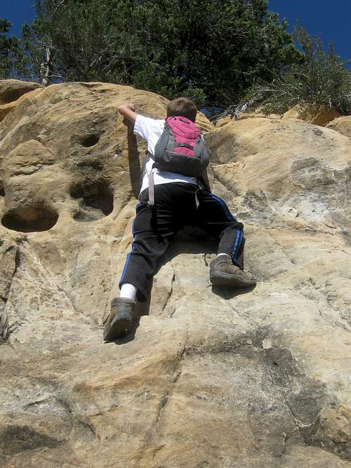 Climbing one of the many cliff bands on the West Ridge of Patmos Head.
Other Routes
The north ridge from Patmos Mountain is probably the easiest route on the mountain, but you would need permission from the land owners (mining company) to use this route. There is no trail, but it has less elevation gain and isn’t as rugged as the other parts of the mountain.
The South Ridge appears to be easier than the West Ridge as well. The road to the trailhead may require 4wd.
The east face of the mountain is also very rugged and finding a route from that direction could be an interesting challenge.
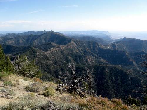 Looking south from the summit of Patmos Head. The south ridge is to the left.
Red Tape
There is no red tape, so make sure to tread lightly.
Camping
There is a good campsite at the trailhead as mentioned above.
Backcountry camping is possible, but other than a creek along the first part of the route, there is no water along the route. Although much of the North Fork Horse Canyon is quite rocky, we found a nice, but dry campsite not far from the base of the West Ridge. You must carry water along the route in order to camp.
 There is no read tape. This is the North Fork of Horse Canyon and is along the route to the base of the West Ridge of Patmos Head.
When to Climb
May, June, September and October (perhaps early November as well) would be the ideal time to climb the peak. Summers can be quite warm and with the steepness and the ruggedness of the routes, winter climbing on skis or snowshoes would be very difficult and isn’t recommended.
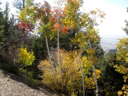 Autumn leaves on October 1. There aren't many colors except for near the very summit.
Mountain Conditions
Weather Forecast for Patmos Head
Below is the National Weather Service Climate Summary for Sunnyside. The data is from 1905-2008. This is the closest long term weather station. Sunnyside is at 6600 feet elevation and temperatures on Patmos Head will be about 10 degrees colder than in Sunnyside.
| MONTH | AVE HIGH | AVE LOW | REC HIGH | REC LOW | AVE PREC (in) |
| JAN | 34 | 14 | 60 | -16 | 0.80 |
| FEB | 40 | 19 | 64 | -17 | 1.03 |
| MAR | 45 | 22 | 80 | -1 | 1.28 |
| APR | 55 | 30 | 81 | 4 | 1.09 |
| MAY | 65 | 39 | 94 | 20 | 1.19 |
| JUN | 77 | 48 | 98 | 28 | 0.83 |
| JUL | 84 | 55 | 105 | 32 | 1.23 |
| AUG | 82 | 53 | 102 | 35 | 1.46 |
| SEP | 73 | 45 | 92 | 24 | 1.71 |
| OCT | 60 | 35 | 86 | 10 | 1.41 |
| NOV | 46 | 24 | 78 | -1 | 0.93 |
| DEC | 36 | 16 | 62 | -14 | 0.73 |