
|
|
Mountain/Rock |
|---|---|
|
|
39.94270°N / 110.7458°W |
|
|
Duchene |
|
|
Hiking, Skiing |
|
|
Spring, Summer, Fall, Winter |
|
|
9463 ft / 2884 m |
|
|
Overview
In some ways, I'd consider Peak 9463 to be second fiddle to Gray Head Peak just to the west. Most people who climb Gray Head Peak (though still very few people) will climb this one too.
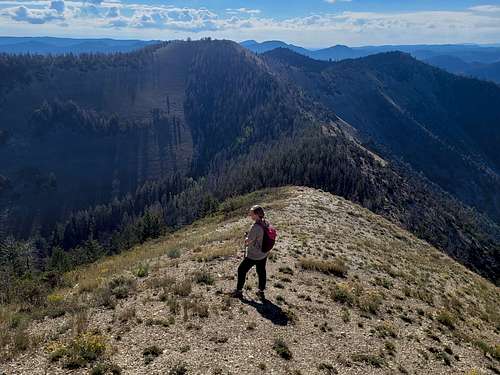
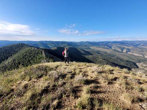
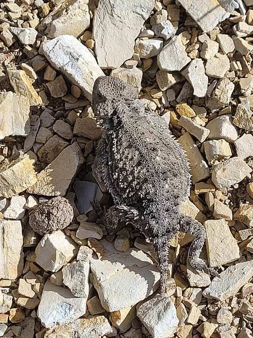
That said, it is a nice enough peak in an interesting area that doesn't see a lot of visitors. It just lacks the more graceful lines and expansive views of Gray Head Peak. Peak 9463 does have a few advantages though. The ridge to the north towards Gray Head Benchmark (not to be confused with Gray Head Peak!) looks really interesting to explore. Peak 9463 also has more bristlecone pines than Gray Head Peak. As with Gray Head Peak, this has been my plan B peak a few times. Once during a snowstorm in January 1998, we came here because we feared that the avalanche danger would be too great in the Wasatch. In August 2022 we were headed somewhere else, but the highway through Spanish Fork Canyon washed out and we decided to hike here. This area, including the peak itself must have a healthy elk population because we saw many signs of elk on our visit. It's a rather interesting area as well.
The mountain is part of what the maps label as the Bad Land Cliffs, but compared to the Book Cliffs just to the south, they are more very steep slopes than true cliffs, at least by Utah standards. Because of its proximity to the Book Cliffs, this page can be grouped with the peaks there.
Getting There
Strangely, the mountain pass on Highway 191 seems to be the only major mountain pass in Utah without a name. It is next to Argyle Canyon though. From either Helper on the south or Duchesne on the north, drive US Highway 191 to the area around the pass. Less than half a mile north of the pass, FR 114/FR 324 (which has a small sign) takes off to the west. Either park here next to the highway (there is plenty of parking just up the road) or drive north on FR 114, making two right turns along the way, to the road end. Park here. Note that if the roads are wet, you don't want to drive them. We tried (and failed) to drive the road when it was wet, but didn't make it far. Park at the highway if the roads are wet or if it might rain or snow. Left Fork Lake Canyon or Right Fork Lake Canyon are alternate approach roads, but I am not familiar with them and they are probably 4wd roads.
Routes Overview
From FR 114
This route has the easiest access to the trailhead and is the approach I have used both times I have been here. From the end of FR 114, an illegal ATV track heads north up the hill. To locate the trail, watch closely for a trail heading left at a small cairn. This trail more or less goes all the way to Gray Head Peak, passing over Peak 9463 along the way, but it isn't used much and in most places is more of a game trail than a hiking trail. Note that the trail isn't where it is marked on the topo map either, so don't try and follow that route. Head north staying on the ridge over point 9115 and then over or around Point 9383 to Peak 9463.
The hike can be done in a moderate day from the highway, or in a half a day from the end of FR 114. I'd suggest continuing on to Gray Head Peak as well. There is some minor bushwhacking and a few steep sections, but no major problems. A strong climber or hiker might consider heading north from Peak 9463 to Peak 9217 and Gray Head BM (called Indian Head on some maps). They look like interesting peaks, but I have not climbed them. Other Routes
The easiest and shortest route up Peak 9463 might be from Left Fork Lake Canyon or Sterling Hollow, but I have not used this route and the approach roads are much more difficult.
Red Tape
None. Please don't drive ATVs off the approach road.
When to Climb
June, September, and October are probably ideal for hiking, while December through March or April is good for skiing or snowshoeing. July and August aren't bad either, but can be warm on some days. Wear hunter orange during hunting season as hunters visit this area more than hikers. This peak does make a good winter ascent since most of the time it doesn't have the avalanche danger as do some of the ranges in Utah, but there are a few slopes that could slide.
Camping
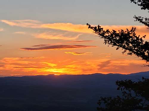
Avintaquin Campground is not far from the trailhead. There are campsites along FR 114 as well. Backcountry campsites are available in several areas, but there isn't any water except snow in winter and spring. Still, if you don't mind carrying water, the sunsets and sunrises from the ridges are spectacular. You can easily make this into a two day (or more) trip by following the ridges to more peaks.
Mountain Conditions
Click Here for the Weather Forecast for Peak 9463.
Below is the National Weather Service Climate Summary for nearby Soldier Summit 1948-2002, which is nearby. During the day time, temperatures on top of Peak 9463 will be a bit cooler (5-8 degrees) than at Soldier Summit.
| MONTH | AVE HIGH | AVE LOW | REC HIGH | REC LOW | AVE PREC (in) |
AVE SNOW (in) |
| JAN | 29 | 4 | 54 | -29 | 1.69 | 22.4 |
| FEB | 34 | 6 | 57 | -30 | 1.67 | 20.1 |
| MAR | 41 | 14 | 62 | -16 | 1.42 | 13.0 |
| APR | 52 | 21 | 75 | -18 | 1.02 | 5.1 |
| MAY | 62 | 28 | 84 | 6 | 1.26 | 2.7 |
| JUN | 73 | 34 | 92 | 11 | 0.57 | 0 |
| JUL | 80 | 41 | 98 | 27 | 1.15 | 0 |
| AUG | 78 | 39 | 91 | 21 | 1.32 | 0 |
| SEP | 71 | 32 | 89 | 13 | 0.87 | 0.2 |
| OCT | 59 | 23 | 78 | -2 | 0.98 | 1.5 |
| NOV | 41 | 13 | 68 | -22 | 0.97 | 3.7 |
| DEC | 31 | 4 | 56 | -31 | 1.63 | 19.2 |