
|
|
Mountain/Rock |
|---|---|
|
|
39.29849°N / 120.31562°W |
|
|
Placer |
|
|
Hiking |
|
|
Spring, Summer, Fall, Winter |
|
|
8243 ft / 2512 m |
|
|
Overview
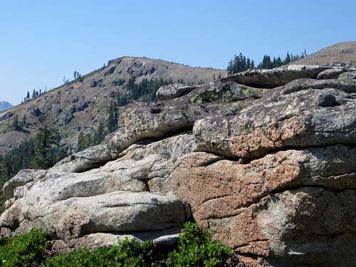
Mount Judah from Donner Peak
Mount Judah is a popular and easily accessible peak near Donner Pass, to the north of Lake Tahoe. Situated near the Sugar Bowl Ski Resort, this area is heavily trafficked in winter. Although people do ski down from Mount Judah during the winter, Mount Judah itself does not have its own ski run.
A loop trail off the Pacific Crest Trail, leads to the summit of Mount Judah. This allows for an easy loop of 4.6 miles without significant elevation gain.
The views from the summit are excellent, with numerous rocky peaks in view, as well as a number of lakes. Nearly all of Donner Lake is in view. The area around Mount Judah is well built out, with the ski area and roads, but the area is still quite pretty. The trail system around Mount Judah is excellent, although not everything is marked 100% clearly, so follow common sense. I noticed the north loop turnoff was marked, but not the south loop. Nor is the trail marked when heading down towards Donner Peak. It is kind of marked, but some people could get confused.
The mountain is quite open, with great views appearing quickly once you start the hike. It is ideal for trail running with many miles of trails in the vicinity without significant elevation increase or steep terrain, as the PCT winds south from Donner Pass towards West Tahoe.
It is often hiked with Donner Peak 8,019' and/or Mount Lincoln 8,383’. Donner Peak adds about 1/2 mile round trip, while Mount Lincoln adds about 2 miles round trip.
In a typical year, Mount Judah can typically be accessed without too much snow starting in June and going through late October. It is accessible in winter for skiers and snowboarders wishing to take in some additional views.
Getting There
There is really only one primary route to Mount Judah, and that is off Donner Pass Road at the Pacific Crest trailhead. Take I-80 West from Reno, or I-80 East from Sacramento, and exit at 180 for Donner Lake Road. Take Donner Lake Road down towards lake level and take a right on Donner Pass Road. Head a few short miles up a windy road, and you will be at Donner Pass. On the left side of the road is a parking area and a gravel road that leads down to the PCT trailhead in about 0.2 miles.Route
Take the Pacific Crest Trail as it winds up into a very rocky part of the trail, and eventually returns to forest. After about a mile from the trailhead is the entry to the Mount Judah Loop trail. You can take this part of the loop – the northern entrance, or head another mile or so to the southern entrance. Regardless, the loop is considered 4.6 miles with an elevation gain of 1,175’, and very easy to follow in summer months. If you want more information, there are numerous write-ups on the internet about this loop, given its popularity.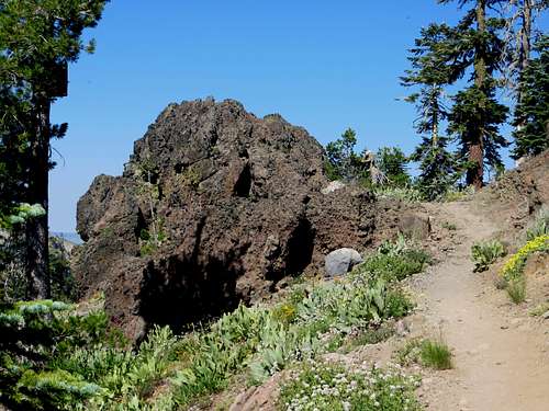
View along the Mount Judah loop trail