
|
|
Mountain/Rock |
|---|---|
|
|
48.17836°N / 119.24987°W |
|
|
Okanogan |
|
|
Hiking |
|
|
Spring, Summer, Fall, Winter |
|
|
3920 ft / 1195 m |
|
|
Overview
Whitmore Mountain is a low-elevation peak located in north-central Washington. The peak is most notable to outdoor enthusiasts for two reasons. The first reason is because the peak is one of the 144 peaks in Washington with at least 2000' of clean prominence, with 2160' of clean prominence. The second reason is because the peak has multiple lookout sites.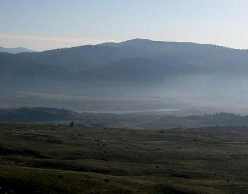
Whitmore Mountain
The mountain is located near the southwestern side of the Colville Indian Reservation. The summit area has great views, especially from its lookout tower. The true summit is a rock outcrop next to the tower.
Summit Rocks Near Tower
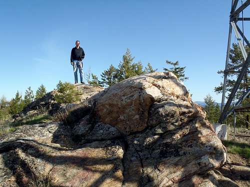
Summit Rocks
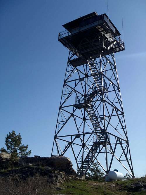
During 1938, a 60' tall three-legged wooden tower was constructed on atop a small hill approximately 0.2 miles northeast of the true summit. An accompanying ground-level L-4 cab lookout building followed. The three-legged tower did not last long but the ground-level L-4 cab still remains standing. During the 1960s, a 67' tall all-steel live-in tower was constructed (and still staffed each year) at the true summit hill of the peak and the other lookout site was abandoned.
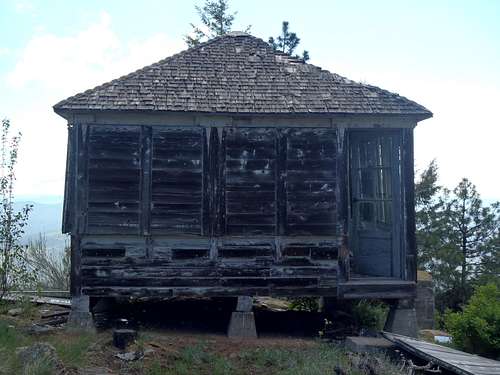
Whitmore L-4 Cab (Secondary LO Site)
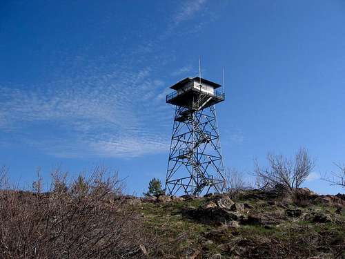
Whitmore Summit Tower
Although several Washington mountains have multiple lookout structures still standing, most of those examples have two lookout structures that were built next to each other (which is why each such peak appears as only one lookout site on corresponding lists). Whitmore Mountain is one of only two Washington peaks (with Mount Leecher being the other) that has two distinctly different areas with lookouts still standing at their officially used locations. The lookout structure still standing at one site cannot be seen at the other site, and vice versa.
Most people who have visited Whitmore Mountain have only gone to the true summit and seen its tower but (typically unknowingly) not to the other site. That is the reason it is important to separate the two different sites on any lookout-related lists; then people interested in lookouts can know to visit each distinct site. That helps define a major difference between a "lookouts" list and a "peakbagging" list. Peakbaggers will want to visit the summit; lookout enthusiasts will want to visit both existing lookout sites.
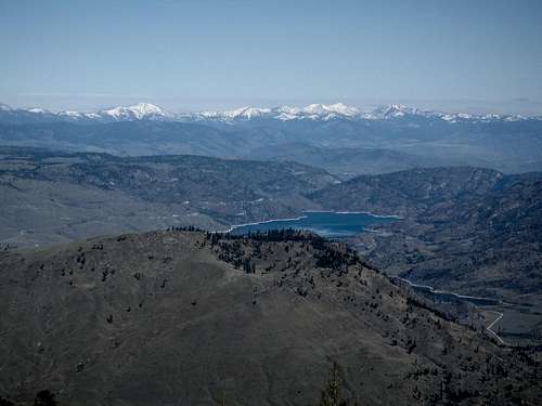
NE View From Summit Tower
Getting There
FROM OMAK, WA:1) Starting at the intersection of Highway 20 & Highway 155 (Omak Avenue), drive east.
2) After 0.8 miles, turn right (south) onto Columbia River Road.
3) After 23.5 miles along Columbia River Road, veer left towards Old Omak Lake Road. Most passenger vehicle should be able to drive to this location. High-clearance vehicles are recommended for the rest of the driving directions.
4) After 0.5 miles, turn right onto Old Omak Lake Road.
5) After 1.5 miles along Old Omak Lake Road, turn left (north) onto BIA-67.
NOTE: There might be a sign for Whitmore Lookout at this intersection.
6) After 7.3 miles along BIA-67, the road ends at the summit of Whitmore Mountain. BIA-67 has several road-bends and turns; watch for signs.
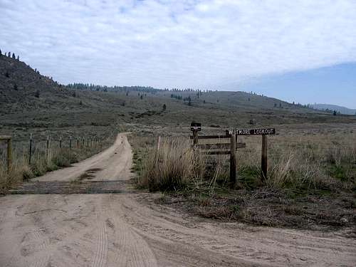
Whitmore LO Road Sign
------------
DIRECTIONS FOR VISITING THE SECONDARY LOOKOUT SITE:
At approximately 3800', where BIA-67 has its final road-bend heading south (or shortly thereafter), park the vehicle alongside the road. Hike steeply up a small semi-forested hill for approximately 80' of elevation gain, until reaching the lookout site (GPS COORDINATES: 48.180139, -119.246874). The concrete foundations and some ruins are all that remain of the former three-legged tower. The ground-level L-4 cab is in poor shape but still quite recognizable. The great views to the south show why this was (and still is) a ideal location for a lookout building.
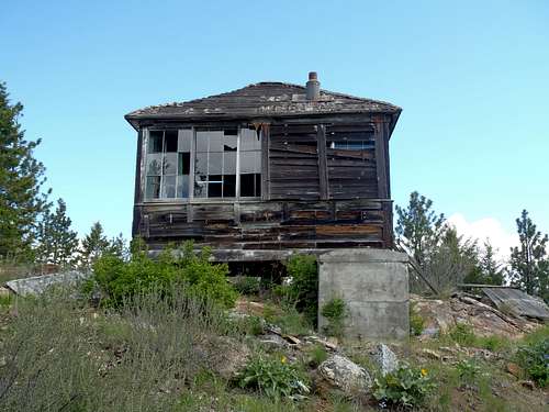
Whitmore L-4 Cab (Secondary LO Site)
Red Tape
There are no permits or fees for visiting Whitmore Mountain.In general, the Colville Indian Reservation requires a "Leave No Trace" policy for any recreational activities.
Considering this peak lies within Colville Indian Reservation, access and permissions might be revoked or changed for non-tribal members at any time. Please respect all rules and regulations.