


-
 3121 Hits
-
 81.18% Score
-
 13 Votes
|
|
Mountain/Rock |
|---|---|
|
|
45.79630°N / 7.35490°E |
|
|
Hiking, Mountaineering |
|
|
Spring, Summer, Fall, Winter |
|
|
8228 ft / 2508 m |
|
|
Note
La montagna chiama i suoi figli, ed essi rispondono fedelmente al suo appello… Osvaldo Cardellina, Diario alpinistico, 1964-65 Page texts: @ OsvaldoCardellina "Osva", passed away on May 2, 2022. Page owners: Christian Cardellina e Osvaldo Cardellina. Any updates from September 12, 2022: Antonio Giani, page administrator, friend and climbing companion. Testi della pagina: @ OsvaldoCardellina "Osva", scomparso il 2 maggio 2022. Proprietari pagina: Christian Cardellina e Osvaldo Cardellina. Eventuali aggiornamenti dal 12 settembre 2022: Antonio Giani, amministratore della pagina, amico e compagno di salite. |
Desolate Overview
This Summit is an elevation of secondary importance, really unpopular, rather would say completely. Better, unknown for everyone. And yet it ranks above the City of Aosta and then in plain view from the valley floor, below as the Village of Blavy (1.475m), the slopes of a very frequented Becca Viou (1.475m). Just between this and the nearby Becca di Roisan (2.546m), put on the back burner for a long time and today "returned to life". At least for local fans who have recently placed a large Cross on its Summit. On the conclusive watershed that, starting from the Eastern Tsaat a l'Etsena (2.967/8m), reaches the Becca of Viou (2.856m) then decline towards Northwest on entry into Valley of Great St. Bernard.
![]()
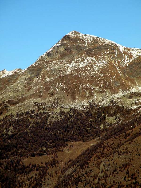
All at the foot of Becca Viou
![]()
Coming out of School, while the Winter was ending, though still leaving its white fingerprint traces on the Spring, it was made the race against Time, since the early Darkness descended. A frantic race into the forest while already melted snow, jumping from "clapeys towards a clapeys" (by a boulder at the other) for not to sink. To the base of the rocks. Were steeper, the better was because it disappeared almost completely snow, leaving the space to the hard ice. A fast climbing, a small crossing on snow cornices, a quick stop for a bite to eat in the freezing cold. Then the descent, now "swimming" in the deep snow, and then get down there to the tiny Village Parléaz, maximum limit for car. So I remember of Becca of Blavy, where in Summer during the numerous climbs to Becca of Viou I never saw anyone. Becoming probably the Kingdom of the Viper ...
![]()
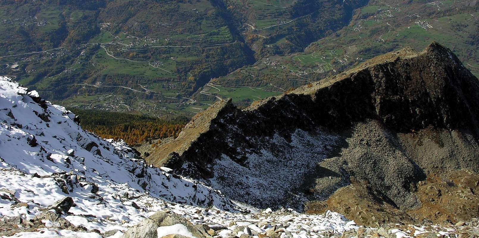
Becca de Blavy & Becca de Roisan Northern Slopes from Becca Viou, by Antonio
Eppur trovasi sopra la Città d'Aosta e quindi ben in vista dal fondovalle come dal sottostante Villaggio di Blavy (1.475 m), ai piedi della frequentatissima Becca di Viou (2.856 m). Per la precisione tra questa e la vicina Becca di Roisan (2.546 m), per tanto tempo messa nel dimenticatoio ed oggidì "tornata a vivere". Almeno per gli appassionati locali che da poco tempo hanno posizionato gran Croce sulla sua Cima. Su quello spartiacque conclusivo che, partendo dalla Sommità Orientale della Tsaat a l'Etsena (2.967/8 m), raggiunge la Becca di Viou per poi declinare verso Nordovest sull'ingresso nella Valle del Gran San Bernardo. Separando la Valle Centrale della Dora Baltea dalla Valpelline situata sull'opposto versante Settentrionale. In effetti questa piccola Sommità non risulta rappresentata e neppur quotata sulle varie Carte, se non in quelle della Regione Autonoma della Valle di Aosta ove vien registrata come quota 2.508 metri, ma priva d'alcuna denominazione. Per i motivi sovraesposti si propone il toponimo di Becca di Blavy, da attribuire anche ai due passi a lei subito attigui ad Est (contro la Becca di Viou) e ad Ovest tra la medesima e la Becca di Roisan. Due passaggi facilmente raggiungibili dal Versante Meridionale, ma piuttosto ostici su quello Settentrionale e che conducono alle Alpi Baraques e Chanté des Meyes (2.383 m, 1.847 m) nel Vallone di Valfredda o Voyfrède. Forse utilizzati dai pastori in un lontano passato nel transito verso le due Alpi di Viou, anche se il giro appena più largo verso Occidente tramite l'Alpe Praperia o Praperiaz (1.737 m) risulta più pratico ed esiste un antico sentiero di collegamento dall'Alpe Rachaud (1.625 m). Si presenta come piccola piramide triangolare con una tetra faccia rivolta a Nord, mentre a Sud il suo versante si sdoppia con un erboso Sudest separato da una parete rocciosa ed obliqua verso Sudovest, dove cade con ripide placche alte oltre un centinaio di metri. Anzi da questo lato risulta sicuramente più in vista della vicina Becca di Roisan o di Pechenville, più conosciuta e frequentata ma dall'aspetto veramente scarsamente appariscente. Per ste ragioni anche i cacciatori l'evitano, mentre la massa và in processione alla Becca di Viou. Che tutto e tutti domina dall'"alto" della sua illesa maestà ...
![]()
Separating the Central Valley of Dora Baltea from Valpelline situated on the opposite Northern side. In fact, this small Summit is not represented, nor listed on the various Cards and Maps, except in those of the Autonomous Region of Aosta Valley where it is registered as an altitude of 2.508 meters, but without any denomination. For the above reasons it is proposed the name of Becca de Blavy, as for the two passes to her immediately adjacent to the East (against Becca de Viou) and West between it and Becca de Roisan. Two passes easily accessible from South Slope, but rather difficult parts on the North and that lead to Alps Baraques and Chanté des Meyes (2.383m, 1.847m) in the Valley of Valfredda or Voyfrède. Maybe used by shepherds in the distant past in transit to the Viou Alps, although the ride just wider Westward through the Alp Praperia or Praperiaz (1.737m) is more convenient and there an old connection path from the Alp Rachaud (1.625m). It looks like a small triangular pyramid with a grim and dark face to the North, while in the South its side splits with a grassy slope Southeast separated by a rocky wall and oblique to the Southwest, where falls with a high and steep rocky plaques of over a hundred metres. Indeed from this side it is definitely more in view of the nearby Becca di Roisan or Pechenville, most known and visited but really poorly by flashy looks. For these reasons also the hunters avoid it, while the masses goes in procession to the above Becca of Viou. That dominates everything and everyone ...

But what is of another era and was built exclusively for lack of time or to start a new season, with the aim to avoid the usual climbing in rock gym near home...
Questa Sommità costituisce una elevazione di secondaria importanza e veramente poco conosciuta, anzi direi proprio del tutto sconosciuta per quasi tutti.
Ma é cosa d'altri tempi e veniva realizzata sol per mancanza di tempo a disposizione oppur per dar l'avvio a nuova stagione a scopo d'evitar "solita" palestra ... Uscendo da Scuola, mentre l'Inverno stava finendo, lasciando però ancor le sue bianche tracce di impronta sulla Primavera, s'effettuava la corsa contro il Tempo, poiché il Buio presto scendeva. Una corsa affannosa dentro la foresta mentre già la neve fondeva, saltando di "clapeys in clapeys" (da un masso all'altro) per non sprofondare. Fino alla base delle rocce. Più ripide eran e megli'era perché spariva quasi del tutto la neve, lasciando spazio al duro ghiaccio. Una svelta arrampicata, una piccola traversata sulle cornici di neve, una breve sosta per mangiare un boccone nel gelido freddo. Poi la discesa, ormai "nuotando" dentro la profonda neve, per poi arrivare laggiù a Parléaz, limite massimo per l'auto. Così mi ricordo della Becca di Blavy, dove in Estate nelle numerose salite alla Becca di Viou non ho mai visto nessuno. Diventando probabilmente il Regno della Vipera ...
First Ascents
- First known on the Summit: Ilario Antonio Garzotto and Osvaldo Cardellina; April 19th, 1969, in ascent from Parléaz Village.
- First in Winter: Unknown.
- Southwestern Face: Ilario Antonio Garzotto and Osvaldo Cardellina; April 19th, 1969, in ascent from Parléaz with traverse to Becca de Roisan.
Getting There
BY CAR:
- From TORINO, MILANO, etc: Motorway A5. Exit at IVREA or Quincinetto (PIEDMONT).
- From IVREA Town: in West to Pont Saint Martin, Donnas, Bard, Verrès, St. Vincent, Châtillon, Nus, Quart, St. Christophe, Aosta and Roisan Municipalities. From Courmayeur Resort: in East to Morgex, La Salle, Saint Pierre, Sarre, Aosta, Roisan and Saint Chistophe Municipalities.
- From Aosta Town to Roisan and to St. Christophe Municipalities
- 1) - From Aosta City with the SS.27 towards the Gran San Bernardo reaching the alternative (782m) near Vainey Fraction and following crossroads nearby Moulin locality (765m) and before Gignod Commune (994m). Turning right and with before Southeast, after North directions towards Roisan Commune (768/843m).
- 2) - From Aosta towards Saint Christophe-Prevot (about 640m), reached by Regional Road and to "Chief-town" Sorreley Village; from this, with Municipal, towards Veynes Fraction up to the junction 1.025 meters "Montagne". By the crossroads to the West reaching Parléaz or Parleyaz (1.274m) and Blavy (1.475m) small Villages.
- 3) - By Aosta towards Saint Christophe "Chief-town" by the SS.26 in East-northeast; from this before in Northeast after West with the Regional Road to alternative 730 meters below Thovex Village. Crossing West reach the fork 746 meters just below Quota Baden-Powell (792m); continuing Northwest and passing Serod, Porossan (754m, now in Aosta Municipality), Nayves, another Serod, Câche (764m), Closellinaz Dessus Fractions or Hamlets reach Roisan Commune.
- From FRANCE: through the Mont Blanc Tunnel to Entrèves-crossroads to Vény/Ferret Valleys - Mountain Guides of Courmayeur - La Saxe Rock Gym - Courmayeur. By Little Saint Bernard Pass, closed since November until half May to La Thuile Valley - Pré Saint Didier - Courmayeur. It is not necessary to take Motorway A5: you can drive on SS.26, in the direction of AOSTA - IVREA - TURIN.
BY PLANE:
- Aeroporto "Corrado Gex" Saint Christophe (Aosta).
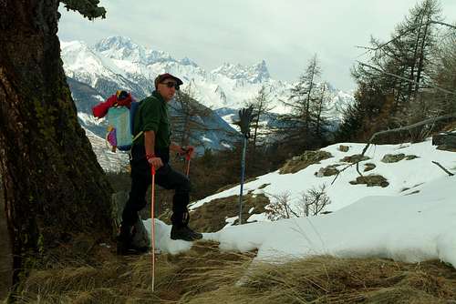
![Nearly Wintry Becca of Roisan & Becca de Blavy 1969]()
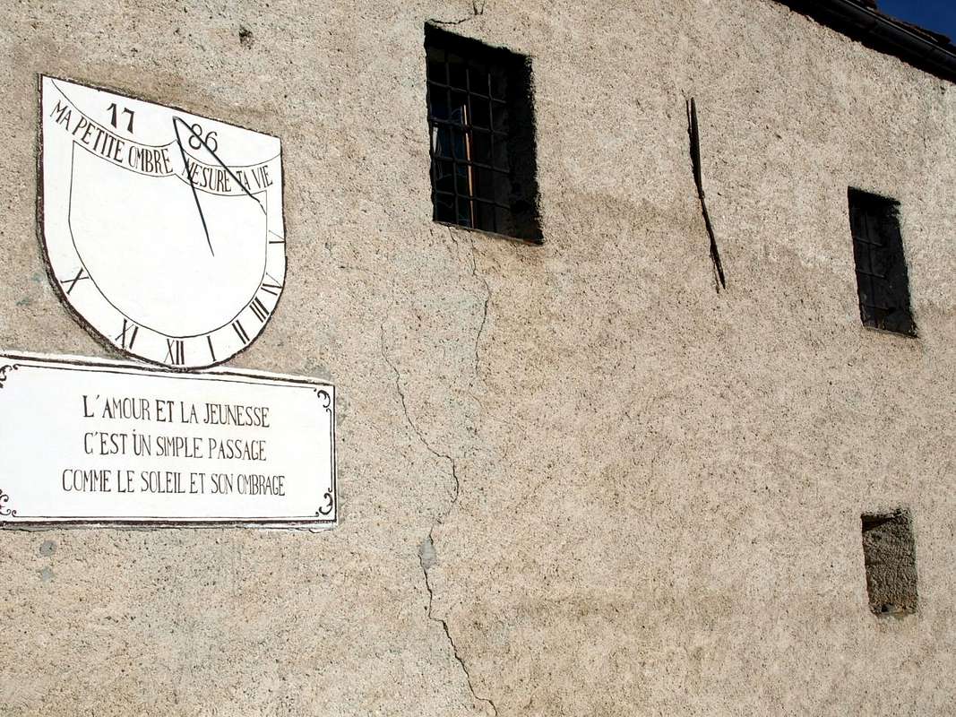
![around four Commons 1786 Blavy Chapel Sundial 2015]()
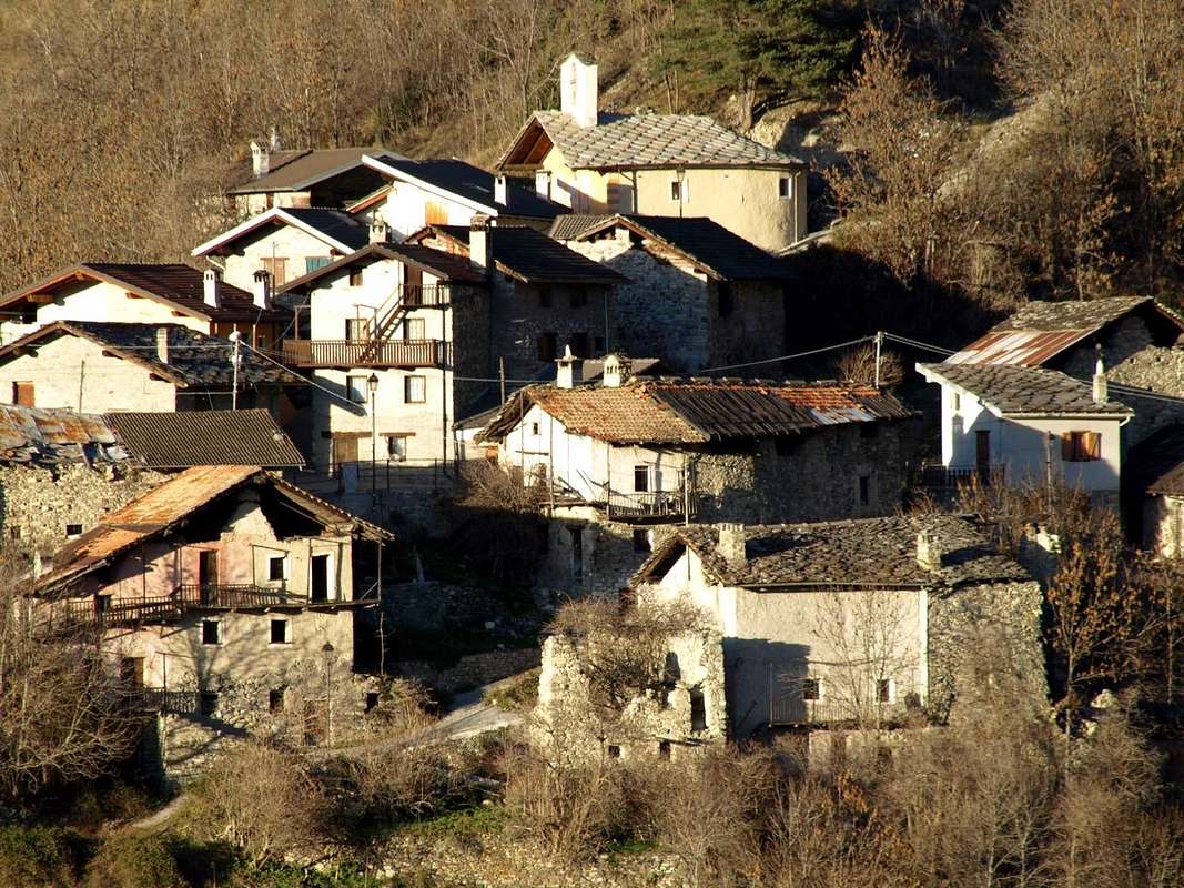
![around four ... Parlèaz or Parleyaz ancient Village 2015]()
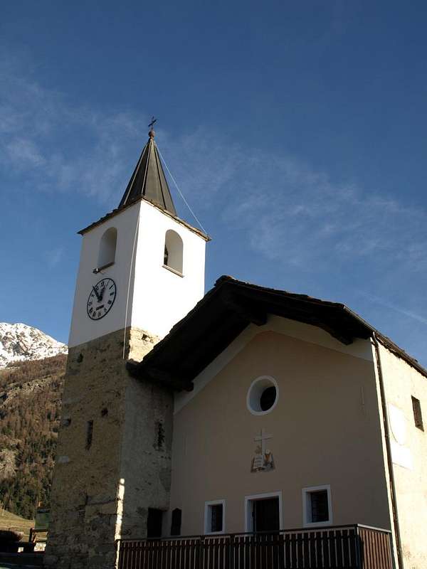
![Tour above Roisan & Aosta Blavy ancient Chapel 2015]()
Approaches & Routes
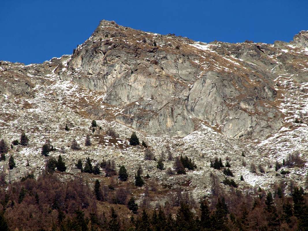
From St. Christophe Common, immediately to the West of Aosta City, to reach with the Municipal Road in asphalt the small isolated Village Parléaz or Parleyaz (1.274m; in winter or with snow, you have to park just before the short descent protected by iron railings to the village). From this, crossing the valley floor, the road improves amplitude and with more comfortable bends, goes up to the small Village of Blavy (1.475m), located in a beautiful and scenic grassy expanse at the edge of the nearby woods. Note: here you can get with many ancient paths and old mule tracks starting from St. Christophe Common and Senin, Sorreley, Veynes Hamlets or, more to the West, from Aosta-Porossan. Also you can, starting from Parléaz, climb with the small unnumbered path that starts just behind the Chapel of St. Margaret, dates the Comba and, crossing the Torrent de Pareylaz, reaches Blavy. Otherwise, excluding this last small village, continue by the same until the ancient and abandoned Varbre Pasture (1.667m), just below the dirt road for Viou Alps, where he reunites with the n° 105 that starts even from Porossan-Serod and , after the Village of Blavy, becomes n° 105/25 former 1A. From Varbre continue for a short time following the torrent to the interior of the forest until you reach the dirt road at an altitude of 1.962 meters; from this point, leaving to the East (right) the same, you have to continue following pathless a little one that is the boundary between the Municipalities of Roisan (West) and Aosta. Proceeding, not without difficulty, to the north in an devastated zone of the forest you reach the altitude of 2.218 meters, where it ends at the base of a great heap of stones in a small basin. Here and at the base of the small Southwestern Wall the same splits sending a branch at the left parallel to the wall and another in right in the direction of the Slope South-southeast and then almost against West-northwest Crest of Becca Viou. This point there are three different possibilities to climb just to the overhanging Becca Blavy:
A) - go to the left, among sparce trees, along the quite steep stony slope reaching the Western Hill of Roisan (2.495m) and by the easy West-northwest Ridge to the Summit.
B) - use the opposite side, more or less with the same characteristics, and, rounding to the East the small wall to reach the rocky base of the inclined Slope Southeast. Overcome a grassy-rocky band reaching quite easily the Top. Or enlarging the ride further East to get to Colle di Blavy Eastern (2.515m) and conclude with the easy East-southeast rocky Ridge (these routes are to be evaluated as EE/F+; 1h'00 from base; 2h'15/2h'45 from the junction with dirt road 4h'00/4h'00 by Parléaz Village).
C) - reached the base of the Southwest Wall, climb with several possibilities facing a series of steps with various difficulties and in respect of the coupling point (upper left, middle or further down diagonally from the right with passages that can vary from II° to IV°). It offers the same half a dozen solutions of beautiful rock slabs unfortunately alternating to ledges often covered by grass. Calculate two to five pitches according to the chosen path and keep in mind that the snow or ice conditions greatly increase both the difficulties and travel times. This is also true for approaches where, in the presence of snow, the same becomes much harder because not always adaptable to Snowshoes. Downhill to Blavy or Parléaz: for the descent should cross to the wide saddle or Colle di Roisan (2.495m) and reach the Becca di Roisan (2.546m); from this or from the saddle, descend directly between large blocks and, flexing slightly to Southeast, reaching the previous itinerary. In case of high snow better to continue with the farm dirt road.
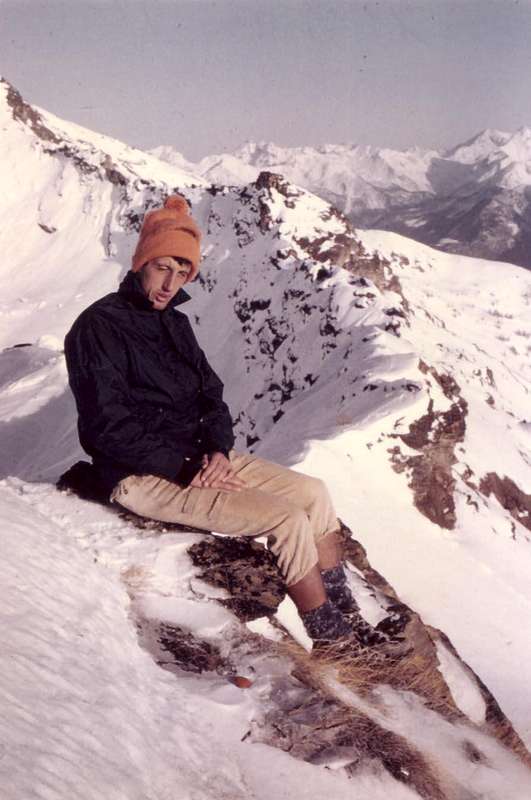
" ... Meditating, going & resting ... ", by Ilario Antonio Garzotto 1969 & emilius 2004
 |
 |
 |
Dal Comune di Saint Christophe, subito ad Ovest della Città d'Aosta, raggiungere con la Strada Municipale in asfalto il Villaggetto di Parléaz oppure di Parleyaz (1.274 m; d'inverno oppure con neve bisogna parcheggiare appena prima della breve discesa protetta da ringhiera in ferro verso il villaggio). Da qui, attraversando il fondovallone, la strada migliora in ampiezza e con più comodi tornanti, salire fino al Villaggio di Blavy (1.475 m), sito in splendida e panoramica distesa prativa al limite del bosco. Nota: Qui si può arrivare con vari antichi sentieri e vecchie mulattiere partendo dal Comune di St. Christophe o da Senin, Sorreley oppure, più ad Ovest, da Aosta-Porossan. Inoltre si può, iniziando da Parléaz, salire con il sentiero non numerato che, partendo subito dietro la Cappella di Santa Margherita, risale la Comba ed, attraversato il Torrent de Pareylaz, raggiunge Blavy. Altrimenti, escludendo quest'ultimo villaggio, continuare per mezzo del medesimo fino all'Alpeggio abbandonato di Varbre (1.667 m), appena sotto la poderale per le duplici Alpi di Viou, dove si ricongiunge con quello n° 105 che parte addirittura da Porossan-Serod e, dopo il Villaggio di Blavy, diventa n° 105/25 ex 1A. Da Varbre proseguire per breve tempo seguendo il torrente allo interno della foresta fino ad incontrare la strada poderane a quota 1.962 metri; da questo punto, abbandonando ad oriente la medesima, si deve proseguire senza alcun sentiero seguendo un pò quella che é la linea di confine tra i Comuni di Roisan (Ovest) ed Aosta. Procedendo, non senza difficoltà, verso Nord in una zona sconvolta della foresta si raggiunge l'altitudine di 2218 metri, dove la medesima termina alla base di una grande pietraia in una conchetta. Qui ed alla base della piccola Parete Sudovest la medesima si sdoppia inviando un ramo a sinistra parallelamente alla parete ed un altra verso destra in direzione del Versante Sud-sudest e quasi contro la Cresta Ovest-nordovest della Becca di Viou. Da questo punto esiston tre differenti possibilità di salita alla soprastante Becca di Blavy:
A) - salire verso sinistra, tra radi alberi, lungo l'abbastanza ripida pietraia raggiungendo il Colle Occidentale di Roisan (2.495 m) e con la facile Cresta Ovest-nordovest in Vetta.
B) - utilizzare il versante opposto, più o meno con le stesse caratteristiche, e, doppiando ad Est la piccola parete raggiungere la base rocciosa dell'inclinato Versante Sudest; superare una fascia erbosa-rocciosa raggiungendo abbastanza facilmente la Cima. Oppure allargando il giro più ad Est arrivare al Colle Orientale di Blavy (2.515 m) e concludere con la facile Cresta Est-sudest (questi itinerari sono da valutare in EE/F+; 1h'00 dalla base; 2h'15/2h'45 dall'incrocio con la poderale 4h'00/4h'00 dal Villaggio di Parléaz).
C) - raggiunta la base della Parete Sudovest, salire con diverse possibilità affrontando una serie di passaggi con varie difficoltà e in relazione del punto di attacco (più in alto a sinistra, medio o più in basso in diagonale dalla destra); la stessa offre una mezza dozzina di soluzioni su belle placche di roccia purtroppo alternate a cengie spesso con erba. Calcolare da due a cinque tiri di corda secondo lia prescelta e tenere ben presente che le condizioni di neve o ghiaccio aumentano notevolmente sia le difficoltà che i tempi di percorrenza. Ciò vale anche per gli avvicinamenti dove, in presenza di neve, il medesimo diventa molto più faticoso anche perché non sempre adattabile alle Racchette da neve. Discesa: per la discesa conviene attraversare verso la larga sella o Colle di Roisan (2.495 metri circa) e raggiungere la Becca di Roisan (2.546 m); da questa, oppure dalla sella, scendere direttamente tra grandi blocchi e, flettendo leggermente a Sudest, raggiungere l'itinerario precedente. In caso di neve alta meglio continuare lungo la poderale.
Campings
Remember that free camping is forbidden (except for emergency reasons, over 2.500m, from darkness until dawn).Mountain Condition
- Meteo: you can find all the needed informations at the official site of the Valle d'Aosta Region:
- Valle d'Aosta Meteo
Books and Maps
BOOKS:
- "Guida della Valpelline" de l'Abbè Joseph-Marie Henry - Societè Editrice Valdotaine 1925 II Edition e Collana Reprint Musumeci (1986).
- "Guida dei Monti d'Italia - Alpi Pennine (Vol. 2)" di Gino Buscaini - Club Alpino Italiano/Turing Club Italiano, Luglio 1970 (In Italian).
- "80 itinerari di Escursionismo Alpinismo e Sci Alpinismo in Valle d'Aosta", di Osvaldo Cardellina, Ed. Musumeci, Giugno 1977 (in Italian); seconda Ed. Luglio 1981; terza Ed. Luglio 1984; (in French), prima Ed. Febbraio 1978; seconda Ed. Marzo 1980.
- "Dove andiamo in montagna? in Valle d'Aosta" di Domenico Caresio Edit. Tipografia Ferraro Ivrea, Marzo 1996.
- "Ascensioni 1964-1969" Diario Alpinistico di Ilario Antonio Garzotto (unpublished).
- "Diari Alpinistici" di Osvaldo Cardellina e Indice Generale accompagnato da Schedario Relazioni Ascensioni 1964-2019 (unpublished).
 |
 |
 |
MAPS:
- Kompass "Breuil/Cervinia-Zermatt" Carta turistica 1:50.000.
- I.G.C. Istituto Geografico Centrale "La Valpelline" (carta n° 115) Map1:30.000.
- I.G.M. Istituto Geografico Militare - Map1:25.000.
- L'Escursionista Ed. Rimini "Gran San Bernardo-Ollomont" (carta n° 5) 1: 25.000.
Important Information
- REGIONE AUTONOMA VALLE D'AOSTA the official site.
- FONDAZIONE MONTAGNA SICURA Villa Cameron, località Villard de la Palud n° 1 Courmayeur (AO) Tel: 39 0165 897602 - Fax: 39 0165 897647.
- SOCIETA' DELLE GUIDE DELLA VALPELLINE Etroubles-Strada Nazionale, n° 13 - Tel +39 0165 78559 - Valpelline-Loc Capoluogo, n° 1 - Tel +39 0165 713502 (AO) Italia.
- A.I.NE.VA. (Associazione Interregionale Neve e Valanghe).
Useful numbers
- Protezione Civile Valdostana località Aeroporto n° 7/A Saint Christophe (Ao) Tel. 0165-238222.
- Bollettino Valanghe Tel. 0165-776300.
- Bollettino Meteo Tel. 0165-44113.
- Unità Operativa di Soccorso Sanitario Tel. 118.