-
 16324 Hits
-
 79.04% Score
-
 10 Votes
|
|
Mountain/Rock |
|---|---|
|
|
46.29571°N / 9.67896°E |
|
|
11131 ft / 3393 m |
|
|
Overview
Higest point of all the
It's situated at the head of Val del Forno (CH), Val dell'Albigna (CH) and Valle di Zocca (IT).
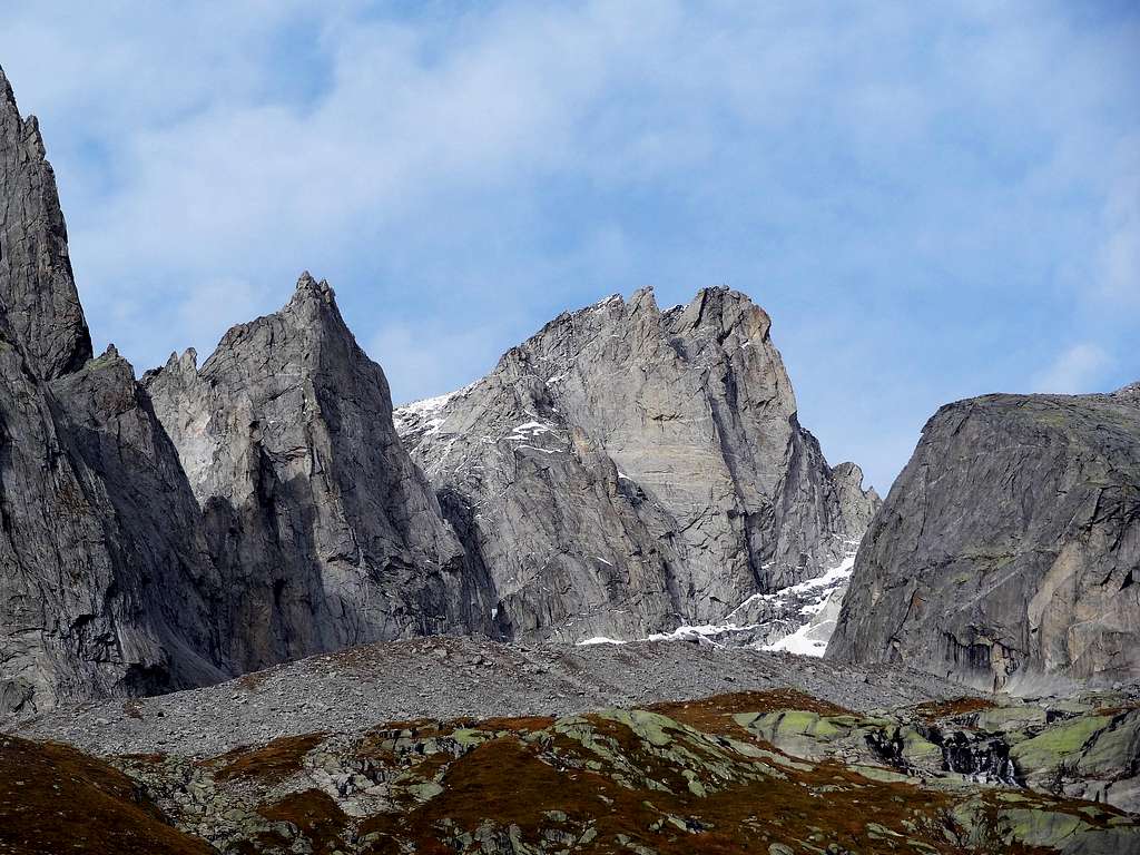
It has a big rocky wall on the south side, not very impressive because it looks subjected to the neighbour Punta Allievi and Punta Rasica, but higher.
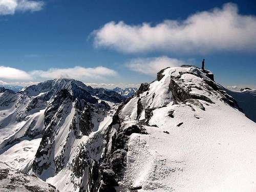
The north side, less steepy, is basicly composed by two glaciers shared by a ridge that connect Cima di Castello to the northern Cima del Cantun.
So there are in total four sides: the south rock wall in Italy, the west and south-west on two section of the main glacier of Albigna, and the east on the upper glacier of Forno.
It's a quite simple climbed mountain, and it's suggested for the beautiful view to all this region.
Getting there
From Swiss:Basecamps for all the swiss routes are the ref. Albigna C.A.S. (2336m) near the lake of Albigna, and the ref. Forno C.A.S. (2574m) on the east side of the homonymous glacier.
Both reachable from the main Val Bregaglia on easy path. The italian and swiss side (Val del Forno), are belonging by a pass called Colle Lurani (3215m)
From Italy:
You must drive along the SS38 starting from Milano or from Sondrio.
Just few km before Sondrio (coming from Milan), on the right side (N) of Adda river, the small village of Ardenno is the starting point for the road 404 that leads to S.Martino in Val Masino.
Once arrived in S.Martino follow the road on the right (East - Val di Mello)and try to find a car parking site (best one is near the "Baita del Gigiat" (1000m).
Here you must start walking following the marks for Refuge Allievi (2387m - about 3.30 hours walk - 1400m difference in elevation): this is the best starting point for all the climbs in this area.
As you can check on the related page, this refuge is placed on the Sentiero Roma, and many people use stop here for a stopping place; from east (bivouac Manzi -2/3 hours), or from west (Bivouac Molteni/Valsecchi - 3/4 hours).
Coming here from swiss Valle Albigna is a long and not so easy walk that requires the crossing of the Passo di Zocca (2749m) along the Albigna glacier (Val Albigna)
Best Map is Swiss SLK 1:25000 Nr. 1296 "Sciora".
History and Routes
History:-First ascent : W.Freshfield/C.Tucker 31/07/1866
-First east flank ascent : A.Rydzewski/Klucker 12/06/1893
-First south wall ascent : Lurani/F.Allievi 13/08/1896
Major Routes
-WEST RIDGE (normal route):Reach the boarder-ridge placed on the west side of Punta Allievi(see P.Allievi page), walk up easily on the north side ice slope avoiding crevasses untill the snow dome summit(4 hours F+).
-SOUTH FLANK (via Baroni):From ref.Allievi walk up to Colle Lurani direction(north-east)and going along the side of Punta Allievi.
Than take the first couloir after this mountain on your left and climb it for all the length till reach the normal route.(difficultyes in relation of the ice condition of the couloir.5 hours).
-EAST FLANK (via Klucker):From ref.Allievi walk up and go across the Colle Lurani.
From the pass climb directly the rocks of the west spur of Cima di Castello(5 hours AD/AD+).
-NORTH RIDGE:From ref. Forno walk across the glacier untill the foot of Cima del Cantone. Take the icey couloir that bring up to the north ridge, and than follow it to the top of it.(5 hours).
-NORTH-WEST FLANK (Swiss normal):From Albigna hut follow the not easy path on the east side of the lake(blu spots),reach the glacier of Castel north and than go through the pass below the summit that connect to the Italian normal route.(4/5 hours F+).
-SOUTH WALL:(Via Diretta)(Corti,Osio 30/08/1969)(V°+/A1)
-SOUTH WALL:(Via della Speranza)(Rogers,Roper 08/08/1969)(VI°/A3)
Refuges
Ref. AlbignaFrom cable car station of Pranzaira(30 min. E).90 places,open summer.
From S.Martino Val Masino(3/4 hours E).100 places,open summer.


