-
 6153 Hits
-
 0% Score
-
 0 Votes
|
|
Route |
|---|---|
|
|
46.42162°N / 14.23008°E |
|
|
Download GPX » View Route on Map |
|
|
Hiking, Scrambling |
|
|
Summer, Fall |
|
|
Half a day |
|
|
Walk-up and pathless scree descent |
|
|
Introduction
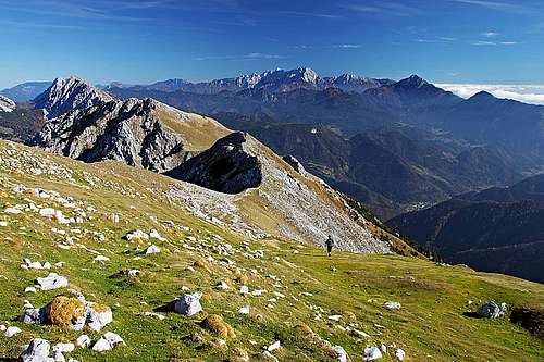
This is one of the normal routes on Begunjščica, not the shortest, but in my view the most beautiful. What is great with this route is the descent option. While the ascent starts gently, warming you up by hiking around the mountain, and then steeply gaining the main ridge and the summit, the descent uses the longest scree field. So, you just "fall down" to the trailhead, without much effort.
General Information
Difficulty (grading is on the Swiss Hiking Scale): T3. It's mostly T2, but a few sections of "Kalvarija" ascent are steep and require sure-footedness, and also on the descent we need to be careful. On key sections the trail is well marked, but the descent is not marked at all, so you must carefully choose the right passages - stick to this description!
Altitude to overcome: 1025 m (from 1050 m to 2060 m).
Time for ascent: 3 h.
Time for descent: 1 h.
Best season: Summer and autumn months, normally from June till November (or first snow). The descent route is also a very popular ski tour, but in that case you should also ascend directly (by Šentanski plaz - ravine), which is then not this route any more.
Best hour: Any time of the day. The ascent slopes are east and south oriented, the descent scree goes towards the north.
Gear: Good shoes and poles. Battery, or at least light from filled enough phone.
Maps: Online Open Street Map is ok.
Hut: On Prevala (saddle), there's a private hut, open in hiking season. There you can get food and drink, otherwise there's no water along the route.
Getting There
The starting point is on the big, free parking place at the southern entry of Ljubelj/Loibl tunnel. You reach there by car, taking the main road Ljubljana - Klagenfurt (or vice versa). There's also a daily bus connection.
Parking place coordinates: 46.431680, 14.259926
Route Description
Ascent


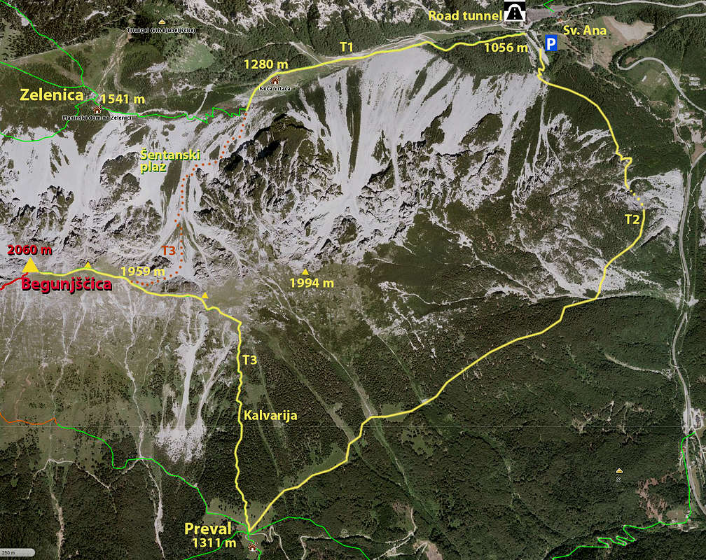
From the parking place you start ascending southwards (not by the marked path westwards, towards Zelenica!). This path (Born trail) is not marked, but is well beaten and clearly seen. From the end of parking place you just continue in the same direction and keep up, until the well beaten path starts crossing the slopes horizontally. It enters the forrest, all the time going around the mountain. On a few places nice views open left - down into the valley and on the screes and ridge of Košuta, on the other side of the valley. Then you reach the first tunnel. It's quite long, so some additional light is useful, but it goes (carefully) also without it. After the tunnels, the trail continues horizontally, more and more exposed, but panoramic and very broad and easy. After the last scree field you finally enter dense woods again and then till the saddle of Prevala, 1310 m, the path gently ascends all the time. Good 1 hour till there.
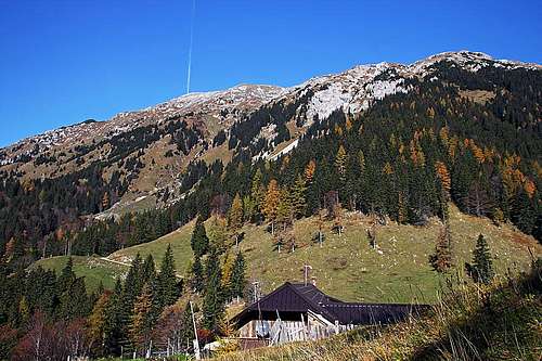
On Prevala saddle, you start following the marked route towards the summit - follow inscriptions. It starts steeply uphills, just opposite the house. Then it goes in many switchbacks through the woods. Almost half of altitude from the saddle we gain by such a shady trail, then clearings start and slopes become intermitted with rocks. That part of the trail is called Kalvarija. It's steep, on some places we need even to pull up a bit with hands.

When we exit on grassy slopes, we are already high below Vrtača, the easternmost high summit of Begunjščica ridge. The trail crosses the slopes left (towards the NW) and soon gains a shallow valley, leading to the main ridge. Leave it to the right and keep following the marks in the same direction. They soon bring you on the main ridge, 1970 m, where horizons open.
Till the next notch, the main ridge is quite narrow, the broad notch is where Šentanski plaz (ravine) exits, 1959 m. Remember that place, there you'll return, descending on the northern side!
Towards the summit we continue along the main ridge. The trail detours another ridge bump and then we already see the summit just in front of us. It's some 50 more meters to ascend.
Descent
You can of course continue traversing the mountain and descend by the marked path to Roblekov dom (mountain hut, 1645 m) and then by the marked path back over Zelenica. But that's much longer.
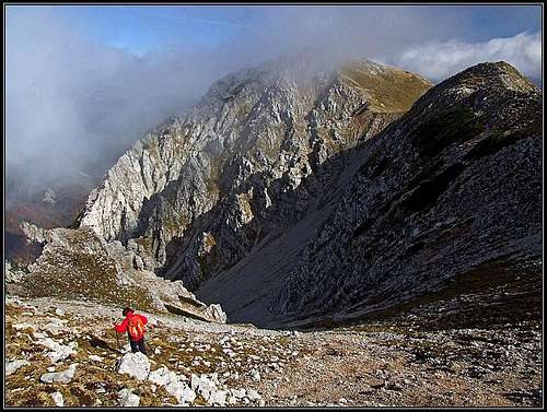
The here recommended descent goes back by the main ridge towards the east, until on the broad notch (1959 m) the passage towards the north opens. The upper slope is still steep, but soon below we already see the long scree fields.
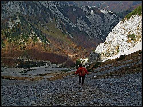
Above, you best descend a bit on the right side, over grassy slopes, then you just follow the softest scree fields, always keeping right. After descending some good 50 m, really enjoyable screes begin and you just slide down. But that field doesn't end nicely. When gravel becomes less soft, cross the grassy slopes on the left and switch to the left scree slope. That one is nice again for another 200 m of altitude. Then the important point is, not to go down by screes just to the trail, which we see below. Cross again to the right (weak trail). There's below steep rocky walls another fine scree field. Slide down by it and repeat crossing to the right once again. In short, by crossing right and sliding down, try to get as low as possible. If you succeed, you will get down in the valley just by the middle station of ex chair-lift (Koča Vrtača, 1280 m). From there you need to walk down by the usual trail only 230 more meters. Normally, from the summit you need for descent only 1 hour.
History of this page
- Dec 28th, 2004: Page created by Bor.
- Sep 28th, 2019: Ownership changed. The following page changes were done:
- description completely changed,
- map and GPX track added,
- images added and visual design updated.


