Geez, a week before I was hiking in rain and fog to do
Lemei Rock(click here for TR) and couldn't see much of anything all day, however, things have a way of balancing out and I was rewarded with a hike up Mt. Aix on a perfect autumn day. Amazing that both these hikes were one week apart.
![]()
I found myself at the TH about 8:30 a.m.Saturday morning and noticed two other vehicles already parked there. By the time I got the day pack re-organized (probably for the third time) I was ready to go. So at about ten till nine, I headed out. I had three friends who I knew would most likely join me but I figured that with my slow pace, a head start might be wise so I wouldn't slow them down. Besides, I had no clue as what time they might show up so I made the decision to strike out alone. About 100 yards up the trail, I managed to make a hive of bees unhappy as I went unknowingly by them and soon received the wrath of three of its members (ouch). I moved fast enough to keep from allowing a few more of them nasty things to get me.
Well, that got my adrenalin going but I had to stop and tend to the smitten spots cause they were hurting a bit. After heading up to the first switchback (and there are many), I began to get back to normal and just did my slow but steady pace and worked my way up the hill. Met a guy from Redmond named Pat, who I had met on a peak the year before and I was to see him later on near the summit of Aix. There are a lot of switchbacks but the neat thing is that the higher you get, the better the view of Mt. Rainer. At first you just see the tip of it over a ridge that lies between but eventually, all of this magnificient mountain comes into view. I could see that this would be a hot thirsty hike in summer so I felt good about doing it on a nice fall day.
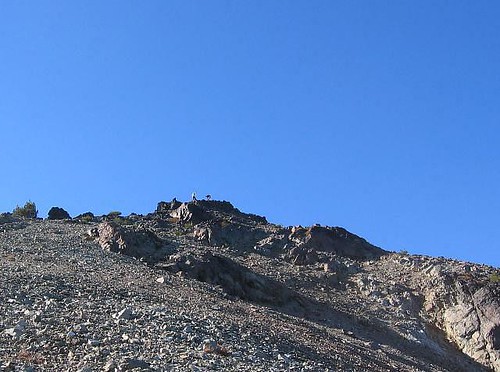
It took me almost three hours to get to the ridge at seven thousand feet, a gain of close to 3500 feet from the TH. A small sign points the way to Mt. Aix and Nelson Peak so I did a traverse that heads toward Mt. Aix, which you can't see at all until you round the corner of a hill that keeps it from your view. As you round the corner of this hill,
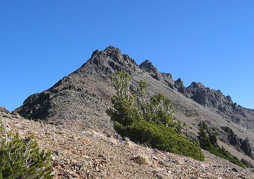
Mt. Aix comes into view and so does the fact that you have to drop about 250 feet to a saddle before you start re-gaining the elevation. Bummer. I quickly dropped the 250 feet and then stopped to pull out a couple trail reports I had with me.
Both recommended the eastern approach which involved a long sidehill along a path on the south side of Mt. Aix to get to a
use trail that is more of a class 2 effort on the east side. I opted for this one and found out later on that I wished I had taken the
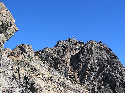
more direct west side route. I kept looking back to see if I could see the three others I hoped were coming but when I couldn't see them I went ahead and did the east route. I found the use trail and it was a pretty easy path with just a couple little scramble spots. It was the route that the lookouts had used years before and was a fairly simple way to the top. It led around to the northeast side and from there descended a bit to a flat spot before it headed up to the
flat summit. I met three people, two men and a woman along with their three dogs on the route as they descended and I went up and tagged the summit . Pat was up there looking at the register which was just a bunch of bits of paper stuffed in a white poly tube. I snapped a few pics and decided to head back down and grab my lunch so I left Pat and dropped back down a bit. As Pat came down he mentioned that he saw three people heading along the trail below and that they might be the ones II had been looking for. We chatted for a few more minutes and I headed back towards the summit where two of the group quickly arrived by going up the west side route. Where was the third? (I found out she had elected to cool her heels a bit below the summit (boots were killing her) and have her lunch).
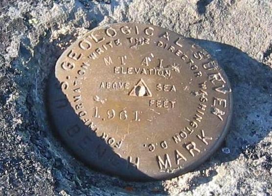
I had to drop back down and then climb back up the lookout trail again but this time I had two friends to greet up there. So for the second time, I stepped back up on the summit but this time I stayed a lot longer. The two were SP member Tazz from Portland and Brad from Redmond Washington. I found the benchmark I had missed the first time (thanks to Tazz) and snapped a few more pics of the same scenery that I had snapped pictures of before. Unfortunately the haze made most of them disappointing but I'll post the best of them at the bottom of this page so those with dial up won't have to wait forever for this TR to develop.
I went down the scramble route and wished I had gone up it in the first place. It was a lot shorter than taking the traverse but for those who don't do a lot of scrambling, the eastern route would be the way to go since its easier although much longer. The trip down was interesting as I had one bout of leg cramps which was solved by a drink with some electrolyte in it and another member of our 4some had boot problems and the last three miles were a real sufferfest for her. I figure that her boots are now in the dumpster outside of her home. All in all, a great day and the second part was a lot more enjoyable with the other three along. We parted ways at the TH as they were going to head back to our NWHiker camp and I headed for the little cafe in Goose Prairie, run by a friend of mine.
Stats: 13 miles , elevation gain 4500+ and four and a half hours up and not as long down (I forgot to check the time)
This hike has a lot that makes it worthwhile. Great views, a nice scramble, an old lookout site, mountain goats are often around,
excellent conditioner if you consider the 12-13 miles roundtrip and almost 5000 feet of elevation gain. This one is a winner. I'd like to do it again andcombine it with Nelson Peak.
Here's a few pics
Tazz and Brad wave from the top
The west side route goes up to the summit
Brad snaps off a few pics from the summit as I head down the west route
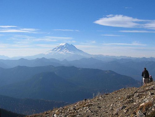
As we head down, rounding the shoulder of a nameless hill, Rainier shows off its majesty.
There is a benchmark on a rock on the west side of the summit area


Comments
Post a Comment