
-
 35079 Hits
-
 84.27% Score
-
 18 Votes
|
|
Mountain/Rock |
|---|---|
|
|
46.34983°N / 112.9796°W |
|
|
Powell |
|
|
Hiking |
|
|
Summer, Fall |
|
|
10168 ft / 3099 m |
|
|
Overview
The Flint Creek Range is a small but high mountain Range west of Deer Lodge and Interstate 90 in Western Montana. It can be considered a northern offshoot of the Pintler Range further south, separated by it a narrow valley traversed by Montana Highway 1 on its way west from the town of Anaconda towards Georgetown Lake. Phillipsburg and its namesake valley lie to the west of the range, with the John Long Mountains the next range over. I-90 makes a left-hand turn to mark the northern boundaries of the range along its way towards Missoula and towards Idaho.
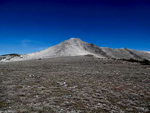 Mt. Powell - South Face Mt. Powell - South Face |
|---|
Most of its high peaks of the Flint Creek Range are clustered in the center of the center, but an off-shooting ridge east contains Mt. Powell, the Range Highpoint, a peak with over 3,700’ of prominence, and the County Highpoint of its namesake county as well. The peak, like many other landmarks out west and including its namesake county (or vice versa), is likely named after famed explorer John Wesley Powell.
 Nearby Deer Lodge Mtn Nearby Deer Lodge Mtn |
|---|
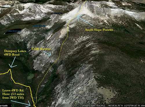
Mt. Powell is quite prominent as you drive I-90 near Deer Lodge, and the range seems dry from the bare sagebrush flats of the lower valley. Drive further in, however, and you’ll find a lush playground of evergreens, meadows, and numerous precious little blue lakes dotting the irregular landscape between oblong ridges and summits. One can access these peaks via long forest roads that may be bumpy but are ultimately passable for a reasonable passenger car; this includes the 2WD trailhead for Powell along the Dempsey Lakes Road, which will put you in a good position to approach the peak.
More ambitious drivers with 4WD can attempt the rocky and bumpy road all the way up towards the Dempsey Lakes and start their ascent from there, although a recommended route (and the one we took) started well short of the lakes themselves and the terminus of the 4WD road.
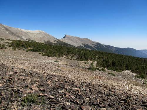
 Vast plateau south of Powell Vast plateau south of Powell |
|---|
This is an area rich in history and scenery. Nearby Deer Lodge’s past and present are driven by the cattle industry, and a National Historic Park at an old ranch bears witness to the area's often ruthless past. Though Lewis and Clark did not pass through the immediate area, nearby ranges feature historic passes and monuments that hundreds of years ago saw the first tentative steps of our westward expansion towards the Pacific.
There is ample evidence of human activity in the area too, starting with the 4WD roads that can take you fairly close to the mountain. The area has a rich mining history, and the nearby Anaconda Smokestack, visible from the range, is possibly the largest structure of its kind in the world. You will likely pass by the Montana State Prison on your way to the peak, so be wary of hitchhikers, but hopefully, the company you meet in the mountains are other hikers, fishers, and recreationists.
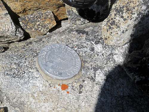 Summit Benchmark Summit Benchmark |
|---|
Getting There
I used Cedron Jones’ directions in Peakbagging Montana to arrive at the trailhead and they worked well:
Take Exit 195 off of I-90 between the towns of Deer Lodge and Anaconda. Drive west one mile to a T intersection. Take a right (north) and drive 0.7 miles and take a left (west) onto gravel Quinlan Road. The road will travel west for 3.5 miles (with a dogleg south then west again in the middle of this stretch). At the end of the 3.5 miles, watch for a sharp right turn down a smaller road; it can be hard to see coming from the east. Take this hard right turn uphill and travel northeast for a mile to a Y intersection. Branch left and after 100 yards branch right up a hill. You are now on FS 8507.
Stay on this road, traversing by the Montana State Prison, as it rounds out the foothills and travels 7.5 miles into the mountains to the 2WD trailhead. It can be rocky and narrow at points, but my Camry was able to make it. If you’re driving a sedan to make sure you take the time to remove any larger rocks from the middle of the road to prevent from bottoming out as my poor little Camry did. Several sandy sections of this road near the Prison area may not be pleasant to drive in wet conditions.
There is another road (FS 5149) that accesses Powell from the north as well, but per Cedron’s guidebook is fairly rough going. The wide and unsigned gravel roads along the benches can be a little confusing, but having either a DeLorme or Benchmark Montana Atlas with you will not hurt. I got a little sidetracked on some different roads on the drive out, but was able to find the frontage road lining the interstate without too much difficulty and hopped on I-90 a few miles south of where I had exited the highway earlier that morning.
Route
There are many ways of gaining Mt. Powell’s summit. Cohp.org has some excellent trip reports, most of which see the hiker walk or drive the jeep trail all the way to Dempsey Lakes, and ascend the mountain from the west. These reports indicate bushwhacking, deadfall, slippery boulders and sidehilling…none too pleasant. You can also loop in Deer Lodge Mountain to the east along with Powell on the ascent or descent, though the connecting ridge from Deer Lodge Mountain southeast to the road is further east from the standard trailhead. Cedron’s guidebook opines Deer Lodge Mountain on the descent, and apparently the traverse between the two peaks is quite pleasant. His ascent route avoids the bushwhacking, cliffs and scree coming from the Dempsey Lakes, however, and though it requires some cross-country route finding through open forest, as promised by the guidebook we found it to be a very pleasant ascent.
 South Slopes Route South Slopes Route |
|---|
Our ascent goes up Powell’s southern slopes. Follow the ORV road from the trailhead for 3.5 miles as it contours around the south of Mt. Powell. At 3.5 miles you’re close to due south of the peak. The ATV road crosses a creek. Take a right off the road before you cross that creek, crossing a small stream nearby.
 Meadow along Dempsey Lakes Rd. Meadow along Dempsey Lakes Rd. |
 Views near beginning of XC acsent Views near beginning of XC acsent |
 Rocky Spur (avoidable if you contour right) Rocky Spur (avoidable if you contour right) |
 Some optional scrambling that's avoidable Some optional scrambling that's avoidable |
 View as you clear the trees View as you clear the trees |
|---|
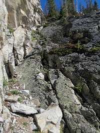
You now want to head north through a U shaped drainage south of the upper slopes of Powell. You traverse the forest and some brush at first, down low, but it’s not too bad. Going up, you want to not just avoid the low center of the U drainage, which is supposedly choked with deadfall, but also the cliffy ridge crest on the left side (west), instead following game trails midway between the crest and the drainage, essentially sidehilling up the left side of the U. We followed closer to the crest on the way up and had encountered some scrambling section, including a rocky rampart over a small cliff that involved some class 2-3 moves through a small cliff band, and some brush choked chimneys. It can be climbed, but it can also be avoided if you stay lower, and contour around these cliffs below and to their right (west).
 Looking back before entering the plateau Looking back before entering the plateau |
 easy going through open forest easy going through open forest |
 views along the plateau walk views along the plateau walk |
 final 1000' up Powell final 1000' up Powell |
 Deer Lodge Mtn to the east Deer Lodge Mtn to the east |
|---|
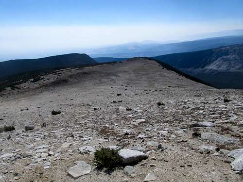
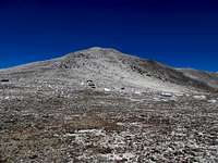
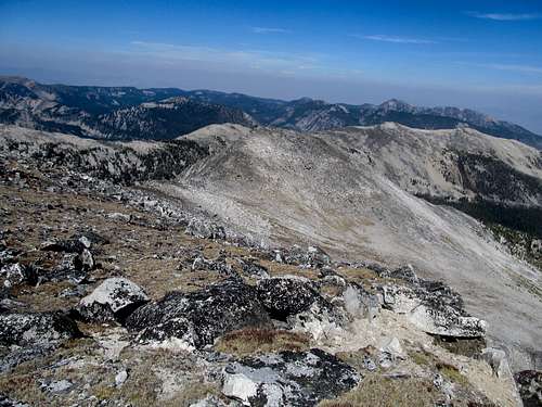
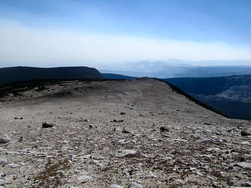
Eventually you’ll reach the top of the U, a plateau around 8,600 ft. Here you slowly cross timberline and the high pointy summit of Powell is obvious ahead. The distances are deceiving though, as it’ll take you awhile to traverse the long flat bench to the base of the peak. You are still a thousand feet below the summit. Scramble up the easy and mostly solid boulders up to the summit, and marvel in the views.
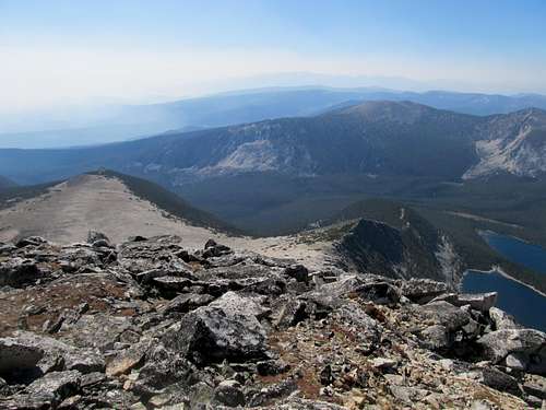
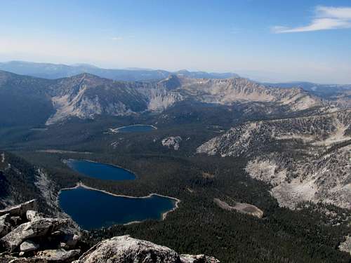
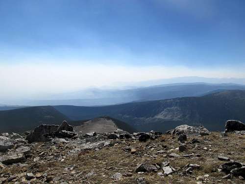
Views
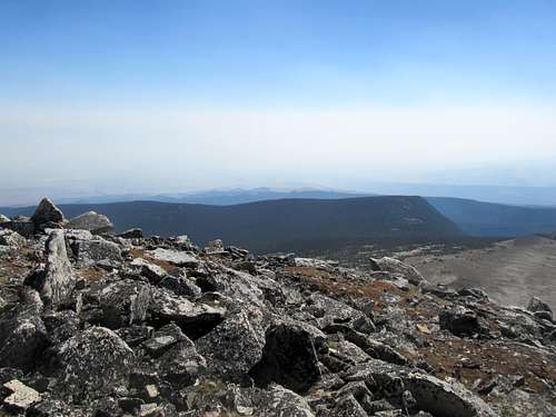
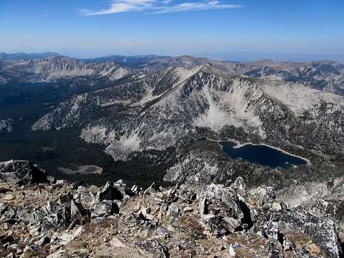
It was clear enough where we could see vague outlines of the surrounding ranges, including the Pioneers and Pintlers to the south. A clearer day would conceivably yield further views, perhaps the Highland Mountain south of Butte, the John Long Range to the west, and the peaks in the Scapegoat Wilderness to the north.
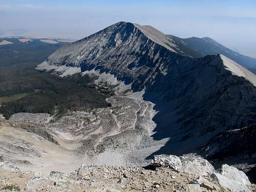
The interior of the Flint Creek Range is amazing in and of itself though, with crystal blue lakes dotting the foreground and the sheer talus cliffs of "the Crater" dominating the view towards neighboring Deer Lodge Mountain.
 |
 |
|---|---|
 |
 |
 |
 |
 |
 |
Red Tape
The peak is located in Deerlodge National Forest. No Fees are required to visit the area. This is bear country, black bears definitely and grizzlies possibly, so bring bear spray and be wary.
When to Climb
Ascents are best made in the summer and early fall. The roads going into Dempsey Lakes are not maintained by the Forest Service in the winter and spring, so you will likely have a long approach, probably starting near the State Prison. I'd imagine the U-shaped valley lining the south of Powell might see some avalanche danger under certain circumstances as well.
Camping
Camp anywhere. You can camp at the Dempsey Lakes 2WD trailhead, or further up at the lakes if you want. Further south you can find the official USFS Racetrack Campground. There seems to be little red tape in this area, and campgrounds are free of charge.
For those more inclined to a mattress and a shower, nearby Deer Lodge and Anaconda have plenty of motels, restaurants and bars (though they all seem to shut down early on a Sunday).