
-
 21145 Hits
-
 73.65% Score
-
 4 Votes
|
|
Route |
|---|---|
|
|
40.05400°N / 105.646°W |
|
|
Scrambling |
|
|
Most of a day |
|
|
Class 3 |
|
|
Approach
Niwot Ridge
Elevation:13,023'
Rank: Unranked
Range: Front
Lat/Lon: 40.05522, -105.63525
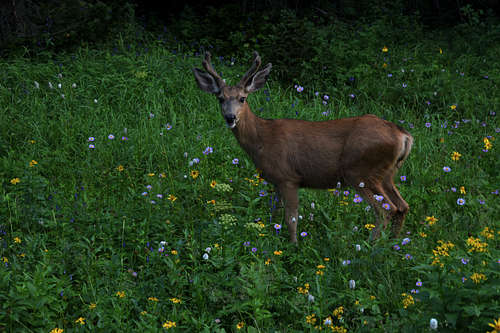
Brainard Lake is surrounded by subalpine forest set in a glacially-carved valley. The peaks of the Continental Divide loom to the west. With a wide variety of year-round outdoor recreation opportunities available, Brainard Lake Recreation Area (BLRA) is the most popular destination on the Boulder Ranger District. Hiking trails to the west of the BLRA enter into the Indian Peaks Wilderness. Visitors that hike trails leading west from the Long Lake or Mitchell Lake Trailhead, are responsible for following all Indian Peaks Wilderness Regulations and permit requirements. Recreational shooting closures exist in this area. Hunting is allowed in accordance with regulations set by the Colorado Parks & Wildlife. Moose may be present in the area. Be considerate of all wildlife. Approaching closely can be threatening to the wildlife and their reactions are dangerously unpredictable.
 |
 |
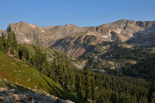 |
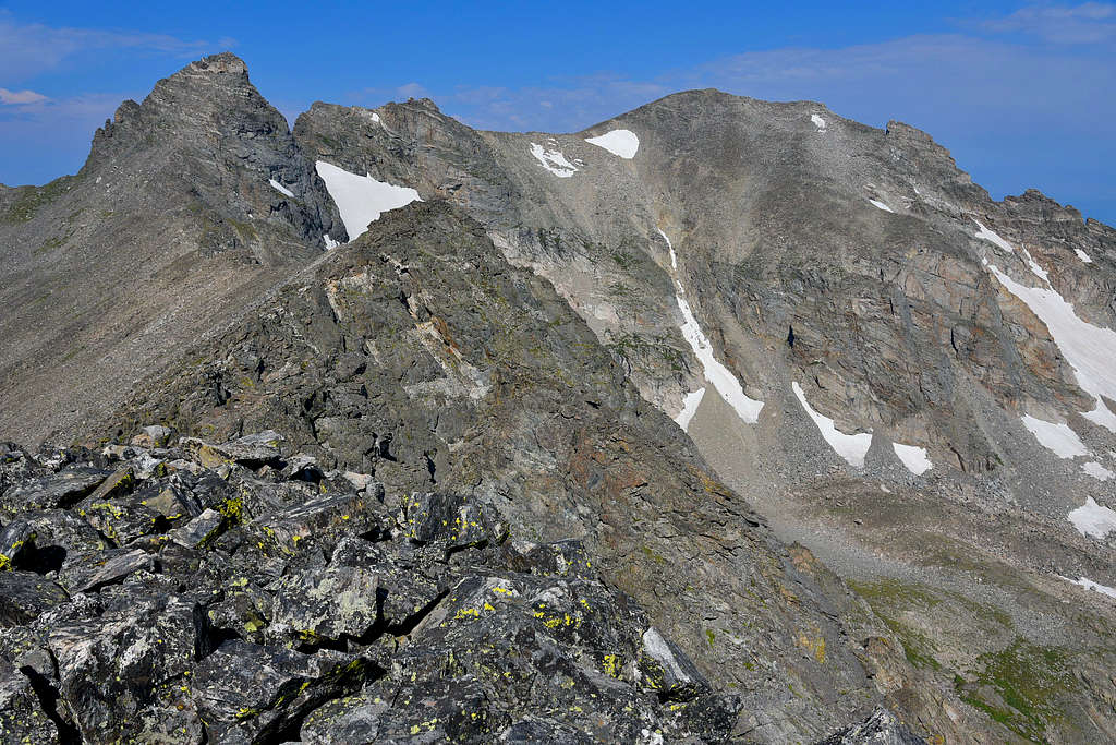
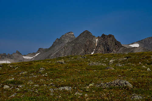
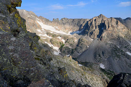
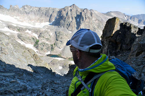
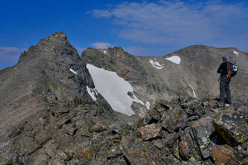
From the Long Lake trailhead, take the Jean Lunning trail several hundred meters to the unsigned Niwot Ridge trail. Head south on this trail and ascend through treeline to Niwot ridge. At first this is a broad grassy ridgeline. Be careful to stay on the trail as it passes through an alpine ecology research area containing many sensitive experiments. Continue west several miles along the broad grassy ridgeline until it becomes a narrow, craggy ridgeline. Be sure to stay on the north side of this ridge because 1) the best routes are along the north side and 2) the south side is in the Boulder Watershed and trespassers will be fined $1000.
Route Description
 |
 |
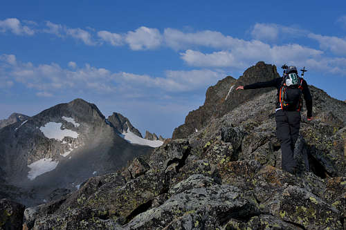 |
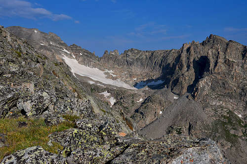
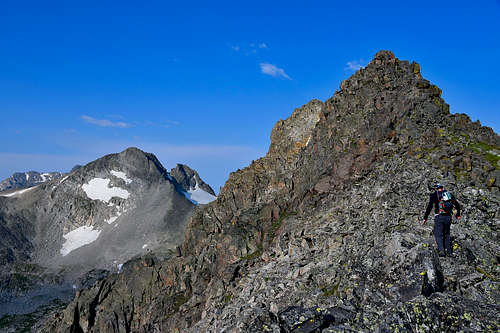
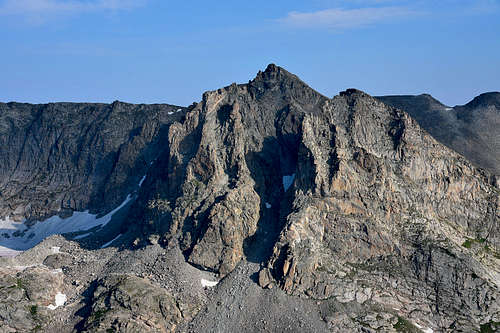
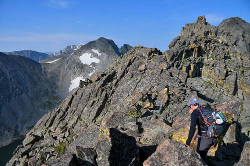
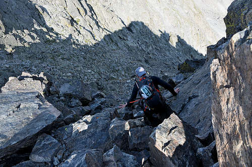
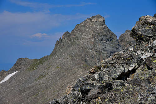
Once along the narrow, craggy ridgeline there will be no trail. To avoid class 4+ climbing one must stay to the north of the ridgeline, except when it seems necessary to attain the ridge. At first the route continues along a series of grassy ledges. Farther on the route crosses several steep, scree-filled gullies as well as steep rock faces. It is important to be careful and patient while finding a route through here. The high point of the ridgeline before Navajo is Niwot Peak. This can be ascended up a small gully and then some large talus, briefly along the south side of the ridge. From Niwot Peak it is easy to descend into the saddle above Airplane gully. Now one must ascend a class 2 talus slope to the summit block. The preferred route to the summit skirts below the summit block to the north and ascends it via a blocky class 3 trail. An altenate and more direct route is to ascend a small class 3 chimney on the south east side of the summit block just above the class 2 slope. The easiest descent can be made through Airplane Gully, a description of which is found on the main Navajo page.
 |
 |
 |
 |
 |
 |
Essential Gear
 |
 |
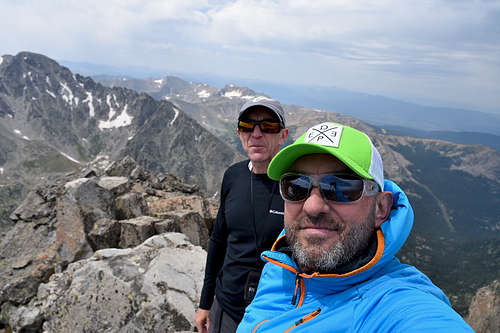 |
Here’s the list in roughly clockwise direction…
- Helmet
2. Food & drink
3. Map & guidebook (he often takes the guidebook info on his phone)
4. Spare clothes (waterproofs, spare warm layer, hat and gloves as a minimum)
5. Rope (usually 35 metres of single rated rope)
6. Harness
7. Protection hardware
8. Bothy shelter
9. First aid kit
10. Abseil tat
11. Compass
12. Suncream (depending on weather)
13. Headtorch & spare batteries
14. Sunglasses (depending on weather)
15. Personal Locator Beacon (Paul currently carries a Garmin InReach Mini)
16. Mobile Phone (not in photo)
Red Tape
The Brainard Gateway Trailhead is located two miles east of Brainard Lake and is the entry point for the Brainard Lake Recreation Area. The trailhead area features a seasonal gate, large parking area, warming hut, bathrooms, fee station and self-service fee area. For road closures, check the Road Status Table. Check the current weather forecast before visiting.
PLEASE NOTE: Visitors that hike trails leading west from the Long Lake or Mitchell Lake Trailheads are responsible for following all Indian Peaks Wilderness permit requirements and regulations including group size, camping and campfire restrictions.
Late-June through mid-October (summer operating season):
- Summer Season Map
- Motor vehicle access is available 24 hours a day
- To protect muddy and snowpacked trails, the Long Lake and Mitchell Lake Trailhead parking areas do not open typically until late June
- A fee applies. A self-service fee station is located beyond the entry booth
- Expect 1-2 hour traffic delays on weekends (there is no bypass route for campers with reservations)
- Camping is allowed at Pawnee Campground (open July through early September).
- Check summer trail conditions before your visit
- See "Restrictions" below for additional regulations
Mid-October through late June (winter season):
- Winter Season Map
- The gate is closed and the area free of charge for winter recreationists
- Park at the Brainard Gateway Trailhead for snowshoe and ski access
- Between November 15 and April 30, dogs are only allowed on the Brainard Lake and Lefthand Park Reservoir Roads
- Check winter trail conditions before your visit
- See "Restrictions" below for additional regulations
Recreational shooting closures exist year round in this area. Hunting is allowed in accordance with regulations set by the Colorado Parks & Wildlife. Moose are present in the area. Be considerate of all wildlife. Approaching closely can be threatening to the wildlife and their reactions are dangerously unpredictable.
At a Glance
|
Operational Hours: |
|
|
Fees: |
Parking at the Brainard Gateway Trailhead is free year round. |
|
Usage: |
Heavy |
|
Restrictions: |
|
|
Closest Towns: |
Ward, Colorado |
|
Water: |
No drinking water |
|
Restroom: |
Practice Leave No Trace principles |
|
Operated By: |
Concessionaire: American Land & Leisure |