|
|
Route |
|---|---|
|
|
15.85302°S / 68.54093°W |
|
|
glacier climb, some ice |
|
|
A few days |
|
|
PD - D (depending on the final ascent) |
|
|
Approach
Organize 4x4 and mules in Sorata (Trekking agencies are near the main square - they also organize porters).From Sorata 4x4 transport (usually Toyota Landcruiser) is available to near Estancia Tusca Jahuira (3600m).
Route Description
Day 1
4x4 transport to near Estancia Tusca Jahuira (3600m). Continue with mules (and mules driver) to
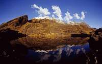
(a) Laguna Chillata (4204m) - nice camp site or
(b) near the abandoned mine of Titisani (you have to carry the rucksacks yourself for the last 30 minutes - mules cannot do the descent from the col nearby).
Day 2
From the mine of Titisani continue southwards on an acceptable trail to Laguna Glaciar (5038m)Day 3
From Laguna Glaciar start towards SE (hard to find the track near Laguna Glaciar).Follow the track up the moraine and stay westward (left hand side) of the glacier (near Point 5462m - you have to cross some meters over the glacier - DAV map).
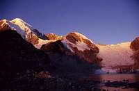
Continue on the glacier (approx. 5600m) - crevasses!! - to the high camp at approx. 5800/5900m (high camp is usually on the plateau between Point 5962m and the summit of Ancohuma.
There are also possible campsites on the moraine (approx. 5400m) and on the glacier 5600m (this place is very windy and cold).
Day 4
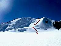
Climb up to the summit via SW ridge and descent via W-face/NW ridge to the High Camp and continue back to Laguna Glaciar.Day 5
Descent to Sorata.Essential Gear
tentsleeping bag
sleeping pad
Goretex jacket
Goretex pants
down jacket
mitts + gloves
double plastic boots
gaitors
ski poles
ice axe
rope
ice screw
crampons
headlamp
stove
food
etc.


