
-
 872 Hits
-
 76.66% Score
-
 7 Votes
|
|
Mountain/Rock |
|---|---|
|
|
37.90064°N / 105.03264°W |
|
|
Pueblo County |
|
|
Hiking, Skiing |
|
|
Spring, Summer, Fall, Winter |
|
|
12200 ft / 3719 m |
|
|
Overview
North Peak
Elevation: 12200 ft / 3719 m
Range: Wet Mountains
County: Pueblo
Nearest Peak: Greenhorn Mountain
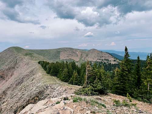
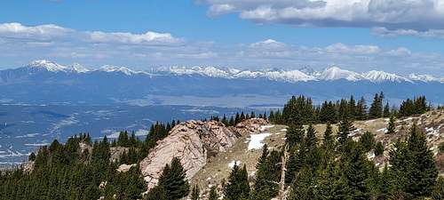
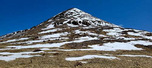
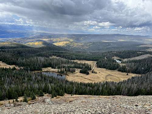
North Peak is a peak in Huerfano, Colorado and has an elevation of 12,200 feet. North Peak is situated nearby to the hamlet Cuerna Verde Park. Peak is second highest in Wet Mountains Range. Usually it’s climb together with Greenhorn Mountain.
|
|
Getting There
|
|
|
Directions:
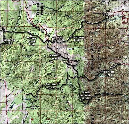
East trailhead is located near the town of Rye, Colorado Southwest of State Highway 165. Head West through the town of Rye on Main Street, then left on Boulder, then left on Graneros road, right on Hunter, then right on Baxter.
Northwest trailhead is located off Forest Service Road # 369. From Rye, Colorado head north on State highway 165 to Ophir Creek Forest Service Road # 360 and go left. Travel on Forest Service Road #360 for 12 miles, then go left on Greenhorn Road/Forest Service Road and travel to the end which is about 17 miles.
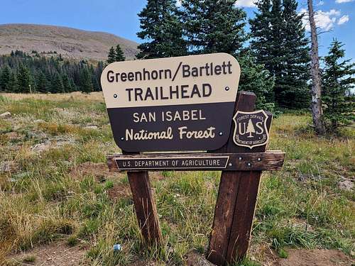
Upper Greenhorn Trail Trailhead:
This is the standard and easiest way to the summit. It is a long drive and involves numerous miles on gravel roads.
From I-25, exit onto Colorado Hwy 165 (exit 74) go west through Colorado City, Rye, San Isabel, and Bishops Castle. At a hairpin turn left onto Forest Service road 400 or Ophir Creek Rd, pass the turn off to the Ophir Creek campground and veering left after 1.25 miles. Finally after 7.5 miles you will come upon a four-way junction. Turn left onto FR403 or Greenhorn Road, travel for an additional 15 miles to the end of the road where there is a parking area. This is the trailhead and there is sign marking the trail.
Lower GreenhornTrail Trailhead:
From I-25, exit onto Colorado Hwy 165 (exit 74) go west through Colorado City for 8 miles to Rye. Instead of veering to the right on Colo 165 go straight into the small town on Main Street which soon turns into Park Rd. From the turn off of Hwy 165 travel for 0.8 miles to a Y in the road veer right onto Cuerna Verde Rd. Heading west and then turning south. After 1.6 miles there will be a small parking lot with a bridge crossing over Greenhorn Creek. This is the trailhead.
|
|
|
Route
Follow route to Greenhorn Mountain!
|
|
|
Red Tape
HISTORY:
Legend has it the Greenhorn Mountians and Greenhorn Valley get their names from Comanche Indian Chief Tabivo Naritgant. The Spanish gave him the nickname “Cuerno Verde”, which translates to “Green Horn” in English. When in battle, Cuerno Verde wore a head-dress with green tinted horns. Cuerno Verde, which translates to “Green Horn” in English, is the Spanish name given to Tabivo Naritgant because of the green tinted horns that he wore on his head-dress in battle. The English translation of the original Comanche name is “Dangerous Man”. He inherited both his name and his distinctive head dress from his father, who was killed in combat against the Spanish at Ojo Caliente, in what is now New Mexico, in October 1768.
Spaniard Juan Bautista de Anza, then Governor of the area that is now New Mexico, hunted Cuerno Verde because of raid he made into Anza’s territories.
Comanche and Spanish forces met in a series of running battles between August 31 and September 3, 1779. Cuerno Verde died in one of those battles on September 3 somewhere between the present day cities of Pueblo, Colorado and Colorado City, Colorado, probably in a gully of the St. Charles River.
Although Anza called him a “cruel scourge” and made note in his diaries of atrocities attributed to him, many modern Comanches question the veracity of Anza’s statements and maintain that Tabivo Naritgant was only meeting the obligations of a responsible Comanche leader of the period.
Source: Wikipedia.org
When to Climb
Add When to Climb text here.
Camping
Red Tape:
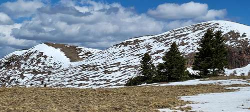
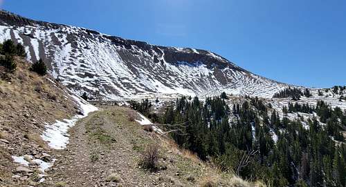
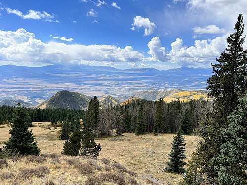
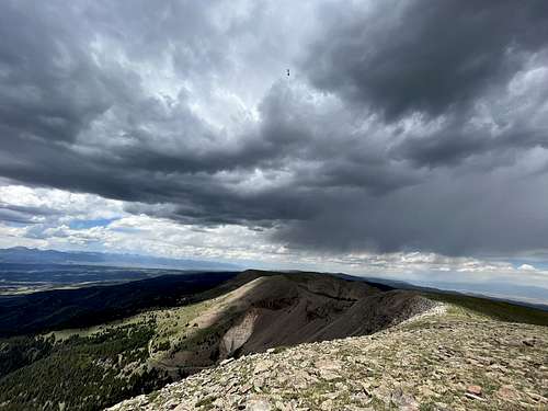
The Greenhorn Mountain Wilderness was designated by Congress in 1993 and it now has a total of 23,087 acres. Soaring dramatically from the plains of Colorado, Greenhorn Mountain rises from 7,600 to 12,347 feet in the center of the northern section. Its summit is the highest point in the Wilderness, and nowhere else in the state provides such a vivid and dramatic change from plains to mountains.
About two-thirds of the area is forested, and as you hike along, you'll pass quickly from dry oakbrush and ponderosa pine country (or pinion-juniper in some places) through aspen, fir, and spruce, and on to alpine tundra. Most of the east-facing slopes are steep, rocky, and generally bare. Unusual for Colorado, Greenhorn Mountain Wilderness has no lakes and no towering alpine peaks--and, consequently, few human visitors. Numerous small canyons and sharp ridges are the dominant geological features. A few streams descending from the mountain furnish a habitat for threatened greenback cutthroat trout. With relatively little snow, the area attracts bighorn sheep, elk, and mule deer.
Only 11 miles of trail cross the Wilderness, all in the northern half. The southern half, remote and rugged and waterless, probably has fewer human visitors than any other area of the state. If you're willing to brave the dense woodlands and rough topography, you'll find few places with as much solitude. Please help keep Wilderness wild by following Leave No Trace practices.
External Links
https://www.peakbagger.com/peak.aspx?pid=56453
https://www.peakbagger.com/range.aspx?rid=14681
https://listsofjohn.com/peak/1581
https://spanishpeakscountry.com/the-wet-mountains/
https://youtu.be/lZrS2O7uguI?si=bsoW_qlEb3cqDIc3
https://www.alltrails.com/explore/trail/us/colorado/north-peak-via-greenhorn-trail
https://youtu.be/jXO1uY0MvmQ?si=A4JHx6sW6_VyShBO
https://losingtrackoftime.com/2019/09/24/greenhorn-mountain-hike/
http://www.sangres.com/colorado/wilderness/greenhornwilderness.htm
https://craftsmanlodge.com/greenhorn-valley/
https://www.alltrails.com/trail/us/colorado/north-peak-to-greenhorn-mountain-loop-via-bartlett-trail
https://www.alltrails.com/trail/us/colorado/north-peak-to-greenhorn-mountain-loop-via-bartlett-trail