
-
 6100 Hits
-
 79.04% Score
-
 10 Votes
|
|
Route |
|---|---|
|
|
39.32860°N / 105.9481°W |
|
|
Hiking |
|
|
Spring, Summer, Fall, Winter |
|
|
Class 1 on-trail to Class 2 Bushwack/Talus Hop |
|
|
Overview
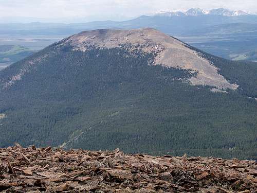
The North Ridge of Little Baldy, from Volz Benchmark.
This is a pleasant, moderately short outing. The first mile or so follows the Gold Dust trail through mostly level terrain through a moist area of beaver ponds, crossing two creeks. The remaining mile and a half is off-trail and it is in this section that the vast majority of elevation is gained. About half of the off-trail portion is through timber, with the remaining on talus above timberline.
Roundtrip Mileage: Roughly 5 miles
Elevation Gain: About 2,000 feet net
Map: Trails Illustrated #109 (Breckenridge / Tennessee Pass)
Getting There
Finding this trailhead may prove to be the trickiest part of your outing. The Gold Dust Trail crosses Park County Road 33 without much fanfare, and the trailhead to gain the Gold Dust Trail southbound is quite indistinct.•From Hwy 285, follow signs to Boreas Pass Road; heat north west through the town of Como. (Set your odometer when exiting Hwy 285; the trailhead is approximately 5.5 miles from this point.)
•Follow the main artery (which may be marked Park County 33 by this point) through town for approximately 4 miles from Hwy 285.
•At a fork in the road at mile 4, follow Park County 50 to the left/straight. (County Road 50 stays in the valley and follows Tarryall Creek; Do not turn right on Park County 33 which leads to Boreas Pass.)
•Continue about 1.5 miles further west on County Road 50. Astute eyes may notice a Forest Service post indicated the Gold Dust Trail (Now #698, formerly marked #653 per SP Member bblack99) is crossing the road. A wide area in the road about a quarter mile further west past this post serves as the parking area for the Gold Dust Trail. A hand-made wooden sign may be present indicating that, upon leaving your vehicle, the hiker should backtrack east along the road briefly to find the true trailhead.
Route Description
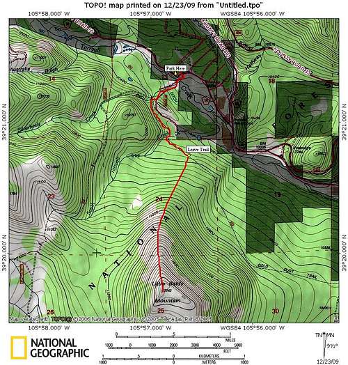
•Leave your vehicle and backtrack less than a quarter mile east on County Road 50. Drop off the road to your right/south to pick up the Gold Dust Trail (#653). Cross the Tarryall Creek on a simple footbridge.
•Follow the Gold Dust trail across a wet meadow of beaver ponds and pools for about ½ mile to the junction with Trail #614. Stay left at this fork to stay on the Gold Dust Trail.
•Almost immediately after the junction, cross Silverheels Creek across a simple footbridge, the after about another half mile cross South Tarryall Creek (again on simple footbridge).
•Anytime after crossing South Tarryall Creek, leave the trail behind and head south, uphill, for 1.5 miles to the summit of Little Baldy Mountain.
oThe first approximately ¾ of a mile after leaving the Gold Dust Trail will be bushwacking through evergreen timber. After breaking through timberline, the second ¾ of a mile will be on mostly stable talus to the summit. Occasion hints of a social trail appear occasionally, easing passage to the top.
oAfter reaching the vast summit plateau, the final summit boulder jumble will be obvious. Enjoy the views!
Route Photos
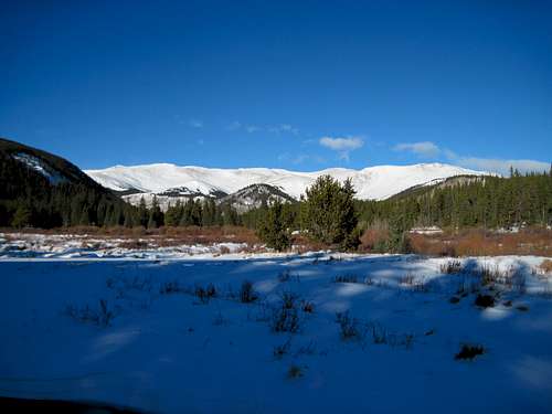
Looking across the meadow from the Gold Dust Trail
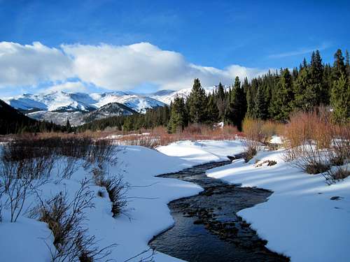
Tarryall Creek, Hoosier Ridge, Red Peak
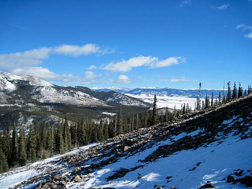
Looking northeast from the ridge
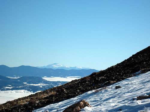
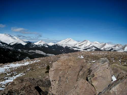
Pikes Peak from the talus slope
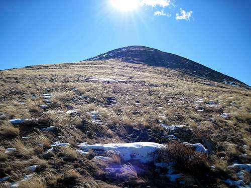
Southbound from the North Ridge
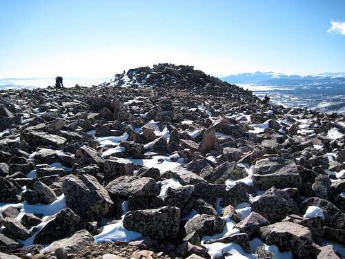
Final boulder hop to the summit of Little Baldy
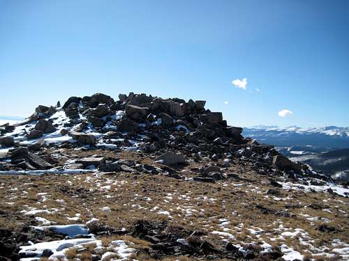
Summit Boulder Jumble
Boreas Pass from the Summit of Little Baldy
bblack99 - Aug 24, 2014 11:53 pm - Hasn't voted
Gold Dust Trail Re-numberedNote that the trail marker has been updated and now reads Trail 698 instead of 653.
Sarah Simon - Sep 3, 2014 1:02 pm - Hasn't voted
Re: Gold Dust Trail Re-numberedThank you much for this update. Ah, the USFS - always keeping us on our toes. I appreciate the update. Safe climbing! Sarah