
|
|
Route |
|---|---|
|
|
39.01400°N / 106.863°W |
|
|
Download GPX » View Route on Map |
|
|
Mountaineering |
|
|
Spring |
|
|
Most of a day |
|
|
moderate snow |
|
|
Overview
I've searched and searched for reference to this line... trip reports, guide books, etc. I haven't seen any. If this route has been identified already, please let me know so I can change the name, appropriately. If not...The route has two couloirs split by a snow field, and the second couloir is split by another cross-cutting couloir. Given the "splits," and the peak name "Conundrum"... hence the name "Split Decision." Maybe it'll stick.
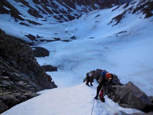
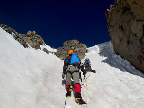
This is a moderate snow climb hitting a maximum angle of about 55 degrees and gaining about 1,100' in elevation. It would be best done in very late spring or very early summer. I imagine rock fall and poor footing would be significant issues any later in the season. It appears from signs of avalanche debris that any earlier in spring or winter would bring avalanche danger into play. I climbed it with my rope mates Chris S and Chris K the second week in June. Being at the bottom of the first couloir before dawn is recommended to mitigate issues of rock fall and too soft of snow.
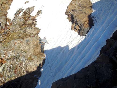
The crux is a traverse of a cross-cutting couloir that bisects the second couloir. There can be a cornice on top of the second couloir, but with a self-evident exit to climber's right.
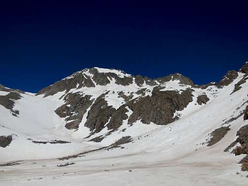
The line is about as direct as you can get, cutting across the northeast face of Conundrum. There is only one rock formation to climber's left that stands between the top of the couloir and the summit.

The route as seen from lower Montezuma Basin.
Getting There
Take Castle Creek Road from the roundabout just west of the center of Aspen to the end of the road. From here, you can continue all the way to 12,800 with a 4WD vehicle with good clearance in the summer. During the season recommended for this climb (very late spring), you are likely to only be able to drive until a river crossing at about 10,200' where either the high, spring flowing river or snow drifts may stop you.If driving from Denver, the 3+ hour drive to the trailhead suggests an overnight trip, camping in Montezuma Basin so that you can start up the couloirs early enough to have still frozen snow.
Route Description
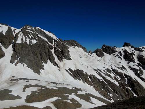
Begining at the Castle Creek Trailhead outside of Aspen, you climb the 4WD road past Montezuma mine and into Montezuma Basin. From the first flat in Montezuma Basin at about 12,800' the route is the dog-legged but direct route immediately in front of you.There are two couloirs on the route. The first couloir takes you from about 12,900' to roughly 13,400' and hits a maximum angle of about 55 degrees. The first couloir also angles in towards the mountain, sloping from climber's left to right, making the higher left line the favored line.
You then cross a snowfield of approximately 30 degrees in slope that takes you to the bottom of the second couloir, which gains approximately 500' vertical to the summit.
The second couloir slopes away from the mountain, to climber's left, making a right sided line the preferred line.
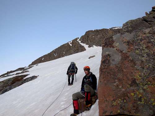
Midway up the second couloir, you will meet the crux. Another couloir coming from climber's left cuts across the route creating a traverse. You step down off of a 4-5ft high rock formation to start the traverse. We choose to place two pickets to protect against a pendulum fall. There is a solid rock formation at the other side of the traverse to allow a rest and re-organization of gear.
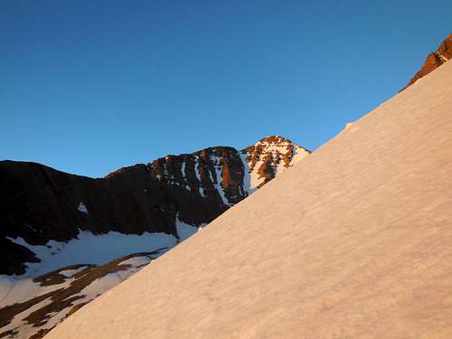
Near the top, the route becomes progressively steeper until reaching the summit; if corniced, the exit of the couloir could prove to be steeper than the 55 degrees mentioned in the overview.
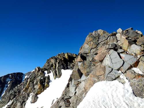
Once out of the couloir, there is one rock formation between you and the summit, to the west (climber's left). The rock formation is easily bypassed on the right.
Decent is most safely done by either descending to the saddle between Conundrum and Castle or making a second summit on Castle and descending its standard northeast ridge route.
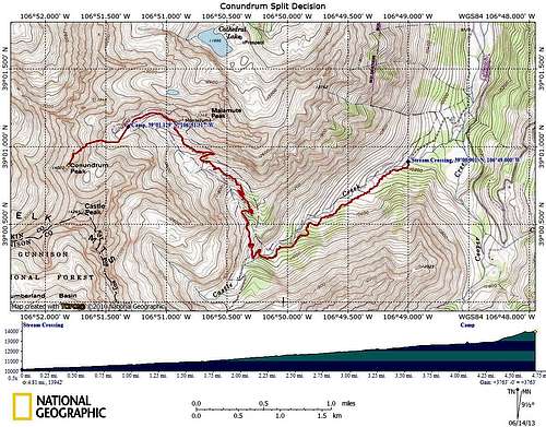
Split Decision Topo Map
Midway up the first couloir
View from the top of the first couloir across the snow field to the bottom of the second couloir
The angle of slope on the snowfield
The point of the crux, as facing the route
The point of the crux as seen from the south, while descending Castle
The crux traverse
Exiting the second couloir
The near rock formation is easily bypassed to the right; the second rock formation is the summit