|
|
Route |
|---|---|
|
|
38.81440°N / 107.145°W |
|
|
Hike |
|
|
Most of a day |
|
|
class 2 |
|
|
Approach

RT-6 miles and 2,600-ft
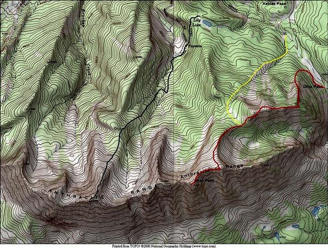
You have two starting points for a hike up Ohio Peak; refer to topo map. Starting the hike from Ohio Pass (10,050-ft) seems the logical choice and it’s easy to locate. This route is marked with red. But the best place to begin an approach may be only .70 mile south of Kebler Pass, just off of the Ohio Pass Road; I have marked this approach in yellow. Both approaches work and will deliver you to Ohio Peaks northeast ridge.
The following route description begins at Ohio Pass.
From a turnoff just north of Ohio Pass, locate Ohio Peak’s steep, talus ridden northeast ridge. Hike north for about 200 yards and begin an ascent up loose talus on a north facing spur ridge. Ascend this ridge 1,200 ft to gain the ridge at Point 11,250. From the tree covered 11,250, hike west along the ridge until you reach tree-line at 11,400-ft and arrive shortly at Point 11,555-ft where the views of the Kebler Pass area will astonish you. From here the rest of the easy class 2 route to the summit of Ohio Peak is visible.
Route Description
From Point 11,555, do an annoying 300-ft descent to a tree-covered col, this is where the alternate approach meets up with the remainder of the route. From here, locate a faint trail that ascends up through the trees and finally gains the northeast ridge. From here to the summit, enjoy mostly class 1 tundra hiking another mile and 700-ft. Again, the views of the immediate area are spectacular.
Essential Gear
Camera
Miscellaneous Info
If you have information about this route that doesn't pertain to any of the other sections, please add it here.

