
|
|
Route |
|---|---|
|
|
39.14300°N / 113.409°W |
|
|
Scramble |
|
|
A long day |
|
|
Class 2 |
|
|
Approach
This is perhaps the most scenic route to Notch Peak, but the access road used to be rough. As of May 2, 2015, SP member EKassan says the road is not in good condition, with only a few places that may stop passenger cars.
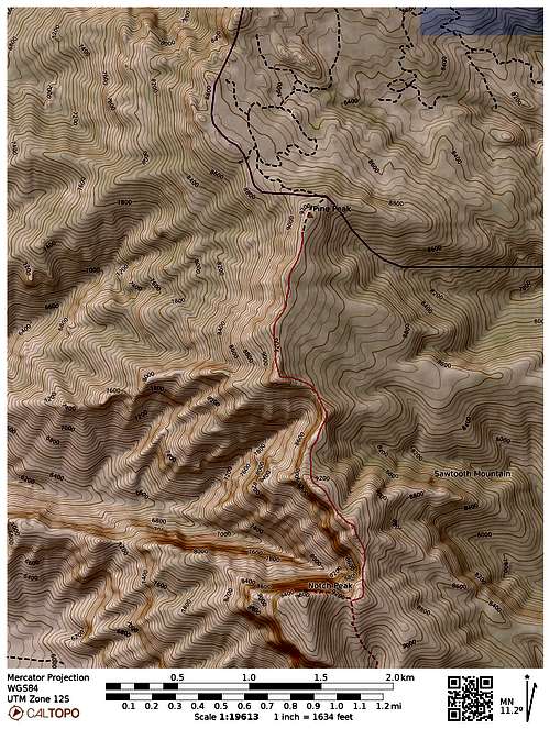
From mile post 46 along Highway 50, drive on the gravel road north all the way north to the former Highway 50. Turn left (west) on the former Highway 50 and follow it for 4 miles. If you reach the high voltage powerlines, you overshot the distance by 0.25 miles.
Turn left (SW) and drive the rough road up North Canyon. The road is suitable for 4WDs only. Drive as far as you can and park next to some big granite towers.
Route Map
Route Description
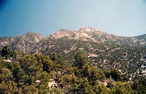
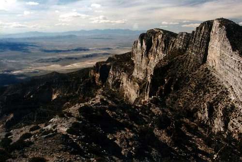
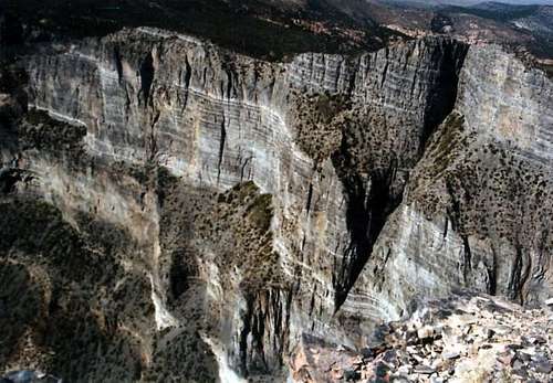
Simply hike up to the north ridge and follow it to the summit of Notch. This is a very scenic route. You will pass by huge granite pinnacles and will have the huge cliffs (thousands of feet) dropping off to the west.
We did encounter a little bushwacking and scrambling as there was no trail in the 1990's when we climbed it, but there were no major obstacles. As of 2015, there is now a trail along much of the ridge.
There are a few areas where you will pass through areas of bristlecone pines, the oldest trees in the world.
There is some scrambling near the end and the views are incredible. Enjoy the views from one of the most spectacular mountains in the United States.
Essential Gear
A good pair of boots is needed. Don't forget your camera!
EKassan - May 4, 2015 11:03 am - Hasn't voted
Road/Trail statusAs of May 2, 2015, the road going in (to the Amasa Valley and beyond) is now in great shape- there are only one or two spots which may be impassible to passenger cars. As for the hike, there is now a trail all the way along this route (not too easy to keep in some places, but it's there). This is really an amazing route!
Scott - May 5, 2015 9:27 am - Hasn't voted
Re: Road/Trail statusThanks for the updates! I sounds like things have changed since the 1990's.