-
 7237 Hits
-
 83.1% Score
-
 16 Votes
|
|
Route |
|---|---|
|
|
40.00700°N / 105.688°W |
|
|
Mountaineering |
|
|
Most of a day |
|
|
Class 3 |
|
|
Steep Snow |
|
|
Overview
Mt. Neva – Northeast Circle (Featuring ‘’Phoebe Couloir’’)
Indian Peaks Wilderness, Colorado
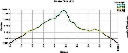
Elevation: 12814 feet / 3906 meters
Roundtrip distance : 8.5 miles
Starting Elevation: 10, 172 feet
Best month to climb: Mid May through June
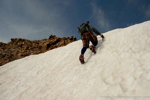
Difficulty: Moderate Snow
Gear: Crampons, Ice Axe, Helmet
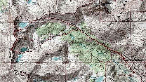
East Portal 7.5 minute
Getting There
Getting There:
Trailhead: Fourth of July Trailhead.
From Nederland (west of Boulder on U.S. 119), drive west on U.S. 119 to the Eldora junction at the edge of town. Turn right here and head west, staying straight after 1.4 miles, where the road to the Eldora Ski Area takes off to the left. At 4.0 miles, the road turns to dirt. Continue to the Buckingham Campground (shown on the map as the Fourt of July Campground) at 8.8 miles. Trailhead parking is visiable from campground. During the summer months parking is full so be advise and be there very early.
Approach:
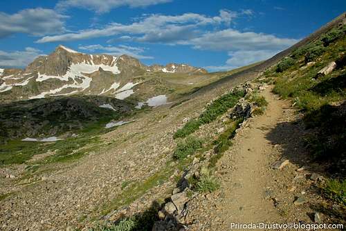
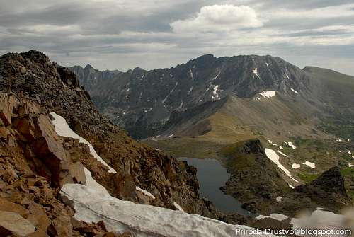
From the trailhead at the Fourth of July Trailhead Campground follow the Arapahoe Pass Trail for 3 miles to Arapahoe Pass. Take the left-hand turn on the Caribou Pass to Lake Dorothy. Circle around the southeast side of the lake, and contour into large cirque bellow the northeast face of Mount Neva.
|
|
|
Route Description
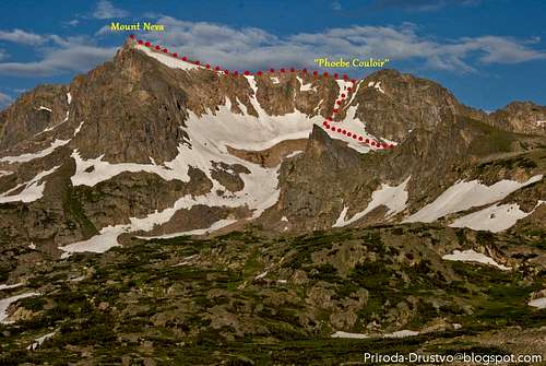
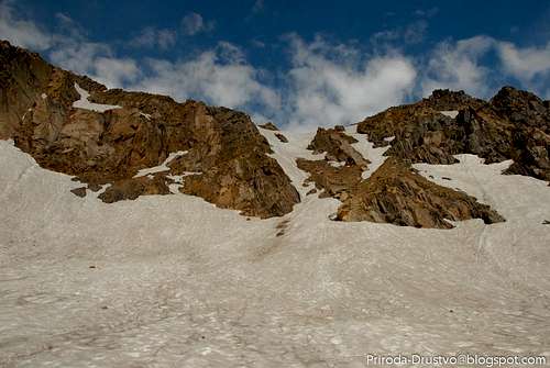
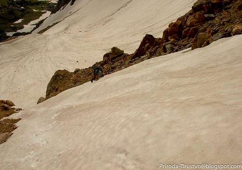
Phoebe Couloir is on northern end of the northeast face and its not direct route to the summit of Neva Mt. Phoebe is made of two or three couloirs separated by small rock formations. Early in the season southern couloirs has a cornice above it, while the northern couloirs reaches the ridge without cornice and it’s much safer choice.
|
|
|
Route:
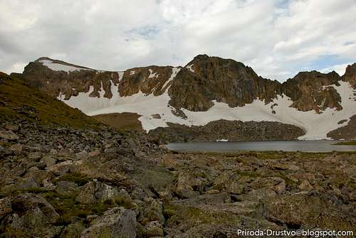
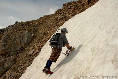
This is the northernmost of the snow couloirs on Neva’s north-east face, and while you approaching this beautiful mountainit it’s visible from Arapahoe Pass Trail. Phoebe couloirs is southwest of the lake and rises above the upper basin. Phoebe is an early summer climb. By mid-July it is completely melted out, but in summer of 2011 cause of late spring storm and late meltdown this route was climable late into season. The climb is short but steep.
|
|
|
Descent;
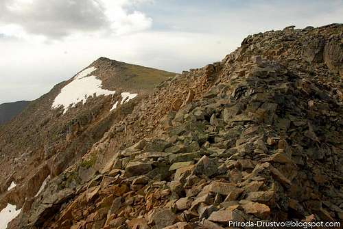
Several descent lines are available from the summit. First option is down climb the route or continue over the summit of Neva for a quarter mile to shallow gully that leads directly to the lakes right bellow Neva’s summit. From that point follow North Creek drainage and reconnect the Arapahoe Pass Trail.
Essential Gear
Gear: Crampons, Ice Axe, Helmet
External Links
Books: Garry Roach “Colorado Indian Peaks’’
Lisa Foster ‘’Rocky Mountain National Park: The Complete Hiking Guide.
http://www.nps.gov/romo/index.htm
http://rockymountainnationalpark.com/
http://en.wikipedia.org/wiki/Rocky_Mountain_National_Park
http://www.coloradowilderness.com/wildpages/indian.html
Camping