
|
|
Route |
|---|---|
|
|
46.49097°N / 9.75993°E |
|
|
Hiking, Scrambling |
|
|
Most of a day |
|
|
T4 (UIAA I) |
|
|
Overview
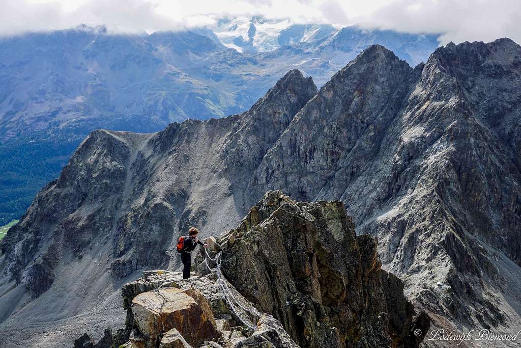
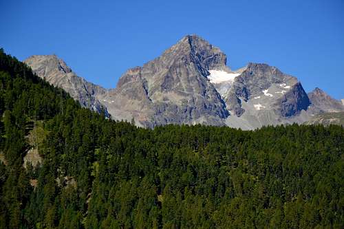
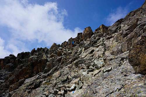
Maarten climbing an exposed part on the E/SE ridge of Piz Julier (3380m)
The normal route to the summit of Piz Julier is a very popular objective. In the summer season this route sees many visitors and this is not without reason: Piz Julier is one of the most wellknown mountains in the entire Provence of Graubunden and is among the highest mountains in the Alps with a “hiking”-trail up to its summit. The gradation of the normal route is T4, making it an alpine hike suitable for (very) experienced hikers. The normal route has 2 approach routes that join each other at the Fuorcla Albana at 2870 meters. The first one starts at Chamanna dal Stradin at 2161 meters, located along the Piz Julier passroad (Julierpass) to the southwest of Piz Julier. The second one starts above St. Moritz at Suvretta (there are multiple starting points on this side of the mountain). It is also possible to shorten the ascent a little by taking one of the chairlifts further up the mountain. Without the use of them the route from Chamanna dal Stradin is somewhat shorter (starting point 2161m vs 1910m), but also somewhat more difficult (T4 vs T3).
 Piz Julier from the Western approach route | 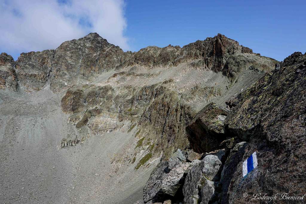 Piz Julier (3380m) from Fuorcla Albana (2870m) |
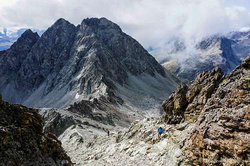
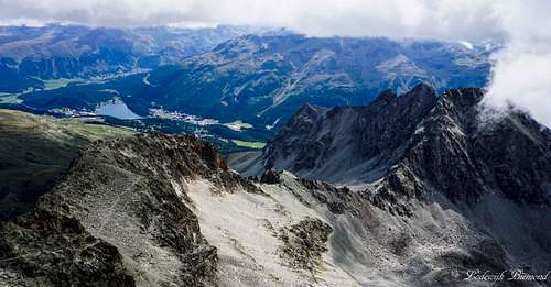
According to my own experience, most people come up from the Moritz/Suvretta side of the mountain. At the Fuorcla Albana (2870m), the pass that separated Piz Julier from Piz Albana (3100m) the 2 approach routes meet up and go up the East-Southeast ridge of Piz Julier. The summit part of the route is graded T4 and involves some light scrambling in the first grade (UIAA I). The trail is marked very well by white-blue painted stripes, and as a result, orientation on route is not a problem and straightforward. On the other hand, the climb along the ridge is very exposed / airy in some parts along the ridge. The more difficult sections are secured by chains / steel cables to ease the ascent. Although secured, the route is not a Via Ferrata, which is stated in some guidebooks and on several maps. Besides the difficulty of the route one should also take the elevation into account. Being close to 3400 meters high, Piz Julier is a serious undertaking and weather can change rapidly at these altitudes, so do not take this route too lightly, just because of the moderate difficulty of the route.
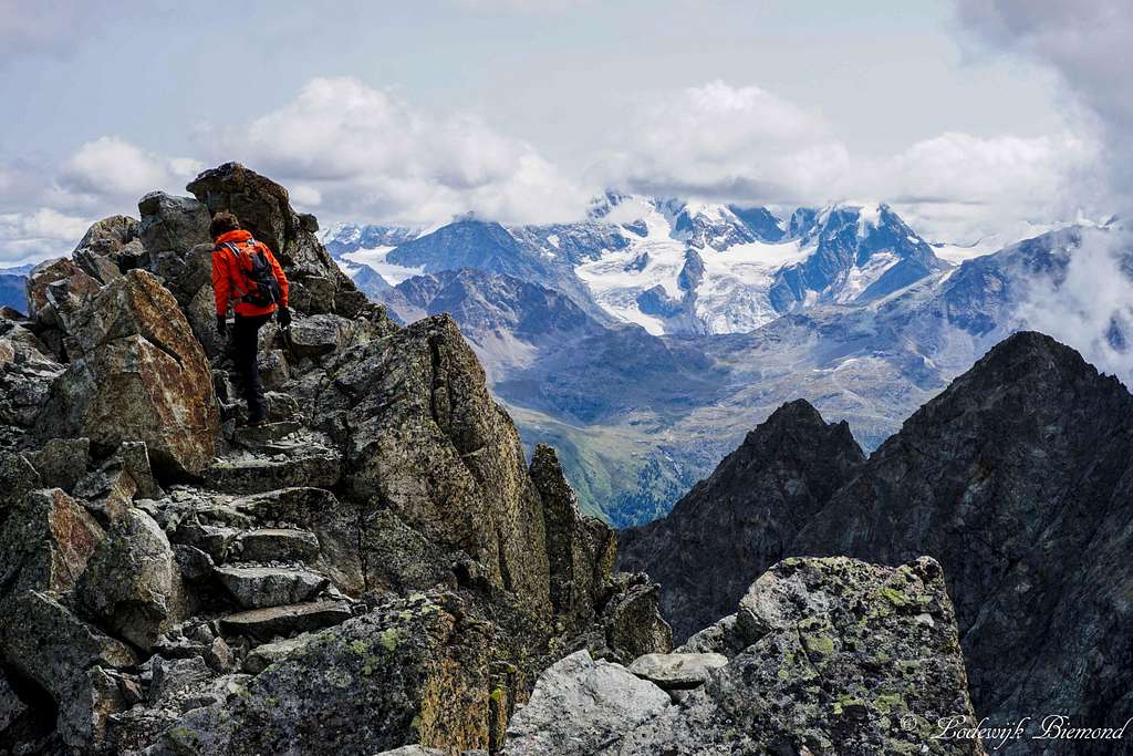 Maarten on the E-SE ridge; Bernina Group behind | 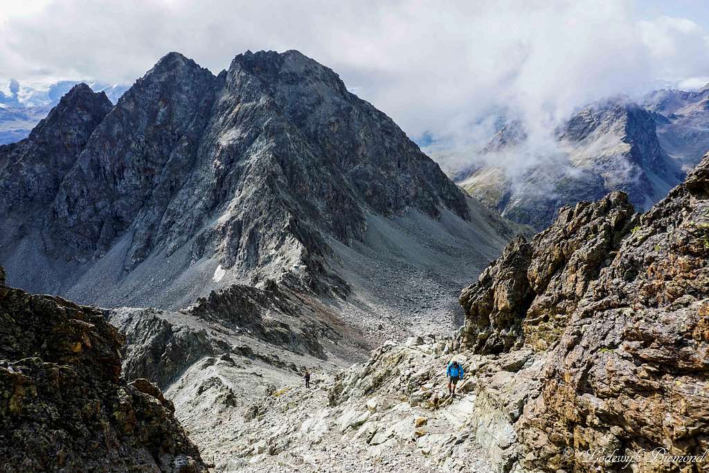 On the E-SE ridge with Piz Albana behind |
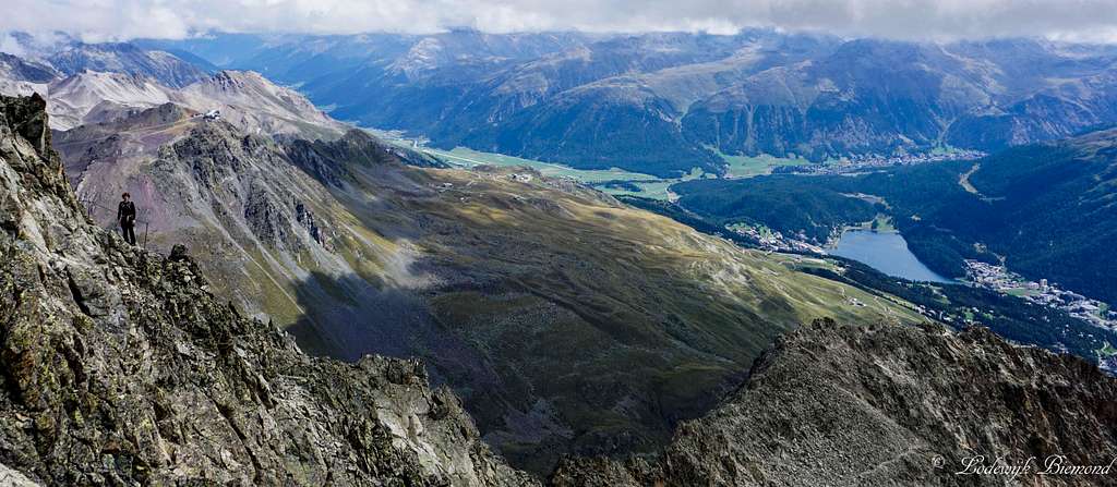
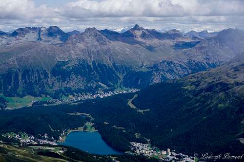
All in all Piz Julier is a fantastic mountain to climb. The route really provides for an alpine experience and standing on the summit of Piz Julier is rewarded with a fantastic 360 degrees panorama with the main eye-catcher being the Bernina Group with Piz Bernina, Piz Palu and co, St. Moritz down in the valley and many other 3000 meter peaks like Piz Ot, Piz Platta, Piz Calderas and Piz Languard.
High on the Piz Julier E-SE ridge; Oberengadin & St. Moritz below
Approach Routes
As already stated in the overview section, the normal route has 2 approach routes that join each other at the Fuorcla Albana at 2870 meters. The first one starts at Chamanna dal Stradin at 2161 meters, located along the Piz Julier passroad to the southwest of Piz Julier. The second one starts above St. Moritz at Suvretta where the road ends. It is also possible to shorten the ascent a little by taking one of the chairlifts further up the mountain. Without the use of them the route from Chamanna dal Stradin is somewhat shorter (starting point 2161m vs 1910m), but also somewhat more difficult (T4 vs T3). In the following paragraphs both approach routes are described in more detail.
I from Chamanna dal Stradin

Piz Julier Approach route: from Chamanna dal Stradin
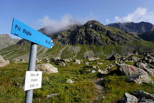
Signpost at Cna dal Stradin
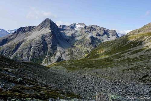
Munteratsch valley with Piz Polaschin
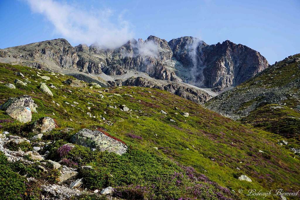
Follow the trail up the mountain in a northern direction ,cross a large boulder field and afterwards go up the slightly steepening slope of Alp Guglia. The route is marked well by white-blue painted stripes, so orientation is not a problem. Go further up along the path , pass point 2369m and head into the Munteratsch valley. At this point Piz Julier is already looming high above you.
Inside the Munteratsch valley the terrain changes from grassy slopes into a large boulder field. Navigating becomes somewhat more difficult here but is still not a problem thanks to the many white-blue markers: At any point at least one or 2 of these makers are in sight, making navigating quite straightforward. Follow the trail up the mountain along the Munteratsch valley until the Fuorcla Albana comes in sight.
The trail makes a loop around a large boulderfield and finally goes up the west flank towards the Fuorcla Albana at 2870 meters. The last part along the west flank is a bit tricky. The trail zigzags up a steepish scree field with a lot of loose stones, so do watch your step here. Finally the trail arrives at the Furocla Albana, which can be recognized by a small emergency shelter. At this point the route from the St. Moritz side joins.
Time required: 1,5 to 2,5 hours; T4
II From St. Moritz / Suvretta

Piz Julier Approach route: from St Moritz
Summit view towards St. Moritz
Piz Julier in late August
From all 3 starting points, head into the valley named Suvretta da san Murezan, so in a Northwestern direction. Eventually, after passing Alp Suvretta at 2211 meters, all access roads come together and form a hiking trail further up the valley. Follow the trail through the valley until you reach Chaschigna (2311m). At the junction leave the trail that heads further up the valley and go up the trail towards Fuorcla Albana / Piz Julier.
The trail leaves the valley floor and goes up the eastern flank of the mountain. From this point on the route is marked by blue-white painted stripes. Follow the trail up the mountain until you reach Fuorcla Albana at 2870 meters, which can be recognized by a small emergency shelter. At this point the route from the Chamanna dal Stradin side joins.
Time required: 1,5 to 2,5 hours; T3
Route Description

Piz Julier Route Map
On the E-SE ridge looking back
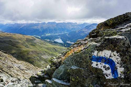
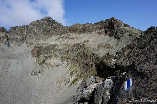
blue-white marker
See the approach routes above for getting from either the eastern or western side of the mountain to the Fuorcla Albana (2870m). Having arrived at the Fuorcla Albana head up towards the north along the ridge that connects the Fuorcla (Pass) with Piz Julier. A blue sign points into the right direction stating “Piz Julier / Piz Guglia”.
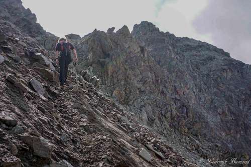
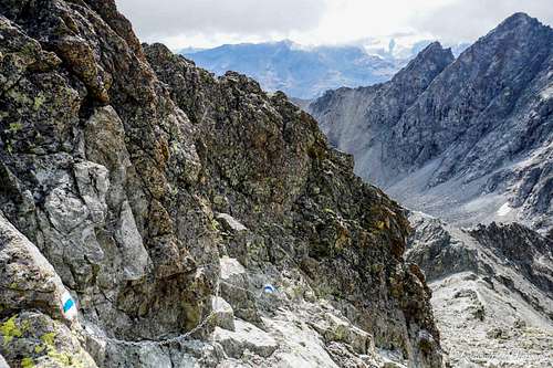
The first part is quite straightforward and more or less follows the ridge up to Piz Julier. This part is graded T3. After some 30 minutes the ridge changes more and more in direction from a N-S orientation to a E-W orientation resulting in a final approach from the east. The terrain gradually becomes steeper and more exposed. At this point, more and more sections are secured by chains and cables. Due to the many cables/chains and the white-blue markers orientation is easy along the entire route from the Fuorcla up to the summit.
Near point 3192m you can look down the NE-face of Piz Julier and spot the impressive Vadret Guglia or Julier Glacier. An impressive sight although sadly, the glacier appears to be retreating fast. After Point 3192 the route leaves the actual ridge for a while and goes up south of the East ridge of the mountain until the foresummit is reached.
Here the trail follows the ridge again and one has to downclimb a small section to the saddle that separates the foresummit from the actual summit. This section is very exposed, but once again also secured very well by chains and cables. From the saddle it is only a couple minutes more until you arrive on the main summit of Piz Julier at 3380 meters. Descent is the same way back.
Time required from Fuorcla Albana: 1,5 to 2,5 hours; T4
Route: Photo overview
This is a photo overview of the route to Piz Julier from Chamanna dal Stradin.
1. Signpost at Cna dal Stradin (2161m); starting point | 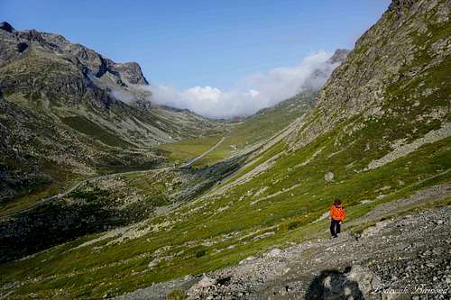 2. Leaving Stradin behind. Julierpass in the back |
 3. Piz Julier from the approach route | 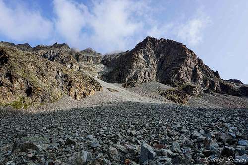 4. The large boulder field in the Munteratsch valley |
5. Munteratsch valley with Piz Polaschin | 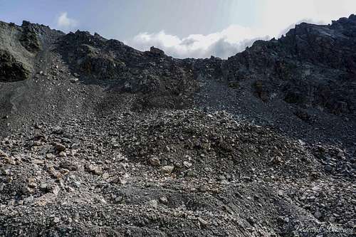 6. View towards Fuorcla Albana (2870m) |
 7. The trail with loose stones just below the Fuorcla | 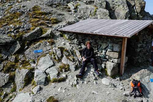 8. The shelter at the Fuorcla Alban; Both approach routes join here. |
 9. Piz Julier (3380m) from Fuorcla Albana (2870m) | 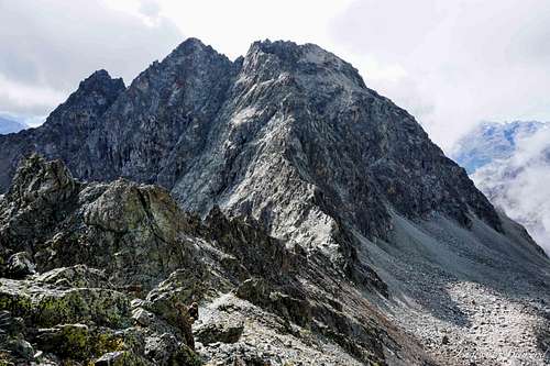 10. View from the ridge back to Fuorcla Albana (2870m) |
 11. A secured part on the ridge | 12. Route marker with the Engadin below |
 13. On the E-SE ridge | 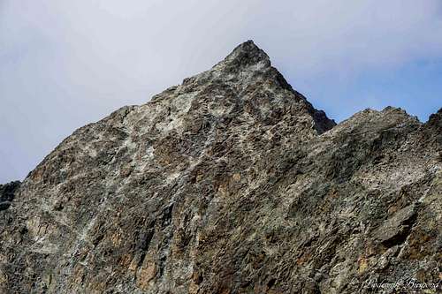 14. Piz Julier (3380m) as seen from the E-SE ridge |
 15. One of the more exposed sections on the E-SE ridge | 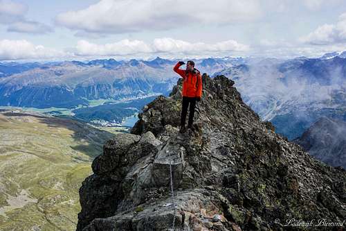 16. High on the E/SE ridge 16. High on the E/SE ridge |
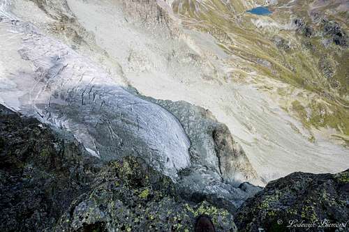 17. My boot and the Julier glacier to show the exposure on route | 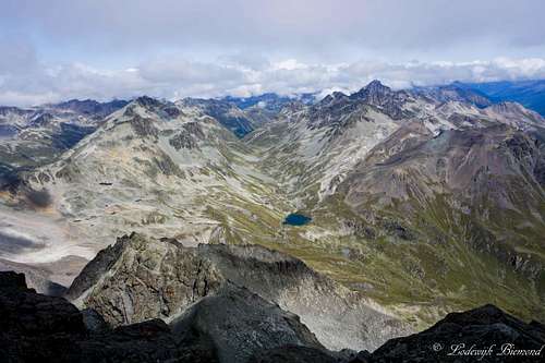 18. Piz Nair & Piz Ot from near the summit |
 19. View back down the E-SE ridge | 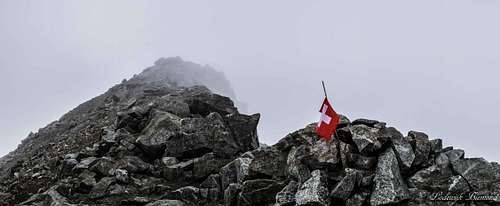 20. Piz Julier Summit |
When to climb
Piz Julier can be climbed best during the summer months when there is no snow present on the route/mountain. Normally this is in July & August and often also september. Be sure to check the actual conditions when planning a climb on Piz Julier!
Essential Gear
Good hiking shoes are mandatory, as well as warm clothing. Climbing equipment (also: Via Ferrata set) is not neccessary since the most difficult sections of the route are secured very well by chains/steel cables. This is only valid in summer when there is no snow present on Piz Julier. If there is snow present on the mountain, climbing equipment is advisable if not obligatory.
Maps
St. Moritz Swisstopo Mao LK 1257
Scale: 1:25.000
ISBN: 978-3302012575
Scale: 1:25.000
ISBN: 978-3302012575
Oberengadin / Alta Engadina - Kompass Verlag
Scale: 1:40.000
ISBN: 978-3850269094
Scale: 1:40.000
ISBN: 978-3850269094
For more maps and for books see the main SP page of Piz Julier
External Links
Piz Julier on Hikr.org - Multiple trip reports (in German mostly)
Piz Julier Weather Forecast by Mountain-Forecast