
Comments
No comments posted yet.
|
|
Album |
|---|---|
|
|
Informational, Scenery, Panorama |
Participants: Sarah Simon, Kiefer Thomas, Brian Core and me.
March 09, 2014 yr.
The Lost Creek Wilderness was created under the Colorado Wilderness Act of 1980. The original 105,000 acres plus the 1993 addition of approximately 14,700 acres brought the total acreage to its current 119,790 acres. The entire Wilderness lies within Pike National Forest, split between the South Park and South Platte Ranger Districts.
Contrary to most of Colorado's jagged alpine wildernesses, Lost Creek is a landscape of rounded granite knobs and domes, granite arches and split boulders interspersed with open parks. Elevations range from about 8,000' to about 12,400'. Lost Creek Wilderness got its name from Lost Creek's several disappearances into rock piles and underground passages before reappearing further down the hill. When it finally resurfaces for the last time, it changes name to Goose Creek.
Black bear, bighorn sheep, deer, elk, mountain lion and bobcat share the forest. Vegetation in the area includes ponderosa, bristlecone, and lodgepole pine, aspen, spruce, fir, and alpine tundra. About 130 miles of trails criss-cross the Wilderness, including the Colorado Trail.
Although there are remains of logging camps and sawmills on the outskirts of the Wilderness, the heart of Lost Creek was too wild for much commercial use other than grazing. There was a failed attempt between 1891 and 1913 by the Antero and Lost Park Reservoir Company to dam Lost Creek underground at a site just below the confluence of Lost Creek and Reservoir Gulch. All that remains now near the site are a few old buildings and some rusting machinery.
One of a set of three maps of the Pikes Peak, Plum Creek, and South Platte Forest Reserves (most of the current Pike National Forest), drawn in 1898 for the 20th annual report of the USGS, shows most of the southern end of the present day Wilderness as being "Badly Burned". In 2002, the Hayman Fire burned approximately 6,000 acres along the east edge of the Wilderness. Fortunately, very little of the trail system, other than the short sections of the Goose Creek and Hankins Pass trails immediately adjacent to the Goose Creek Trail head, were affected. Be aware of the possibility of falling snags, particularly on windy days.
In 1963, the 15,120 acre Lost Creek Scenic Area was created under the precursor of the Wilderness Act, the “U-Regulations” of 1939. In 1979, it was also designated a National Natural Landmark. During the first U.S. Forest Service RARE process, Lost Creek received more recommendations for its eventual designation as a wilderness than any other Colorado area.
Maps:
The following maps cover the Lost Creek Wilderness and can be purchased at many area stores:
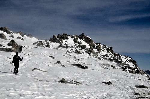 Brian bellow summit Brian bellow summit | 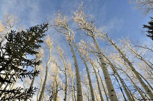 Aspen trees along the trail Aspen trees along the trail |