
|
|
Mountain/Rock |
|---|---|
|
|
48.93390°N / 19.11690°E |
|
|
Hiking |
|
|
Spring, Summer, Fall, Winter |
|
|
5026 ft / 1532 m |
|
|
Overview
|
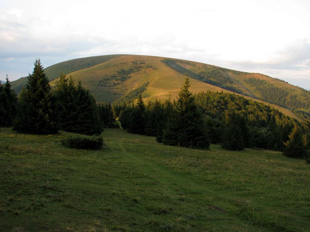
| Ploská (Flat in English) at 1532m is an aptly named mountain that I did not mean to climb. I had been thinking of climbing nearby Borišov, bolder and sort of famed, and then of traversing Ploská on my way to Rakytov. But on arrival at Kýšky (Chyžky) saddle I realized I didn't have so much time as I’d left the campground by the unmanned refuge Salaš pod Suchým vrchom terribly late. (The night before I managed to fall asleep well after midnight, when the friendly but noisy Slovak hikers occupying the refuge finished partying by a bonfire at last.) So I decided to switch Borišov for Ploská, hoping for equally good views, and I wasn't disappointed. |
|
|
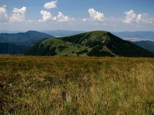
| Ploská is a truly focal mountain where the main ridge of the Veľká Fatra forks. South from Ploská runs the highest ridge of the mountains. To the north and northeast trend the Turiec and Liptov ridges divided by the long valley of the Ľubochnianka brook. What is more, at the beginning of the Turiec Ridge the short spur of Borišov branches off to the west. Thus Ploská happens to be surrounded by the highest and most interesting peaks in the Veľká Fatra: Ostredok, Borišov, Kľak, Rakytov and Čierny kameň. Ploská has a prominence of 222m. |
|
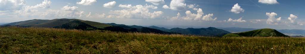
| The Bralná Fatra is also in sight plus – weather permitting – a ring of mountain ranges around the Veľká Fatra, such as the Malá Fatra, Nízke Tatry (Low Tatras), Chočské vrchy, Western Tatras, Strážovské vrchy and even the High Tatras. The only problem is that the grassy summit of Ploská, being gentle and broad, does not allow you to see all those mountains in full view, so you have to walk a little away from the very summit to get a better view of some of them. |
|
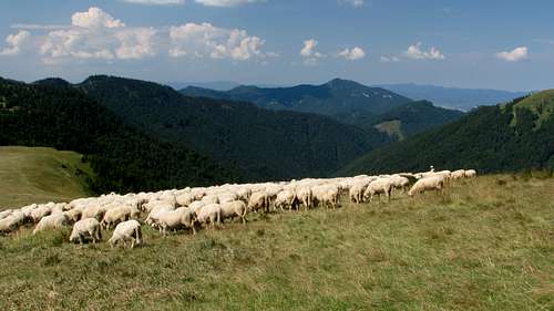
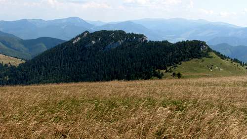
| Just southwest of Ploská, southeast of Kýšky (Chyžky) saddle is a sheepfold whose sheep graze on the southern slopes of the mountain. Another sheepfold is at the valley head northwest of Ploská. However, the summit area and the eastern side of the mountain that slants towards the saddle separating Ploská from Čierny kameň (Sedlo Ploskej at 1390m) are not pastured and form a vast sea of high grasses. |
|
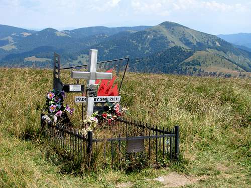
| At the very summit is the grave of Andrej Kiss, a Slovak National Uprising fighter who died at the age of 21 in 1944. |
|
|
Getting There & Routes
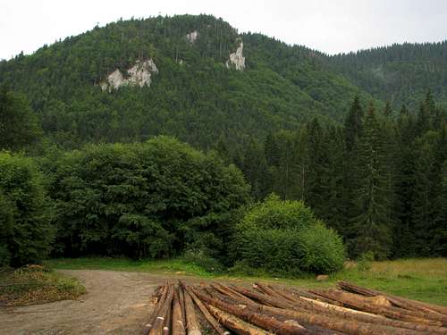 In Zelená dolina
The shortest trails to the summit of Ploská lead from the village of Vyšná Revúca. Both (!) are waymarked with yellow stripes. The shorter of them follows a lateral ridge to Sedlo Ploskej and is 5.5km long, the longer (7km) runs via the Zelená dolina (Green Valley) and Sedlo Kýšky (Chyžky). Net elevation gain will be around 815m.
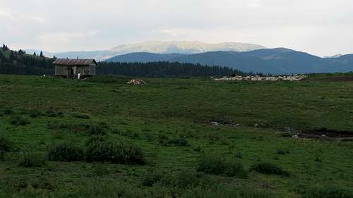 Sheepfold near Kýšky (Chyžky) saddle, Low Tatras in background
Huts, Bivouacking & Red Tape
Just past the saddle between Ploská and Borišov sits an atmospheric mountain hut called Chata pod Borišovom.
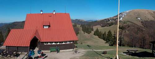 Chata pod Borišovom
Around Ploská there are a few shepherd’s summer chalets. Some of them are normally locked, some are not but are used by shepherds in summer anyway. By one of the latter, southwest of the summit and just southeast of Kýšky (Chyžky) saddle is a designated campground. (Please see the area page for information on red tape).
 Salaš pod Kýškami
 The way I see it, a nicer option is an unmanned refuge that used to be a shepherd’s chalet and is known as Salaš pod Suchým vrchom. It is located about 1.5km southwest of Kýšky (Chyžky), i.e. over 3km southwest of the summit of Ploská, 150m west of the main ridge trail.
 Salaš pod Suchým
Maps & Mountain Conditions
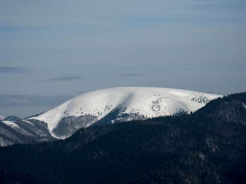 Avalanche-prone slopes of Ploská (W side) - photo by LukZem