Intro/Stats
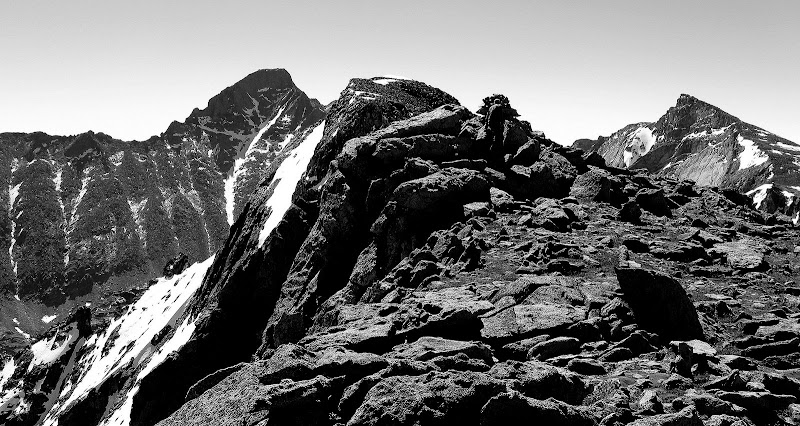
Powell Pk (13208')
Taylor Pk (13153')
Otis Pk (12486')
Via Taylor Glacier
13.9 miles RT, 5220' gain
From Glacier Gorge TH
Participants: Gary Neban, Sarah Thompson, Dominic Meiser, & Kevin Baker
Slideshow
I was looking to squeeze in one more snow climb before switching to scrambling mode. Rocky Mountain National Park is obviously one of my favorite destinations to hike, but I somehow don't get up there as much as I would like. The Taylor Glacier is an intimidating, steep snowfield that splits Taylor and Powell Peaks, topping out in dramatic fashion to the Continental Divide. It is hard to catch the right conditions for this climb as cornices plague the top. We weren't sure what to expect, so we brought harnesses, rope, a couple pickets, and even a fluke just in case things got spicy near the top.
We met Gary at the Bus Stop in Boulder, but this wasn't your typical bus stop. A park-n-ride at a strip club? Hope he explained why he was parking there to his wife! Sorry, Gary. We arrived at the usually bustling Glacier Gorge trailhead, which surprisingly already had a few cars at such an early hour. We set out at 4:25am with hopes of getting off the glacier before things softened up too much.
Taylor Glacier: The Runnel Express
We made great time up to The Loch, easily finding the shortcut trail just .4 mile into the hike, which shaves off a fair amount of distance. There was not a cloud in the sky, so things were looking good. Everybody had ants in their pants except for me, so I played the role of clean up man on the approach. Must have been the Mexican food the night before, although I was feeling good.
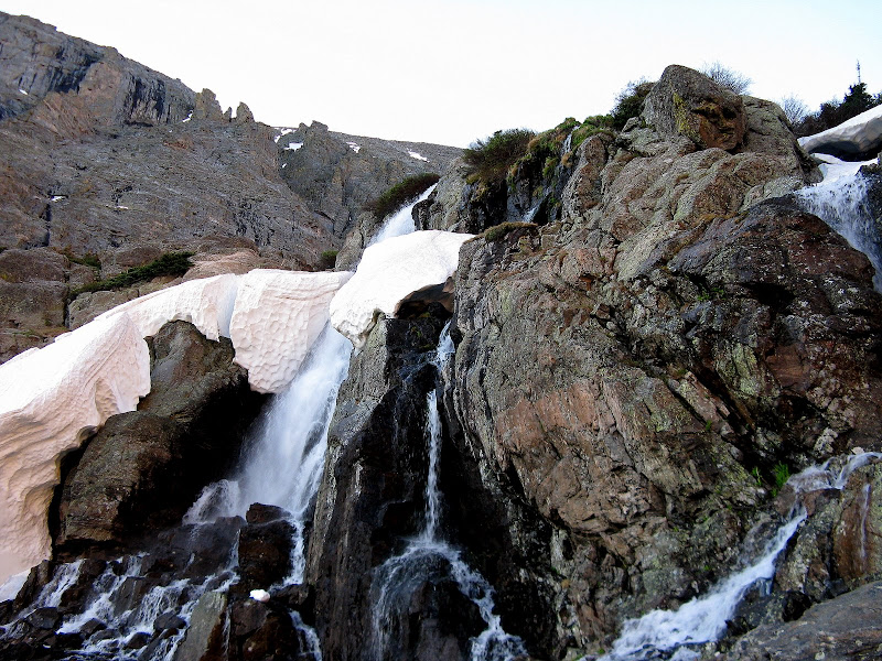
We didn't run into snow until about 9500' and it wasn't continuous until we were well above Sky Pond. The warm days are melting the snow fast in RMNP after a wet spring. Cresting the headwall to Glass Lake was a bit icy, punctuated by a cool cascade that was just melting out along Icy Brook. Dwight would have liked this section. Too bad he wasn't here to make a movie.
We were able to follow the cairned trail all the way to Sky Pond, then avoided some steep snow on talus and grass on the north side before boulder hopping our way to the apron of magnificent Taylor Glacier. The hike to Sky Pond is simply amazing with jaw dropping views in all directions, but I don't think too many tourists make it up this far.
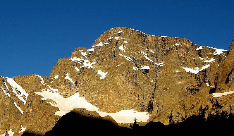
The magnificent east face of Taylor:
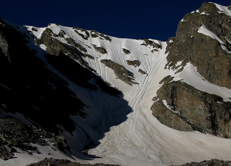
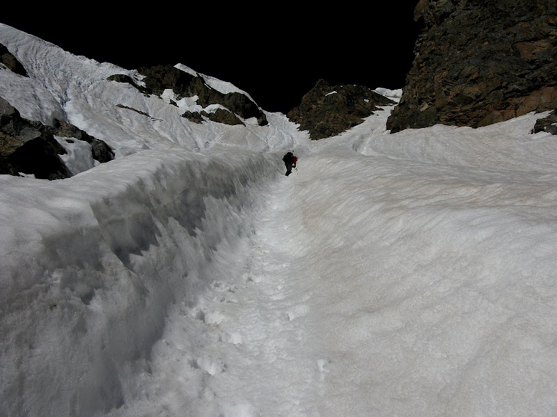
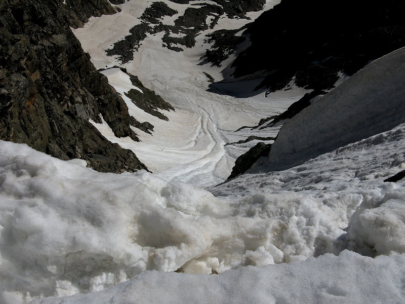
It was looking like Taylor Glacier was in great shape, as the top of the headwall held some weaknesses where cornices had broken off. Multiple runnels ran down the headwall as well, likely caused by old cornice breaks. We were worried about the snow being firm enough after a forecast low of 37, but a decent breeze and clear night had firmed things up well.
Our route was up the far right side, which offered the most reasonable finish.
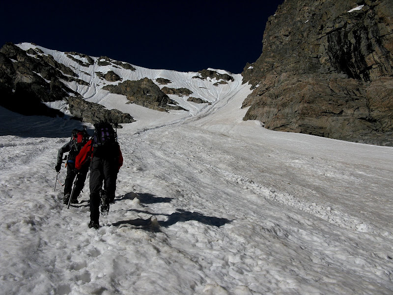
We took a long break gearing up, donning harnesses, helmets, axes, and 2nd tools. We set out at 11600' at 7:20 and the snow on the apron was firm, but soft enough to kick easy steps. It was looking like we were timing this climb just right!
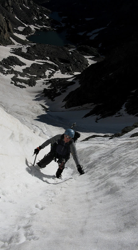
Dominic and Gary did a fine job of kicking steps all the way up, with Dominic dreaming of a hearty meal at Oscar Blues while Gary was planning his descent route. We went up a huge, deeply cut runnel that worked out really well. This runnel was over 3 feet deep in spots, and when it started getting steep, it was nice to throw down a 2nd tool into its walls.
Gary bombs up the runnel:
Dominic gives some scale to the size of the runnel:
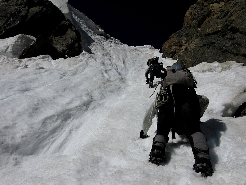
We took a short break at the base of a cliff band to regroup and checked out our options at the top. The last 50 feet or so get quite a bit steeper. I was bummed to have forgotten my inclinometer again, but a conservative estimate would be in the 50 to 55 degree range.
Dominic and Sarah approaching the crux of the headwall:
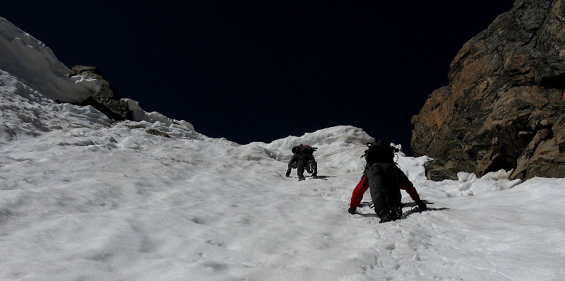
The sun and rock underneath was now rapidly softening the shallow snow at the top. Dominic led the way to the top and we ended up traversing slightly left to overcome a small, non-threatening remnant of a cornice.
Self belay was now becoming questionable in the softening snow, so I decided to be conservative and Dominic kindly gave me a belay up the final ten feet or so. We topped out at 8:40 and probably should have started just a hair earlier, but it still worked out pretty well as conditions were great until the slop at the top.
Dominic was having so much fun that he made a red, white, and blue slurpee for his bride to be! What a way to impress a girl. Gary, being the stud that he is, decided to see how quick he could self arrest with his 2nd tool. He downclimbed the crux and was able to stop on a dime in the runnel!
Looking down from the top:
Divide Ridge Run to Powell, Taylor, & Otis
Rejuvenated after a long break, we headed up the mellow but somewhat long west ridge of Powell. I remember this ridge taking forever on my first visit, but that was a much longer hike from Dragon's Tail. We topped out on Powell at 10:05. This little summit offers dramatic views over to Longs and company.
We returned to our packs at the top of Taylor Glacier and headed up Taylor, which is just a short boulder hop. We met a couple heading over to Powell from Flattop and some guys from MN on the summit of Taylor.
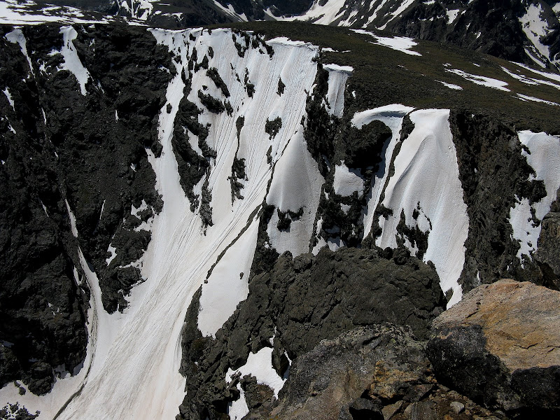
Looking down to Taylor Glacier from Taylor. Our ascent line is out of sight behind the ridge in the center:
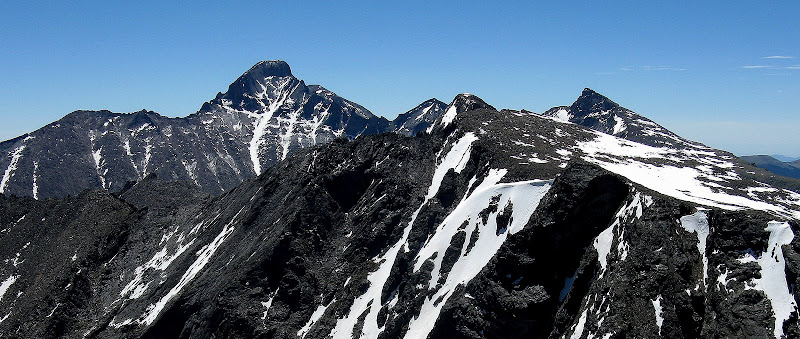
Longs and company from Taylor:
Gary made me forgo a nap on Taylor as he had visions of Otis dancing in his head, so we kept our break short and headed over to my first repeat 12er! There were a fair amount of folks out enjoying the day. Not sure where the 30% chance of rain went, as it turned out to be a textbook bluebird one! We boulder hopped our way up Otis's mellow west slopes from Andrews Pass, topping out around 12:30.
The descent was quick made possible by a nice plunge step & glissade down benign Andrews Glacier.
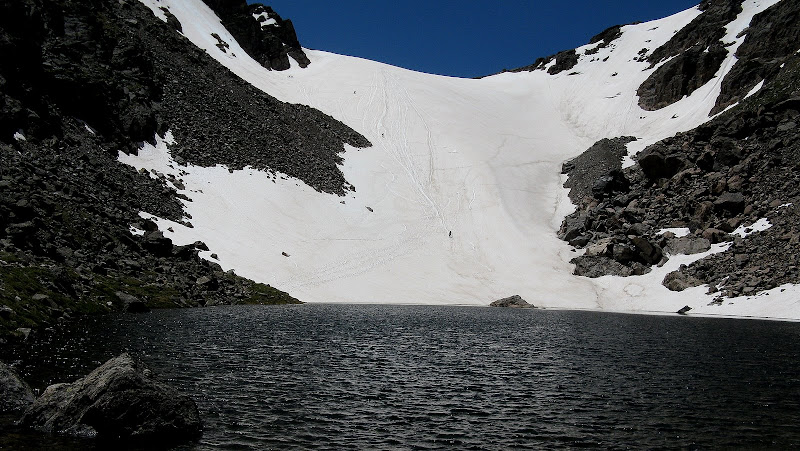
Sarah surprised me by busting out a homemade bobsled that she had crafted just for this descent. Low and behold, she miscalulated how far she would go and ended up stopping just a few feet short of the icy waters of Andrews Tarn!
Anybody want to take a dip in Andrews Tarn?
The descent was uneventful but very pleasant as we came across quite a few tourists enjoying the day, including a guy who lugged up an inflatable raft to The Loch! Dominic set a quick pace on the way down, but were ultimately passed by some tourists at the end, finishing at 3pm.
If you read this far, the bolded text is made up. Gotcha, although I think Dominic has made a slurpee for Sarah and Gary is rumored to be a world class self-arrester! Sarah needs to work on her bobsledding skills though. Another magnificent day in RMNP.
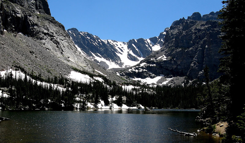
Taylor Glacier above The Loch:


Comments
Post a Comment