-
 9534 Hits
-
 74.92% Score
-
 5 Votes
|
|
Mountain/Rock |
|---|---|
|
|
40.00680°N / 9.31890°E |
|
|
5879 ft / 1792 m |
|
|
Overview
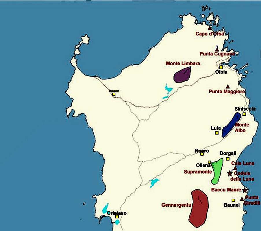
Punta Paulinu belongs to the Monti del Gennargentu Mountain Range on Sardinia / Sardegna, which is by roughly 400m Sardinia's highest. It is part of the Gennargentu main ridge which is composed of the five highest mountains of the island (Punta La Marmora (1833m), Bruncu Spina (1828m), Punta su Sciusciu (1823m), Punta Florisa (1822m)). Being the lowest of them, Punta Paulinu makes up for this lack of height by being the most rugged. In contrast to the other summits there is only one easy ascent route to the summit coming from the southwest. All other require some scrambling which I would rate UIAA I and II.
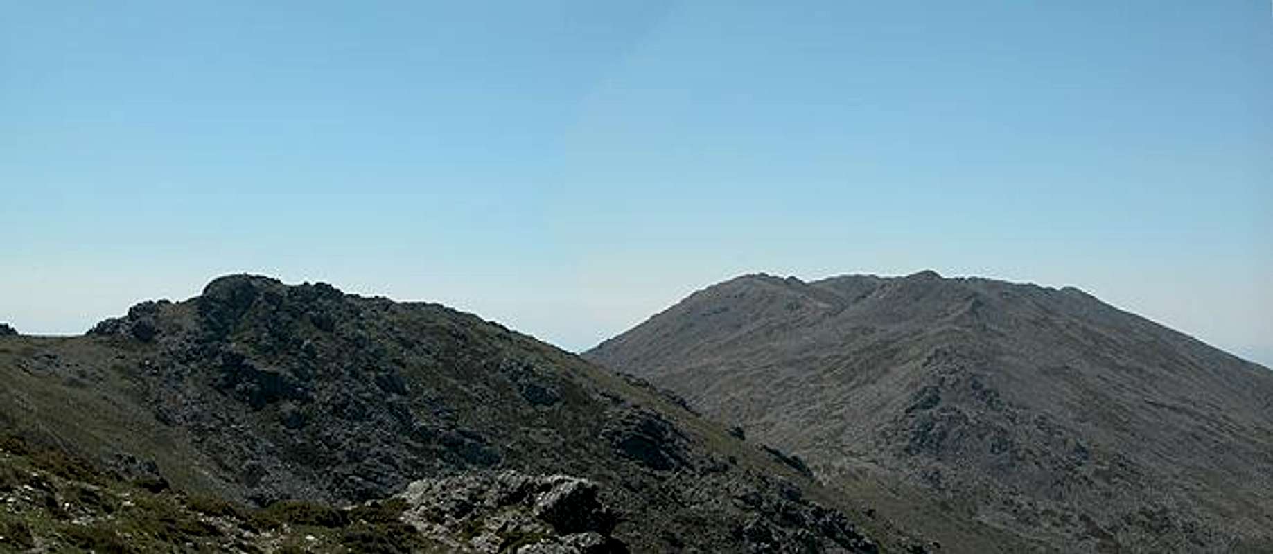
The summit is located right at the centre of the ridge and thus offers great views on the neighbouring four mountains. It "towers" above Arcu di Gennargentu, the saddle which gave the mountain range its name - Silver Saddle. This pass is flanked by Paulinu to the north and Punta su Scisciu to the south. Like from the other Gennargentu summits you can see the whole island from Punta Paulinu. Only the east coast is hidden from view by the Supramonte Mountain Ranges. On clear days you can even see Corsica in the north or the Italian mainland to the east.
The Gennargentu Mountain Range well above the timber line, which on Sardinia is man made. Like on so many of the mediterrenean islands the forests were logged in the 18th and 19th centuries in order to produce charcoal. Though the logging has subsided still the range is barren. The highest elevation, to which the timberline nowadays rises, is about 1600m - and this on a latitude of almost exactly 40°! Part of this is certainly due to the fact that the range is used extensively for herding cattle and sheep. Wildlife also is scarce - though one should be able encounter mufflons and golden eagles. We only saw kestrels and cows.
The ascent trail to Punta Paulinu follows the route up to Punta La Marmora.
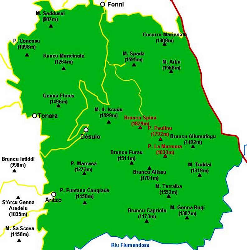
Interactive overview map of the Gennargentu mountain range. The summits which have been posted to SP are marked in red.
 |  |  |
Getting There
Sardinia can be reached either by plane or by ferry. The main ports are Porto Torres and Olbia in the north and Arbatax and Cagliari in the south. Airports are at Alghero and Olbia in the north as well as (again) Arbatax and Cagliari in the south. For exploring the north eastern part of the island where most of the mountains are the best entry point is Olbia, which is where most flights go anyway.
Approaching the mountain from Arbatax airport
From the airport take SS125d west towards Tortoli and onwards on SS198 to Lanusei. There switch to SS389 north direction Nuoro until you reach Passo di Caravei. At the pass turn west again un SS389, direction Fonni. Shortly before you reach the town SP7 (a small side road) turns off left (south) and leads in direction Desulo. After 5km turn left (signs Monte Spada, Bruncu Spina). 7km will lead you to the trailhead which is not at the end of the road at the ski lift but rather some 1km before, where there is a dirt road to the right and a parking place to the left.
Approaching the mountain from Olbia airport
Get on motorway SS 131 south in the direction of Siniscola / Nuoro. At the second exit for Nuoro get off and turn onto SS389 south direction Mamoiarda. First get around Nouro to the west and then follow the road to Fonni. After the town, turn on SP7, direction Desulo and follow the descriptions given above.