-
 23732 Hits
-
 71.06% Score
-
 1 Votes
|
|
Route |
|---|---|
|
|
48.49140°N / 121.0378°W |
|
|
Hiking, Mountaineering, Scrambling |
|
|
One to two days |
|
|
Class 4 |
|
|
Grade II, class 3-4 rock, steep glacier |
|
|
Overview
This is one of two walk up routes up Sahale Mountain, the other one being up Sahale Arm. The phrase Quién Sabe is Spanish for "who knows".Getting There
Easy Directions 124 Miles - 2 Hours & 55 Minutes
From Seattle: Drive North on I-5 until you get to Arlington which you take a right at exit 208 onto highway 530. The highway briefly takes a left in down town Arlington onto highway 9 which a few seconds later be sure to turn right back onto highway 530 east to Darrington. At Darrington where the road pretty much ends you take a left onto highway 530 which goes north. In about 19 miles the highway ends, take a right onto highway 20 towards Marblemount. In about 7.5 you arrive at the city of Marblemount. After passing a few gas stations the highway curves, be sure to go strait which goes onto the Cascade River Road. This road takes you all the way to the trailhead of Quien Sabe (Boston Basin trailhead) which is a little beyond mile marker 22. Keep in mind that after mile marker 10 the road becomes gravel and washes out often. The last 2 miles are paved but is a little steep. The trailhead itself is a pull out on the left side of the road.
Easy Directions 74.8 Miles - 1 Hour & 59 Minutes
From Mount Vernon: Depending on where your at if your taking I-5 be sure to take exit 230 east onto highway 20 (North Cascades Highway). Drive along Highway 20 to Marblemount (45 miles). From Marblemount drive strait which crosses a bridge and the road goes a little over 22 miles down the Cascade River Road. Park at the Boston Basin trailhead which will be on the left side less than a mile from the Cascade Pass trailhead.
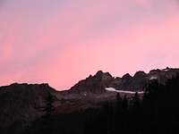
The views from the trailhead alone are quite impressive with Johannesburg looming over the valley as well as seeing many other impressive peaks like Eldorado, The Triad, Mixup Peak, and Mount Torment.


