
-
 1847 Hits
-
 78.27% Score
-
 9 Votes
|
|
Mountain/Rock |
|---|---|
|
|
40.24448°N / 5.27779°W |
|
|
Hiking, Mountaineering, Scrambling, Skiing |
|
|
Spring, Summer, Fall, Winter |
|
|
7615 ft / 2321 m |
|
|
Overview
 Risco de las Hoyuelas with Circo de Gredos summits in the background
Between El Morezon to the north and the Cuchillar de Ceraillos main summits to the south there are two less dominant peaks which are called Risco de las Hoyuelas. There is a tame north summit and a more rocky south summit, the latter being the higher of the two.
Despite of their minor appearance these two summits are visited frequently during the El Morezon – Peñón de Casquerazo traverse or during the Integral de Gredos traverse. They can easily be bagged on one of those outings.
Even in winter these summits are one of the main targets together with a winter tour to El Morezon.
Located between the Portilla de las Hoyuelas to the south and the Portilla Morezon to the north Risco de las Hoyuelas has a low prominence. These two summits are more advanced to the south, so the view of Circo de Gredos is more of “being into it” whereas nearby El Morezon is more of a “distant overview”.
What is more: both summits are an easy target in comparison of the other Cuchillar de Ceraillos summits which require some rock scrambling or serious climbing. The north summit is a 5 minutes hike from the Portilla El Morezon, the connecting ridge requires some easy rock scrambling, the south summit is an UIAA grade I climb from the cairned traverse route on the east slopes of the Risco.
Getting There
Northern trailhead
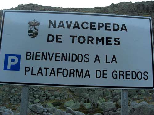
Main trailhead for Risco de las Hoyuelas is the Plataforma de Gredos.
Road number N 110 goes from Caceres – Plasencia or from Salamanca region to El Barco de Àvila.
Road number N 502 goes from Talavera de la Reina or Avila to the Puerto de Pico pass.
Talavera de la Reina can be reached from Madrid or Toledo within 1,5 hours on the highway number A 5.
Between El Barco de Ávila and Puerto del Pico / Venta Rasquilla is the road number AV-941, which runs along the north side of Sierra de Gredos.
Follow this road to Hoyos del Espino and turn on road number AV-931 which leads up to the parking area of Plataforma de Gredos.
A southern approach out of the Tietar valley is unusual.
I have no information about public transport facilities in this region.
Route Overview
 El Morezon and, right, Risco de las Hoyuelas as senn from Los Barrerones
Normal routes from Plataforma de Gredos
Direct chute
Follow the paved road in southern direction to the first trail junction, go right there and ascend to the meadows of Prado de las Pozas. To your right is the Refugio Reguerdo Llano.
Traverse these meadows and follow the Laguna Grande trail up to the Fuente de los Cavadores and Fuente los Barrerones fountain, passing by Los Barrerones with the first great views into Circo de Gredos.
Descend into the huge cirque and follow the trail until you reach the northeast edge of Laguna Grande.
Leave the trail where a broad chute goes up to the Portilla El Morezon between the El Morezon to the north and the Risco de las Hoyuelas to the south. It is an off-trail route which uses easy grantite rock sections and meadow ledges.
Turn right at the Portilla and summit the north peak and the south peak of Risco de las Hoyuelas.
 El Morezon south face and Portilla Morezon
From El Morezon
The routes to El Morezon summit are described here
Go south from the summit traversing the rock plateau of the main and the south summit of El Morezon. Climb down the steep south rock face of El Morezon (slabs, chutes and good granite talus) to Portilla Morezon (UIAA grade I), where you meet a cairned foot track.
Either follow the ridge crest to the north and the south summit or follow the foot track until you are right below the south summit. Ascend over granite rock and talus directly to the summit (UIAA grade I).
Route via Cuchillar de los Ceraillos
The traverse route starts below the summit block of Peñón de Casquerazo in the broad chute from Laguna Grande up to Portilla de los Machos.
Between the steep upper and lower rock faces dropping down from Cuchillar de Ceraillos to the Laguna Grande there is a sort of a terrace going from the chute to the Portilla de las Hoyuelas.
Follow a cairned route on this terrace traversing below El Perro que Fuma to the Portilla los Hermanitos. Ascend the slab below Los Tres Hermanitos (crux of the route, especially when wet or iced) and continue the traverse below the Cuchillar de Ceraillos summits until you reach – descending – the Portilla de las Hoyuelas.
 The route from Penon de Casquerazo to Portilla de las Hoyuelas
Traverse from the west to the east side of the ridge and ascend steeply the east slopes of Risco de las Hoyuelas. Where the cairned track levels out, leave the trail and ascend directly to the south summit of the Risco. Follow the ridge to the north summit and the nearby Portilla Morezon and continue to El Morezon.
This route is part of the Integral de Gredos and is more closely described here.
Red Tape & Accommodation
 Risco de las Hoyuelas north and south
Red Tape
Parts of the Sierra de Gredos are protected as Parque Regional de la Sierra de Gredos.
This is the case for the part of the range which belongs to Castilla y Leon. The whole of Peñón de Casquerazo belongs to this protected site.
Information centers are at Hoyos del Espino (to the north) and Guisando (to the south). There is no entrance fee but several regulations to protect the regional plants and animals. You find regulation panels at the Plataforma de Gredos parking area.
Accommodation
Both on the south and north side of Sierra de Gredos are many accommodation facilities as hotels, b&bs, holiday houses and appartments and camping facilities. The north side is located at about 1200 m sea level and has a cooler and rougher climate than the mediterranean and sunny south side.
Good locations for a stay are
on the south side:
 Almanzor summit view to Circo de Gredos Almanzor summit view to Circo de Gredos |  El Morezon and - right - Risco de las Hoyuelas El Morezon and - right - Risco de las Hoyuelas |
on the north side
Mountain Huts
Gear & Mountain Condition
 North summit with El Morezon
Risco de las Hoyoelas is a year round summit.
In summer and autumn you need at least good hiking gear and good boots; you must be able to deal with off trail terrain, talus and steep scree and some scrambling (UIAA grade I) in exposed terrain.
In winter and spring you need crampons, gaiters, hiking poles and winter mountaineering gear (warm clothes). An ice axe and a rope with hareness and belay tools can be useful.
Current Weather:
Maps
 Connecting ridge from south to north summit with El Morezon
Mapa Excursionista – Hiking Map, scale 1 : 25.000, Sierra de Gredos, Circo de Gredos, Cinco Lagunas, Los Galayos, Editorial Alpina, number E-25
Parque Regional de la Sierra de Gredos, scale 1 : 25.000, Adrados Ediciones
Sierra de Gredos, Valle del Alberche y del Tietar, scale 1 : 50.000, La Tienda Verde