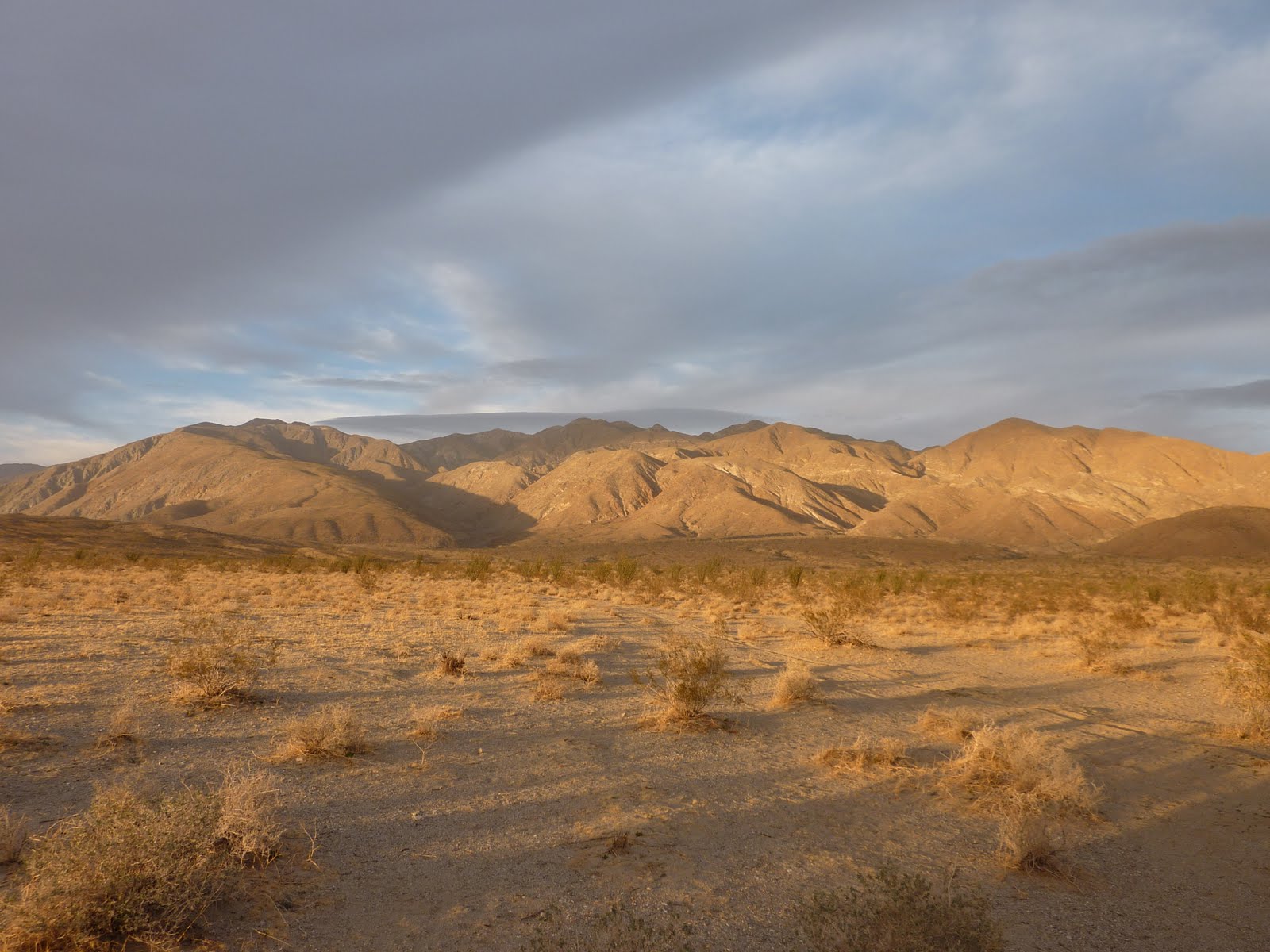
After hiking Villager and Rabbit peaks last January, I didn't think I would be making it out a year later to hike another peak just to the east. The long drive (~3hrs) each way wasn't really pleasant even with a night of car camping. However this time, a planned car camping expedition by Kathy and the peakbaggers meetup group for both Friday and Saturday nights allowed for a nice hike on Saturday without the long drive.
Rosa Point is likely less climbed than its neighbours to the west, but it is brutal and beautiful on its own.
We started out at the Thimble trailhead - the same starting place for Villager peak - and headed northeast toward Palo Verde canyon. Our plan was to take the standard route (hps route 1) up, and possibly route 3 down. Route 1 requires ascending the ridge just west of Palo Verde. Route finding can be challenging so you want to start off correctly.
We found a slight use trail and took that up heading NE then slightly NW to the first bump, where we then headed generally north.
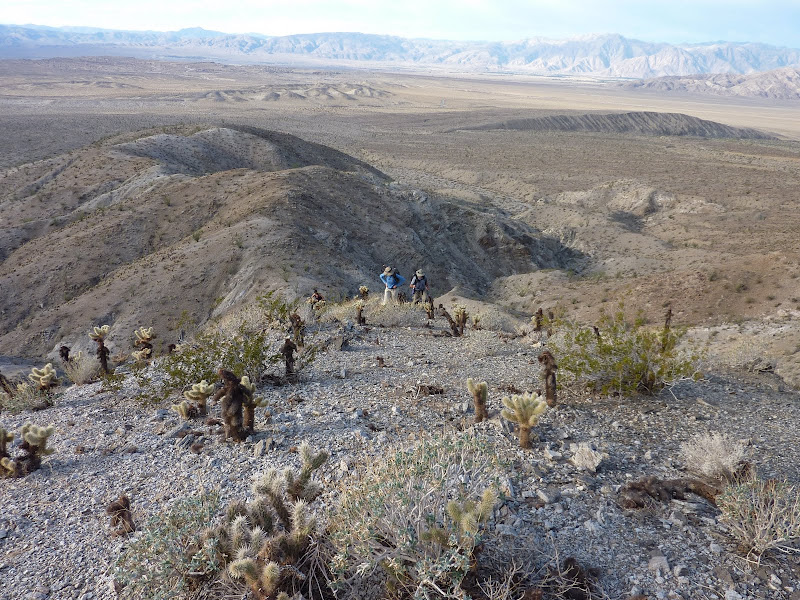
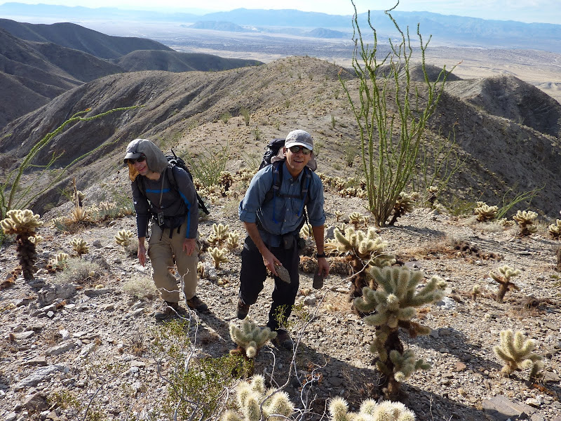
Cholla are everywhere, and their ability to 'jump' was witnessed by many during the early part of the hike. The pain of them stabbing you in the leg and hands helped improved awareness, and cholla related incidents reduced dramatically as the hike continued.
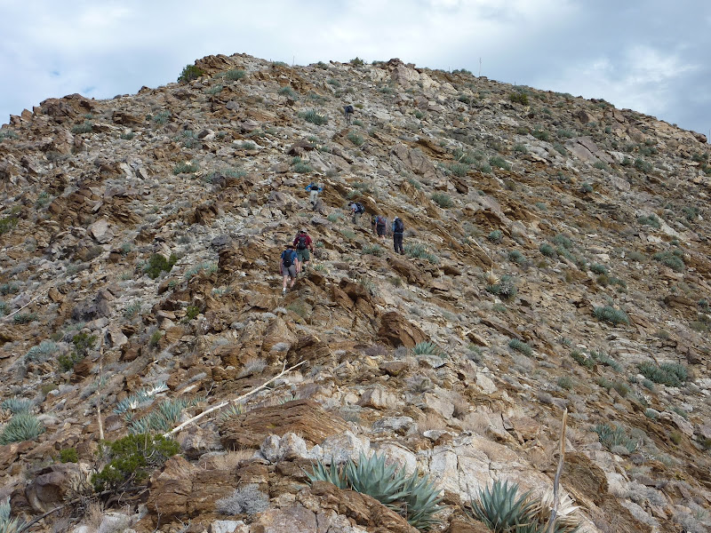
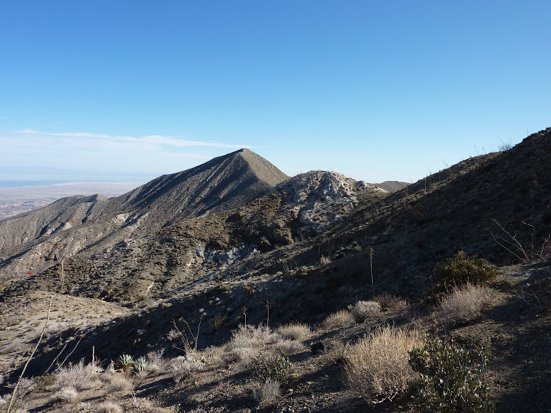
At a bump at ~3530 ft and 3.5 miles in, we veer NE again following the use trail. For a while I accidentally headed east along the ridge and we had to correct back (should be able to see this on the map), so heading NE should be the proper route. We dropped down to a rocky wash and crossed over. A steep climb up to 3650' saddle brought us to the junction with route 3. From here we headed north up a very steep and rocky ridge. A good ascent culminating in a ascending Rosa Point - the high point just east of the ascending ridge.
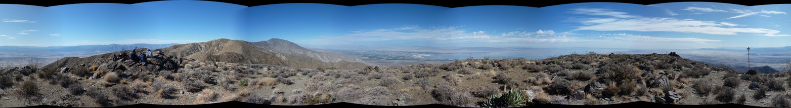
Rosa Point gave great views of the area. It was just another really clear day in the desert. We enjoyed a long lunch on top and looked through the old register entries, and decided on doing a loop and bagging Pyramid Peak on the way down.
Hiking down in this area is probably worse than even just west on the Villager / Rabbit traverse. The terrain is very steep and very rocky. Not only did we have to really concentrate all the time, the pounding on the feet and knees from rocks with no give was not too pleasant!
Back at the saddle, we headed SE all the way to Pyramid. The use trail here seems in better condition than on the way up. At Pyramid, we continued south and pick up the long ridge heading SW then S to the area where there are supposedly "Natural Rock Tanks". Sadly we did not see any and were probably too tired to really do any extra exploration.
We picked up an old miner's trail that was well worn and followed it out to the trailhead.
I can totally understand that. I like it too very much. Maybe it's the open views all around along the way or the much less bushwhacking.
Viewing: 1-3 of 3
to post!
Don't have an account?
Parents
Parents
Parents refers to a larger category under which an object falls. For example, theAconcagua mountain page has the 'Aconcagua Group' and the 'Seven Summits' asparents and is a parent itself to many routes, photos, and Trip Reports.


Comments
Post a Comment