-
 4381 Hits
-
 0% Score
-
 0 Votes
|
|
Route |
|---|---|
|
|
0.1667°S / 78.5667°W |
|
|
Overview
Getting There
There are various ways to get to Rucu Pichincha via bus. Because the bus line from where I lived was the Ecovia, the way I went was to take the Ecovia to the parada “Baca Ortiz” from there a bus could be caught in front of the KFC/Texas Chicken across from the Febeca. Just ask all the bus drivers if they can drop you at the “entrada del teleferico” and you’ll eventually find the right bus. From Baca Ortiz, you can also take a taxi to the Teleferico. Insist they put on the meter and it should only cost $3ish.
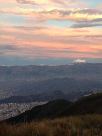
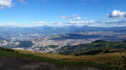
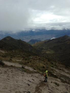
Rucu Pichincha Distance Round Trip: 6.4 miles Elevation Gain: 2,411 feet Good Wikiloc route can be found here!
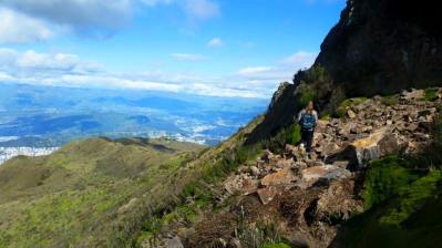
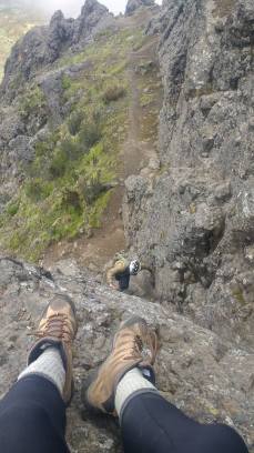
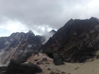
Often underestimated as an easy tourist day hike, the Rucu Pichincha can be both difficult and dangerous. Many tourists go ill-equipped and unprepared. This lack of preparation can become dire as the mountain can quickly go from a sunny clear day to completely enveloped in fog. Many hikers believe they have finished at the base of the rock but the hike is still about an hour or two from its end. Past the cave, the trail becomes much more difficult to follow and some false trails have led many hikers astray. (Including a group of 15 Peace Corps volunteers not a month after they had arrived in Ecuador.) The last 10 minutes of this hike is a scramble. Coming down is much more fun and simple and hikers take to sprinting down the deep sand.
Without the Teleferico: Distance Round Trip: 12. 6 miles Elevation Gain: 4,839 feet Here is a Wikiloc trail. It will work but its more efficient to stay to the left of the switchbacks when you’re beginning and through the forest on the second set of switchbacks. This particular Wikiloc trail also fails to reach the summit.
To extend the Rucu Pichincha hike, summit without the help of the teleferico cable car! To do this, follow the road past the teleferico to a gate. Go through the gate and follow the trail up. Years ago this was said to be dangerous with both robberies and assaults. However, it is now a somewhat common training ground for Ecuadorian trail runners. I’ve summited this over a dozen times and never had any problems. However, do be wary of the dogs about 20 minutes into the hike. They can get slightly aggressive though I’ve never been bitten. After passing the dogs, go straight up the hill (it will feel a bit counter-intuitive). Follow the hill directly up until you hit the road, walk on the road until it curves to the left, straight on you will see a trail that goes up into the forest. Take that. Note that, if you look gringo, guards might stop you from taking this route right at the beginning claiming it’s prohibited. This has happened to me only once. The best way to get around this is by following the outer fences until you get to a small hole that
you can climb through and hike past the guards without their taking notice. Alternatively you can start the hike from Mira Flores instead of the base of teleferico, that way is longer but more beautiful.
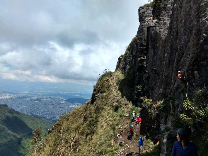
Paso De La Muerte (Death’s Pass): Wikiloc map can be found here!
An alternative option to wrapping along the rock and then climbing through the volcanic ash to summit rucu is taking Paso De La Muerte by going straight up the nose of the rock. This is no recommended unless you are going with someone who has gone beofore. Getting lost could mean your stuck on the rock. If you chose to go bring a helmet. Some climbers also chose to bring a rope for the more exposed part of the scramble known as “Death’s Pass”. It is often no possible to down climb once you’ve gone up so be sure you stay right on the crest so not to get off track.
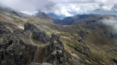
Intergral: Guagua, Ladrillos and Padre Encantado Total Distance: 18. 7 miles Total Elevation gain: 8,100 feet Wikiloc route can be found here!
To do the peaks behind that of Rucu, the main Pichincha peak, go straight over the ledge instead of turning left to scramble to the top of Rucu. Drop down a steep decent and follow the path to either Ladrillos on the right or Padre Encantado on the left. For an even more ambitious trek, continue to Guagua Pichincha behind that. However, if you intend to several of the Pichincha peaks in one day, its best to start at the opposite end with Guagua Pichincha. To get to Guagua you much begin via Lloa, a small town in South Quito. Ambitious hikers will actually start walking from there. From Lloa to the summit of Guagua Pichincha is 8.5 miles and 5,325 feet of elevation. If you take a taxi truck (“camioneta”) to the refugio the summit is less than a mile away and only 400 feet of elevation. Whichever option you choose, from Guagua you can work your way back to
Rucu. The distance from the top of Guagua to the top of Rucu is 3.2 miles and 1,200 feet of elevation. Both the Ladrillo peak and Padre Encantado are on the way to Rucu and summiting them additionally on you way to Rucu would only add about a half a mile and 1,000 feet of elevation gain. After these summits and then Rucu, you can make you way down the mountain and take the teleferico to the bottom. Note that the teleferico usually runs from 8 am to 7:40 pm but can shorter hours on weekdays. From the bottom of the teleferico, transportation is easy and accessible although taxi drivers will try to take advantage of you. Remember they are legally obligated to put on the taxi meter.
Also note that while there is a refugio at the base of Guagua that you could potentially sleep in to break up the multi-peak hike, I have only ever seen it locked and closed. I am not sure how you would arrange staying there but if your heart is set on it, reach out to me and I’ll talk to some of the guides I know that might be able to help.
Rock Climbing Area:
If among hiking up tall mountains you are also rock climbing, the Politecnica Climbing Club has recently established routes in the area. To get to these routes walks about 10 to
20 minutes on the upper trail ridge (not down by the church). When you get to the area selling food and renting horses, drop down to the right directly off the side of the cliff. After a 5 minutes decent, you’ve arrived. There is a copy of the climbing topos there (or at least there was). As with all rock climbing in Ecuador, there isn’t much for beginners but there are some beautiful more advanced routes if you’re already an established climber. Beware though, the routes haven’t been clean quite well yet so get ready for some chossy climbs and lots of falling rocks. Wear a helmet at all times.
Okay get at it! Look good, have fun, be safe.