
-
 6378 Hits
-
 75.81% Score
-
 6 Votes
|
|
Route |
|---|---|
|
|
29.17689°N / 13.50786°W |
|
|
Hiking, Scrambling |
|
|
Spring, Summer, Fall, Winter |
|
|
Most of a day |
|
|
Hike and exposed scramble |
|
|
Overview
 On Ruta de las Salinas On Ruta de las Salinas |
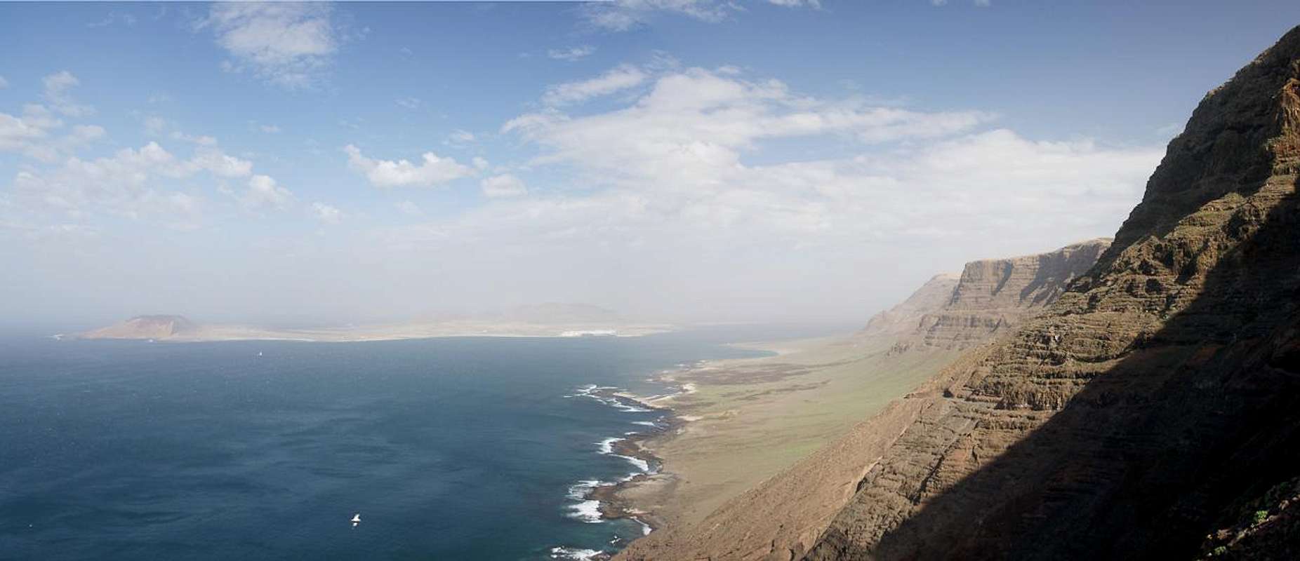
For most of its length Risco de Famara drops directly into the Atlantic Ocean. But there is an exception in its north-west, where a small plain developed underneath the cliff. Here in the early 20th century a saline, Salinas del Rio, was established to provide the north of Lanzarote with much needed salt. Maintaining the salines proved to be difficult - the shortest path to any village was the climb along a spur of the Risco towards Ye on the plateau on top. This track was soon developed into a mule trail but still turned out to be too demanding on man and animal. Therefore a road was developed, starting at Caleta de Famara in the south of the cliff. It climbed halfway into the cliff, reaching about 300m at a place called Punta de los Roques. From there it descended to the salines. But soon after the construction it became evident that builders hadn't accounted for the Risco's rock quality. Frequent landslides made the road unprofitable so that eventually the Salinas del Rio were abandoned.
Today this support road is one of the most spectacular hikes on Lanzarote. It winds along a ledge through Risco de Famara, offering great views and a bit of adventure. In some places rock slides have taken away the ledge altogether leaving you to scramble across very exposed sections of horribly brittle rock. Some guidebooks as well as local authorities try to discourage hiking the road but from my experience it still can be done fairly securely. In some places you wish for opportunities to place protection but these spots are still pretty rare.
Getting There
 At the trailhead during Sahara Dust weather
The trailhead for the hike along the Ruta de las Salinas is at the Urbanisation Famara, to the north of Caleta de Famara, Right at the southern base of the cliff. The main page describes how you can get there from the island capital Arrecife.
Route Description
 Balanced Rocks
- Start altitude: 20m
- Summit altitude: 300m
- Prevailing exposure: West
- Type: Hike and Scramble
- Protection: None
From the Urbanisation Famara, a square development with apartment houses, a road leads northward. At an intersection it splits in two, the lower road leading to a beach, the upper one directly heading for Risco de Famara. You pass a farm building, always ascending towards the cliff. A second inhabited building is passed after which you leave civilization behind.
 |  |  |
The road climbs steeply towards a spur, which heads out from the cliff to the sea. Reaching it you'll get a taste of things to come: right after the spur much of the road has been taken down by a rock avalanche, leaving only a narrow path on old cinder scree to reach the other side. In this place the rock is incredibly brittle - you get the impression you can induce another rock slide by simply looking at the slopes. Some huge rocks are balanced within the scree, already halfway carved out of their surroundings by erosion.
 |  |  |
The next section takes you through the Risco, always at an altitude between 300m and 350m. The road constantly heads up and down and in about half a dozen places it has either been buried or destroyed by rock slides. Some of the spots are outright scary but most can be managed with a little level-headedness. At the end of the section you close in on Punta del Roque, an impressive rock needle, balanced high above the surf. Right before you get there you pass a token of civilization: a car has fallen over the edge of the cliff, coming to a rest 300m underneath. Nothing will tell you, what brand it used to be.
 |  |  |
From Punta del Roque the route descends slowly into the coastal plain, which is home to the Salinas del Rio, the final destination. From high above two hiking trails head down to Ruta de las Salinas, first one from Guinate, later another one from Ye. Once in the plain you can either head directly for the salines or go the detour along Playa del Risco, a wonderful sand beach. Finally both tracks rejoin directly near the salines. You can head onwards in direction of Punta Fariones, Lanzarote's northern cape but you will be forced to turn around about 1km shy of the destination.
  |