
|
|
Mountain/Rock |
|---|---|
|
|
41.92080°N / 123.657°W |
|
|
Del Norte |
|
|
Hiking |
|
|
5862 ft / 1787 m |
|
|
Overview
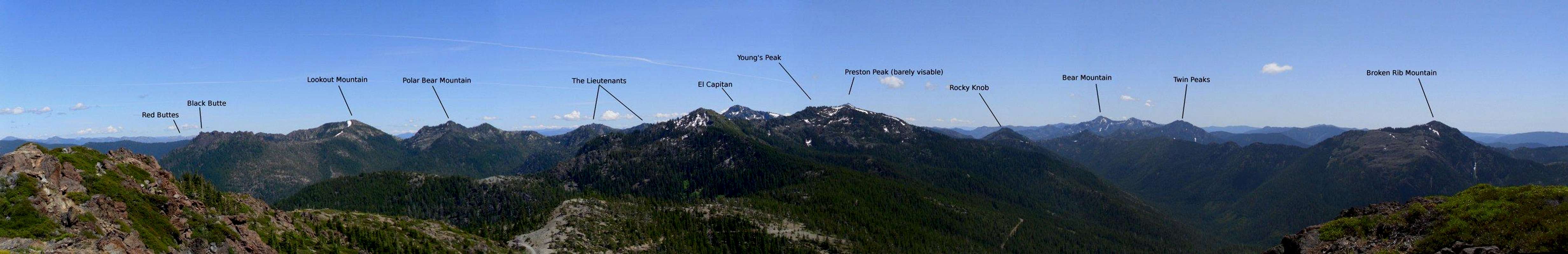
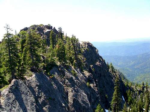
Located in the northeast corner of Del Norte County Sanger Peak sits on the edge of the Siskiyou Mountains most rugged section. The peak sits at a lofty perch some 3500 feet above the middle fork of the Smith River. Along with Haystack and Broken Rib Mountain, Sanger Peak lines the edge of a deep U-shaped glacier carved canyon that defines the headwaters of the Smith River. The ocean is clearly visible on clear days to the west and Mount Shasta can be seen to the east. The summit offers some great views of the most rugged section of the Siskiyou Wilderness as well.Sanger Peak is prominently visible from several populated areas including the Illinois Valley as well as northern Crescent City. The summit was once home to a fire lookout, however it has recently been decommissioned and destroyed with the ruins left in place. The summit can be accessed by a somewhat faint and difficult to follow trail that has not seen any maintenance since the lookout was decommissioned.
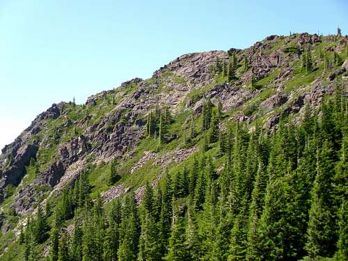
The peak is fairly rugged on most sides with its numerous cliffs and outcrops. Its north face drops 800 feet into a small tarn. The dominant rock type is serpentinite but some granite is present as well.
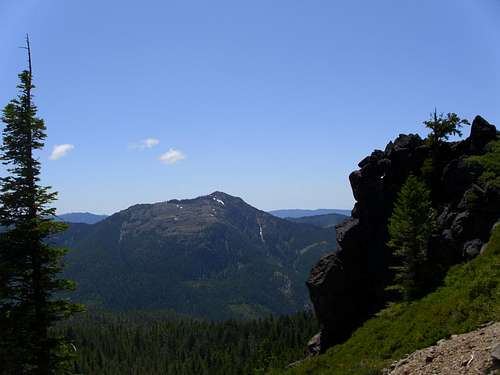
  Summit View |
Getting There
Knopki Creek Road:30 miles up US 199 from Crescent City (or 49 miles over From Grants Pass) Turn on Knopki Creek Road (Forest Route 18N07). 11 miles up Knopki Creek road turn left at the junction with the road to the Young's Valley Trailhead towards Sanger Lake. 1.5 miles farther will put you at the roads highpoint in a pass between Sanger Peak and unnamed peak 5582. The Sanger Peak Trailhead is marked but the words faded off long ago, still it is obvious when you're here as it's the only sign you'll encounter after the Young's Valley Trailhead Junction. The road is well graded gravel and should be passable to any vehicle.
 |  |
Waldo Road:
44 miles up US 199 from Crescent City (or 35 miles over From Grants Pass) Turn on Waldo Road. Continue on Waldo Road for 3.3 miles, then turn on forest route 4803. Follow road 4803 for 14 miles to the pass between Sanger Peak and unnamed peak 5582. The trailhead is here. This road is considerably rougher. High clearance required, 4wd recommended.
 |  |

Sanger Peak Map

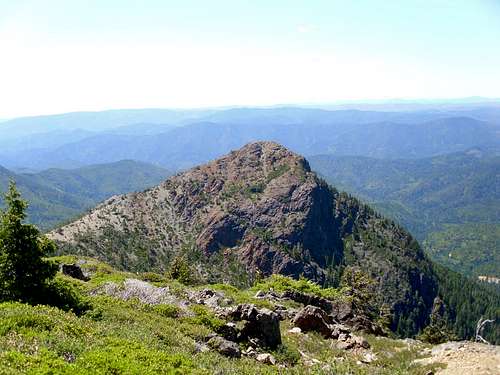
Sanger Peak Trail
From the trailhead the hike to the summit is fairly short at only 3 miles round trip. However the trail has not seen any maintenance since the lookout was decommissioned and is very difficult to follow. Heading directly up the ridge will require significant bushwhacking through chest deep manzanita, so the trail is generally worth staying on. The route begins on the south side of the ridge, then gains ridge in a level area, then finishes on the north side near the summit.
Side Trip: Middle Fork Falls
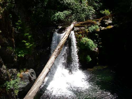
Middle Fork Falls
2.9 miles up Knopki Creek Road an unmarked Trail goes down to Middle Fork Falls. The falls plunge 35 feet off a serpentinite cliff into an extremely deep pool on the Middle Fork of the Smith River. The view is well worth while if you're already here.
The trail head can be very difficult to find. It comes just a few hundred yards after the third bridge, at the end of a large road embankment on the right (south). The hike is short and steep, the final few hundred feet is a steep scramble on slick moss-covered rock complete with fixed ropes.
The entire detour only takes a matter of minutes if already traveling on Knopki Creek Road and only slightly longer adding in driving time from the highway.
Red Tape
The roads on both sides close around late October to early November and stay closed until the snow melts out. If you want to camp outside a designated campground you will need a California campfire permit. No other special regulations.Camping
US 199 has several good campgrounds near Gasquet. Dispersed camping is permitted anywhere on National Forest land unless otherwise posted. Numerous areas along Knopki creek road are suitable for dispersed camping. Camping on the summit is also possible, a fire ring is present there indicating people have done so in the past.  |  |  |  |
Contact and Links
Rogue River-Siskiyou National Forest3040 Biddle Road
Medford, OR 97504
(541) 618-2200
TTY 1-866-296-3823
www.fs.fed.us/r6/rogue-siskiyou/
Six Rivers National Forest
1330 Bayshore Way
Eureka, CA95501
707.442.1721
fax 707.442.9242
TTY/TDD 707.442.1721
www.fs.fed.us/r5/sixrivers/
Smith River National Recreation Area Visitor Center, Gasquet, (707) 457-3131