
|
|
Mountain/Rock |
|---|---|
|
|
44.42639°N / 112.09884°W |
|
|
Madison |
|
|
Scrambling |
|
|
Spring, Summer, Fall, Winter |
|
|
10090 ft / 3075 m |
|
|
Overview
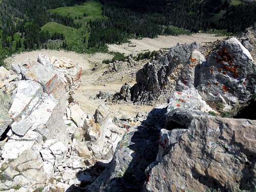
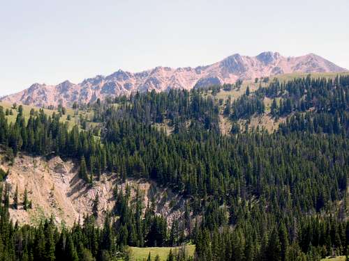
Sawtooth Mountain, though far from the highest, presents the boldest terrain and sharpest profile of any summit in the Snowcrest Range. Probably named by early settlers, as Native Americans had few saws; this mountain was surely noticed for the unmistakable resemblance to a large, albeit ragged, forestry tool. The “teeth” are very rugged with steep cliffs dropping from each one. This becomes evident when nearing the apogee, and looking down the row from the summit itself. The cliff terminations and the chutes in between on the mountains’ north side are clearly visible on aerial photographs.
![Looking down the north cliffs]()
Looking down the north cliffs
Although of less stature than the neighbors, this high point has character and is a worthy introduction to the semi-obscure Snowcrest Range. Expect to see mountain goats and other large mammals on this peak.
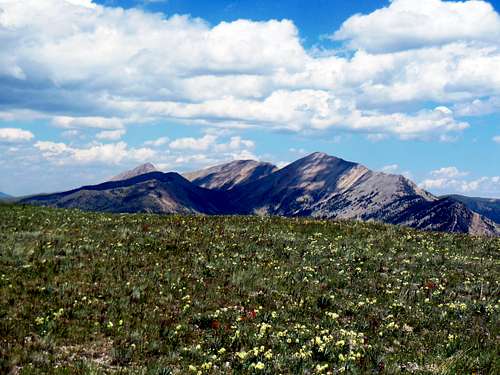
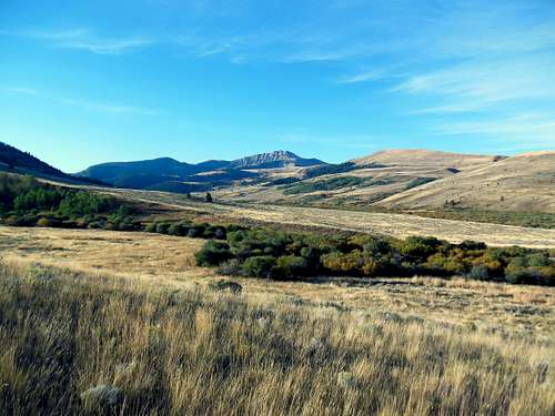
This sizable mountain presents a west-east descending ridge of over one and a half miles. Sawtooth stands far enough away from other peaks that fine birds-eye views of Olsen,Sunset and Antone Peaks are afforded. In all directions more distant panorama are equally outstanding.
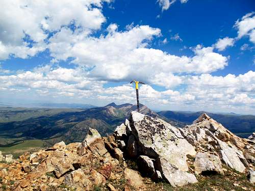
Sawtooth Mountain summit,Olson and Sunset Peaks in background
PROMINENCE OF SAWTOOTH MOUNTAIN- 1,510'
Getting There
The first objective is to reach the Blacktail Road. The north end begins at exit 59 on I-15 near Dillon, Montana. The southern route begins at Monida, Montana at exit 0 also on I-15. This northern approach is more straightforward though perhaps less scenic than the southern one. Starting at exit 59, go east on Mt-222. This leads in a couple of miles to the Blacktail Road turnoff heading right or in a southeastern direction. Travel about 24 miles down this road to the junction with the East Fork Road. Drive east from the junction about 4 miles to a little bridge crossing the East Fork. This is BLM-1808/FSR-963 which follows the stream 6 miles generally southward to the East Fork Campground and the Indian Creek trail head (route 1). Another 10 miles further southeast from this East Fork turnoff brings one to the Antone Station road (FSR-325) and routes 2 and 3.
For the southern route, drive east from Monida, Montana on the Red Rock Road (MT-509) approximately 10 miles to the junction with BLM-1806 to the left or north. This six mile trip across the Centennial Valley presents a stark beauty of its own. There are often storms moving through this valley accompanied by high winds. After crossing the Red Rock River just upstream from Lima Reservoir, the road has a junction with the North Valley Road heading to the right. (This road connects with FSR-100 along the Ruby River further north as well as a cutoff to the southern terminus of the Gravelly Range Road (FSR-290)). For our mountain, continue on three miles past the North Valley Road to a 90* turn to the left or west. This is the start of the Blacktail Road for all practical purposes. Follow the road ten miles into the mountains to reach the Clover Divide. It is here that the Antone Station Road(FSR-325) bears right or east and leads to routes 2 and 3. From this direction, route 1 is another ten miles generally northwest to the junction with the East Fork Road heading to the right.
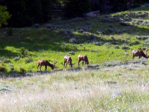
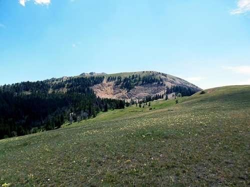
Bull elk on Sawtooth Mountain, lower meadows
Routes
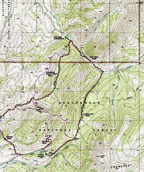
Sawtooth Mountain area map
ROUTE 1-WEST RIDGE AND NORTH-NORTHWEST RIDGE-
Once completing the enjoyable journey up Indian Creek to its head, eventually one comes to timberline and those wide open views. The first little high saddle crossed at 9,200’ begins Route 1b, the NNW Ridge which is centered in the photo below. An ascent is made by traveling up through the mixed talus and grassy slopes of the barely discernible ridge. The lower appearing second crag to the left is the actual summit. The right skyline is the West Ridge, and is Route 1a.
TOTAL ELEVATION GAIN- 2,850'
TOTAL DISTANCE- 3.5 MILES ONE-WAY
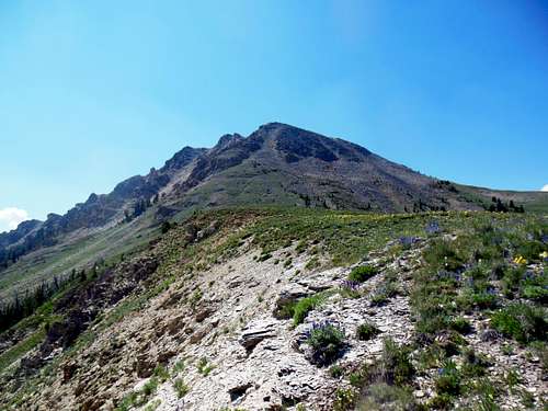
Sawtooth Mountain, western end
Traversing on trail across open slopes brings one to the west ridge of the mountain. This point on the trail can perhaps be accessed in less strenuous fashion from the Cornell Trail which originates close by the Antone Cabin on FSR-325. This ridge seems to be the easiest route up, though none will seem hard to a regular mountain scrambler. Just walk up the not too steep ridge to the first “tooth”. The next, slightly higher crag is the summit.
An interesting variation which the author used involved descending north from Point 9,328’ down vast open grassy slopes. This is the Route 1b shown on the area map paralleling Indian Creek below. Although this way was used as a descent, there is no reason why it couldn’t be followed as an ascent instead. These green slopes can be wandered on past Point 8,216’ for an easy reunion with the Indian Creek Trail just ½ mile from the trail head. Could very well be the most spacious and pleasant way up of all. It was so nice,what a shame to run out of ridge. :)
Descent ridge north of Sawtooth
Take a look at the cliffs below, but don’t lean over too far!
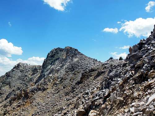
Sawtooth Mountain summit area, summit in center
ROUTE 2- SOUTH SLOPES
While starting a climb of Antone Peak from the guard station, an old road was noticed zig-zagging high up on Sawtooth Mountains’ south slope. Later investigation of this track to the end revealed a decent little ridgelet leading from roads end straight to a midway point on the Sawtooth summit ridge. This would be the shortest, most direct route to the top. Route 2 is comparable looking in workload, with the lack of horizontal travel being compensated for by the availability of steeper vertical travel. Looks short and sweet. Please see the driving directions to Antone Station under the Snowcrest Range page.
TOTAL ELEVATION GAIN- 2,151'
TOTAL DISTANCE- 2 MILES ONE-WAY
ROUTE -3 EAST RIDGE
The East Ridge is approached from the Antone Guard Station. This would also be the start to a climb of Antone Peak. Once hiking a little over a mile up the mellow grade to Antone Pass, the start of the route is reached. The ridge can also be reached from East Fork Campground with more walking. Hike up the East Fork Trail (FST-6069) for 1.5 miles to the junction with the Rough Creek Trail (FST-670). Take this uphill trail generally southwest 2.5 miles to the pass. Walking down from the summit a bit, revealed this ridge to be a little rugged but possible. Combining this route with Route 1b would make a great traverse of the mountain.
TOTAL ELEVATION GAIN (FROM ANTONE STATION)- 2,010'
TOTAL ELEVATION GAIN (FROM EAST FORK CAMPGROUND)- 2,850'
TOTAL DISTANCE (FROM ANTONE STATION)- 3 MILES ONE-WAY
TOTAL DISTANCE (FROM EAST FORK CAMPGROUND)- 5.5 MILES ONE-WAY
Close-up of Sawtooth Mountain
Red Tape
There is no red tape involved in the visiting of this mountain. Just please remember to pack out whatever you packed in.When to Climb
Sawtooth Mountain could probably be climbed any time of the year, with summer and early fall as always being the premier seasons. Indian Creek was running as late as the first of August this past dry year. Robb Creek and East Fork Blacktail Deer Creek are both year-round streams, so water is assured when in their vicinity. The rest of the range is fairly dry with only seasonal flows in most drainages, so carrying water is usually called for.
Looking at route steepness and the crossing of avalanche slopes seems to point towards Route 3 via Antone Pass as the safest winter alternative. One could stay overnight at the Antone cabin, then snow shoe the trail to Antone Pass. The trees just right of the open ridge crest should make the journey up to Point 9,194’ easy enough. From there following the East Ridge should be possible and not too risky. The only portion of some concern could be that open slope between Point 9,194' and Point 9,727’. At that spot, the grade lessens and the ridge becomes more refined. Sawtooth Mountain may not even have been climbed in winter yet. Now that sounds like some real fun there; would anyone like to try this?
Taking the long view
Camping
Some fine camping can be had at either Antone Station area, or the East Fork Campground. This East Fork camp is especially nice, with the streams constant sound and the comfort of the vault toilet. Neither place is heavily used,so solitude is possible. There are a couple of high meadows along the Indian Creek Trail that would be good also. Scenic, though dry camps can be made around timberline, at the start of Route 1b. The high grassy slopes north of the mountain would also be nice. The point is camping is for the beauty of the area, not because the climb warrants an overnight stay. But camp out anyway!External Links
Click for weather forecast