-
 20207 Hits
-
 80.75% Score
-
 13 Votes
|
|
Mountain/Rock |
|---|---|
|
|
49.79278°N / 123.30194°W |
|
|
Canada |
|
|
Mountaineering |
|
|
Summer |
|
|
7632 ft / 2326 m |
|
|
Overview
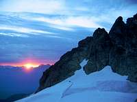
Located in the Coast Mountains of British Columbia, Canada Serratus Mountain lies between Alpha and the Tantalus-Dione massif. The mountain is mostly broken rock with a heavily glaciated north face and a wide south face with couloirs offering modest rock climbs. There are several modest one day 4th class and ice routes. The East Ridge, North Face and West Face Couloir routes range in grade PD to AD+ all ending in a difficult south-side descent given poor snow conditions recently. Within this range there are several other mountaineering objectives within reach on Alpha Mountain and Mounts Dionne and Tantalus ranging in grade from PD to TD/TD+ 5.10b, A2. The area is seldom climbed due to its location west of the Squamish River with a basic hut offering little in the way of ammenities.
Getting There
Head north out of Squamish, BC on Highway 99 for 10km to the Squamish Valley Road opposite to the entrance of Alice Lake Provincial Park. Follow this road over the Cheakamus River and stay to the left at the fork in the road. Continue along the unmarked road for about 2km until you arrive at the cable-car crossing. Cross the Squamish river by canoe or Tyrolean style across the cable-car wire. Bring an oversized steel carabiner or pulley to attach your climbing harness to and hang your pack off the wire, not your back, as you cross. On the west side of the river follow a trail along the bank for 300m to a canoe landing then head up to the hill to the top of a large clear-cut area. After that the trail is well marked left of Lake Lovely Water Creek. Continue ascending until you reach theh Alpine Club Tantalus Hut at Lake Lovely Water. The Tantalus Hut has a large kitchen/living room on the main floor with a loft and foam sleeping mattresses for 20 people above. The cabin is open from late May to early October and cost $10 CDN per night for members and $15 per nioght for non-members. For more information check out the Alpine Club of Canada web site at www.alpineclubofcanada.ca. Also listed on the Tantalus Hut page are several options for crossing the Squamish River by boat, float plane and helicopter. Helicopter service is available from the Suamish Airfield directly to the Red Tit Col where several camp sites exist free of charge.
Red Tape
There is no red tape in this range.
Camping
A small base camp can be set up on the Red Tit Col between Serratus and Dione Mountains. There are several tent sites available free of charge and a new hut was to be erected by BC Parks. In the summer water is readily available from small glacial streams beneath the camp.
Routes
North Face AD ice 1000' The North Face route is a steep 1000' snow and ice face graded AD to AD+ depending on conditions. Difficulty is usually determined by the number and size of crevasses and bergschunds that may be encountered and is best attempted in early-summer. From the Red Tit col head east down the Serratus Glacier avoiding crevasses and a small icefalls. Make your way upward weaving to the right-side of the north face finishing up the rock ridge to the summit (4-6h). To descend head down the south-west spur and follow the left-side couloir heading towards the Ionia-Serratus col. This can be a more difficult downclimb that the route taken up. Loose rock, few good anchors to rappel from and little summer ice lead to one scary descent when you see what a few small boulders are holding back in this couloir. Once down head north across the dry glacier back to the hut (1 1/2 - 2h). East Ridge AD 4th 1300' This is the high ridge running east-west from the Alpha-Serratus Col. Protected with numerous gendarmes it is mopstly 3rd class terrain on poor rock. From the Ionia-Serratus Col weave along the ridge, mostly 3rd class with a few rappels, to the summit. Interesting classic mountaineering and use the same descent described above. West Face Couloir PD 4th 650' From the Red Tit Hut head head south until you reach the bottom of the couloir on the west face. This route takes the couloir on the left side of the west face straight to the summit. Descent using the same route described above.
Other Stuff
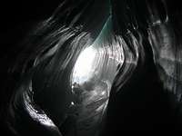
Of course there are lots of other things to do here. Pleanty of crevasses to explore and it's a good place to practice glacier travel and crevasse rescue.


